Cancel

    Open app

    Search

    Spruce Knob

    4.8 (12 reviews)

    Spruce Knob Photos

    Recommended Reviews - Spruce Knob

    Your trust is our priority, so businesses can't pay to alter or remove their reviews. Learn more about reviews.
    Yelp app icon
    Browse more easily on the app
    Review Feed Illustration

    Reviews With Photos

    Sahar R.

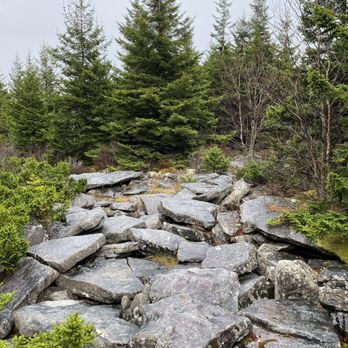
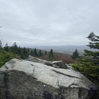
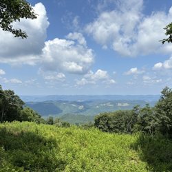
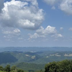
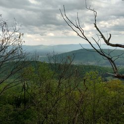
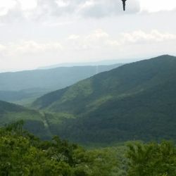
    Do you want to get high? Spruce Knob is the highest point in West Virginia and offers great views. The drive up is bumpy enough to dislodge a kidney stone and goes from paved to gravel for most of the way. In winter this road is sometimes unpassable in non 4WD in winter but the views are worth testing your car's suspension. You can drive all the way up to the summit and hike around the small loop trail that leads to the observation tower and then to a small wooden look-out on the far side of the loop. The trail is only a 1/2 mile, not strenuous (my pug in a wheelchair could do it)except for the stairs up to the observation deck. As a word of warning, it's about 20 degrees cooler up here. We went from 80 degrees at the base to 60 degrees up at the summit. So dress appropriately. The severe climate here means that cold fogs and strong winds can occur even in summer.

    Johnny H.

    I had a good experience at the highest point in West Virginia, Spruce Knob. The plateau is quite developed with lots of parking, hiking trails and an observation tower. It is worth the drive up if you are in the area. There are some very informative signs in the area explaining the creation of the mountain. You don't have to be a geology fan to enjoy yourself here!
    Tiffany B.

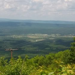
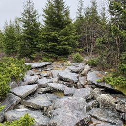
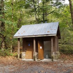
    Great, breath- taking views of West Virginia! All the trails are well-marked, restrooms, trash receptacles, and picnic tables located at top of mountain near watch tower. Great restaurant at base of mountain called "The Gateway Family Restaurant".

    Highest point in West Virginia!
    Cecilia S.

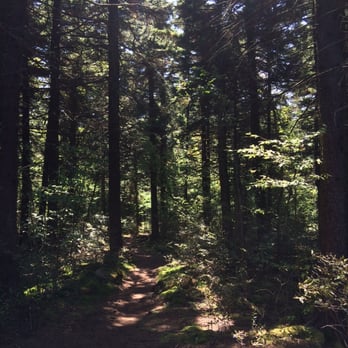
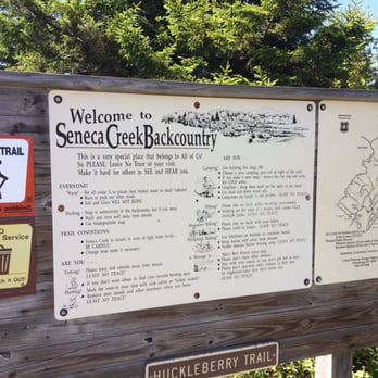
    The highest point of West Virginia! This was probably my favorite spot. The observation tower is an easy way to get a gorgeous view of the area, but I would also recommend taking the short half mile hike around the tower - Whispering Spruce Trail. If you're feeling up for it, there's also a pretty decent trail that connects to several other trails on the other side of the tower. I really enjoyed the hike on Huckleberry Trail. It starts off going through the deep woods, and then it kind of changes subtly as you move through the land. You'll start to see more moss and the temperature kind of dips down the deeper you get into the woods. I loved the smell of the spruce trees and it's an awesome spot for camping too. The ground was covered mostly in pine leaves, so it makes a soft surface for camping. I totally loved it!

    See all

    Photo of Rob B.
    665
    669
    2843

    3 years ago

    Helpful 3
    Thanks 0
    Love this 1
    Oh no 0

    4 years ago

    Helpful 7
    Thanks 0
    Love this 5
    Oh no 0

    4 years ago

    Helpful 1
    Thanks 0
    Love this 0
    Oh no 0
    Photo of Sahar R.
    1366
    681
    9169

    7 years ago

    Helpful 5
    Thanks 0
    Love this 5
    Oh no 0

    6 years ago

    Helpful 2
    Thanks 0
    Love this 0
    Oh no 0

    7 years ago

    Helpful 1
    Thanks 0
    Love this 0
    Oh no 0

    8 years ago
    Helpful 1
    Thanks 0
    Love this 0
    Oh no 0

    11 years ago

    Helpful 7
    Thanks 0
    Love this 4
    Oh no 0
    Photo of Kelly K.
    305
    2329
    1860

    11 years ago

    Helpful 3
    Thanks 0
    Love this 4
    Oh no 0

    8 years ago

    Absolutely love this place... Other than the bumpy road I have no complaints. Well worth the ride.

    Helpful 0
    Thanks 0
    Love this 0
    Oh no 0

    8 years ago

    Helpful 0
    Thanks 0
    Love this 0
    Oh no 0

    8 years ago
    Helpful 0
    Thanks 0
    Love this 0
    Oh no 0

    Ask the Community - Spruce Knob

    Verify this business for free

    Get access to customer & competitor insights.

    Verify this business

    Spruce Knob - Seneca Rocks National Recreation Area

    Spruce Knob - Seneca Rocks National Recreation Area

    4.6(33 reviews)
    7.0 mi

    Seneca Rocks Trail. A number of years ago, my husband and I visited the educational Discovery…read moreCenter for the Seneca Rocks National Recreation Area, and got a great view of the Seneca Rocks from the parking lot. But, it was late in the day on a Sunday and we had a long drive ahead of us, so we decided not to attempt to hike up the trail, but we put it as yet another item on our bucket list. We returned to the area in Sept, 2025, specifically to attempt to do the hike. No concerns as to whether my husband would be able to do it, but I have to admit that I was apprehensive as to whether I could! The brochures say that it's 1.5 miles each way (up, and then back down) and you gain almost 850' in elevation. And, did I mention that I'm in my 60s, NOT a regular hiker, and with a medical condition that affects my balance? Nonetheless, my husband and I donned our hiking boots, put on some sunscreen, packed a picnic lunch, snacks, and water, and my hiking stick -- and we were on our way! The trail is wide and well-maintained and, as others have mentioned, has steep sections, especially in the switchbacks towards the top. It's a steady climb up, and my Fitbit registered some intense exercise, but my heart rate never reached its peak category. Given my balance issues, having my walking stick and an occasional hand from my husband, especially on the descent in steep areas with roots or stones, were helpful. I tried not to be discouraged by the two very fit runners who raced by us, recognizing that the majority of hikers and dogs on leash were panting at least to some degree! There are occasional benches, especially towards the bottom, and signs pointing out ecological features. There's an observation deck at the top, with gorgeous views of the valley below, as well as shaded benches to enjoy our picnic lunch. You can't see the rocks from the observation deck. However, some hikers scramble over some additional rocks for more views though signage warns that this can be dangerous. I'm happy to report that my husband and I both completed the hike, and we are now able to cross that item off of our joint bucket list. We celebrated our accomplishment by getting some ice cream at Yokum's, just down the street! Admission to the Seneca Rocks National Recreation Area and parking is free. Staff in the Discovery Center are exceptionally helpful. There are picnic tables and restrooms at the base, and the Seneca Shadows Campground is about a mile down the street.

    Literally a quick trip ( sadly), recommended by a friend, en route from Cass to Elkins…read more Absolutely beautiful and would have loved to have hiked this beauty. Hope to return one day ( Florida resident), preferably again in the fall to see the colors. Nature center sadly closed because of the government shut down.

    Photos
    Spruce Knob - Seneca Rocks National Recreation Area
    Spruce Knob - Seneca Rocks National Recreation Area - Another view of the top.

    Another view of the top.

    Spruce Knob - Seneca Rocks National Recreation Area

    See all

    Falls at Hills Creek

    Falls at Hills Creek

    4.8(5 reviews)
    63.7 mi

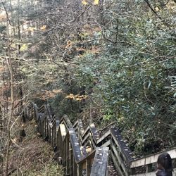
    An amazing set of Falls. See the Lower falls if you can…read more This is one of the best sights along the entire drive. There are 3 different sights to see at this stop. There are upper, middle and lower falls. Let's start at the beginning. There is a parking lot for about 30 cars directly off the road. There is a set of restrooms in the parking lot across from the trailhead. The trailhead has a solid pathway of switchbacks that leads to an observation point to the upper falls viewpoint. For people that want to shortcut the windy path, there is a straighter trail that goes directly down the hill to the first viewpoint. From there, there is a boardwalk with lots of steps that leads down the a bridge that crosses the river. Then more boardwalk and a steel set of stair to two platforms to view the middle falls. More boardwalk along the river and a large wooden stair platform leads to the lower falls. If you get a chance, you should see all three as each is unique and all are beautiful as much as the walk is enjoyable. Just remember, walking down is easy and you have to walk back up to return to the parking lot. Well worth the walk. Enjoy.

    This was an unexpected find on my trip to WV. The trail was nice, if a little strenuous for this…read morefatman, and the water falls (plural) were lovely. It is a well developed trail with lots of stairs, including an actual stairwell to get you to the bottom of the falls. If you are mobile and in the area you should visit, just give yourself some time on the hike back if your a big person like myself.

    Photos
    Falls at Hills Creek - Upper Falls from boardwalk and about .3 miles from parking lot!

    Upper Falls from boardwalk and about .3 miles from parking lot!

    Falls at Hills Creek - Stairs to lower falls

    Stairs to lower falls

    Falls at Hills Creek

    See all

    Eagle Rock / Tuscarora Trail - WV to the west. Wardensville.

    Eagle Rock / Tuscarora Trail

    5.0(3 reviews)
    63.4 mi

    Absolutely beautiful landscapes and views of the valley and ridge lines. The hike is a short…read moredistance (0.8 miles) to the view point, but the change in elevation makes it a great workout.

    - Update - *Several…read morepeople have advised me that the bird that tried to attack me is a Ruffled Grouse!* Apparently, they are well known in the area and confirmed to be aggressive and make strange noises! *Don't say you haven't been warned! :-) Saturday for the Memorial Weekend, I went to Wardensville WV to hike the Eagle Rock. AKA Tuscarora Trail. It's a simple 1 hour from my house. It's part of the Great North Mountain that acts as part of a natural border of WV and VA for some miles. The total miles of the Tuscarora Trail is 252 miles. It runs through PA/MD/WV and VA. It catches some of the Appalacian Trail at the Matthew's Arm Campground area. This trail was built as an alternative route for the Appalacian Trail due to the fear of the AT being shut down from development along the areas. The Tuscarora Trailhead for this location starts on the tippy top of The Great North Mtn on US48/VA55. At this location also you are in George Washington National Forest. You honestly can't miss it. 66w to 81s. Strasburg Exit to US48/VA55 follow for about 17 miles and you crest the mountain. There is a sign at the crest on the left near the wooods saying Tuscarora Trail. You can see it from the road. It slightly catches your eye but on the right side, you will see a big brown sign that says Entering Wardensville Cooperative Wildliffe Management Area. Park at the sign. Do not block the fire gates. I started out a little upset by the amount of hiker garbage on the o/s guardrail. Tons of Ice tea and water bottles littering the entire area. Not just a couple. It's like a ground of plastic bottles here. Also a bit worrisome was the constant gunshots. Over and Over until about the 1.5 mile stretch ends. I even saw Shot gun casings on the path, but I guess the sign did say Wildlife management Area. Geeze. The first mile was strenuous. There, I passed my first and only group of people I ever saw. They seemed to be teens chaperoned by 3 adults. They were catching their breath on the first mile. It was steep. Afterward, it leveled out and you could see you were walking the ridgeline of the mountain by looking o/s the trees to the mountain next door. Same height. From here it went from breathlessly uphill to muscle scortching downhill and leveling out.. over and over.. so overall there was give and take. A lot of the path became weedy and made my legs itchy. Some times it was almost knee length weeds. and the bugs. oh... the bugs. Don't stop for too long. I was breathing in a lot of bug protien on Saturday, let me tell you I had bugs for prelunch, lunch and snack! You could hear them around your head like a beehive. It was very much more wild than SNP. You could feel the wildness out here... I swear I am surprised I didn't see a bear. It was definately Bear Country! Speaking of this, let me also tell you what scared the living heck out of me up there. (Turns out after the scare I was laughing out loud all to myself but at the the time... I thought I was going to die) I heard some leaves russling... I slowed down and made a little noise...This...This... Turkey Bird Thing races out of the woods at full turkey bird speed and is coming right at me. It puffs up it's whole body and the tail spreads out like a Turkey but it's not big like a Turkey, more of a chicken size but fatter.... anyway this thing runs to me with his body puffed out and all I could do was walk backward and shout No over and over and over.. It's amazing I didn't fall down! That bird was litterally attacking me. I guess there was a nest along the patch in the woods and I was a bit close but OMG, If it were a bear, I'd be dead. That simple. Freaking Bird. OMG.... so it went off to the right and made this sound like a beaten dog.. wimpering..it was terrible. and When I started on my way, it followed me ! It was walking in the woods making that sickening noise for a good couple yards...That whole situation made me wonder about this dumb whistle I brought with me for safety. wow. wth is this whistle going to do! I forgot it was even in my hand! and that was a bird! lol. So later at a rock outcrop I almost sit on the one snake I saw the entire time. He was identical to the rock. Identical. I looked right at him and sat next to him. (?!?) The views were nice. A good change from SNP views. I'm glad I chose to hike this mountain this summer. There's so much more of it to hike and it even meets up with the Stairway to Heaven I did a couple weeks prior. I'm interested in exploring it a bit more. I may need to invest in a bigger whistle and perhaps a nice size knife as well. In the end, I was trying to outhike the storm on the way back to the car. I almost made it. But I was dripping wet once I turned the key! It was a great day and a great hike.

    Photos
    Eagle Rock / Tuscarora Trail - Trail grass can get high and is pretty itchy.

    Trail grass can get high and is pretty itchy.

    Eagle Rock / Tuscarora Trail - More scenery

    More scenery

    Eagle Rock / Tuscarora Trail - Scenery

    See all

    Scenery

    Tibbet Knob Hiking Trail

    Tibbet Knob Hiking Trail

    5.0(2 reviews)
    48.0 mi

    The tibbet knob hiking trail is what I would consider a moderate trail located on the border of…read moreWest Virginia and Virginia. The trailhead begins at the wolf Gap recreation area. To get to the tibbet knob trail after parking at Wolf Gap, you cross the road and find the trailhead on the south side of the road. It is very well-marked. The trail itself is 1.6 miles from the trailhead to the summit of tibbet knob. The trail first ascends through a sparsely wooded area with very little underbrush and several large campsites that would be perfect if you were camping in the area and the Wolf Gap campground was full. Since the only amenities at Wolf Gap our privys and tent sites, you wouldn't really be giving anything up to camp here on the tibbet knob trail. After passing through the sparsely wooded area, the trail ascends to a small ridge and the trail itself is very well marked with yellow blazes. The trail is somewhat Rocky but overall very smooth and comfortable. When you get to the top of the small ridge there are good views to the east. The trail then descends into a saddle between the ridge and the actual knob. It is at this point that the real ascent begins and the hike becomes somewhat harder as you take on the majority of the 800 FT elevation gain. This is a fairly strenuous climb and there are two small rock scrambles before you get to the actual summit. At the summit there's a wonderful overlook providing views to the West of the trout run valley, and really good views to the north of big Schloss and half moon mountain. Just past the actual summit there is a spectacular campsite with a fire ring that would probably hold as many as four tents. there is of course no water so this is a dry site and all water must be packed in.

    This trail was very well marked! I would recommend reading the map at the begging of the trail. It…read moreis very pretty. There are a lot of look out spots along the way. It was a moderate trail. Some spots were steep and rocky. The bathrooms were dirty. Overall would highly recommend! Had a great time!

    Photos
    Tibbet Knob Hiking Trail
    Tibbet Knob Hiking Trail
    Tibbet Knob Hiking Trail

    See all

    Dolly Sods Wilderness

    Dolly Sods Wilderness

    3.7(11 reviews)
    25.1 mi

    Access to the preservation is on a narrow gravel road, with lots of uneven places. I do not…read morerecommend if you don't have AWD or have an aversion to narrow spaces and heights, one side of the road is a high drop off. I also recommend taking a map of the preservation and trails with you, as the signs posted can be confusing. That being said once you arrive and find your way to the trail you have selected, the trails are very well maintained and marked, the scenery is spectacular. I did notice signs posted that hunting is allowed Oct -Mar and hikers should wear bright clothing during this time, I think I would just prefer to avoid the area during this time. The area was also a WWII training ground, signs are posted for visitors not to touch any ordnance they may find.

    One of the premier hiking locations on the east coast. The sods are a high altitude tundra like…read moreterrain at about 4000 feet of elevation. The wilderness features many different trails and lots of primitive camping. Access is from forest road 75, a gravel and dirt road that is mostly inaccessible in winter. The trails are well marked but not blaised, which can be a problem if you intend to night hike. Water is plentiful but has high levels of iron. Some of the trails are very boggy, especially the Dobbins grade trail. You are warned,! This area is so popular that on weekends it can be very crowded. Parking is limited so go early.

    Photos
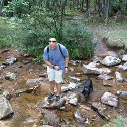
    Dolly Sods Wilderness - Creek crossing with our pup

    Creek crossing with our pup

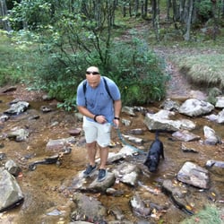
    Dolly Sods Wilderness - Creek crossing with our pup

    Creek crossing with our pup

    Dolly Sods Wilderness

    See all

    Spruce Knob - hiking - Updated May 2026

    Loading...
    Loading...
    Loading...