Sunset Peak Hike Photos
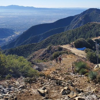


You might also consider


More like Sunset Peak Hike
Recommended Reviews - Sunset Peak Hike
Start your review...


Reviews With Photos


Apple Maps can be misleading and All Trails doesn't navigate you to the trail just through it. So here's how to get there through Mount Baldy Rd.: take Mount Baldy Rd all the way to Glendora Ridge Rd. At Glendora Ridge Rd. make a left and continue straight until you see an empty lot with red poles and signs that say NO PARKING. The entrance to the trail is to the left of this lot, you'll see a yellow gate. You can't park in the lot but you can park on the side of the road. The trail was mostly clear with the exception of rock piles in some areas from prior night rain. Lots of shade and overall a well kept trail. Happy hiking!


I'm not really so sure I want to share this, but what an absolutely amazing hike! From the Village it was 9.9 miles round trip. It was refreshing not to do an excruciatingly steep hill, but to enjoy one with a slow yet steady incline. It definitely didn't feel like nearly 5 miles up hill. Lots of shade, but a few really sunny areas too. Today was nice because it was only about 51 degrees so the sun wasn't an issue. There are numerous trees that have fallen down from recent storms I'm guessing. So you either climb over, under or go around them. The pinecones are amazing and beautiful up there. Once you reach the summit, we found several signs people had left you there. We could not however find the summit marker. Guess that means I'll be going back! Beautiful views of our truly precious mountain landscape and the cities below. Hazy so couldn't see Catalina, but did find LA. As of today 2/5, there is snow in many areas. Especially on the north side (Baldy side) as you approach the summit. But we only had hiking boots and a few man made poles we found left at the trailhead and we were fine. We also left the poles for the next people. I wish it had been a more clear day, but I couldn't have enjoyed a better day with my bestie by my side! Elevation gain 1,272 from trailhead. Miles 7.3 from trailhead. Miles from the village 9.90.


Beautiful and easy 7.3 mile hike! This is great got first timers who can endure long walks. The incline is steady and gradual so it won't hurt the knees or shins. You'll see wildflowers, grand trees, and lots of rolling clouds along the way -- well, make sure to go early enough so you can catch the clouds and even go above it. Soon enough you'll be floating on the clouds! Or you can go in the evening to catch the sunset. Total elevation gain is only about 1200 feet, but you'll be at 5500 feet elevation. It's chilly in May so make sure to dress in layers and bring gloves if you have them handy. When you get to the top, there are wooden boards with the names of the trails for Instagram-worthy photos.


You will start at Cow Canyon Saddle. Please display your adventure pass, there is no restroom in the area. You can hike this in a few different ways. The route I choose was to hike up the steep shortcut to sunset peak, then loop back down onto sunset ridge fire road to complete a loop trail. It's roughly about 3 to 8 miles round trip pending how you want to tackle this trail. But for my hike I clocked in about 5 miles. At the Cow Canyon Saddle area, you will see the yellow gate fire road. But to the left of this gate, you will see a steep trail going up, just follow this trail. It's actually pretty fun and I love hiking on a trail versus a fire road any day. Almost near the top you will intersect onto the fire road twice. So you will have the option to jump onto the fire road if the trail is just too steep. But I want to finish a loop, so I continue on this steep part of the trail. Once you make your way up to Sunset Peak, you will see the metal flooring and the wooden signs at the peak. Just relax and enjoy the view. When ready, either hike back down the way you came up or follow the fire road back down to finish this hike as a loop trail. As always pack accordingly to the weather and have fun. At the time of the hike, the mosquitoes are out. So wear long pants and long sleeves or have some bug spray.


Did this hike for the 1st time on 4/9/17. I clocked it at 2 hrs 30 mins and 7.35 miles RT with about 1200 ft of elevation gain. I would classify this hike as moderate. We drove about 2-3 miles past the parking for Potato Mountain on Mount Baldy Rd. After passing an elementary school you need to look for Glendora Ridge Rd. and make a left. In less than a mile you will come across the trailhead which is a yellow gate to a fire road on the left side. We parked across the road in a dirt lot. The trail is wide and there were a lot of small rocks on the trail and there isn't much of a view at the beginning with the side of the mountain to your left and trees to the right...that changes at about 1 1/2 miles in and the trees are no longer blocking the view to relatively untouched mountains upon mountains. At about 2 miles in you will come to a fork in the road with no signs and you must make a left. About a mile and a half later you will make it to the top and be rewarded with great views looking south and southeast toward San Bernardino County. You take the same way back down and about half way down at about mile 5 is when we encountered the first fellow hikers and saw a few more as we approached the end. I like having trails that are not very crowded and this was definitely that...we started the hike a little before 7 am and were done before 9:30.


I was here on Saturday, August 6th. I arrived at 6am and there were cars already parked. The trail is easy. It has a gradual incline but nothing too strenuous. There were a couple of bees at the top. It was pretty warm and it got hotter as the day progressed. I recommend this hike. Happy Hiking!


Second attempt and I made it! The first time I drove out here the gate on Glendora ridge was closed! I drove to the Mount Baldy visitor center & the ranger said it was closed due to the weather. Instead of wasting my drive, I decided to hike Ice House Canyon instead! (So by any change if you try to drive up Glendora Ridge and it's closed, there are plenty of other hikes near by) My second try this morning and the gate was open (yay!) I drove a few miles up and to my right was a large parking area. I parked my car (not too sure if a permit is required) and walked across the street to where the trail was. The start of the trail is a closed yellow gate and all you have to do is walk around it. The hike is easy/moderate and honestly a little boring. It is a steady incline and paved way all the way up. The only fun part of the hike up has to be the views. You are completely surrounded by beautiful mountains! At one point I was a bit bored, I prefer hikes that are more adventure like :P and get your heart rate going! I encountered a fork in the road twice and each time I turned left and luckily it led me to the top! The five stars has to be for the views. This hike has the most amazing and beautiful views! I was shocked at how beautiful it was at the top. I grabbed a snack, sat on a rock, and just stared at the gorgeous setting around me. I definitely recommend everyone to try this hike. I do not understand why it's not so popular! It is dog friendly and you don't need crazy gear to hike it. Just sturdy shoes, some snacks and water!


This hike is less than 7 miles roundtrip. The trail is a wide,dirt fireroad with a bit of rock under foot. It is a gentle slope up for the most part, so this hike is fairly easy overall. There is some shade, especially if you go early morning. But most of the hike is exposed to the sun, and it gets very hot in the summer. Once you get close to the summit, there is an option to go straight up on a ridge to the peak for about 100 yards. If you want to get your heartrate up, take it - it's pretty difficult, but is short-lived. Being on the peak is nice and you are surrounded by a 360 degree of mountains and city. It is pretty, but I was expecting more, given some of the reviews. parking - small lot right next to the trail, or park about 1 mile before reaching the trail in a residential area


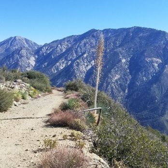
Beautiful views during the entire hike! Made it to the top & back down the mountain in less than 3 hrs(first time hiking a Mount Baldy trail). The incline to the top of the peak is moderate. The trail is rocky, so be sure to wear appropriate shoes! Went in the morning, so it was a bit cold. At 8am, most of the trail is shaded. From the top of the peak the views are incredible. Well worth it! Looking forward to hiking this trail again at sunset.


Sunset Peak Trail was a 7.2 mile round trip hike that took 3 hours or so to complete. Limited parking on the side of the road. Gradual inclines to the peak with plenty of shades. Trail was sort of rocky in some areas. Overall, not too difficult with some nice views. Short video of the hike for those interested: https://www.youtube.com/watch?v=ba1OUC3LKKg read more


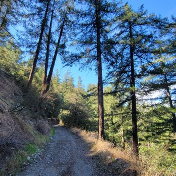


Hiking super early in the morning to catch a sunrise at Sunset Peak, is a heart and soul-filling adventure in my book. Totally worth the experience, at least once in your lifetime :) Sunset Peak Trail is an absolutely gorgeous hike in the San Gabriel Mountains all year long. Gate is closed at Glendora Ridge Road, during snow/winter season. I parked along Mount Baldy Road and hiked 1/2 mile along Glendora Ridge Road to the trailhead. There are two ways of hiking to the peak. You could hike on the fire road or take the steeper trail. Steeper route starts to the left of the fire road and is definitely more scenic with a tiny, tiny bit of rock scrambling. I prefer hiking the steeper trail. AllTrails rates this hike as "moderate" and estimates: 7.3 miles with a 1,272 ft elevation gain via the fire road. My first time here, I hiked up the steep ridge line, did some "extra exploring/wandering" then down the fire road. I clocked in 10 miles with about the same elevation gain. Bring your hiking 10 essentials always (REI has a good 10 essential list). Check weather reports, to bring microspikes and hiking poles, during winter/snow seasons. Sounds like a heavy load to bring, but guaranteed you'll leave feeling lighter at the end of the hike. May your 2021 be filled with heart-filling adventures that'll nurture your beautiful soul! Stay safe and healthy (mind, body and soul) Yelping out there :) read more


A nice "introductory" hike compared to the other big peak hikes in the Baldy area (Cucamonga, Ontario, and Mt Baldy peak). There's two ways to get to Sunset peak from the start of the trail head at Cow Canyon Saddle. The 3 and a half mile ish fire road trail where the yellow gate is, or the steep 1 and a half miles is trail to the left. I took the challenging steep trail which had my heart rate going at times. I hiked here mid fall of 2021 on a pretty cloudy day and there was still ice on part of the fire road from the snow fall weeks earlier, but even on a cloudy day on this mountain range you get nice views above the clouds as far out as you can see. The views on this trail alone make this a must do hike. I came during the week so I'm not certain if this was the reason but Glendora Ridge Road was closed so I had to hike up an extra mile from there to the trail head, and I also had to park in front of the Mt. Baldy visitor center since most of the spots on Baldy Rd weren't for public parking. Across from the trail head there was a parking area but when I was there it had no parking signs. It might have had something to do with the road construction going on at the time, but just in case be prepared to possible have to park a little further away from the actual start of the trail head, and remember to display your adventure pass. One last note, the All Trails app has a map of this route. The route is for the 7 plus mile hike along the fire road, but it also has the dotted trail for the steep short cut to sunset peak also. read more


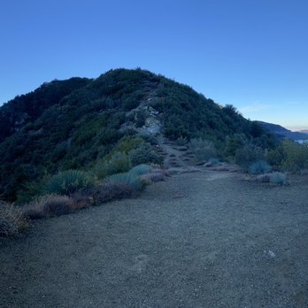


Apple Maps can be misleading and All Trails doesn't navigate you to the trail just through it. So here's how to get there through Mount Baldy Rd.: take Mount Baldy Rd all the way to Glendora Ridge Rd. At Glendora Ridge Rd. make a left and continue straight until you see an empty lot with red poles and signs that say NO PARKING. The entrance to the trail is to the left of this lot, you'll see a yellow gate. You can't park in the lot but you can park on the side of the road. The trail was mostly clear with the exception of rock piles in some areas from prior night rain. Lots of shade and overall a well kept trail. Happy hiking! read more


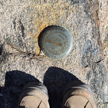
I'm not really so sure I want to share this, but what an absolutely amazing hike! From the Village it was 9.9 miles round trip. It was refreshing not to do an excruciatingly steep hill, but to enjoy one with a slow yet steady incline. It definitely didn't feel like nearly 5 miles up hill. Lots of shade, but a few really sunny areas too. Today was nice because it was only about 51 degrees so the sun wasn't an issue. There are numerous trees that have fallen down from recent storms I'm guessing. So you either climb over, under or go around them. The pinecones are amazing and beautiful up there. Once you reach the summit, we found several signs people had left you there. We could not however find the summit marker. Guess that means I'll be going back! Beautiful views of our truly precious mountain landscape and the cities below. Hazy so couldn't see Catalina, but did find LA. As of today 2/5, there is snow in many areas. Especially on the north side (Baldy side) as you approach the summit. But we only had hiking boots and a few man made poles we found left at the trailhead and we were fine. We also left the poles for the next people. I wish it had been a more clear day, but I couldn't have enjoyed a better day with my bestie by my side! Elevation gain 1,272 from trailhead. Miles 7.3 from trailhead. Miles from the village 9.90. read more


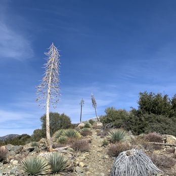




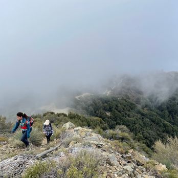
Beautiful and easy 7.3 mile hike! This is great got first timers who can endure long walks. The incline is steady and gradual so it won't hurt the knees or shins. You'll see wildflowers, grand trees, and lots of rolling clouds along the way -- well, make sure to go early enough so you can catch the clouds and even go above it. Soon enough you'll be floating on the clouds! Or you can go in the evening to catch the sunset. Total elevation gain is only about 1200 feet, but you'll be at 5500 feet elevation. It's chilly in May so make sure to dress in layers and bring gloves if you have them handy. When you get to the top, there are wooden boards with the names of the trails for Instagram-worthy photos. read more



6 years ago
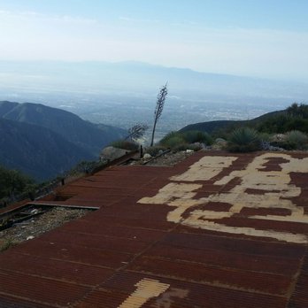
You will start at Cow Canyon Saddle. Please display your adventure pass, there is no restroom in the area. You can hike this in a few different ways. The route I choose was to hike up the steep shortcut to sunset peak, then loop back down onto sunset ridge fire road to complete a loop trail. It's roughly about 3 to 8 miles round trip pending how you want to tackle this trail. But for my hike I clocked in about 5 miles. At the Cow Canyon Saddle area, you will see the yellow gate fire road. But to the left of this gate, you will see a steep trail going up, just follow this trail. It's actually pretty fun and I love hiking on a trail versus a fire road any day. Almost near the top you will intersect onto the fire road twice. So you will have the option to jump onto the fire road if the trail is just too steep. But I want to finish a loop, so I continue on this steep part of the trail. Once you make your way up to Sunset Peak, you will see the metal flooring and the wooden signs at the peak. Just relax and enjoy the view. When ready, either hike back down the way you came up or follow the fire road back down to finish this hike as a loop trail. As always pack accordingly to the weather and have fun. At the time of the hike, the mosquitoes are out. So wear long pants and long sleeves or have some bug spray. read more


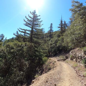


Did this hike for the 1st time on 4/9/17. I clocked it at 2 hrs 30 mins and 7.35 miles RT with about 1200 ft of elevation gain. I would classify this hike as moderate. We drove about 2-3 miles past the parking for Potato Mountain on Mount Baldy Rd. After passing an elementary school you need to look for Glendora Ridge Rd. and make a left. In less than a mile you will come across the trailhead which is a yellow gate to a fire road on the left side. We parked across the road in a dirt lot. The trail is wide and there were a lot of small rocks on the trail and there isn't much of a view at the beginning with the side of the mountain to your left and trees to the right...that changes at about 1 1/2 miles in and the trees are no longer blocking the view to relatively untouched mountains upon mountains. At about 2 miles in you will come to a fork in the road with no signs and you must make a left. About a mile and a half later you will make it to the top and be rewarded with great views looking south and southeast toward San Bernardino County. You take the same way back down and about half way down at about mile 5 is when we encountered the first fellow hikers and saw a few more as we approached the end. I like having trails that are not very crowded and this was definitely that...we started the hike a little before 7 am and were done before 9:30. read more



4 years ago
I was here on Saturday, August 6th. I arrived at 6am and there were cars already parked. The trail is easy. It has a gradual incline but nothing too strenuous. There were a couple of bees at the top. It was pretty warm and it got hotter as the day progressed. I recommend this hike. Happy Hiking! read more


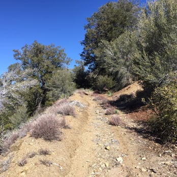
Second attempt and I made it! The first time I drove out here the gate on Glendora ridge was closed! I drove to the Mount Baldy visitor center & the ranger said it was closed due to the weather. Instead of wasting my drive, I decided to hike Ice House Canyon instead! (So by any change if you try to drive up Glendora Ridge and it's closed, there are plenty of other hikes near by) My second try this morning and the gate was open (yay!) I drove a few miles up and to my right was a large parking area. I parked my car (not too sure if a permit is required) and walked across the street to where the trail was. The start of the trail is a closed yellow gate and all you have to do is walk around it. The hike is easy/moderate and honestly a little boring. It is a steady incline and paved way all the way up. The only fun part of the hike up has to be the views. You are completely surrounded by beautiful mountains! At one point I was a bit bored, I prefer hikes that are more adventure like :P and get your heart rate going! I encountered a fork in the road twice and each time I turned left and luckily it led me to the top! The five stars has to be for the views. This hike has the most amazing and beautiful views! I was shocked at how beautiful it was at the top. I grabbed a snack, sat on a rock, and just stared at the gorgeous setting around me. I definitely recommend everyone to try this hike. I do not understand why it's not so popular! It is dog friendly and you don't need crazy gear to hike it. Just sturdy shoes, some snacks and water! read more





12 years ago
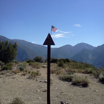
This hike is less than 7 miles roundtrip. The trail is a wide,dirt fireroad with a bit of rock under foot. It is a gentle slope up for the most part, so this hike is fairly easy overall. There is some shade, especially if you go early morning. But most of the hike is exposed to the sun, and it gets very hot in the summer. Once you get close to the summit, there is an option to go straight up on a ridge to the peak for about 100 yards. If you want to get your heartrate up, take it - it's pretty difficult, but is short-lived. Being on the peak is nice and you are surrounded by a 360 degree of mountains and city. It is pretty, but I was expecting more, given some of the reviews. parking - small lot right next to the trail, or park about 1 mile before reaching the trail in a residential area read more



9 years ago
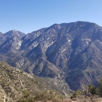
Beautiful views during the entire hike! Made it to the top & back down the mountain in less than 3 hrs(first time hiking a Mount Baldy trail). The incline to the top of the peak is moderate. The trail is rocky, so be sure to wear appropriate shoes! Went in the morning, so it was a bit cold. At 8am, most of the trail is shaded. From the top of the peak the views are incredible. Well worth it! Looking forward to hiking this trail again at sunset. read more




10 years ago
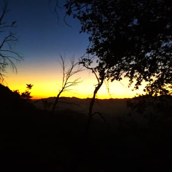
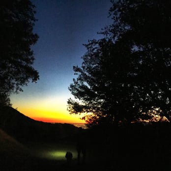
Beautiful sunset hike near Mt Baldy. The hike is about 7 miles roundtrip with an elevation gain of about 1,500 ft. The incline is very gradual until the last section to the peak. The final ascend to the peak is quite steep but it's fairly short. We pretty much slid down the loose sand on the descend. There are actually two trailheads for this hike, both starting on Glendora Ridge Road. The trailhead starting further down Glendora Ridge Road is more exposed so you may want to hike this from the other trailhead since there's more shade. The hike is pretty much all fire road and is quite wide so we didn't really have a problem hiking our way back to our car in the dark with headlamps/flashlight. I would just make sure there's still daylight when going down that steep section by the peak. This trail definitely was not a popular hike since we did not run into a single person on the way up or down on a Sunday. I would probably not do this alone as a sunset hike since the way back will be dark & if there's no one else on the trail, you may encounter some wildlife that you don't want to. One important advice: HEAD NETS! Bugs are EVERYWHERE!! We had a hard time breathing without getting those flying bugs up our nose! That part was not fun! read more




13 years ago

8 years ago
5 years ago

11 years ago
13 years ago

10 years ago
8 years ago
More info about Sunset Peak Hike
Glendora Ridge Rd
Mount Baldy, CA 91759
Directions
Hours
Indoor Amenities
Outdoor Amenities
Ask the Community - Sunset Peak Hike
Review Highlights - Sunset Peak Hike
You might also consider


Why does Yelp recommend reviews?
1 review that is not currently recommended
The reviews below are not factored into the business's overall star rating.

9 years ago
Sunset Peak Hike - hiking - Updated August 2026
Best of Mount Baldy
People found Sunset Peak Hike by searching for…
Star Gazing in Mount Baldy, CA
Beautiful Views in Mount Baldy, CA
Sunrise View in Mount Baldy, CA
Scenic Drive in Mount Baldy, CA
Secluded Spots in Mount Baldy, CA
Hiking Trails in Mount Baldy, CA
Sunset View in Mount Baldy, CA
Scenic Night View in Mount Baldy, CA
Picnic Areas in Mount Baldy, CA
Lookout Points in Mount Baldy, CA
Dog Friendly Things to Do in Mount Baldy, CA
Waterfall Hike in Mount Baldy, CA
Empty Parking Lot in Mount Baldy, CA
Running Trails in Mount Baldy, CA
Free Things to Do in Mount Baldy, CA
Dog Friendly in Mount Baldy, CA
Dog Friendly Hiking Trails in Mount Baldy, CA


