Stoddard Canyon Falls Photos


You might also consider


More like Stoddard Canyon Falls
Recommended Reviews - Stoddard Canyon Falls
Start your review...


Reviews With Photos


It's a pretty crowded hike. Not sure if it was time I went. There is so much graffiti everywhere. It makes this once beautiful place, pretty ghetto now. The path down to the waterfall is pretty steep, a lot of the land slides. The path could be pretty unstable at times. But once you get to the water, it's peaceful and beautiful. But be prepare for a lot of people! The parking is limited, and the more you drive down to the ditch, the harder it is for your car on the way out. There is no parking on the actual pathway, but we saw plenty of people park there.


Has a blast just driving there... curvy roads - Great scenic sites and nature all over. Arrived, small parking lot- get a space if not, you might get ticketed. Entrance has to roads old road has the access to creek and falls and the old road is mostly hiking. Important Don't litter and bring water appropriate shoes and attire. Grear trails, slippery rocks and falling rocks . No trash cans, so take your trash with you. Over all a simple trailhead with simple access and good elevation change. What would be great - trash can at least and benches and or notices...


One day, I would love to bring my children here . So sad to see this beautiful place being ruined by so much trash. Just on the way from the start of the trail to the waterfall was over a dozen items of trash. While being there people were snacking, drinking and leaving their trash behind. Sad to see. I didn't wanna cause problems by calling people out. But I also can't carry a 12 pack of bottles back by myself. SMH The water was freezing my hands went numb in minutes. It was beautiful and you can slide down. It's not a far drive from the freeway. If you come, please be respectful. Please pick up after yourselves. It's really embarrassing when grown people cannot even pick up their own trash that they bring.


We took about 20 of us. Ages from 5 to adults. We went in 104 degrees. . But, honestly when you got down you didn't feel it and the water was so refreshing. I enjoyed the small hike, mile of that. The climb and the beauty. There is a down side. There is lots of people going there and hanging out drinking and smoking. Saw people pouring their beer out. Other than that . Loved it


Stoddard canyon falls was absolutely beautiful. We went in the middle of August and the waterfall was full. Because the falls is in between the rocks the weather is relatively cooler on a sunny day. It is easy to get to from the parking lot. The path is clearly marked and there is an opening on the left side that is pretty steep. That opening is where you will go down to get to the falls. Getting to the falls itself is a little difficult. You will get wet and have to climb over rocks which may be slippery. Along the way there are places you can swim in but the water is extremely cold. The trail to the waterfall is short only a little over a mile but you can make it longer by hiking along the river.

It was a super fun trail! The waterfall was fun to slide down even in the winter. The waterfall was cold but you get used to it. There was plenty to hike and the trail was easy to follow. The only negative was that someone smashed my car window and stole my purse. So just be careful what car you take, what you leave in your car and where you park, the mountains can be shady. All in all definitely a trail to hike! I would suggest going before sun set because it's better to see what you're climbing. It can get a bit steep.


3 months ago
Incredible the energy, peaceful and quiet. The weather was beautiful, and it was very safe. read more


11 days ago
Pretty easy hike. Not far from the falls. Just gotta be careful to not slip into the pools of water. You will get wet and you might have to walk through water. Waterfall is real cool. People slid down it, but their feet hit the bottom real quick. So I don't recommend going head first or diving in. It is shallow at the bottom of the falls. Their are alot of people here now due to social media. Parking is packed. You might have to park across the street. Get an adventure pass from 7-11. Big 5 has them, but they don't open till 10. Have fun! read more


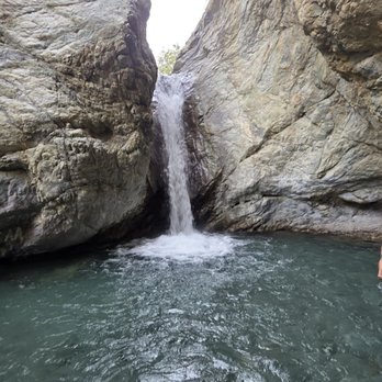


Avoid During Summer Weekends! This is a short hike in Stoddard Canyon to the waterfall and swimming hole in the Mt Baldy region. The hike is approximately 1.25 miles out and back. There are several routes to get to the waterfall- the safest route is to descend down the side of the canyon by a pillar like structure using a rope. The river leading to the waterfall is within a canyon, temperature is cooler, water temperature is comfortable. During the hike to the waterfall, you will have to meander around boulders, rocks, and use ropes to get to the endpoint where the final pool and waterfall exist. On a crowded day, you may have to wait patiently and you might feel pressure, which could lead to an injury. Rocks are also very slippery as you transcend to the waterfall. Wear slip resistant shoes- I wore my hiking boots. Unfortunately the rocks along the river has been trashed. People are partying in this area and leaving their trash behind. Plus you will see graffiti on the rocks. Sad to see in such a beautiful area. All this takes away from the beauty of the river and the waterfalls. There are several parking lots near the trailhead- the parking lots on the weekends fill up quickly so get to the park early. Also, read the signs, as there are a lot of no parking signs near the trail. Lastly, do not leave valuables in the car, as some break ins are know to occur in this area. read more


It's a pretty crowded hike. Not sure if it was time I went. There is so much graffiti everywhere. It makes this once beautiful place, pretty ghetto now. The path down to the waterfall is pretty steep, a lot of the land slides. The path could be pretty unstable at times. But once you get to the water, it's peaceful and beautiful. But be prepare for a lot of people! The parking is limited, and the more you drive down to the ditch, the harder it is for your car on the way out. There is no parking on the actual pathway, but we saw plenty of people park there. read more


5 months ago
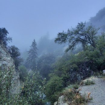
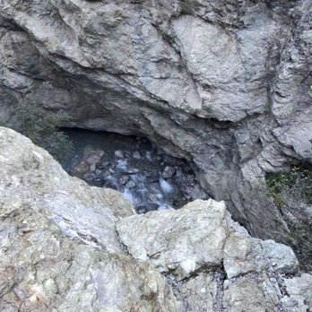
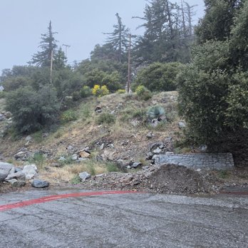
Has a blast just driving there... curvy roads - Great scenic sites and nature all over. Arrived, small parking lot- get a space if not, you might get ticketed. Entrance has to roads old road has the access to creek and falls and the old road is mostly hiking. Important Don't litter and bring water appropriate shoes and attire. Grear trails, slippery rocks and falling rocks . No trash cans, so take your trash with you. Over all a simple trailhead with simple access and good elevation change. What would be great - trash can at least and benches and or notices... read more





1 year ago
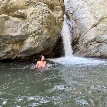
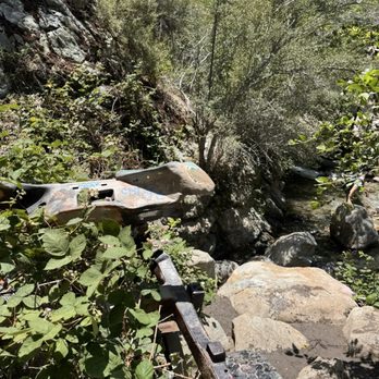
One day, I would love to bring my children here . So sad to see this beautiful place being ruined by so much trash. Just on the way from the start of the trail to the waterfall was over a dozen items of trash. While being there people were snacking, drinking and leaving their trash behind. Sad to see. I didn't wanna cause problems by calling people out. But I also can't carry a 12 pack of bottles back by myself. SMH The water was freezing my hands went numb in minutes. It was beautiful and you can slide down. It's not a far drive from the freeway. If you come, please be respectful. Please pick up after yourselves. It's really embarrassing when grown people cannot even pick up their own trash that they bring. read more




4 months ago

2 years ago
We took about 20 of us. Ages from 5 to adults. We went in 104 degrees. . But, honestly when you got down you didn't feel it and the water was so refreshing. I enjoyed the small hike, mile of that. The climb and the beauty. There is a down side. There is lots of people going there and hanging out drinking and smoking. Saw people pouring their beer out. Other than that . Loved it read more


1 year ago
1 year ago
Okay so I went there with my girlfriend it was cool looked so beautiful it was really hard to find the waterfall so we didn't we tried to follow the stream upwards but we couldn't get past the rocks and everything was unmarked but so far everything looked so pretty read more


3 years ago
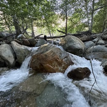
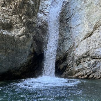
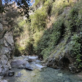
Stoddard canyon falls was absolutely beautiful. We went in the middle of August and the waterfall was full. Because the falls is in between the rocks the weather is relatively cooler on a sunny day. It is easy to get to from the parking lot. The path is clearly marked and there is an opening on the left side that is pretty steep. That opening is where you will go down to get to the falls. Getting to the falls itself is a little difficult. You will get wet and have to climb over rocks which may be slippery. Along the way there are places you can swim in but the water is extremely cold. The trail to the waterfall is short only a little over a mile but you can make it longer by hiking along the river. read more




1 year ago
10 months ago
1 year ago
It was a super fun trail! The waterfall was fun to slide down even in the winter. The waterfall was cold but you get used to it. There was plenty to hike and the trail was easy to follow. The only negative was that someone smashed my car window and stole my purse. So just be careful what car you take, what you leave in your car and where you park, the mountains can be shady. All in all definitely a trail to hike! I would suggest going before sun set because it's better to see what you're climbing. It can get a bit steep. read more


2 years ago


2 years ago
3 years ago
Do not come to this, place very ghetto they will rob your stuff and there's no service so you have to wait till you go down the hill read more


2 years ago

5 years ago
2 years ago

2 years ago

6 years ago
I've been seeing alot of people confuse these water falls with the one in the mt. Baldy wilderness preserve. Stoddard canyon falls(3 waterfalls) are in stoddard canyon. The waterslide is in San Antonio canyon. And the ones in the real stoddard canyon are a little bit harder to get to. There's one other review on here with the pictures of the real stoddard canyon falls. The directions are all wrong not sure why. read more


7 years ago
First hike of 2020 and I have to say it wasn't what I was expecting. There really isn't any signage as to where the trail start it end besides the info board, it could be my failure in reading the map. My pup and I didn't get to go to the waterfall. We hike along pave and mostly rocky path. I turn around after an hr in fear of my pup's paw getting hurt because there were broken glasses mixed in :( read more


6 years ago
Beautiful hiking area.. little waterfalls on the way up.. not alot people around... nice scenery.. little waterfalls on the way up to look at.. not a bad place to go not busy at all.. I posted some videos to get idea of the areas.. read more

3 years ago
3 years ago

7 years ago
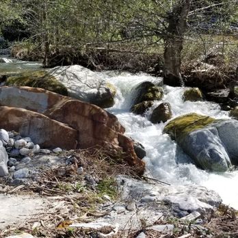
This is a pretty little hike and perfect if you have little dogs like mine. Its not hard to get there either just go up Mt Baldy Road amd when you see the barret Stoddard road sign park in the lot. If you head on the trail to yoir right its about 1 mile and you see the falls, head to the left to hold Stoddard peak which is only a 6 mile RT. Leave no trace. PLEASE AND THANK YOU read more


8 years ago

7 years ago
This is one of my favorite trails. It's really easy to get to the water and the hike isn't bad at all. It's really beautiful and secluded. There isn't too much parking though. read more


6 years ago
8 years ago
More info about Stoddard Canyon Falls
N Mountain Ave
Upland, CA 91784
Directions
Hours
Outdoor Amenities
Stoddard Canyon Falls Reviews in Other Languages
Ask the Community - Stoddard Canyon Falls
Does anyone know if this hike was affected by the fires? is it open?, today 09/18/2024
No, it is safe to go. Went the weekend before
How long is the hike before you reach the actual water?
What's the correct address to actually view the waterfall? I drove over to address listing here and only to find all dry land and blocked off thanks
402-416 Mountain Ave La Verne, CA 91750 United States
Review Highlights - Stoddard Canyon Falls
You might also consider

















Why does Yelp recommend reviews?
4 reviews that are not currently recommended
The reviews below are not factored into the business's overall star rating.

9 years ago
10 months ago

3 years ago

6 years ago
Stoddard Canyon Falls - hiking - Updated August 2026
Best of Upland
People found Stoddard Canyon Falls by searching for…
Trending Searches in Upland, CA
Barbershop For Men near Stoddard Canyon Falls
Bike Shop near Stoddard Canyon Falls
Cliff Jumping near Stoddard Canyon Falls
Consignment Shops near Stoddard Canyon Falls
Cruising Spots near Stoddard Canyon Falls
Dog Friendly Things To Do near Stoddard Canyon Falls
Ear Piercing near Stoddard Canyon Falls
Elementary Schools near Stoddard Canyon Falls
Eyebrow Threading near Stoddard Canyon Falls
Flower Fields near Stoddard Canyon Falls
Hair Braiding near Stoddard Canyon Falls
Kids Haircut near Stoddard Canyon Falls
Lakes near Stoddard Canyon Falls
Lookout Points near Stoddard Canyon Falls
Parks near Stoddard Canyon Falls
Pedicure near Stoddard Canyon Falls
Picnic Areas near Stoddard Canyon Falls
Preschools near Stoddard Canyon Falls
Public Golf Courses near Stoddard Canyon Falls
Rock Quarry near Stoddard Canyon Falls
Running Trails near Stoddard Canyon Falls
Scenic Night View near Stoddard Canyon Falls
Scenic Overlook near Stoddard Canyon Falls
Sports Card Shops near Stoddard Canyon Falls
Sunrise View near Stoddard Canyon Falls
Swimming Holes near Stoddard Canyon Falls
Trading Card Shops near Stoddard Canyon Falls
Uniforms near Stoddard Canyon Falls
Browse Articles
Browse Nearby
BEST of Upland, California Restaurants near Stoddard Canyon Falls
BEST of Upland, California Coffee near Stoddard Canyon Falls
BEST of Upland, California Things to Do near Stoddard Canyon Falls
BEST of Upland, California Breakfast near Stoddard Canyon Falls
BEST of Upland, California Campgrounds near Stoddard Canyon Falls
BEST of Upland, California Ski Resorts near Stoddard Canyon Falls
Browse Brands
Related Searches in Upland, CA
Best Dog Hiking Trails Around Upland, California
Best Fishing Locations and Guides in Upland, California
Best Nature Trails for Hiking in Upland, California
Best Places for Horseback Riding in Upland, California
Check Out Off Road Trails in Upland, California
Discover Dog Friendly Trails to Explore in Upland, California
Discover Easy Hiking Trails Near Upland, California
Discover Kid Friendly Hiking Trails in Upland, California
Discover Popular Bike Trails in Upland, California
Discover Scenic Mountain Bike Trails Near Upland, California
Discover Walking Parks in Upland, California Near You
Discover a Hiking Trail in Upland, California
Discover the Best Night Hike Trails in Upland, California
Dog-Friendly Hikes With Dogs in Upland, California
Enjoy Camping Adventures Around Upland, California
Enjoy Kayaking Adventures in Upland, California
Enjoy Off Leash Dog Hikes in Upland, California
Enjoy Scenic Places to Walk in Upland, California
Enjoy Tent Camping Spots Around Upland, California
Enjoy a Beautiful Waterfall Hike in Upland, California
Enjoy the Best Walking Path in Upland, California
Enjoy the Best Walking Trails in Upland, California
Explore Beautiful Parks and Green Spaces in Upland, California
Explore Easy Hikes Perfect for All in Upland, California
Explore Fun Activities to Do in Upland, California
Explore Popular Campgrounds Near Upland, California
Explore Popular Dog Walking Trails in Upland, California
Explore Top Dog Parks in Upland, California Near You
Family Friendly Hiking With Kids in Upland, California
Find Top Dog Friendly Parks to Visit in Upland, California
Find Top-Rated Waterfalls in Upland, California Now
Find the Best Parks for Picnics in Upland, California
Hiking Trails With Waterfalls in Upland, California
Off Leash Dog Hiking Trails in Upland, California
Perfect Spots to Watch Sunset in Upland, California
Picnic Areas With BBQ Pits Available in Upland, California
Popular Outdoor Activities to Try in Upland, California
Popular Picnic Spots to Visit in Upland, California
Popular Waterfall Hiking Trails in Upland, California
Safe River Swimming Areas in Upland, California
Safe and Fun Parks for Kids in Upland, California
Top Hiking Trails to Explore in Upland, California
Top Playgrounds for Kids to Enjoy in Upland, California
Top Running Trails to Explore in Upland, California
Top Swimming Lakes to Enjoy in Upland, California
Top Swimming Spots and Pools in Upland, California
Top-Rated Camping Sites in Upland, California


