1. The Nature Conservancy

    1. The Nature Conservancy

    0

    Morocco, IN

    Cancel

    Open app

    Search

    The Nature Conservancy

    5.0 (1 review)

    The Nature Conservancy Photos

    Recommended Reviews - The Nature Conservancy

    Your trust is our priority, so businesses can't pay to alter or remove their reviews. Learn more about reviews.
    Yelp app icon
    Browse more easily on the app
    Review Feed Illustration

    3 years ago

    Helpful 0
    Thanks 0
    Love this 0
    Oh no 0

    Verify this business for free

    Get access to customer & competitor insights.

    Verify this business

    Wabash Heritage Trail - Zoey enjoying exploring and sniffing

    Wabash Heritage Trail

    3.9(7 reviews)
    50.1 mi

    The best trail for running in the West Lafayette/Lafayette area. On the southernmost point, you can…read morepark at Fort Ouiatenon, take the sidewalk 3/4s of a mile to the trailhead then follow the dirt path along the Wabash River up to the pedestrian bridge, where you can cross over to the Lafayette side or continue up a bit more on paved surface toward a small park, restaurants and the edge of Purdue's campus. If you head over to the Lafayette side, the trail continues on paved surface for a while before returning to a dirt surface and concludes at the Tippecanoe Battlefield Park in Battle Ground, roughly 13 miles from Fort O. The trail is mostly flat and runnable from start to finish. After heavy rains, the river regularly floods the southern part of the trail.

    The Wabash Heritage Trail is 13 miles long making it a perfect training ground for a mini marathon…read more However, today we were exploring nature with our granddaughter. We started on the north end at Battleground Memorial. At the head of the trail is a sweet little nature center (Wah-ba-shik-a Nature Center) filled with descriptions of wildlife and fauna that are native to the area. My granddaughter was delighted to see the big white owl that greeted us at the door. The volunteer at the Center was welcoming and admission was free. They had maps for the trail that you can take. There are also special programs offered throughout the year. The trail starts and Battleground and extends all the way to Fort Ouiatenon. We only toured a couple miles along a creek that eventually meets the Wabash River. The trail is mulch covered and easy to navigate by foot. It would be difficult to maneuver a stroller or wheelchair onto the trail. The trail is lined with very large sycamores, oaks, walnuts and other trees native to the area. Some of the trees were at least 300 years older. The creek is clear and suitable for a little stomping. There are occasional benches along the trail as well as informational markers. There were also picnic tables and a water fountain at the trail head. We did not see any restroom facilities, but there were probably some in the Battle Ground Museum. The hike is quiet during the week. You can enjoy the sounds of birds and squirrels. I can imagine how beautiful the trail is when the leaves are changing color. There is some highway traffic noise as you get closer to the highway. The trail does not loop, so you have to backtrack to return to your car. There was plenty of parking at the Memorial. The map indicated that there were about five parking lots along the trail. We enjoyed the hike and will return to do a different section soon. I highly recommend.

    Photos
    Wabash Heritage Trail
    Wabash Heritage Trail - The Snowy owl at the nature center.

    The Snowy owl at the nature center.

    Wabash Heritage Trail - The creek along the head of the trail.

    See all

    The creek along the head of the trail.

    Midewin National Tallgrass Prairie

    Midewin National Tallgrass Prairie

    4.6(17 reviews)
    40.9 mi

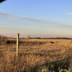
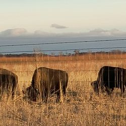
    Midewin is worth the drive from Chicago -- 90 minutes…read more The visitor's center is closed during the pandemic. We followed the signs and went there, thinking we'd find the trailheads. We didn't. We eventually found a man moving grass who recommended we drive north to the Iron Bridge and park there. That was good advice. Not only is there parking, pit toilets, and picnic tables, but the trailhead, and connections to several trails. I recommend everyone start at the Iron Bridge trailheads. We did not see the bison, but we did enjoy a few hours of walking on flat trails. We admired the prairie grasses and flowers, reveled in the sunshine and breeze on this cool day, and just loved every minute we were there. Hikers, remember to wear a head covering. You are on the prairie, after all. Officially, this is a national park, and I brought my national parks pass, but we saw no rangers at all. Nobody checked for park passes or any kind of entrance fee.

    If bison, wildflowers, wildlife, & pastures are your thing, you've come to the right place. I'm…read morefrom Ohio and it was my husband's idea to come here. He saw it on a map and said, that's something we've got to do because we live less than 6 hours from it and it's got National in the name... We were not disappointed. I noticed that most people come here for the bison viewing, and that was nothing short of spectacular. However, there are so many trails in addition to that that make this place all the more worthwhile! I especially enjoyed the history, this park was the former Joliet Army Ammunition Plant, and when you walk some of the trails, that becomes apparent in the sense of abandonment that it gives you. However the peaceful ponds and gorgeous wildlife found along the way makes the hike both interesting and fulfilling. The hikes are not strenuous unless you hike in the heat like we did. There are no inclines or anything. You'll be out in the prairie or into the shade of the woods, but more of the former. Just be aware if you hike in the heat, to bring lots of water and sunscreen, as the sun seems to be more brutal in the open plains. The park gave us plenty to do in our 3 days in the area and it was a unique park for us in the sense that it was a prairie and not woods or mountains or beach...when have you ever hiked a trail through a prairie? Try it, you won't be disappointed.

    Photos
    Midewin National Tallgrass Prairie
    Midewin National Tallgrass Prairie
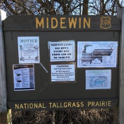
    Midewin National Tallgrass Prairie - Sign

    See all

    Sign

    Falls Creek Gorge - the path is narrow, only one person wide

    Falls Creek Gorge

    4.0(2 reviews)
    49.4 mi

    The Falls Creek Gorge is one of those places that if you go at the right time and/or have the right…read moreclothing/gear, you get a nice experience. Maybe even some great photos, too! The entire trek from parking lot to the potholes, then the mini waterfall, and then back the way you came to your car, is less than a mile. So, if you pack your car accordingly with a change of shoes or water shoes, you may not mind getting your feet wet if the water level is higher than when I went. Know that once you climb down a short stairway, you will most likely have to cross a slightly sloped rock area where water flows over it. I wasn't worried about getting my shoes wet (it was only about 1/4 inch deep) but because of the possibility of slipping and taking a hard fall onto the rock and sliding into the creek. The creek wasn't deep either, but rock is a lot harder than my bones, so I was careful as I crossed the area to the stairs that lead sharply up to the rest of the trail. I was fortunate that the water level was low and easily crossed to a spot where I could stand at creek level to view the potholes. The eddying current of the creek has worn a series of potholes in the river bed than make for a great audio experience hearing the water flow through them. The trail is steep at points and is narrow most of the way as you can get views from above the potholes and the creek. If you continue on the trail, it leads back to a mini waterfall that is only a couple feet high, but because of the setting and the sound, I found I was very pleased I went the extra distance to view it. I understand that the experience can be completely different after a heavy rain or in the winter when ice covers much of the creek. My advice is to know your own skill level at handling flowing water and ice before you undertake this park when the conditions are more challenging. Review #2843

    Sign, sign, everywhere a sign. This attraction was one of only two in Williamsport that enticed us…read moreto drive here from Indy. The gorge itself was splendid but upon our return to our vehicle we were welcomed by the local anti-economic development committee (the local police force) trying to scare us away. Weird. Oh well, enjoyed the trip anyway.

    Photos
    Falls Creek Gorge - Fall Creek heading towards the potholes

    Fall Creek heading towards the potholes

    Falls Creek Gorge - View from the trail of the mini waterfall

    View from the trail of the mini waterfall

    Falls Creek Gorge - Although it's only a couple feet high, it can be heard from a fair distance and is worth the short hike

    See all

    Although it's only a couple feet high, it can be heard from a fair distance and is worth the short hike

    Sand Ridge Nature Center

    Sand Ridge Nature Center

    4.6(8 reviews)
    39.0 mi

    This is a very nice nature center, which features a really nice exhibit space with animal displays,…read moreincluding turtles, snakes, and toads, and information about the region. The space opens up into a beautiful garden area with some log cabins, and there are a few more animals set up outside - a hawk, turkey, and a very talkative Great Horned Owl. We took a nice walk along the Lost Beach Trail, though part of it is gated off. It was still fun to explore the marshy area and see all of the plants and animals. There is a boardwalk that lets you get further out into the area. There is a parking lot available.

    Sand Ridge is a part of the Forest Preserves of Cook County system. You almost miss it when you…read morepass by! As a nature center, it has an interpretive center in addition to the trails, gardens, and prairies. When I was there there was an exhibit about Lake Chicago, which may or may not be a permanent exhibit. I attended the night sky walk they hosted inert and it's a good location for such a program. It's a heavily wooded area, and whilst it's very near the city, it's a better place from where to stargaze. We went on a short hike, in part to help adjust our night vision, and followed with using the large telescopes that the nature center has. There are many trials here for a leisurely walk or a more advanced hike. I am not opposed to the concept of a night hike (I actually think it's pretty cool); what concerns me more is not being able to see the trail and whether there's a lot, root, or other obstruction on the trial. The trail we used here was pretty level and had few trip hazards, though they don't generally allow evening hikes--that was specifically a feature of this program. Some of the attendees at the program I attended were fairly inconsiderate. Some were loud and constantly talking (had they not been talking as much and kept the volume much lower, we might have seen other creatures, or those like bats might have swooped down closer to us). The guide did remind folks of that, but I don't think it helped. I think what annoyed me more was that for a night hike and a 35 minute walk to develop some night vision, there were people taking photos with full flash. Rude. You don't have to document ever moment of a kid/persons life! I'm not sure I'll return to Sand Ridge for a program unless it's something I REALLY want to attend. It's pretty far from me--I live in the north side and this place is a good 55 minutes from me when traffic is reasonable. Also, I got here about 15 minutes before the start... but they didn't actually begin the program until 20 minutes after the stated start time. I totally understand waiting a few minutes, maybe as much as 10, for latecomers; oftentimes that would mean they were waiting for me! But 20 minutes is really excessive, especially for a program that was billed as 1.5 hours. The guide said something about another hike (I couldn't hear since I was near the back), which I may have been able to join if it had started promptly, and they said that though the program had an end time of 9 they could go as late as 9:39. I needed to leave at the original time since I have an hour long drive to get home, so I ended up leaving about half hour early. I took a look in one of the telescopes but it didn't look any more magnified than what I could see with the naked eye (i overheard someone else make the same comment). They did mention sky tracker apps which help one view and learn what is in the night sky, so that was helpful. The trail we walked was not accessible. There were some areas that where wooden planks were laid down, ostensibly because there was marshy area it was providing a path over. They may have an accessible trail here (just inside the entrance I saw something that could have been), but I'm not sure. I do wish the FPDCC would list more information in their events--particularly basic information like whether it's accessible or not.

    Photos
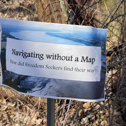
    Sand Ridge Nature Center - Underground Railroad Walk, 2023

    Underground Railroad Walk, 2023

    Sand Ridge Nature Center - Underground Railroad Walk, 2023

    Underground Railroad Walk, 2023

    Sand Ridge Nature Center - Underground Railroad Walk, 2023

    See all

    Underground Railroad Walk, 2023

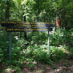
    Portland Arch Nature Preserve

    Portland Arch Nature Preserve

    4.6(8 reviews)
    57.6 mi

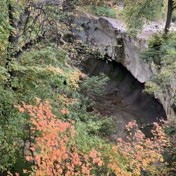
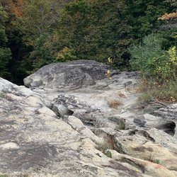
    Unless you are a skilled hiker, I recommend going to this beautiful nature preserve when the…read moreweather has been dry. There is about 90 feet of elevation change on the 0.8 mile loop that can be a bit slippery if you pick a time when mud/rain can be a problem. I only explored the north end trail during my visit. After parking in a shaded lot, I went into the park where I had a choice of left or right. The right side has a steeper descent than the left. Fortunately, there is a hand rail for stability. I figured it easier to go down the steep side than up, so I stayed on the right hand path. There is a fairly level area before you reach the "stairs". The stairs are mostly natural, so they aren't evenly spaced. Just keep focused and you should be alright. Once the trail reaches the bottom of the gorge, there are places where elevated paths keep your feet from trekking through the mud. Depending upon how much rain has fallen, you may get some mud, but my feet stayed dry the entire loop. At the base, there are deep ravines where the trees catch the sunlight and light up in brilliant yellow greens. The rocks are layered and take on a rusty color that can make for some great photos. The highlight of the loop is finding the "arch" through the ridge of rock. It was just a bit taller than my head (I would say most folks won't need to duck going through.) After that, you will start working your way back. Although I traveled the same distance up, it was gradual and not nearly as challenging as climbing steps. I didn't see much wildlife there, but there were squirrels and butterflies that showed themselves. I like a short hike that features a destination and great scenes along the way. If you like that too, then seek out this park. Review #2840

    Great trail among beautiful landforms. It's a nice hike that makes for a good day trip along with…read moreWilliamsport Falls, Attica, and the courthouse murals on Covington.

    Photos
    Portland Arch Nature Preserve - Portland Arch trail

    Portland Arch trail

    Portland Arch Nature Preserve - Halfway down the ravine - rugged

    Halfway down the ravine - rugged

    Portland Arch Nature Preserve - Portland Arch trail

    See all

    Portland Arch trail

    The Nature Conservancy - hiking - Updated July 2026
    Loading...
    Loading...
    Loading...