Toro Canyon Park Photos


You might also consider


More like Toro Canyon Park
Recommended Reviews - Toro Canyon Park
Start your review...


Reviews With Photos
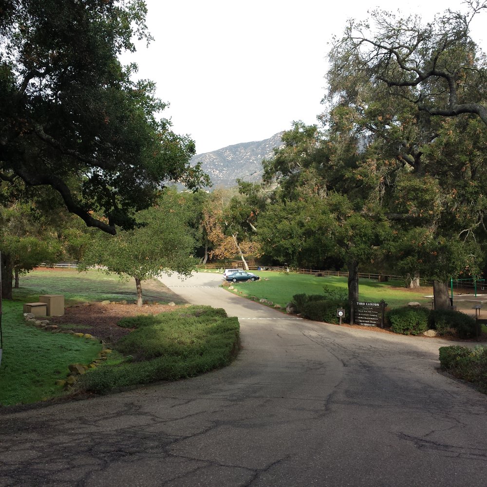

Years ago I hiked the trail here and was unable to remember where it was when I moved back to the Ventura area seven years ago because I couldn't remember the park name and thought it was in Carp. Thanks to Yelp when I searched Summerland, I found it again. Hiking the trail is like finding an old friend on Facebook. I vaguely remembered the gazebo view and the trail but not much else about the place. I now remember the peacefulness, the boulders, the bird chirps and the oak woodland around the scattered picnic areas. The dog park is a new feature. I was also happy to see that they have flush toilets which are a more important feature to me all these years later. It is rare in this area to find any place that's totally natural and even here there are homes on the ridgetop, you overlook distant fields of plastic towards the ocean, and yes, at the viewpoint you can hear the 101 freeway roar. However, I had the benches at the view gazebo to myself, the woodland smells are carried on a gentle breeze, and the mountain views are as spectacular as I remember. I am happy to find this old friend even with its few wrinkles.


Dog friendly! Address on yelp might leave you confused, so use this one to get to the exact front of the park: 3399 Toro Canyon Park Rd Carpinteria, CA Stopped by here to check out the trails on the way to Santa Barbara. We are early hikers (to avoid the heat of the summer) and accidentally came too early, most parks open at sunrise but this park doesn't open until 8am apparently. Driving to the park was interesting, there was no traffic, very deserted, in the middle of no where feeling. There seemed to be at least a ranger truck plus some maintenance people so that at least was comforting. There is a wire, fenced in area where you can have your dog off leash, it's not very big but its something I suppose. Plenty of parking. There is a trail sign where the trail starts, we walked all the way to the gazebo and it was only about half a mile. It looks like you might be able to walk further on paved road, but we heard coyotes barking and decided it would be safer if we were not so adventurous. There might be another trail at the end of the parking lot, the path did not look very worn and there was a mountain lion warning sign by the gate, so again we erred towards the side of safety. This place really does have that middle of nowhere, wilderness feeling. Its eerily (and peacefully) quiet, but do watch out for fox tails, mountain lions, and coyotes. Due to this place probably not receiving much traffic, I think you might be more at danger here if you're not careful.


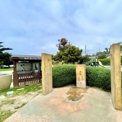
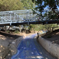
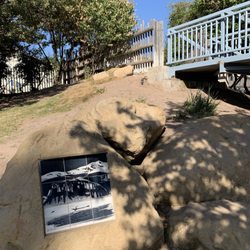
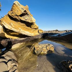
No smoking allowed throughout the entire park. SWEET! Clean flushing bathrooms, running water, soap. Dogs have dog park area fenced off and not allowed in bathrooms. Nice for dog people and those of us that prefer the park experience to be dog free and smoke free. We've stopped in quite a few times now this summer. The grandkids love climbing up the huge rocks and enjoying the view from the top. It's a great spot for a picnic, some photo ops or just a short break from driving between LA and Santa Barbara or beyond. We haven't tried out the creek bed yet, but I'm sure we will on a future trip.


3 years ago
Ohhhh my gosh! This is a hidden gem! Seriously HIDDEN! Went for a drive thru the hills of Carpenteria and Montecito and stumbled upon this park... saw the sign for the turn off and decided to take it! Drove for a while on this gorgeous lush road with so much foliage and trees that you could barely see the sky, that led us to a beautiful park with a ton of trees, and a creek running through it! A wooden bridge crossing over...There was a huge dog park area; A nice bathroom; Playground for kids; There are several picnic areas available to reserve for events... Just lovely! read more


4 years ago
Only four stars for lack of puppy water... GPS is a little misleading. Once you see the Toro Canyon Park sign on the road you must keep going. It's definitely worth the extra drive. The fenced in off-leash dog park is big, but all dirt. The entire park itself is Amazing!!, Huge!!!, Clean And nicely done. We lucked out & were the 1st ones in. When we were leaving this nice park ranger type woman asked us if we'd be interested in attending a Rattlesnake Avoidance Training Class ?!?!? Lucky, Blessed, Confirmed! (9/14/22) read more


This park has a quick trail that leads to a gazebo with a partial ocean view. It's a simple hike which kids could definitely do. The park is great but the real 5 star show stopper is the Toro Canyon Ridge hike up the road from the park. It is just a small pull off with room for about 2 parked cars just up the hill from the park (if you start driving downhill you've gone too far). There is a sign that says no parking after dusk and it's right after a gated drive. The hike is relatively steep at first but not bad after the initial incline. Most of the hike is hiking the perimeter of a beautiful estate. You'll walk around and then at the end have a slight incline and then BAM the most gorgeous sweeping ocean views come out of nowhere. There are few Santa Barbara views that leave me as awestruck as this one. There is a stone bench up top to enjoy the views from. This hike is worth it for sure! read more


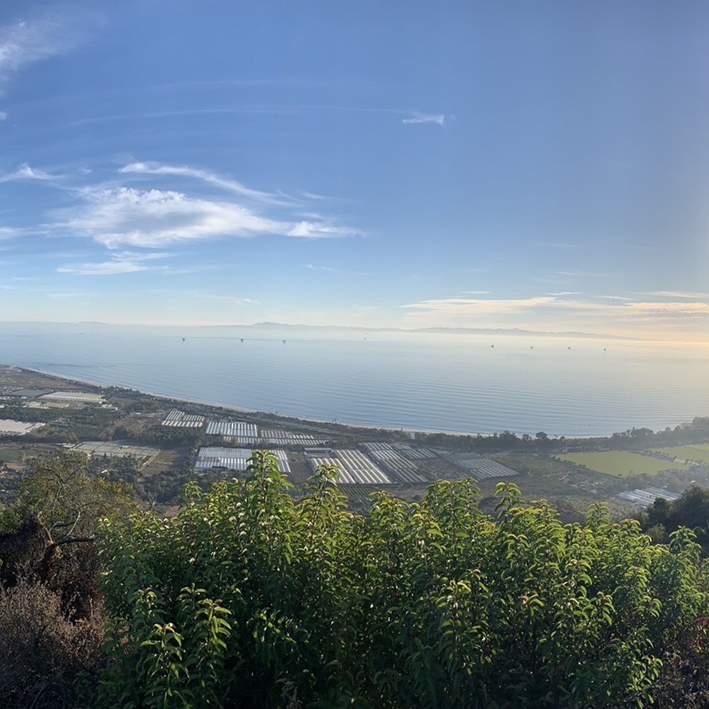
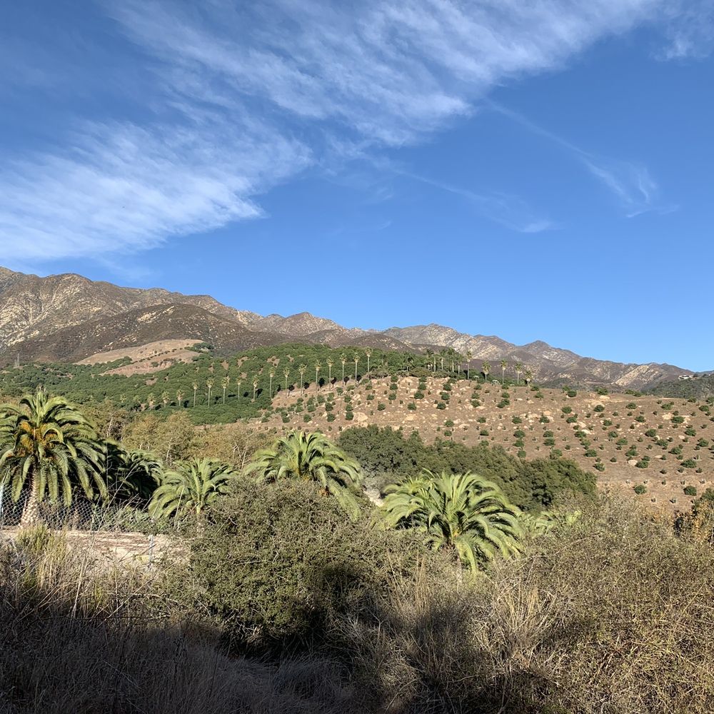


Years ago I hiked the trail here and was unable to remember where it was when I moved back to the Ventura area seven years ago because I couldn't remember the park name and thought it was in Carp. Thanks to Yelp when I searched Summerland, I found it again. Hiking the trail is like finding an old friend on Facebook. I vaguely remembered the gazebo view and the trail but not much else about the place. I now remember the peacefulness, the boulders, the bird chirps and the oak woodland around the scattered picnic areas. The dog park is a new feature. I was also happy to see that they have flush toilets which are a more important feature to me all these years later. It is rare in this area to find any place that's totally natural and even here there are homes on the ridgetop, you overlook distant fields of plastic towards the ocean, and yes, at the viewpoint you can hear the 101 freeway roar. However, I had the benches at the view gazebo to myself, the woodland smells are carried on a gentle breeze, and the mountain views are as spectacular as I remember. I am happy to find this old friend even with its few wrinkles. read more


9 years ago
Dog friendly! Address on yelp might leave you confused, so use this one to get to the exact front of the park: 3399 Toro Canyon Park Rd Carpinteria, CA Stopped by here to check out the trails on the way to Santa Barbara. We are early hikers (to avoid the heat of the summer) and accidentally came too early, most parks open at sunrise but this park doesn't open until 8am apparently. Driving to the park was interesting, there was no traffic, very deserted, in the middle of no where feeling. There seemed to be at least a ranger truck plus some maintenance people so that at least was comforting. There is a wire, fenced in area where you can have your dog off leash, it's not very big but its something I suppose. Plenty of parking. There is a trail sign where the trail starts, we walked all the way to the gazebo and it was only about half a mile. It looks like you might be able to walk further on paved road, but we heard coyotes barking and decided it would be safer if we were not so adventurous. There might be another trail at the end of the parking lot, the path did not look very worn and there was a mountain lion warning sign by the gate, so again we erred towards the side of safety. This place really does have that middle of nowhere, wilderness feeling. Its eerily (and peacefully) quiet, but do watch out for fox tails, mountain lions, and coyotes. Due to this place probably not receiving much traffic, I think you might be more at danger here if you're not careful. read more


15 years ago
No smoking allowed throughout the entire park. SWEET! Clean flushing bathrooms, running water, soap. Dogs have dog park area fenced off and not allowed in bathrooms. Nice for dog people and those of us that prefer the park experience to be dog free and smoke free. We've stopped in quite a few times now this summer. The grandkids love climbing up the huge rocks and enjoying the view from the top. It's a great spot for a picnic, some photo ops or just a short break from driving between LA and Santa Barbara or beyond. We haven't tried out the creek bed yet, but I'm sure we will on a future trip. read more

14 years ago

4 years ago

18 years ago
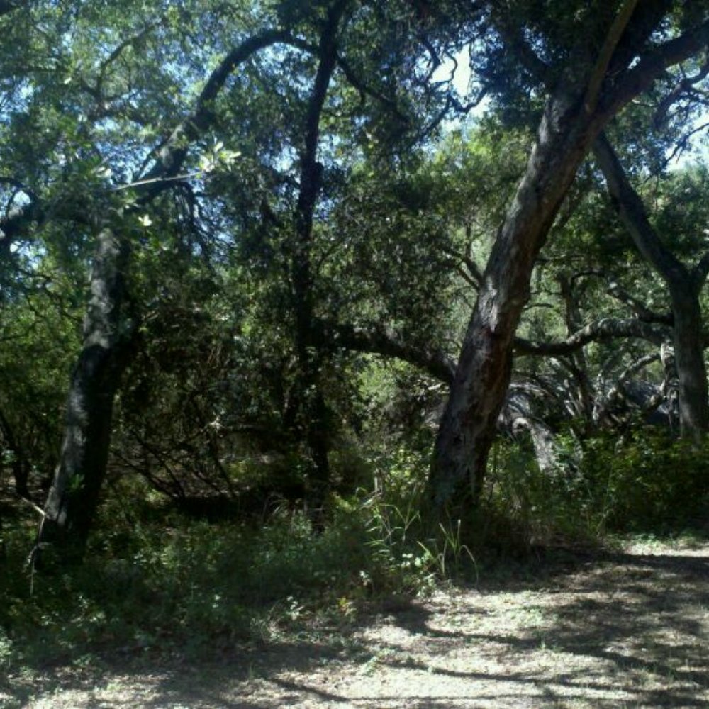
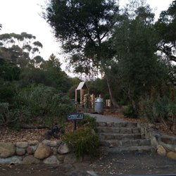
All right, It's my turn to give back to Yelp and share one of my absolute favorite parks in Santa Barbara. My wife and I used to come here when we were dating, and now we share it with our 5 year old daughter. I have always enjoyed catching frogs in the creek at this park, and sharing it with my daughter feels like a right of passage. Located above Summerland in the foothills between Montecito and Carpinteria, Toro Canyon Park is 74 heavily wooded acres of secluded beauty. A creek meanders through this oak filled canyon past playgrounds, horseshoe pits, several large group BBQ areas, a dog park, horse trails, hiking trails and even a sand volleyball court. There is even a trail that starts by a huge sandstone outcropping and takes you up to a gazebo at the top of a hill that overlooks the entire region. It is an easy hike, and well worth the sweeping vistas. Although pretty close to several cities and the 101 freeway, we rarely ever run into more than one or two other people at this park. Of course we typically go on weekdays, so perhaps the weekend gets busier. On past visits we have seen innumerable birds, a few rabbits, plenty of lizards and even a skunk. The area surrounding the park is even wilder. Just how wild is Toro Canyon Park? Last February we decided to blaze a new trail along a rain run-off ditch that went deep into the chaparral. It had rained the day before, but that afternoon had been a beautifully warm and sunny day. As we hiked up the hill about an hour before dusk I noticed some large dog footprints heading down the hill in the direction we had just came. Now, mountain lion and dog prints look pretty similar except mountain lion tracks have an "M" shaped pad while dog track's usually imprint claw marks (I was an eagle scout that spent summers as a camp counselor in the mountains of Kern County!) Well, I couldn't see the claw marks or really make out the pad shape, but the ground was hard and really didn't leave the best tracks. I half joked that It might be a mountain lion, sending my wife (who has a mountain lion phobia) into a heightened state of nervousness. :) Slightly amused, I trekked forward, but made sure to make a bit more noise and keep my daughter close. Next I spotted the scat, but being much better at tracks than scat, I reassured my now noticeably concerned wife that it was probably just a dog returning back down the path (oh yeah, we weren't on a path) from a hike. I told her we would just follow the trail up and around the bend, and then we would head back (after all, whatever left the tracks was already behind us right?) Well, true to famous last words . . . around the bend we come upon a large muddy ravine with a recognizable set of "M" shaped, no claw tracks that came to the side of the ravine, lept up onto the bank and extended its claws to grip the ground as it pulled itself up. The print was dry, but it was still wet inside the claw marks!!! We headed back down the hill loud and quick! I have this theory that people who live with wild bears, play with rattlesnakes or perform any other act where they show a disregard for safety, or a lack of respect for nature, deserve what they get. You really can't mourn any loss of intelligence here! Add me to this list, because I then realized that I had a 5 year old (10 minutes up a remote hill) in some fairly dense hard chaparral with a big cat probably between us and our car at the park grounds. It then hit me that if I had really thought that the tracks belonged to a big dog coming back from a hike, where were the shoe prints from his companion. (OK, I became flushed with stupidity!) Well, we made it back safely but upon returning to the park what should I see on the bridge crossing the creek? A mountain lion warning sign . . . really! So whether the cat was already gone or hiding a few feet away from us in the underbrush, we were left alone. Rest assured that the park has always been safe, and that there are plenty of rabbits and deer to keep a mountain lion away from people. Stay on the trails, enjoy the park and don't let this brief encounter dissuade you from experiencing one of the finest parks that Santa Barbara has to offer. Hours are 8 am to sunset. The park boasts some pretty nice restrooms and the drive to get there includes phenomenal views of the coast and the mountains. I personally like taking E. Valley Road from Santa Barbara and Montecito to get to Toro Canyon Park. Lower your windows or drop the top and experience the beauty that makes this the most desirable (and expensive) place to live in America. read more


More info about Toro Canyon Park
Ask the Community - Toro Canyon Park
Is this a place to hike?
Review Highlights - Toro Canyon Park















Why does Yelp recommend reviews?
1 review that is not currently recommended
The reviews below are not factored into the business's overall star rating.

18 years ago
Toro Canyon Park - hiking - Updated August 2026
Best of Montecito
People found Toro Canyon Park by searching for…
Hiking Trails in Montecito, CA
Off Leash Dog Parks in Montecito, CA
Picnic Areas BBQ Pits in Montecito, CA
Things to Do With Kids in Montecito, CA
Volleyball Courts in Montecito, CA
Off Road Trails in Montecito, CA
Running Trails in Montecito, CA
Playgrounds for Kids in Montecito, CA
Camping Cabins in Montecito, CA
Camping Sites in Montecito, CA
Secluded Spots in Montecito, CA
Trending Searches in Montecito, CA
Barbershop For Men near Toro Canyon Park
Bike Shop near Toro Canyon Park
Bird Sanctuary near Toro Canyon Park
Boardwalk near Toro Canyon Park
Cliff Jumping near Toro Canyon Park
Consignment Shops near Toro Canyon Park
Dog Friendly Beaches near Toro Canyon Park
Dog Friendly Things To Do near Toro Canyon Park
Ear Piercing near Toro Canyon Park
Elementary Schools near Toro Canyon Park
Eyebrow Threading near Toro Canyon Park
Fishing Spots near Toro Canyon Park
Flower Fields near Toro Canyon Park
Fun Things To Do With Kids near Toro Canyon Park
Fun Things To Do With Toddlers near Toro Canyon Park
Hair Braiding near Toro Canyon Park
Kids Activities Indoor near Toro Canyon Park
Kids Haircut near Toro Canyon Park
Lakes & Ponds near Toro Canyon Park
Lookout Points near Toro Canyon Park
Outdoor Activities near Toro Canyon Park
Parks With Pull Up Bars near Toro Canyon Park
Parks With Shade near Toro Canyon Park
Pedicure near Toro Canyon Park
Picnic Areas near Toro Canyon Park
Playgrounds near Toro Canyon Park
Public Golf Courses near Toro Canyon Park
Public Pools near Toro Canyon Park
Public Running Track near Toro Canyon Park
Public Tennis Courts near Toro Canyon Park
Rock Quarry near Toro Canyon Park
Scenic Night View near Toro Canyon Park
Scenic Overlook near Toro Canyon Park
Sunrise View near Toro Canyon Park
Swimming Holes near Toro Canyon Park
Toddler Activities near Toro Canyon Park
Trading Card Shops near Toro Canyon Park
Uniforms near Toro Canyon Park
Used Furniture Stores near Toro Canyon Park
Volleyball Courts near Toro Canyon Park
Browse Nearby
BEST of Montecito, California Coffee near Toro Canyon Park
BEST of Montecito, California Restaurants near Toro Canyon Park
BEST of Montecito, California Things to Do near Toro Canyon Park
BEST of Montecito, California Breakfast near Toro Canyon Park
BEST of Montecito, California Parks near Toro Canyon Park
BEST of Montecito, California Beaches near Toro Canyon Park
BEST of Montecito, California Campgrounds near Toro Canyon Park
Browse Brands
Related Searches in Montecito, CA
Affordable Kayak Rental Services in Montecito, California
Best Dog Hiking Trails Around Montecito, California
Best Fishing Locations and Guides in Montecito, California
Best Kids Playgrounds to Visit in Montecito, California
Best Nature Trails for Hiking in Montecito, California
Best Off Leash Dog Parks in Montecito, California
Best Parks for Parties and Events in Montecito, California
Best Places for Horseback Riding in Montecito, California
Best Play Place Options for Families in Montecito, California
Best Sightseeing Experiences Available in Montecito, California
Best Water Parks for Kids in Montecito, California
Check Out Great Playgrounds in Montecito, California
Check Out Off Road Trails in Montecito, California
Discover Baseball Fields Around Montecito, California
Discover Beautiful Garden Spots in Montecito, California
Discover Dog Friendly Trails to Explore in Montecito, California
Discover Fun Activities to Do in Montecito, California
Discover Fun Kid Activities to Enjoy in Montecito, California
Discover Fun Toddler Parks in Montecito, California for Your Little One
Discover Kid Friendly Hiking Trails in Montecito, California
Discover Kids Indoor Play Area Venues in Montecito, California
Discover Lakes & Ponds to Explore in Montecito, California
Discover Outdoor Playgrounds for Kids in Montecito, California
Discover Popular Bike Trails in Montecito, California
Discover Soccer Fields in Montecito, California Near You
Discover Top Nature Parks to Visit in Montecito, California
Discover Top State Parks to Visit in Montecito, California
Discover a Hiking Trail in Montecito, California
Discover the Best Beaches in Montecito, California
Discover the Best Kids Park Spots in Montecito, California
Discover the Best Night Hike Trails in Montecito, California
Dog-Friendly Hikes With Dogs in Montecito, California
Enjoy Camping Adventures Around Montecito, California
Enjoy Kayaking Adventures in Montecito, California
Enjoy Kids Play Activities in Montecito, California
Enjoy Off Leash Dog Hikes in Montecito, California
Enjoy Tent Camping Spots Around Montecito, California
Enjoy a Beautiful Waterfall Hike in Montecito, California
Enjoy the Best Family Activities in Montecito, California
Enjoy the Best Picnic Spots and Ideas in Montecito, California
Enjoy the Best Walking Path in Montecito, California
Enjoy the Best Walking Trails in Montecito, California
Explore Beautiful Parks and Green Spaces in Montecito, California
Explore Easy Hikes Perfect for All in Montecito, California
Explore Free Picnic Areas Around Montecito, California
Explore Fun Activities to Do in Montecito, California
Explore Outdoor Basketball Courts for All Skill Levels in Montecito, California


