Local Walk: "SLIPPERY WITH LOOSE PEBBLES"…read more
Of course there are nice 360 views on the sizable plateau on top, and going up is steep for a short bit. Unfortunately, if you are used to even easy to moderate hiking, it is a near insignificant amount of Cardio, since it may take only 5-10 minutes to get to the top, using the steepest assent.
Now if even you did prepare by wearing decent hiking sneaker or shoes, you would still have to be cautious going back down since there are tons of loose pebbles & dirt all over the rutted well worn path.
Since most people come up here not for hiking, but for a nice walk, the view, or even a picnic, I think that they should make a concrete or asphalt path for those people for safety reasons. I did see a least one big group of about 15 people complete with coolers coming down, without really paying attention to the risk of falling.
The short path up is rather nice and either side can be filled with yellow wildflowers along the way. Before you know it, you are on top, and you wonder if that is it. It is.
While there are a few more meandering paths up or down, they again has quite a few loose pebbles, and are not much of an improvement. Since I read that it was considered not much of a hike, I did not prepare and did wear my older New Balance 990 running sneakers. While they are great for flat smooth ground, they are definitely not good to navigate a step slope with loose pebbles, even for such a short distance.
Once you get on top, the views are quite nice, but if you are a local, you are going up there more to do stuff. You will either see people picnicking, walking around, or even doing Yoga.
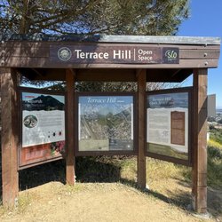
While it is called a Preserve, and can be termed a hike, a park, or a walk, it is really quite limited in value, since there are no services, water, nor bathrooms.
In conclusion, it is more for immediate locals, or for those who want some cool pics, but not worth a special trip.
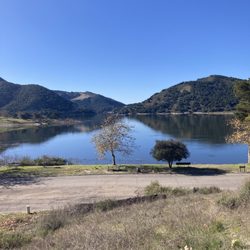
Compared to let say Laguna Lake trails, it is rather disappointing. At least with Laguna Preserve, you do see birds, varied terrain, can do a whole range of easy to challenging distances and elevation, and have good views to boot. Laguna Lake also has restrooms on the bottom.
If one is really into trying different hiking areas, the Alltrails website/app is likely the best for finding viable trails, but since mostly experienced hikers do the reviews, they have a bias toward making things seem easier for those who are not in shape. You can even set your iPhone to use both your GPS & Alltrails to map your progress, time, elevation, & more. Along with your iwatch, you can also keep track of your heart rate and more over your hike and during recovery.