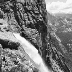
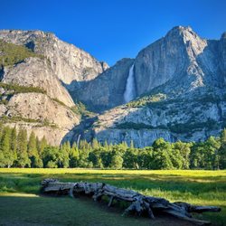
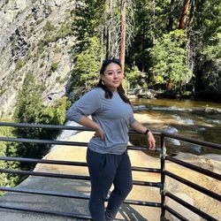
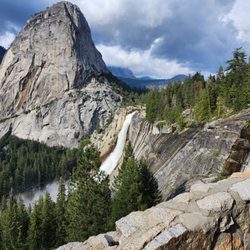
Vogelsang Photos


You might also consider
More like Vogelsang
Recommended Reviews - Vogelsang
Start your review...

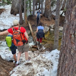
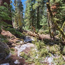
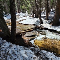
Vogelsang area is so beautiful. I went backpacking (2 nights/3 days) on Labor Day weekend. I started at Tuolumne Meadow, then went through Rafferty Creek, then passed Vogelsang HSC, then camped at Vogelsang Lake. Super beautiful and quiet. The next day was a dayhike. From Vogelsang Lake to Vogelsang Pass, Babcock Lake, then back to Vogelsang Lake. 12 miles +-1500 feet change. Then stayed one more night at Vogelsang Lake and hiked back on the third day. Highly recommended. read more


More info about Vogelsang
Yosemite Valley, CA 95389
Directions
Hours
Outdoor Amenities


Vogelsang - hiking - Updated June 2026
Best of Yosemite Valley
People found Vogelsang by searching for…
Trending Searches in Yosemite Valley, CA
Browse Articles
Browse Brands
Related Searches in Yosemite Valley, CA
Affordable Kayak Rental Services in Yosemite Valley, California
Best Fishing Locations and Guides in Yosemite Valley, California
Best Fun Things to Do in Yosemite Valley, California
Best Places for Horseback Riding in Yosemite Valley, California
Best Sledding Spots and Fun in Yosemite Valley, California
Check Out Off Road Trails in Yosemite Valley, California
Discover Kid Friendly Hiking Trails in Yosemite Valley, California
Discover Scenic Waterfall Spots in Yosemite Valley, California
Discover a Hiking Trail in Yosemite Valley, California
Discover the Best Night Hike Trails in Yosemite Valley, California
Enjoy Camping Adventures Around Yosemite Valley, California
Enjoy Kayaking Adventures in Yosemite Valley, California
Enjoy River Tubing Adventures in Yosemite Valley, California
Enjoy a Beautiful Waterfall Hike in Yosemite Valley, California
Enjoy the Best Family Activities in Yosemite Valley, California
Enjoy the Best Picnic Spots and Ideas in Yosemite Valley, California
Enjoy the Best Tubing Experiences in Yosemite Valley, California
Enjoy the Best Walking Trails in Yosemite Valley, California
Exciting Cliff Jumping Spots in Yosemite Valley, California
Experience Stunning Sunset Views in Yosemite Valley, California
Experience Thrilling White Water Rafting in Yosemite Valley, California
Explore Beautiful Parks and Green Spaces in Yosemite Valley, California
Explore Bike Rentals Throughout Yosemite Valley, California
Explore Easy Hikes Perfect for All in Yosemite Valley, California
Explore Fun Activities to Do in Yosemite Valley, California
Explore Popular Campgrounds Near Yosemite Valley, California
Explore Popular RV Parks Around Yosemite Valley, California
Explore Scenic Lakes to Visit in Yosemite Valley, California
Explore Top Dog Parks in Yosemite Valley, California Near You
Explore Top Water Parks in Yosemite Valley, California Today
Explore the Best Beach Spots in Yosemite Valley, California
Explore the Best Boating Spots in Yosemite Valley, California
Family Friendly Hiking With Kids in Yosemite Valley, California
Find Beautiful Views in Yosemite Valley, California
Find Popular Ziplining Spots Around Yosemite Valley, California
Find the Best Scenic View Locations in Yosemite Valley, California
Locate a Public Shower Facility in Yosemite Valley, California
Off Leash Dog Hiking Trails in Yosemite Valley, California
Picnic Areas With BBQ Pits Available in Yosemite Valley, California
Plan a Scenic Drive Route Near Yosemite Valley, California
Popular Fishing Spots to Explore in Yosemite Valley, California
Popular Things to Do in Yosemite Valley, California
Popular Things to See in Yosemite Valley, California
Safe and Fun Parks for Kids in Yosemite Valley, California
Top Paddleboarding Activities in Yosemite Valley, California
Top Running Trails to Explore in Yosemite Valley, California
Top Swimming Lakes to Enjoy in Yosemite Valley, California
Top Swimming Spots and Pools in Yosemite Valley, California
Top Things to Do With Kids in Yosemite Valley, California
Walk Dog Friendly Hiking Trails in Yosemite Valley, California