Cancel

    Open app

    Search

    Walking Trail At Kunia

    4.0 (1 review)

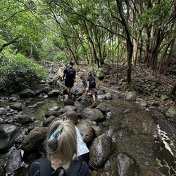
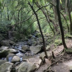
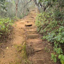
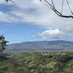
    Walking Trail At Kunia Photos

    You might also consider

    Recommended Reviews - Walking Trail At Kunia

    Your trust is our priority, so businesses can't pay to alter or remove their reviews. Learn more about reviews.
    Yelp app icon
    Browse more easily on the app
    Review Feed Illustration

    14 years ago

    Helpful 1
    Thanks 0
    Love this 1
    Oh no 1

    You might also consider

    Verify this business for free

    People searched for Hiking 4,471 times last month within 15 miles of this business.

    Verify this business

    Lulumahu Falls

    Lulumahu Falls

    4.5
    (360 reviews)
    21.1 km

    A beautiful day for a hike! Every time I do this hike it's a little different. Today the waterfall…read morewas cold and bracing and there were a lot of people hiking the falls. We started out around 8:45 AM and by the time we reached the waterfall, it was getting full of families and pairs of hikers. I recommend go early to skip the crowds. The hike itself isn't too technical and there are only a few places where you have to step up high over a rock or scramble through a stream.

    Here are clear and concise directions for this hike!!…read more Main parking off Pali hwy. Entrance is easily visible. You'll enter the bamboo forest. Within the first 50 feet it will split into a Y trail, take the left path. If you go straight you'll likely end up in the bamboo section for 20-40 mins. If you do not exit the bamboo area within 10 mins, you're lost. You'll exit the bamboo area through a lifted/broken section of the fence. Walk uphill onto the paved pathway. This will open onto a wide valley. You'll pass a large bridge structure. Follow that till road till you get to the supply shed structures. Look for a small concrete stairway in the trees. Stay left mostly, and look for pink ribbons. Pass the old fenced off pool looking area. Once you hit the rock/mud path (approx 10 mins) there's a hard right turn down into the main river area. A large tree has fallen so you'll need to spot the ribbons, and climb over this tree. If you pass this fallen tree by mistake, the trail will seem oddly difficult and dense. You'll need to turn around. Walk until you see the man made rock wall with a small waterfall, and walk across this to the other side. Follow the ribbons up the path and you'll need to cross the river 3-5 more times after this. Keep looking for clear open paths. There's two ways you can continue after that point so don't worry. (One way is just more difficult) Before the waterfall there's a larger section of rocks you'll have to climb over. Main takeaways: You will have to walk across slippery rocks several times. It is muddy. It's not that difficult but can be dangerous at some parts. If you don't see a pink/orange ribbon for more than 5-10 mins at any time, you are likely lost.

    Photos
    Lulumahu Falls
    Lulumahu Falls
    Crossing through the stream - hopping on the rocks

    See all

    Crossing through the stream - hopping on the rocks
    Pu'u Hapapa Trail

    Pu'u Hapapa Trail

    4.8
    (12 reviews)
    15.4 km

    Open to the public only a few days a year (when the military isn't having live ammo exercises), we…read morewere lucky to hike it on 4th of July. We came up Kunia Road and entered Schofield Barracks. You tell them you wanna hike Kole Kole trail. Then you pull over and get a permit. Your car must be fully legal and bring ID for everyone. They take your photo. Then we drove back into the base a while to the trail head. Nice parking and safe from thieves and vandals. The first 0.4 miles is extremely easy, like easier and shorter than Diamond Head. You get to a bench viewing area that is absolutely gorgeous. Unique views of West side. If you continue on to the left of the bench is a trail partially obscured by tall scratchy California grass. The trail is still easy for awhile, we took the left fork which is more gradual. Then you start ascending the side cliff which gets progressively more challenging, loose gravel, rock climbing but there are ropes to help you. Glad I brought spikes for the way down. Should have brought my gloves and worn long pants as I got lots of scratches on my legs from plants. We went to the top a little past where the junction is. You can see North Shore, West side, and all the way to Diamond Head. Approximately 2.5 miles total. Not too dangerous and mostly shaded until the ridge part. Sae many other side trails would love to explore.

    We tried this trail this past Sunday as it was open to the public. Keep checking thier FB page for…read moredates and times the trail will be open. https://www.facebook.com/usaghawaii/ First thing, it had been raining that morning, so we knew there was a possibility we wouldn't be going up and down the notches. The thing about Kolekole trail is that if it had been raining, it dries up pretty quick. It's like the trail just absorbs all the rain. The hike up was fairly easy and clear however very gusty. We made our way up the summit only to feel the gusts even more. And that then was the end of the trail for us. Always practice safety first. There is always another day. The views were spectacular so it wasn't a total loss.

    Photos
    Pu'u Hapapa Trail
    Pu'u Hapapa Trail
    Pu'u Hapapa Trail

    See all

    Pu'u'ohulu Kai

    Pu'u'ohulu Kai

    4.7
    (153 reviews)
    20.2 km

    Very cool hike. Unexpected difficult hike I would guess 2 miles round trip with some steep…read moreclimbing. I wouldn't bring kids unless they experienced hikers and no small dogs. But very rewarding hike with a beautiful 360 view at the top. Bring extra water and snacks and can have a nice picnic at the top.

    This west side Pink Pillbox Trail isn't as famous as the east side's Lanikai Pillbox Trail, but…read moreit's only about a 15-minute drive from Aulani and way less crowded -- definitely a nice bonus. Just set your GPS to Puʻu O Hulu (Pink Pillbox) Trailhead, and you'll find plenty of street parking along that stretch. Still, I'd recommend parking closer to the entrance for safety because we noticed broken glass scattered on the ground further down the road, probably from past break-ins. We actually parked once, saw the glass right by our car, and quickly moved closer to the entrance instead. Right after we parked, it started raining. The forecast said it would last about 30 minutes, so we just waited it out in the car before starting our hike. The trailhead is right between a yellow "Falling Rocks" warning sign and a white "Speed Limit 25" sign on a utility pole. The hike starts with a steep incline, but overall it's not too hard and just a bit narrow at parts. There are three pillboxes total. It took us around 30 minutes to reach the first one at a relaxed pace, stopping for photos along the way. The first pillbox is painted in blue graffiti inside, and from there you can continue up to the famous pink one. When we got to the pink pillbox, there were surprisingly tons of flies swarming around the entrance for some reason, so we didn't stay too close. The wind was really strong up there -- strong enough that I had trouble keeping my balance! It looked like reaching the third pillbox would require climbing over quite a few rocks, so we decided to turn back instead. On the drive back, we passed Ulehawa Beach Park, where we saw a whole row of homeless encampments right by the ocean -- literally parked and camped along the beachfront. We even saw a few people running across the road and one guy riding his motorcycle the wrong way, yelling at drivers passing by. If that's a regular thing, really sad to see this.

    Photos
    Pu'u'ohulu Kai
    Pu'u'ohulu Kai
    Pu'u'ohulu Kai

    See all

    Pu'u 'Ualaka'a State Park

    Pu'u 'Ualaka'a State Park

    4.8
    (173 reviews)
    20.7 km

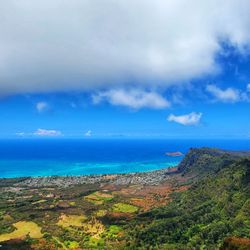
    Visiting Pu'u Ualaka's State Park is on my top ten favorite things to do in Honolulu. The Park…read moreoffers spectacular views of the entire Southside of the Island. I travelled up Mount Tantalus to the Park yesterday with my daughter. We travelled through beautiful dense forest at the Park entrance. At the highest overlook, we could see everything and more from Diamond Head out to (and beyond) the airport. We could see all of Honolulu. I felt like we were on top of the world! Plaques offer fascinating overviews of the history and geology of the landmarks below. We could even see inside the famous tuff cone, Punch Bowl! Nearby is the first macadamia nut orchard in Hawaii. The overviews are paved with railings and easily accessible. The Park offers picnic areas with a couple pavilions and picnic tables. There is a charge for non-resident parking of $7 that can be paid electronically. Resident parking is free. Parking is limited, but there are several parking areas. We had no trouble finding parking mid week. Warning signs tell guest not to leave valuables in the car. Pu'u Ualaka'a State Park is only two miles from downtown Honolulu (maybe a couple more miles to the top). The Park is an easy 5 star and worth a visit.

    Puʻu ʻUalakaʻa State Park offers some of the best views of the greater Waikiki and Honolulu area…read more It's well worth the drive up for the panoramic vista that stretches from Mānoa all the way to Diamond Head, and out toward Honolulu Airport and Pearl Harbor. The park officially closes at 6pm, but I've walked in after hours before to enjoy the city lights, and the views are just as impressive at night. It's a bit off the typical tourist path, so it doesn't get overly crowded. Highly recommended if you want a different perspective of Honolulu.

    Photos
    Pu'u 'Ualaka'a State Park
    Pu'u 'Ualaka'a State Park
    Pu'u 'Ualaka'a State Park

    See all

    Maili Pillboxes

    Maili Pillboxes

    4.7
    (65 reviews)
    16.8 km

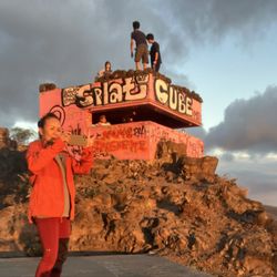
    If you are looking for amazing views, a good workout, on the West side of Oahu, the Maili Pillboxes…read moremay be the hike for you! My girlfriend and I knew we needed to get at least one hike on our trip, and this one was close to our resort (15ish minutes for Ko Olina) and all I have to say is bring sunscreen and good walking shoes. The trail itself isn't long and pretty easy to navigate up the hill but it's pretty rocky at points. I slipped a few times going up and down but it was no biggie. The views once you get up there though is super worth it. The best part about this hike (aside from the views) is that it wasn't busy at all. We came around 8am and there was only a handful of people on the trail. Definitely recommend coming early to beat the heat or at sunset to catch the sun setting over the Pacific Ocean. There's plenty of street parking available and the trail entrance is easy to find. If you are in the area and want a little bit of a challenging hike with great views, this is the spot.

    I never grow tired of the amazing ocean and mountain views from this short hike…read more Have hiked both sunset and sunrise hikes enjoyed both. Although not a long hike, if you are not use to uneven rocky uphill the first section may be alittle rough for you both going up and down. We use poles, especially useful going down. The trail has very little shade so best done in morning or late afternoon. We usually only go to the first 3 pillboxes, which all have beautiful views. The art in the first one is fairly uncovered. Unfortunately the second one's art has been mostly covered by graffiti. I don't get why anyone would deface it. It is late February and the mountain has lush tall green grass lining the trail. Summertime is completely different being on the dryer side of island. The wind has been quit strong so instead of hanging on top of pillbox we spent sometime inside looking out the openings taking it all in. Back to the views, I never, never grow tired of them. Absolutely stunning!!!!

    Photos
    Maili Pillboxes
    Maili Pillboxes
    Maili Pillboxes

    See all

    Mānoa Falls Trail

    Mānoa Falls Trail

    4.4
    (1.3k reviews)
    22.6 km

    This is a great little hike that is not difficult at all. The trail seems mostly maintained for the…read moremost part. It was raining when we went, so it got super muddy, but that is to be expected and was totally fine. My only real disappointment was that you cannot actually get into the water to swim anywhere along the trail or at the falls. Also, be aware that they charge for parking, though they do offer a military discount if that applies to you. Overall, it is a nice, accessible walk through nature, just do not bring your swimsuit expecting to dive in.

    Service- 3 stars Ambiance- 5 stars…read more I usually hike this trail once a month to put myself out in the jungle and get away from concrete and I love it every time. This trail is located deep and all the way in Manoa valley- past the gym, Manoa elementary school where the road becomes pretty much a one lane street until you get around to the stop where you pay the attendant. I think this part is what disappoints me the most is because kama'aina still have to pay to hike this trail. Geez. If you are kama'aina, you have to present your ID to the attendant where you will have to pay $4. Not sure what the cost is for tourists or non-residents. There are lots of spaces to park when you past the attendant. You have the option to park at your first right past the old Treetops restaurant or further down. There is a restroom and little convenience shop if you want to purchase a souvenir, ice cream, water, etc for your hike. This trail can get super muddy and dangerous after rainfall so I would use caution if you choose to hike during wet season. There are big rocks you will have to step over all throughout the trail so be sure to go with proper hiking shoes with good grip. The waterfall at the very end isn't much but a good little reward as a picture opportunity. Folks can no longer go into the water due to leptospirosis. I highly recommend visiting this spot if you're a hiking person and nature lover!

    Photos
    Spectacular!
    Spectacular!
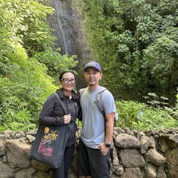
    Water fall behind me and my boo 3
    Water fall behind me and my boo 3
    Lonely self

    See all

    Lonely self

    Walking Trail At Kunia - hiking - Updated August 2026

    Loading...
    Loading...
    Loading...