Washington & Old Dominion Trail Photos


You might also consider


More like Washington & Old Dominion Trail
Recommended Reviews - Washington & Old Dominion Trail
Start your review...


Reviews With Photos


Love it! Rode the trail from Reston to DC (took a couple other connecting trails) and back on day 1. On day 2 I rode from Reston to Leesburg and back. About 100 miles total. The trail was great, not perfect, but great. Lots of road crossings but none were unsafe as some website reviews claimed. 100% ride this trail if you get the chance. There is some elevation but nothing too hard.
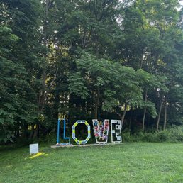

This trail is a haven for runners and bikers. It's next to the major roadways but still quite secluded. It can get crowded in the morning and afternoons, but usually resolves by noon/early evening. There are limited parking spots located throughout the duration of the trail, so be sure to get there early . . . or be lucky!


Virginia has some impressive trails. The WOD trail is not exception. It is a 45 mile paved trail. You can cycle, run, walk or skate. The section I walked/jogged was in Ashburn, near the Trailside Park. This area allows horseback riding. And yes, I saw some horses. A lot of people complain that it is not very scenic. The portion I walked, runs behind some very impressive houses, and once in a while there is a pond. Sometimes long trails can feel creepy, but there was always people exercising on the trail, at least in the mornings. I never felt alone. 5 stars!


This is a public/private partnership that started with Dominion Virginia Power and the state. The Northern Virginia Regional Park Authority (NVRPA) administers and maintains the park and its trails. NVRPA keeps most of the parkland surrounding the trails in a natural state. The park authority has placed mile markers and exhibits that describes some of the history. If you ride a bike, go during the week or early on the weekend; otherwise you'll be dodging the roller blader's, M & D with the kids & critters in tow and the dog walkers. Be careful for the semi-pro speed race biker wanna be's who run in packs up to 20 or more and two abreast and think they own the trail. Rarely will you get an 'on the left' warning. That said, My favorite part of this park is either starting at Dulles off Pacific Blvd and riding to Leesburg and back which is about 21 miles. Or starting in Leesburg near at Raflo Park at Harrisonburg St SE and riding to Purcellville and back. which is about 22 miles round trip. In the morning you'll see all kinds of critters; bunnies, squirrels, snakes, deer and all types of birds. These two rides will allow you steady riding with very few intersections and less congestion. A great stop over place in Leesburg is the Lightfoot where the have outside tables and plenty bike racks. In Purcellville, I like the patio at Magnolias at the Mill which is Trails End.


The Washington & Old Dominion Regional Park (aka W&OD or WOD) is probably the longest, skinniest park you'll ever visit. At just 100 feet wide it stretches 45 miles from Shirlington, VA in the east to Purcellville, VA in the west. As a Rail-to-Trails project, it 's a mostly flat, paved trail that is perfect for bicycling, inline skating and hiking. As you head west, you'll discover 32 miles of gravel trail for horseback riding. The W&OD is one of my top "Go-To" spots for a bike ride. The trail provides a great break from the frenetic roads inside (and outside) the DC Beltway. The W&OD connects with several other bike trails (Four Mile Run Trail, Custis Trail) making it a great way to get around. It's definitely a popular commuter route. During the morning and evening commutes, you'll find as many folks in suits and ties as in the multi-colored lycra of competitive cyclists. WARING: It can get very crowded on weekends. There are stretches that will require lots of patience and braking. But the wide open areas make it all worth it. Get out there and enjoy the scenic beauty of the Washington & Old Dominion Trail. For trail maps, check out Friends of the W&OD (http://www.wodfriends.org).


This is one of the major access points to the W&OD Trail in the Town of Vienna. Plenty of parking provided. Lots of cyclists, runners, walkers hopping on the trail here. Perfect meeting point to meet friends. Also, well lit in the evenings. read more

A nice area to hike or bike. The W&OD is a gem. This spot especially, because if you travel west bound, it's not as busy closer to the DC area. Less crossings on roads is safe. Definitely have had fun with the Cannondale here. Also have walked it, and most of the trail is flat. Only problem I see, is speeding bikers. Some think this trail is the Tour de France. It's not and a hazard to everyone. Weekends can be quite busy. My recommendation is go during a weekday. Here you can pound out some mileage, and stay physically fit. Lots of parking spots close to the trail. Get on your bike and take care of business! read more

One of the most fascinating trails you'll see in Northern VA. It's approximately 45 miles long From Purcellville to Arlington. There's all kinds of stops along the trail giving easy access from multiple posts along the rt 7 area. Biking, walking/running, and even horseback riding is allowed on here. Great way to get your steps in. I usually start in Leesburg @ Raflo Park and walk the 2.6-3 miles to the Ashburn area and then head back to Leesburg. Someday I'll try to go further to Reston if I have the time and energy. Best during the day instead of night. But you already knew that! read more


Love it! Rode the trail from Reston to DC (took a couple other connecting trails) and back on day 1. On day 2 I rode from Reston to Leesburg and back. About 100 miles total. The trail was great, not perfect, but great. Lots of road crossings but none were unsafe as some website reviews claimed. 100% ride this trail if you get the chance. There is some elevation but nothing too hard. read more


This trail is a haven for runners and bikers. It's next to the major roadways but still quite secluded. It can get crowded in the morning and afternoons, but usually resolves by noon/early evening. There are limited parking spots located throughout the duration of the trail, so be sure to get there early . . . or be lucky! read more


2 years ago

9 years ago
Virginia has some impressive trails. The WOD trail is not exception. It is a 45 mile paved trail. You can cycle, run, walk or skate. The section I walked/jogged was in Ashburn, near the Trailside Park. This area allows horseback riding. And yes, I saw some horses. A lot of people complain that it is not very scenic. The portion I walked, runs behind some very impressive houses, and once in a while there is a pond. Sometimes long trails can feel creepy, but there was always people exercising on the trail, at least in the mornings. I never felt alone. 5 stars! read more


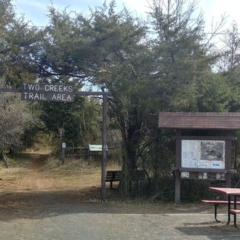


6 years ago

3 years ago

This is a public/private partnership that started with Dominion Virginia Power and the state. The Northern Virginia Regional Park Authority (NVRPA) administers and maintains the park and its trails. NVRPA keeps most of the parkland surrounding the trails in a natural state. The park authority has placed mile markers and exhibits that describes some of the history. If you ride a bike, go during the week or early on the weekend; otherwise you'll be dodging the roller blader's, M & D with the kids & critters in tow and the dog walkers. Be careful for the semi-pro speed race biker wanna be's who run in packs up to 20 or more and two abreast and think they own the trail. Rarely will you get an 'on the left' warning. That said, My favorite part of this park is either starting at Dulles off Pacific Blvd and riding to Leesburg and back which is about 21 miles. Or starting in Leesburg near at Raflo Park at Harrisonburg St SE and riding to Purcellville and back. which is about 22 miles round trip. In the morning you'll see all kinds of critters; bunnies, squirrels, snakes, deer and all types of birds. These two rides will allow you steady riding with very few intersections and less congestion. A great stop over place in Leesburg is the Lightfoot where the have outside tables and plenty bike racks. In Purcellville, I like the patio at Magnolias at the Mill which is Trails End. read more


16 years ago


16 years ago
The Washington & Old Dominion Regional Park (aka W&OD or WOD) is probably the longest, skinniest park you'll ever visit. At just 100 feet wide it stretches 45 miles from Shirlington, VA in the east to Purcellville, VA in the west. As a Rail-to-Trails project, it 's a mostly flat, paved trail that is perfect for bicycling, inline skating and hiking. As you head west, you'll discover 32 miles of gravel trail for horseback riding. The W&OD is one of my top "Go-To" spots for a bike ride. The trail provides a great break from the frenetic roads inside (and outside) the DC Beltway. The W&OD connects with several other bike trails (Four Mile Run Trail, Custis Trail) making it a great way to get around. It's definitely a popular commuter route. During the morning and evening commutes, you'll find as many folks in suits and ties as in the multi-colored lycra of competitive cyclists. WARING: It can get very crowded on weekends. There are stretches that will require lots of patience and braking. But the wide open areas make it all worth it. Get out there and enjoy the scenic beauty of the Washington & Old Dominion Trail. For trail maps, check out Friends of the W&OD (http://www.wodfriends.org). read more


11 years ago
I've worked in the area for 4 years now and didn't know this ran right by my work place until about August 2015.. How convenient is that? I'll have to start checking in now when I hit this trail. I sometimes take light 2 mile jog during my lunch break. approx 45 min and then some cool down. It intersects with Sterling Blvd and runs back near my office park. I happened to notice it was on Yelp when I reviewed Thai Thai. (also next to the trail). Also Beltway Brewery is just a hop off the trail as well. I've never had any issues with safety but always best to be alert. Enjoy. read more


16 years ago

6 years ago
7 years ago


13 years ago

16 years ago

17 years ago


13 years ago

15 years ago


8 years ago

15 years ago
15 years ago

18 years ago

16 years ago

13 years ago


15 years ago

10 years ago


19 years ago
Page 1 of 2
More info about Washington & Old Dominion Trail
Ask the Community - Washington & Old Dominion Trail
Review Highlights - Washington & Old Dominion Trail
You might also consider


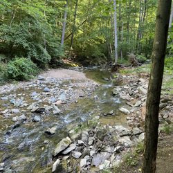
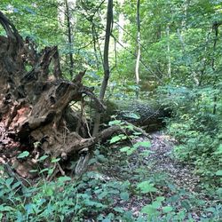
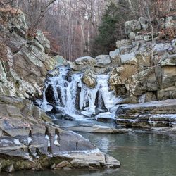


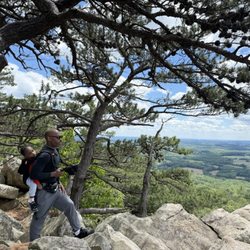


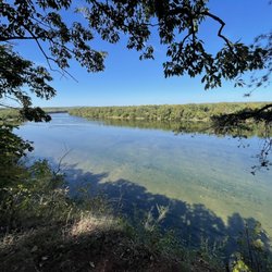







Why does Yelp recommend reviews?
2 reviews that are not currently recommended
The reviews below are not factored into the business's overall star rating.

13 years ago

2 years ago
Washington & Old Dominion Trail - hiking - Updated September 2026
Best of Ashburn
People found Washington & Old Dominion Trail by searching for…
Trending Searches in Ashburn, VA
Apple Orchards near Washington & Old Dominion Trail
Apple Picking near Washington & Old Dominion Trail
Barbershop near Washington & Old Dominion Trail
Bike Shop near Washington & Old Dominion Trail
Blowout near Washington & Old Dominion Trail
Casinos near Washington & Old Dominion Trail
Cliff Jumping near Washington & Old Dominion Trail
Consignment Shops near Washington & Old Dominion Trail
Cruising Spots near Washington & Old Dominion Trail
Dog Friendly Things To Do near Washington & Old Dominion Trail
Estheticians near Washington & Old Dominion Trail
Eyelash Extensions near Washington & Old Dominion Trail
Furniture Stores near Washington & Old Dominion Trail
Hiking Trails With Waterfalls near Washington & Old Dominion Trail
Kids Birthday Party near Washington & Old Dominion Trail
Lookout Points near Washington & Old Dominion Trail
Makeup Artists near Washington & Old Dominion Trail
Mattresses near Washington & Old Dominion Trail
Parks near Washington & Old Dominion Trail
Picnic Areas near Washington & Old Dominion Trail
Places To Take Pictures near Washington & Old Dominion Trail
Public Shower near Washington & Old Dominion Trail
Rock Quarry near Washington & Old Dominion Trail
Scenic Night View near Washington & Old Dominion Trail
Scenic Overlook near Washington & Old Dominion Trail
Sugaring near Washington & Old Dominion Trail
Sunrise View near Washington & Old Dominion Trail
Swimming Holes near Washington & Old Dominion Trail
Browse Articles
Browse Nearby
BEST of Ashburn, Virginia Parks near Washington & Old Dominion Trail
BEST of Ashburn, Virginia Restaurants near Washington & Old Dominion Trail
BEST of Ashburn, Virginia Things to Do near Washington & Old Dominion Trail
BEST of Ashburn, Virginia Coffee near Washington & Old Dominion Trail
BEST of Ashburn, Virginia Lakes near Washington & Old Dominion Trail
BEST of Ashburn, Virginia Breakfast near Washington & Old Dominion Trail
Browse Brands
Related Searches in Ashburn, VA
Affordable Kayak Rental Services in Ashburn, Virginia
Best Dog Hiking Trails Around Ashburn, Virginia
Best Fishing Locations and Guides in Ashburn, Virginia
Best Nature Trails for Hiking in Ashburn, Virginia
Best Places for Horseback Riding in Ashburn, Virginia
Best Sightseeing Experiences Available in Ashburn, Virginia
Best Waterfalls and Swimming Holes in Ashburn, Virginia
Discover Dog Friendly Trails to Explore in Ashburn, Virginia
Discover Kid Friendly Hiking Trails in Ashburn, Virginia
Discover Popular Bike Trails in Ashburn, Virginia
Discover Scenic Mountain Bike Trails Near Ashburn, Virginia
Discover a Hiking Trail in Ashburn, Virginia
Discover the Best Night Hike Trails in Ashburn, Virginia
Dog-Friendly Hikes With Dogs in Ashburn, Virginia
Enjoy Camping Adventures Around Ashburn, Virginia
Enjoy Kayaking Adventures in Ashburn, Virginia
Enjoy Off Leash Dog Hikes in Ashburn, Virginia
Enjoy Scenic Places to Walk in Ashburn, Virginia
Enjoy Tent Camping Spots Around Ashburn, Virginia
Enjoy a Beautiful Waterfall Hike in Ashburn, Virginia
Enjoy the Best Walking Path in Ashburn, Virginia
Enjoy the Best Walking Trails in Ashburn, Virginia
Explore Beautiful Parks and Green Spaces in Ashburn, Virginia
Explore Easy Hikes Perfect for All in Ashburn, Virginia
Explore Fun Activities to Do in Ashburn, Virginia
Explore Popular Campgrounds Near Ashburn, Virginia
Explore Top Dog Parks in Ashburn, Virginia Near You
Explore Top Water Parks in Ashburn, Virginia Today
Explore the Best Swimming Holes Around Ashburn, Virginia
Family Friendly Hiking With Kids in Ashburn, Virginia
Find Popular Ziplining Spots Around Ashburn, Virginia
Find the Best Parks for Picnics in Ashburn, Virginia
Find the Best Playgrounds to Visit in Ashburn, Virginia
Hiking Trails With Waterfalls in Ashburn, Virginia
Off Leash Dog Hiking Trails in Ashburn, Virginia
Popular Outdoor Activities to Try in Ashburn, Virginia
Popular Picnic Spots to Visit in Ashburn, Virginia
Popular Waterfall Hiking Trails in Ashburn, Virginia
Safe River Swimming Areas in Ashburn, Virginia
Safe and Fun Parks for Kids in Ashburn, Virginia
Top Hiking Trails to Explore in Ashburn, Virginia
Top Paddleboarding Activities in Ashburn, Virginia
Top Playgrounds for Kids to Enjoy in Ashburn, Virginia
Top Running Trails to Explore in Ashburn, Virginia
Top Swimming Lakes to Enjoy in Ashburn, Virginia
Top Swimming Spots and Pools in Ashburn, Virginia
Top-Rated Camping Sites in Ashburn, Virginia


