Cancel

    Open app

    Search

    Wawayanda State Park

    4.0 (47 reviews)

    Wawayanda State Park Photos

    You might also consider

    More like Wawayanda State Park

    Recommended Reviews - Wawayanda State Park

    Your trust is our priority, so businesses can't pay to alter or remove their reviews. Learn more about reviews.
    Yelp app icon
    Browse more easily on the app
    Review Feed Illustration

    Reviews With Photos

    #IntenselyPassionatePhotography
    Tiffany M.

    Happy weekend my fellow Adventurers! I got to camp out overnight here for the Ragnar (24 hour overnight race) relay over the fall and had a blast! The grounds themselves are beautiful, well kept, and great for hiking. We happened to be there at the perfect time for fall foliage while it was turning. The photos were spectacular and amazing to be in the wilderness. I would recommend going here during fall for nature and leaves overall. They have facilities on ground and trails that go for miles. The body of water is pretty cool from what we could see, since it was blocked off for the relay.

    Burning Bush (heat wave edition)
    Mick L.

    Great Park Mostly Unspoiled Nice Trails Place Is Huge I go in the fall, winter and spring when the place is empty, this is when I can really enjoy the outdoors in quiet. Keep The Parks Clean And Your Dog On A Leash!

    Great location to kayak
    Lisa A.

    We were looking for a good local spot to bring our kayaks for the day. A few things to note: Parking is free before memorial weekend. After that it's $10 for a NJ plate car, and $20 for any other state (on weekends.) During the week I believe its $5/$10. I called the number on google, and surprisingly, they answered and were very informative. They do offer seasonal passes which is around $30 for NJ resident. This is a great place to kayak- there are several "islands" to explore and just great scenery all around. We also noticed tons of fishers out there on their boats, so I'm assuming it's a good place to do that as well. This lake is huge, we were tired before we could even make it around the whole thing. I'm not sure how great this would be for swimming, when we were kayaking we noticed tons of seaweed type plants in the water that would probably get wrapped around your legs. There's nothing worse than something unknown touching your leg in the water. Also, while the sand near the water is nice and clean, the grassy area (see pic) was covered in duck poop. It was really gross. If you're planning to bring your kids here make sure they wear shoes on the grass. They have actual bathrooms- but the toilets are those you find in porta potties; a scary unknown dark hole.

    Little explorers at Lake Wawayanda!
    Paula L.

    Ok...I have mixed feelings about this one! The lake and the scenery is beautiful. The water was very clean. The sand and the beach however, had lots of poop. I guess they were geese poop but they looked bigger than what I would typically see in parks and fields. I don't get grossed out easily but if you decide to bring kids who want to play in the sand, it is pretty gross. I wish that they would clean it up every morning prior to opening. Besides, they open at 10 and the beach is not that big. So there should be enough time to scoop out the poop. Aside from that, the kids loved it and the lake was really fun for them. It doesn't go deep quickly and parents can enjoy watching their kids swim more as compared to going to an actual beach (ocean) where you worry about the waves. We went on a weekday and it wasn't crowded.

    See all

    13 years ago

    Helpful 0
    Thanks 0
    Love this 0
    Oh no 0

    15 years ago

    Helpful 2
    Thanks 0
    Love this 2
    Oh no 0

    7 years ago

    Helpful 1
    Thanks 0
    Love this 0
    Oh no 0

    10 years ago

    Helpful 1
    Thanks 0
    Love this 0
    Oh no 0
    Photo of John P.
    8
    219
    1

    12 years ago

    A gem of a park. Lake is crystal clear, makes for great swimming.

    Helpful 0
    Thanks 0
    Love this 0
    Oh no 0

    12 years ago

    Helpful 0
    Thanks 0
    Love this 0
    Oh no 0

    11 years ago

    Helpful 0
    Thanks 0
    Love this 0
    Oh no 0

    Page 2 of 2

    Ask the Community - Wawayanda State Park

    Review Highlights - Wawayanda State Park

    Went to the park on a beautiful day at the end of September.

    Mentioned in 3 reviews

    Read more highlights

    Verify this business for free

    People searched for Parks 1,090 times last month within 15 miles of this business.

    Verify this business

    Stairway to Heaven

    Stairway to Heaven

    4.5(93 reviews)
    2.4 mi

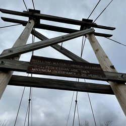
    **We just did the boardwalk then into the woods. We did not continue on to the Stairway**…read more I've lived in NJ over 30 years and I'm still pleasantly surprised when I find new places. My NY plus size hiking group stuck to the Jersey side last weekend and hit the boardwalk. It rained 2 days before so some of the older sections were mighty slick. All Trails reviews warned of dog poop and bugs everywhere but I was doused in OFF and people were cleaning up after their pets. Highlights: The vegetation was gorgeous. NJ has so many landscapes. Loved it. The suspension bridge - very cute but once you get to the middle prepare to sway baby! The woods - the trees were singing but unfortunately one half of the loop was submerged so we called it a day early and then went for beer lmao The Boardwalk is accessible to a point. Strollers, wheelchairs, etc will be good until the suspension bridge. Lots of bench seating along the way. Loved! Things to Know: Parking rules. This is in a neighborhood so park on the main road and main road only. Get there early for a spot. There's a farm right up the street - I was counting on apple cider donuts but we opted to go to a brewery on the NY side so we skipped that. Boo. I'll be back for the stairway one day. And the donuts.

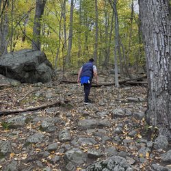
    I did the Stairway to Heaven hike and let me tell you. It was a tough one. I parked in one of the…read morelots that was across the street from Heaven hill farm. If you search up this particular trail and look up its difficultly. It is listed as moderate but to me it was more hard. What made it difficult was the extremely rocky sections which there were a lot of them. The whole hike is pretty much rocky. Not only that there were steep sections during this hike. This hike definitely made me realize that I actually need to invest in proper hiking shoes and not just sneakers as well as hiking sticks. I'm not the only one who thought this hike was difficult. I went with a hiking group and we all thought it was challenging. Once we made it to the top the view was definitely beautiful. We decided to relax for a bit and enjoy the view before heading back down. I came prepared and I enjoyed my peanut butter and jelly sandwich and my iced lemon water. Both were hitting the spot after the hike up. I will admit going down was just as hard because you had to deal with steep terrain. If you aren't careful you can definitely roll an ankle. Overall a challenging hike but the view and then getting my goodies from heaven hill farm was a plus.

    Photos
    Stairway to Heaven
    Stairway to Heaven
    Stairway to Heaven

    See all

    Surprise Lake ll

    Surprise Lake ll

    4.4(5 reviews)
    5.1 mi

    Medium level hike with great scenery. Not much elevation but part of the trail is rocky. Wear your…read morehiking shoes instead of sneakers, otherwise you will get a foot massage like I did today =) It's a good 3-4hours hike. Parking lot is 50 meters away from the entrance. Hiking might require hands at some points but overall it's smooth and agreeable. Following white trail, then at the crossing of white trail and yellow trail (2.5hours hike), you will enjoy the great view from the top of the mountain. Then follow the yellow trial for 30mins, surprise lake is right in front of you. It's surrounded by the forests with the branches of the trees touching the water. A soft breeze from the lake is very refreshing after a long hot hike. Follow the orange trail, you will get to the entrance nicely and easily. Def worth a visit if you like hiking.

    For an inexperienced party of hikers, this trail might not be the best choice, but we had a…read moregrueling and fulfilling hike. With ample breaks (~10 short water breaks and 3-4 longer breaks to admire scenery), we finished in 5.5 hours. If a short but rough bit of rock scrambling will be a challenge, make sure to bring gloves and proper hiking footwear, and durable fitted clothing. The path we took had varied terrain and tended to go up and down in elevation. Definitely download a hiking app that works without good phone service since there are multiple trails and we had multiple instances where we had to choose the correct direction. We brought 2 bottles of ice water each, but decidedly towards the end we should have really brought 4-5. Didn't see any wildlife except a hawk/falcon, plenty of millipedes, and a weird alien-like squirming worm sticking straight out of a tree looking like a stubby branch. Pathing: we started at the parking lot and followed the blue state line trail (which apparently leads to Maine, informed fellow hikers). We probably missed any views until we changed to the yellow trail (the beginning is denoted by three yellow squares, as well soon learned). On the yellow trail, we were soon treated with a small, private feeling view of a pond next to a campfire pit. The next viewing area consisted of a closeup experience of the same pond from the ground level. After another hour of hiking, we had our best view yet, a canopy high view of the river and small houses across, with trees as far as the eye can see. Seemed worth it after four hours of rocks and mud. Terrain: Short easy walking portions are split between rocky paths with the occasional climb up or down. Having a stick really helped during both parts. Watch out for slick mossy rocks. Weather: matters! We luckily came on a cloudy cool summer day (70-80F) and with shade and breeze it was very pleasant. I could imagine running out of water in the first two hours if it was sunny and hotter. Unluckily, it rained during the last hour as it became afternoon. It will be very hard to hike this trail without sunlight. It also became frigidly cold. Crowdiness: crossed about 10 hikers during the five hours, could be due to the rain warning, but still much less crowded compared to any other spots I've been to. Also saw almost no trash, thumbs up to all the hikers here. Danger: heard about snakes, never saw any. Most dangerous thing on the trail is probably the dwarves that surely live in the trees with the little doors, and slick rocks along with unsure footing. Few scrapes and bruised backsides can be expected for amateur hikers like us, especially when it rains. Feels amazing after we finished, my last hour of the journey nearly blank with desperation to reach the end. Good meal and foot massage ahead! tl;dr fairly difficult trail with ups and downs and rock scrambling, bring more water than you think you need, a hat, gloves, sunscreen if you like, a stick, good shoes, and a tested hiking app. Views depend on the trail you take, we got the best views on the yellow trail. Be careful and enjoy being nearly alone on the trail. Don't stay til dark, and run from the rain.

    Photos
    Surprise Lake ll
    Surprise Lake ll - Beautiful and peaceful lake

    Beautiful and peaceful lake

    Surprise Lake ll - The eagle in the sky

    See all

    The eagle in the sky

    Sterling Forest State Park

    Sterling Forest State Park

    4.4(20 reviews)
    9.0 mi

    We've hiked in Sterling Forest several times and have enjoyed the experience! Typically less…read morecrowded than Harriman State Park and others in the area, Sterling has a very nice visitor center with clean bathrooms, a helpful light up model of the forest, a store, and friendly staff to help with any questions. The parking lot is decent sized too. They have some varied hikes but most aren't too difficult. Whether you want lakes, forests or views you can get them here. Many of the trails also connect if you want to make them longer or shorter. Some of the hikes like Mckeags in the summer can be very tick ridden so do all the usual precautions. There's spotty reception in this area so if you're using All Trails or other app, you'll want offline view.

    I loved my hike 5 mile hike in Sterling Forest State Park. We did the Doris Duke loop which was…read morejust under 5 miles. We started the hike going clockwise, and in so doing did most of the elevation gain at the start of the hike. I found the path to be very comfortable to walk on, with less rocks and exposed tree roots than typical for NYS. I was also very surprised at how peace full it was, we did not see another living soul until we were 2/3s of the way through the hike, and then didn't see anyone else until we got to the parking lot. I was all set to only hike in this park going forward, because Harriman can get way too busy for me, and then the ticks started. SO MANY Ticks. I hike frequently and ticks are a fact of life in the north east, but this was next level tick infestation. I tuck my pant bottoms into my boots and spray tick repellent on my clothes, boots, and arms. We were pulling them off ourselves in the car on the drive home, and then off ourselves at home. Thank god they were the large size kind of tick and easy to see. I have never seen so many ticks at one time. 100% avoid Sterling Forest.

    Photos
    Sterling Forest State Park
    Sterling Forest State Park
    Sterling Forest State Park

    See all

    Wallkill River National Wildlife Refuge

    Wallkill River National Wildlife Refuge

    4.0(4 reviews)
    7.0 mi

    Wallkill River National Wildlife Refuge was established to conserve and enhance populations of…read morewildlife and their habitats, to protect and enhance water quality, and to provide opportunities for wildlife-dependent recreation and research. The refuge conserves the biological diversity of the Wallkill Valley by protecting and managing land, with a special emphasis on forest-dwelling and grassland birds, migrating waterfowl, wintering raptors, and endangered species. The North American Waterfowl Management Plan identifies the Wallkill River bottomlands as a priority focus area for waterfowl management within New Jersey.

    ***2 1/2 stars***…read more Wallkill was the site of our First of the Year hike this year, on a warmer than usual January 1 with some decent sunshine. We picked this based almost solely on location - in recent years, a Sussex native has been trekking all over the state to participate in this noble event so a nearby spot was selected as a gesture of good will. Our specific sojourn took place exclusively on the Wood Duck Trail, a back and forth hike that was about three miles in total (perfect mileage for this event). The parking lot is easy to spot, just off 23, and while the lot itself does not have a port-a-potty, the spiffy QuickChek nearby does - and for what it's worth, the bathroom there was pretty clean and the employees very pleasant. I am always warmly received in the Kingdom of Sussex. It absolutely could have been the time of year, but this place seemed super desolate and not conducive to decent optics. It's a lot of marshy/swampy areas off to the sides of the trails, which can be spooky under the right circumstances (maybe they could do some kind of Halloween hike over here with lanterns?) but after a while it's just repetitive. At the end of the trail (very easy to spot - it's literally gated so you have no choice but to turn around), there's a pleasant little off-shoot where you can get pretty close to the Wallkill River and admire the water features. Our Honorary Young Pup scampered down to the edge and played around there for a few minutes before we headed back. There were also one or two wooden bridges to cross over little streams, which were nice enough. However, they were a bit slippery - all of us watched the Honorary Young Pup skip across them with gritted teeth, but she stayed upright. I don't know if that's just the result of recent thawing and the prior day's rain, but something to keep in mind if you're tromping around there in similar weather. Once or twice we also encountered lookout points ostensibly to view birds and other wildlife, but they were not interested in making themselves known on January 1. Our only wildlife sighting of the day was a cardinal hopping around on the ice nearby. It would have been improved if this trail permitted pooches, but alas - only service animals are allowed, and they were off doing their duty elsewhere on this particular day. I don't see any reason why the powers that be couldn't at least allow leashed canines here - I can't imagine a tethered retriever doing any damage to the waterfowl, but I don't make the rules. On the positive side, the trail IS pretty well maintained. Part of that could be the minimal brush along the edges (there were a few sticker bushes but nothing that really hindered our journey), but it was very easy and straight-forward to follow, and even on a morning where everything was still in the process of drying out, I was impressed by how solid the path was. I'd anticipated navigating around a few puddles, and there really weren't any to speak of. Also in that regard, it's very young pup friendly. Our Honorary Young Pup is now a cagey veteran of this event and was comfortable frolicking by herself further down the trail and had no issues completing this adventure. This wasn't terrible by any means, but personal preference-wise, I prefer hikes/trails that are more interesting.

    Photos
    Wallkill River National Wildlife Refuge
    Wallkill River National Wildlife Refuge
    Wallkill River National Wildlife Refuge

    See all

    High Point Monuments of Sussex County - #IntenselyPassionatePhotography

    High Point Monuments of Sussex County

    4.3(6 reviews)
    9.4 mi

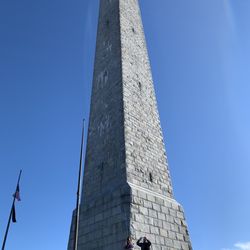
    Not sure why there aren't more reviews regarding High Point, but it's a time when I really, really…read morewish I could post photographs (although there are some provided on the main page that give an approximation of the beauty of the place). My coming here yesterday was completely unexpected. I grew up in Wayne, down Rt. 23 (which is supposedly now known as "the heroin highway"), and I've had some exposure to this upstate region over the decades (I can just barely remember my father bringing me to Stokes State Forest as a kid; I went camping at "Camp Silver Lake" with "Indian Guides" when I wasn't much older--- I think the camp/lake was at Hardyston; and I went with family once to the spot near Port Jervis where NJ/NY/PA meet). I met up with an old friend, and we stopped at the Sound Exchange on Rt. 23 in Wayne. Spent money on CD's (Moby Grape for me; Johnny Thunders for him), and then asked each other, "What next? What do we do now?" I remembered that driving north on Rt. 23, once you get past the seemingly endless mini malls and the burgeoning congestion...usually up past Butler and Kinnelon...the scenery becomes quite extraordinary (I've been told the area resembles Scotland in parts) and...for me, at least...therapeutic. If I ever feel close to whatever God(s) might exist, it's invariably when I'm out enjoying the loveliness and grandeur of nature. It was brutally hot, though, and I was ready to pack it in at some point near Sussex (which resembled a ghost town), when my friend suggested, "We're close to High Point. How about High Point?" I wasn't enthused. He mentioned that he had been there with his ex-wife (I guess there's a reason we're hanging out bored together at a record store buying CDs like aimless adolescents and then driving numb up a scenic highway...2 middle aged men...on a glorious Summer afternoon; he's got ex-wives, I've got ex-girlfriends, we've got too much time on our hands, limited money in our pockets, just above a half tank of gas in the car, not enough interests or stimulating hobbies to occupy ourselves with, no noble, altruistic activities to inspire ourselves with..etc...etc...but I'm not entirely sure what the reason(s) is(are), and why depress myself further by continuing this line of thought? Why indeed?), and she (and he) had loved it. I replied, "Ok, Ok." I figured it was easier to comply than try to formulate a reason why we shouldn't. Did I mention how enervating the heat was? We drove up bucolic mountain roads until we reached a toll booth. My first thought was, "I'm not paying out money for this." But it was after 4pm, and there was no admission charged after 4. Again, we drove on rolling mountain roads, past people picknicking and cooking food (the smell was intoxicating). There was a beautiful lake surrounded by pine-covered mountains, with people swimming. And then we reached the area where the High Point Monument towered above. A steady breeze was blowing, and the brutally hot day suddenly felt Fall-like, even chilly, despite the sunshine (I have to wonder if it's like that all the time? I guess it is). Off to one side was PA. Off to the other was NY. Over that way was NJ. Which one was which? I couldn't tell; I had been completely disoriented by our ride. I figured the side with the little toy village down below (Port Jervis?) was probably NY. But it didn't really matter. We were presented with a panorama of splendid, natural beauty, awe-inspiring and majestic, stretching out as far as the eye could see. (By the way, there are "Tower Viewers" available if you want to bring the scenery in closer...they charge a quarter for about a minute of magnification...but you really don't need them.) Even the man-made tower jutting up into the sky inspired awe, and I'm less moved by the constructions of man than I am by the constructions of nature. The tower (or monolith, or obelisk) was closed, so we couldn't climb our way to the top, but that was fine (especially for my friend, who, despite his initial enthusiasm, did not want to climb several flights of stairs to the top of a stone tower). Still, I'd like to come back earlier some day and make that climb and see the view from the top. I can't imagine how much more impressive it could be, but I'm motivated now. We stayed for several minutes, enjoying it. What had started out as a day of half-hearted, desultory boredom had ended extremely well. And riding back down Rt 23 with Moby Grape playing on the car's CD player was the icing on the cake. A dull day had become one that I'll remember with fondness for a long time. I fully expect to come back here. And I recommend it to anyone with a beautiful summer day on their hands, and no idea of how to spend it. I also heartily recommend it to those who have better, more constructive ways to spend their time than I usually do. It seems like a great place to bring your family if you grow tired of the seashore (and its numbing traffic jams). In other words, check this place out.

    Meh! The monument is cool but I'd only visit if you're camping nearby or live relatively close by…read more It's nothing grand so I don't have much to say about it.

    Photos
    High Point Monuments of Sussex County - Https://youtu.be/Zg_uAAW3OYo

    Https://youtu.be/Zg_uAAW3OYo

    High Point Monuments of Sussex County - Https://youtu.be/Zg_uAAW3OYo

    Https://youtu.be/Zg_uAAW3OYo

    High Point Monuments of Sussex County

    See all

    Abram S Hewitt State Forest

    Abram S Hewitt State Forest

    3.8(5 reviews)
    6.5 mi

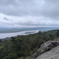
    I usually have to pump myself up to go over to Abram Hewitt; even for legit North Jersey hikes,…read moreit's super out of the way (at least 20 minutes from Route 23, with minimal post-hike eating options) and there's no way to avoid having to walk on the shoulder of a busy state highway for at least 15 seconds - and often significantly more if you don't get there before literally two other cars. This particular hike I did on Saturday IS one of my favorites though and a strong recommend. You can see in the attached pictures that despite a dreary day, the optics here are pretty fantastic. You have to earn the view, and when the sun actually decides to show up, it's arguably a top two or three optic in NJ. Yesterday I did about a 7-mile hike along the Bearfort RIdge, from the trailhead on the Warwick Turnpike, up the western side of the Bearfort Ridge Trail before making a left onto the Ernest Walter Trail before connecting up with the almighty AT for a few moments, then hopping onto the blue State Line Trail before reconnecting with Ernest Walter to the Greenwood Lake overlook before going south to hook up again with the Bearfort Ridge Trail (this time on its eastern side) back to the trailhead. The whole journey took about 4 1/2 hours for me, which includes moseying along for a while and a snack break at the overlook. The parking situation is rough; it's a huge reason you can't say this is an unequivocally positive hiking experience. There's a very small parking area on the shoulder of the Warwick Turnpike that can fit three cars. That's it. There's no signage to speak of, so unless you see one or two other cars there for context, it's not even clear you're allowed to park there for a few hours. Further down Warwick going toward Greenwood Lake, there's a bigger shoulder on the other side of the road that can probably fit 10 more cars but again, no signage and parking there requires you to walk alongside Warwick for a solid few minutes with not a lot of space to avoid vehicular traffic. Not pleasant, and I think they probably could figure out a way to make this much more hospitable for hikers. There's also no port-a-potty at any point in this hike, so I'd stop at the Dunkin or something in the downtown West Milford area beforehand. This is definitely not an easy hike, but the toughest part to me is the first half hour, where you're scaling up the ridge. I prefer to get the rough stuff over at the beginning as a warmup, but it's a fairly steep climb. Once up on the ridge, you're not really doing much more in the way of significant inclines (though there is more up and down, especially on the yellow trail where you have some legit scrambling), but the terrain is VERY rocky/rough, which is to be expected. It's a lot of outcroppings and hopping from one rock formation to the next. The final 2.5 miles or so on the Bearfort is comparatively easy; it's basically just a woods road, and the most annoying part of it was the bug situation, which was nastier than usual with some recent rain. I had some sweat-resistant Off, but it barely made a dent. By far the best part of this hike is the overlook area on yellow that has viewpoints going up and down the length of Greenwood Lake. The eastern side where Sterling State Forest is has some decent eye candy as well, but this is the gold standard because there's minimal foliage on the rock outcroppings; you can just on the boulders and see everything in front of you. There's no way to get up there without doing the work so it tends not to be as crowded as some of the nearby vistas in the area; an added bonus. The trail maintenance and markings are very solid and easy to find for the most part; they were either freshly painted on rocks/trees or actual physical markers nailed down (there's probably an official term for those). The blue trail has a few issues where it's super easy to lose your way because there's more than one possible option to turn onto; an extra rock cairn or two could go a long way here. Unfortunately due to the weather the canine chum situation was nonexistent, and so were the wildlife sightings. I saw/heard a few squirrels, but nothing to write home about. If this one is on your list, I'd recommend getting there early so you're literally one of the first three cars. Otherwise, your warmup is going to consist of exhaust fumes and sadness. Very cool hike though if you can make the time.

    I did the Surprise Lake loop in Abram S. Hewitt State Forest this past weekend. I would say this…read morewas a intermediate level hike, there was a lot of rock scrambling. Nothing too crazy, but a few spots were a little tricky. The hike offered some challenges because of the torrential rains the previous day. The rocks were extremely slippery at some points. We carpooled to the parking lot opposite the marina. The parking lot can accommodate probably 10 cars. There was one porta potty at the parking lot, no other facilities. We started with the blue trail, followed it up to the yellow trail on the left. From yellow, we moved on to a portion of the Appalachian trail then backtracked to reach the blue all the way to the parking lot. The hike offers some great views of the Greenwood lake and the surrounding peaks and valleys from the top of the Bearfort mountain. We traversed the ridge line and arrived at the Surprise Lake where we took a break for lunch. Total distance covered was about 5 miles. We didn't spot any bears or snakes while hiking, but kept an eye out just the same as they are supposed to be common in the area. A good pair of hiking shoes will be useful on this hike, be careful while scrambling over the rocks if you're wearing sneakers. As always, carry sunscreen and map of the trail. Hiking map:http://www.nynjtc.org/files/u1/PettyHJH_chp24-SurpriseLakeLoop.pdf

    Photos
    Abram S Hewitt State Forest
    Abram S Hewitt State Forest
    Abram S Hewitt State Forest

    See all

    Wawayanda State Park - parks - Updated September 2026

    Loading...
    Loading...
    Loading...