Apshawa Preserve Photos



You might also consider


More like Apshawa Preserve
Recommended Reviews - Apshawa Preserve
Start your review...


Reviews With Photos
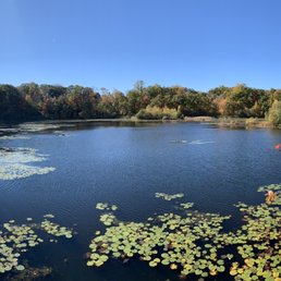

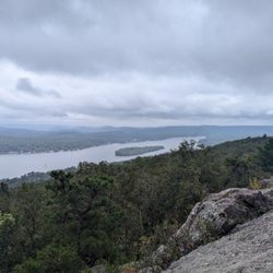
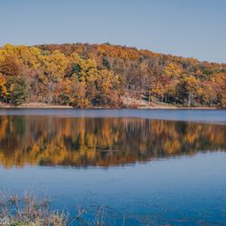
Easy hiking spot with very peaceful lake views. There are trails anywhere from 1/2 mile and up


I discovered this park when I "Google" best hikes in New Jersey. It was hard to get to the entrance. The park shows up on Google maps but if follow the directions you wind up in front of someone's house! Put in the latitude and longitude provided on the website to arrive at the parking lot. The preserve is not well known. Place was empty when we arrived. Trail maps are provided at the entrance. There is a deer fence around the preserve. Just pull up on the latch to enter and make sure to close it back up. We only hiked the blue trail. It is a mile long hike. Nice hike. At the end you end up at a pond. All in all a nice little side trip.


This is our first hike that we took in NJ and although we did not see any bears (thankfully!!) - my husband did pull out a huge dog tick which was making its way into my skin!! This was absolutely my nightmare come true and I am partially to blame for because I did not spray an insect repellant. I also did not wear clothing that covered my stomach (it was hot!). Anyways, apart from that little scare, it was a beautiful hike. There are a few different trails (based on difficulty) which are detailed on a billboard at the entrance. There are a ton of squirrels and chipmunks running around...like A TON! So don't get scared and think it's a bear. The Butler Reservoir is a beautiful scenery and you can take some awesome pictures! Also, the trail itself is pretty rocky. TIPS: *Wear good hiking shoes, there are some steep/slippery areas and it's rocky most of the way. *Spray insect repellant, inspect your exposed skin for ticks AND take a shower right after you get home. Remove the tick very slowly to prevent the head from breaking off. *If you see a bear - DO NOT RUN! Scream and make yourself appear bigger/more scary by waving hands. *Take a lot of beautiful pictures! *Plan and follow the trail. The trail is available on google maps if you ever get lost and there are color coded markings on the trees throughout the hike. And most importantly - HAVE FUN! read more





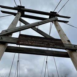
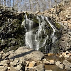
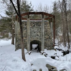
It's beautiful but be careful and aware. It's definitely very scenic, waterfalls, old structures, streams, etc. We had a great hike in on the green trail, however when we were leaving we saw a bear on the trail. It was surreal! I asked my oldest daughter - "is that a dog?" (It was a way down the trail) and she replied "mom- it's a bear!!" Not what you want to hear when on a quiet hike. The trail was a bit tough- lots of climbing and downed trees when we went- the green trail was definitely not easy.. We made a lot of noise and kind of hung out until the bear wandered off out of sight but by that time we were petrified. I had to grab my little one because instinct kicked in and she started running . I ruined a perfectly good water bottle by banging it with a rock (which I kept and wrote bear on it as a reminder though I don't need one)and we sang loudly while leaving!! The trail was quiet - we had only seen about 6 other people but we arrived mid afternoon and we were leaving before dusk so maybe the bears become more active at that time? Funny thing is I saw the sign warning about bears when we entered and said "whar?! Bears?!"!But the more seasoned hiker assured me we probably wouldn't even see any. I am scarred for life. Everyone says oh they're harmless and won't bother you but it's really hard to be so nonchalant when one is watching you. It must've followed us for a while after that because when my oldest daughter looked back she saw it up on some rocks watching us. We made it out safely and while it's beautiful I can't say I'd return. After our encounter I read that there was a fatal bear attack here- so again, I'm. 99.9 percent sure I won't return. If you're adventurous and want see a bear here's your chance! read more


6 years ago
Easy hiking spot with very peaceful lake views. There are trails anywhere from 1/2 mile and up read more
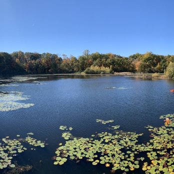
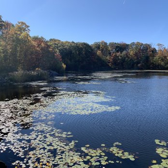

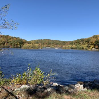


I discovered this park when I "Google" best hikes in New Jersey. It was hard to get to the entrance. The park shows up on Google maps but if follow the directions you wind up in front of someone's house! Put in the latitude and longitude provided on the website to arrive at the parking lot. The preserve is not well known. Place was empty when we arrived. Trail maps are provided at the entrance. There is a deer fence around the preserve. Just pull up on the latch to enter and make sure to close it back up. We only hiked the blue trail. It is a mile long hike. Nice hike. At the end you end up at a pond. All in all a nice little side trip. read more

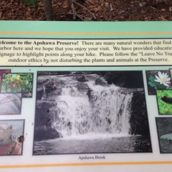




9 years ago
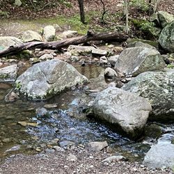
Went on a Saturday AM after it had rained the night before. Only about four other cars in the lot. Used google Maps for the parking lot instead of the website address since it brings you to someone's home. Started out on blue and then connected to white. A bit slippery and muddy because of the rain, but nothing unmanageable. You could hear howling in the distance at the top of the white trail and it was unclear if the animal was close or the howl echoed. Followed white to meet red and green. Three stars because I wanted to see the dam, but it's fenced off with signs. Followed red green for a bit to see if we could get a better view of the dam. Answer is no. Double backed and hit the blue trail back to the lot. Overall, an easy 3 miler with short inclines. The blue route on the way back had a small rocky creek to pass and the pup had fun with that. read more


More info about Apshawa Preserve
Ask the Community - Apshawa Preserve


















Apshawa Preserve - hiking - Updated September 2026
Best of West Milford
People found Apshawa Preserve by searching for…
Hiking Trails With Waterfalls in West Milford, NJ
Things to Do in West Milford, NJ
Waterfalls and Swimming Holes in West Milford, NJ
Scenic View in West Milford, NJ
Scenic Drive in West Milford, NJ
Walking Trails in West Milford, NJ
Lakes & Ponds in West Milford, NJ
Running Trails in West Milford, NJ
Swimming Lakes in West Milford, NJ
Places to Take Pictures in West Milford, NJ
Sunrise View in West Milford, NJ
Night Hike in West Milford, NJ
Night View in West Milford, NJ
Off Road Trails in West Milford, NJ
Beautiful Views in West Milford, NJ
Fishing Spots in West Milford, NJ
Scenic Overlook in West Milford, NJ
Scenic Spots in West Milford, NJ
Dog Swimming in West Milford, NJ
Cliff Diving in West Milford, NJ
Waterfalls in West Milford, NJ
Trending Searches in West Milford, NJ
Apple Orchards near Apshawa Preserve
Apple Picking near Apshawa Preserve
Barbershop near Apshawa Preserve
Baseball Fields near Apshawa Preserve
Beautiful Views near Apshawa Preserve
Blow Dry Bar near Apshawa Preserve
Corn Maze near Apshawa Preserve
Dog Friendly Things To Do near Apshawa Preserve
Dog Parks near Apshawa Preserve
Eyelash Extensions near Apshawa Preserve
Haunted Houses near Apshawa Preserve
Hiking Trails near Apshawa Preserve
Kids Birthday Party near Apshawa Preserve
Lookout Points near Apshawa Preserve
Makeup Artists near Apshawa Preserve
Off Road Trails near Apshawa Preserve
Outdoor Activities near Apshawa Preserve
Photo Spots near Apshawa Preserve
Picnic Areas near Apshawa Preserve
Places To Take Pictures near Apshawa Preserve
Playgrounds near Apshawa Preserve
Private Schools near Apshawa Preserve
Public Running Track near Apshawa Preserve
Public Shower near Apshawa Preserve
Public Tennis Courts near Apshawa Preserve
Pumpkin Patches near Apshawa Preserve
Rock Quarry near Apshawa Preserve
Scenic Night View near Apshawa Preserve
Scenic Overlook near Apshawa Preserve
Browse Nearby
BEST of West Milford, New Jersey Restaurants near Apshawa Preserve
BEST of West Milford, New Jersey Coffee near Apshawa Preserve
BEST of West Milford, New Jersey Things to Do near Apshawa Preserve
BEST of West Milford, New Jersey Breakfast near Apshawa Preserve
BEST of West Milford, New Jersey Shopping near Apshawa Preserve
BEST of West Milford, New Jersey Wineries near Apshawa Preserve
Browse Brands
Related Searches in West Milford, NJ
Affordable Kayak Rental Services in West Milford, New Jersey
Best Dog Hiking Trails Around West Milford, New Jersey
Best Fishing Locations and Guides in West Milford, New Jersey
Best Parks for Parties and Events in West Milford, New Jersey
Best Places for Horseback Riding in West Milford, New Jersey
Best Water Parks for Kids in West Milford, New Jersey
Best Waterfalls and Swimming Holes in West Milford, New Jersey
Check Out Great Playgrounds in West Milford, New Jersey
Check Out Off Road Trails in West Milford, New Jersey
Discover Baseball Fields Around West Milford, New Jersey
Discover Dog Friendly Trails to Explore in West Milford, New Jersey
Discover Fun Toddler Parks in West Milford, New Jersey for Your Little One
Discover Kid Friendly Hiking Trails in West Milford, New Jersey
Discover Popular Bike Trails in West Milford, New Jersey
Discover Soccer Fields in West Milford, New Jersey Near You
Discover Top Nature Parks to Visit in West Milford, New Jersey
Discover Top State Parks to Visit in West Milford, New Jersey
Discover a Hiking Trail in West Milford, New Jersey
Discover the Best Beaches in West Milford, New Jersey
Discover the Best Kids Park Spots in West Milford, New Jersey
Discover the Best Night Hike Trails in West Milford, New Jersey
Dog-Friendly Hikes With Dogs in West Milford, New Jersey
Enjoy Camping Adventures Around West Milford, New Jersey
Enjoy Exciting Mountain Biking Adventures in West Milford, New Jersey
Enjoy Kayaking Adventures in West Milford, New Jersey
Enjoy Off Leash Dog Hikes in West Milford, New Jersey
Enjoy Scenic Places to Walk in West Milford, New Jersey
Enjoy Tent Camping Spots Around West Milford, New Jersey
Enjoy a Beautiful Waterfall Hike in West Milford, New Jersey
Enjoy the Best Picnic Spots and Ideas in West Milford, New Jersey
Enjoy the Best Walking Path in West Milford, New Jersey
Enjoy the Best Walking Trails in West Milford, New Jersey
Explore Beautiful Parks and Green Spaces in West Milford, New Jersey
Explore Easy Hikes Perfect for All in West Milford, New Jersey
Explore Family-Friendly Zoos and Wildlife in West Milford, New Jersey
Explore Free Picnic Areas Around West Milford, New Jersey
Explore Fun Activities to Do in West Milford, New Jersey
Explore Parks With Pull Up Bars in West Milford, New Jersey
Explore Picnic Parks Near West Milford, New Jersey
Explore Popular Campgrounds Near West Milford, New Jersey
Explore Popular Picnic Areas Around West Milford, New Jersey
Explore Popular RV Parks Around West Milford, New Jersey
Explore Scenic Lakes to Visit in West Milford, New Jersey
Explore Secluded Beaches to Relax in West Milford, New Jersey
Explore Top Dog Parks in West Milford, New Jersey Near You
Explore Top Trampoline Parks in West Milford, New Jersey
Explore Top Water Parks in West Milford, New Jersey Today
Explore the Best Swimming Holes Around West Milford, New Jersey
Family Friendly Hiking With Kids in West Milford, New Jersey


