1. Wawona Point
1. Wawona Point
0

,

Cancel

Open app

Search

Wawona Point
4.0 (1 review)

Wawona Point Photos

Recommended Reviews - Wawona Point

Your trust is our priority, so businesses can't pay to alter or remove their reviews. Learn more about reviews.
Yelp app icon
Browse more easily on the app
Review Feed Illustration

1 month ago

Helpful 1
Thanks 0
Love this 1
Oh no 0

Verify this business for free

Get access to customer & competitor insights.

Verify this business

Mariposa Grove of Giant Sequoias - 2025 May 12: Mariposa Grove Perimeter Trail and Biledo Meadow Trail

Mariposa Grove of Giant Sequoias

4.4(125 reviews)
0.6 km

The Wawona entrance to Yosemite and the Mariposa Grove of Giant Sequoias was a new to me area of…read morethe park, when I visited in Mid-June 2026. Without the reservation system this year, even a weekday brings lines at the entrance kiosk. It was about a 45 minute wait. But, once entering the park, the Mariposa Welcome Center parking area had ample parking. The grove's gateway is just a couple of minutes from the Wawona entrance where there's a gift shop, restrooms and the shuttle bus to the grove (only runs seasonally.) I found the shuttles to run efficiently, albeit crowded. However, unless you want to hike up a steep paved road and add 2 miles to your hike, they're the only way up to the grove, as private vehicles are not allowed to drive or park there (those with disabilty tags are the exception.) The lower grove was packed and features the popular and iconic trees such as the Grizzly Giant and Tunnel Tree. It was too chaotic to really enjoy fully, but I was on my way to Wawona Point and the upper grove, so didn't linger in the main area too long. Once past the Grizzly Giant loop, the crowds exponentially thinned out and the forest became peaceful. It's a beautiful area and has a decent length hike to the upper grove, where the Guardians Loop trail was the standout along with Wawona Point (featuring a scenic overlook of the Wawona area.) The upper trails reminded me of a shorter version of Sequoia National Park's "giant forest loop." The trails were well kept and featured an array of wildflowers, green meadows and of course the iconic sequoias. You can make a longer loop or out and back and see most of the area in a longer day hike. It's a quieter and beautiful area of Yosemite that gets overlooked in comparison to the touristy lower grove and the valley. It is about a 45-50 minute drive to connect back down to the valley so you can visit both in one day, but I decided to linger and take my time in the beautiful upper grove areas. Either way, Mariposa Grove is a worthwhile stop in your Yosemite itinerary

Half day at Mariposa Grove. Parked at the visitor center and took a shutter. This will be the only…read morelocation for parking and shuttle ride. 6mins and you will reach the groves. We did the grizzly giant loop trail. Very easy and we took our time and enjoyed the trees. The trail is nicely kept and very easy to walk on. The end of the loop has a slight incline and it is all down hill from there and it peas straight out to the shutter.

Photos
Mariposa Grove of Giant Sequoias - 2025 May 12: Mariposa Grove Perimeter Trail and Biledo Meadow Trail

2025 May 12: Mariposa Grove Perimeter Trail and Biledo Meadow Trail

Mariposa Grove of Giant Sequoias

See all

Chilnualna Falls Trail - View from the trail

Chilnualna Falls Trail

4.6(18 reviews)
4.4 km

2025 Apr 29: Chilnualna Falls Trailhead, Yosemite National Park (5 of 5)…read more Description: Chilnualna Falls is a series of waterfalls totaling 690 feet (210 m), located on Chilnualna Creek in the southern section of Yosemite National Park. Chilnualna Falls consists of five tiers ranging from 30 to 300 feet (9-91 m) in height. The first tier is 90-120 feet (27-36 m) high. The second is a 30-foot (9 m) high cascade. The third and largest is 300 feet (91 m) high. The fourth is 60 feet (18 m) high. The final tier is a 180-210 foot (54-64 m) high cascade. The trailhead elevation is approximately 4,000 feet (1,200 m), and the trail reaches the main portion of the waterfall at 6,200 feet (1,900 m). The trailhead to the falls is in the northeastern portion of Wawona, at the end of the paved portion of Chilnualna Falls Road. *public info Chilnualna Falls 5 large cascades slide through and over large granite formations above the Wawona basin - water here is fullest in spring and early summer. This strenuous trail allows for you to view the Chilnualna Falls cascades in many locations along the hike and also rewards you with expansive views overlooking Wawona Dome during your uphill climb. It is a strenuous hike, but well worth it - for its views of the falls and Wawona Dome. Directions: From the South Entrance, drive towards the roundabout - continue at 12 o'clock. Take Wawona Road. Drive Past Wawona Hotel. You'll soon come to a bridge. After the bridge - turn right onto Chilnualna Falls Road. Keep driving past houses, school, library & market. There is parking right before you reach the Chilnualna sign. A public toilet is further down the road from the parking area. Hiking Distance: 9.65-miles round trip (CalTopo mileage) I think the links online show 'where the crows fly', so the distance is shorter, plus they may not include the multiple switchbacks. Length-of-Time: 5 to 6 hours if you're not stopping to rest or enjoy the views Elevation Gain: 2,400 ft (732 m) Difficulty: Challenging. This is not for the faint-of-heart. Because of the steep mountainside - there are many switchbacks. You definitely cannot climb straight up the mountain. The paths can be as narrow as one-foot wide on the rugged terrain. A misstep could see someone tumbling down the mountain into the waterfall. Along your hike, you'll go past several sections - man-made steps (some steep and narrow), through the forest, over several streams, and switchbacks (some steep and slippery). Highlights: Stunning waterfalls, beautiful scenery, and peaceful sections. The sounds of the first waterfall can be heard even before you reach the sign to the trail. As you hike up the mountain, some of the waterfalls may sound muffled - but don't give up. The waterfalls are your reward - the sounds of the waterfalls nudge you on. The views are exhilarating. The highlights also include the trees that stood majestic over hundreds of years, and the wonderful smoky cedar scent of Yosemite. Tips: 1) Start early. Preferably before 6:30 am. 2) Wear layered clothing so you can peel off a layer or two on your way up. 3) Bring plenty of water. Dehydration sets in pretty quickly. 4) Pack emergency items just in case. 5) Pack a light lunch. 6) Wear hiking shoes, not walking shoes. Yes, they're different. I wish I could share the sounds and sights of the rushing waterfall with you, but trust me when I say you need to make this hike up Chilnualna Falls - at least once in your life. It's been worth every pain in my muscles to do it at least once a year. Cheers!

This review is for Chilnualna Falls Trail which was a ~7.7 miles round trip that took ~6 hours to…read morecomplete in the snow. Chilnualna Falls Trail was located near the south entrance of Yosemite National Park; away from the busy Yosemite Valley. Lower Chilnualna Fall was a short ~0.2 miles and gets crowded at this particular spot. For the most part, the trail was a steady incline on dirt and rock with snow at higher elevations. In addition, there were a few downed trees over the trail. Overall, stunning views throughout this hike! There was a ~3 minute walk from the parking to the trailhead. Restrooms available at the parking area. Short video of the hike for those interested! https://youtu.be/jACscCHBcOg

Photos
Chilnualna Falls Trail - 2025 Apr 29: Chilnualna Falls

2025 Apr 29: Chilnualna Falls

Chilnualna Falls Trail

See all

Tiltill Valley - This is the the 5900 peak where I   was standing.

Tiltill Valley

5.0(1 review)
5.0 km

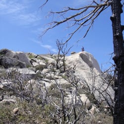
Trail head Elevation: 3818 Feet…read more Top Elevation: 5,900 Feet Trail Type: Out-and-back Range: 2.7 Miles from Rancheria Falls Type: Moderate to Strenuous Tiltill Valley is a remote valley in northern Yosemite National Park. It is accessible only to hikers. The valley is most easily reached via trail heads in the vicinity of the Hetch Hetchy Valley and Lake Eleanor.The valley provides access to many remote alpine lakes throughout the largely untamed wilderness that defines the northern portion of Yosemite National Park and the adjacent Emigrant Wilderness. This route tours the northern edge of Hetch Hetchy Reservoir. Across the lake, the views of Kolana Rock and the sheer granite walls of the Grand Canyon of the Tuolumne are majestic, contrasting pleasantly with the intimate serenity of Tiltill Valley. The trail was barely used. Strewn with broken trees and branches. We had to jump over some big branches and I have a few scratches to show for. This is one of our three day hikes from the base camp in Rancheria falls Sunday. It was a solitary hike. No one was there at all. We can not see the trail at 5900 feet. At the top at 5900 feet there was about two feet of snow. We were sinking and it was fun for a little bit but without our snow shoes it just won't work. We also decided that since we can not see the trail it is not safe to proceed. So we headed back down to camp.

Photos
Tiltill Valley
Tiltill Valley - On top of a peak on Tiltilly @ 5900 Feet

On top of a peak on Tiltilly @ 5900 Feet

Tiltill Valley

See all

Wawona Point - localflavor - Updated July 2026
Loading...
Loading...
Loading...