Wert Warwick to Ephrata Rail Trail Photos


You might also consider
More like Wert Warwick to Ephrata Rail Trail
Recommended Reviews - Wert Warwick to Ephrata Rail Trail
Start your review...

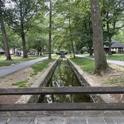
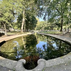
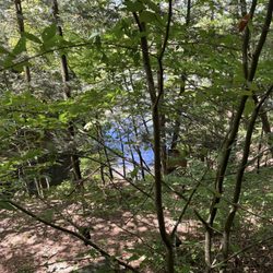
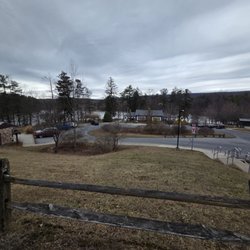
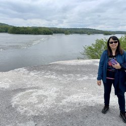
This 6 mile trail is full of pleasant surprises; it's one of the more interesting and versatile trails to ride on. We started at the Warwick Twp Municipal Park, which itself has a pleasant 3/4 mile paved loop. Plenty of space at the parking lot which also boasts a Bike Share! It's a self-service bike rental for which you can pay online for 2 or 4 hours of use. If you cross the street, the trail is supposed to continue for another 3/4 miles. So in all you have about 7.5 miles of trail to work with in this domain. The trailhead is just behind the Bike Share. The surface is mostly smooth crusted stone until you reached the Ephrata Linear Park portion which is fully paved -- and lighted! I am now really curious if I should come back and check it out at night one of these days. The trail is mostly wooded, at least on one side. It passes through Amish farms - you can also tell by the aeromatic air as you pass through them? So many silos in sight along the way, you can even make it a point to count them! You will ride past the Gnome Village, Winters statue, and some interesting murals. There is also a bike park, not sure if it's free to ride through it, but there was a birthday party going on at the time and we got a treat watching young kids getting airborne. There's one "permanent" porta potty on the Ephrata side of the trail. The trail ends at the Main St in Ephrata. It's such a contrast coming out of the trail, as we suddenly immersed into "civilization"! Seriously, our eyes literally lit up at the sight of downtown Ephrata which is surprisingly quaint, especially with the fall foliage still lingering. It was such a delightful experience. All of the roads we had to cross had very little traffic, and the drivers were all so courteous and stopped for the bikers. The only slightly negative was the trail was noticeably crowded. But it's totally understandable as it was a sunny, pleasant, 72 degree weather on a Saturday in November! We were so blessed! read more


5 years ago
More info about Wert Warwick to Ephrata Rail Trail
315 Clay Rd
Lititz, PA 17543
Directions
Hours
Outdoor Amenities


Wert Warwick to Ephrata Rail Trail - hiking - Updated June 2026
Best of Lititz
People found Wert Warwick to Ephrata Rail Trail by searching for…
Things to Do in Lititz, Pennsylvania
Hiking Trails With Waterfalls in Lititz, Pennsylvania
Beaches in Lititz, Pennsylvania
Night Hike in Lititz, Pennsylvania
Scenic View in Lititz, Pennsylvania
Scenic Overlook in Lititz, Pennsylvania
Secret Spots in Lititz, Pennsylvania
Walking Trails in Lititz, Pennsylvania
Night View in Lititz, Pennsylvania
Lookout Points in Lititz, Pennsylvania
Things to Do at Night in Lititz, Pennsylvania
Swimming Holes in Lititz, Pennsylvania
Off Leash Dog Hikes in Lititz, Pennsylvania
Running Trails in Lititz, Pennsylvania
View Points in Lititz, Pennsylvania
Places to Take Pictures in Lititz, Pennsylvania
Waterfalls in Lititz, Pennsylvania
Mountain Biking in Lititz, Pennsylvania
Attractions in Lititz, Pennsylvania
Off Road Trails in Lititz, Pennsylvania
River Swimming in Lititz, Pennsylvania
Trending Searches in Lititz, PA
Black Owned Nail Salons near Wert Warwick to Ephrata Rail Trail
Boat Rental near Wert Warwick to Ephrata Rail Trail
Cliff Jumping near Wert Warwick to Ephrata Rail Trail
Day Trips near Wert Warwick to Ephrata Rail Trail
Fishing Spots near Wert Warwick to Ephrata Rail Trail
Jet Ski Rental near Wert Warwick to Ephrata Rail Trail
Kayak Rental near Wert Warwick to Ephrata Rail Trail
Lakes & Ponds near Wert Warwick to Ephrata Rail Trail
Off Road Trails near Wert Warwick to Ephrata Rail Trail
Outdoor Activities near Wert Warwick to Ephrata Rail Trail
Places To Walk Around near Wert Warwick to Ephrata Rail Trail
Public Pools near Wert Warwick to Ephrata Rail Trail
Public Shower near Wert Warwick to Ephrata Rail Trail
River Swimming near Wert Warwick to Ephrata Rail Trail
Rock Quarry near Wert Warwick to Ephrata Rail Trail
Scenic Night View near Wert Warwick to Ephrata Rail Trail
Scenic Overlook near Wert Warwick to Ephrata Rail Trail
Secluded Spots near Wert Warwick to Ephrata Rail Trail
Soccer Store near Wert Warwick to Ephrata Rail Trail
Splash Pad near Wert Warwick to Ephrata Rail Trail
Strawberry Picking near Wert Warwick to Ephrata Rail Trail
Sunrise View near Wert Warwick to Ephrata Rail Trail
Swimming Holes near Wert Warwick to Ephrata Rail Trail
Swimming Lakes near Wert Warwick to Ephrata Rail Trail
U Pick Farms near Wert Warwick to Ephrata Rail Trail
Watch Sunset near Wert Warwick to Ephrata Rail Trail
Browse Articles
Browse Nearby
BEST of Lititz, Pennsylvania Coffee near Wert Warwick to Ephrata Rail Trail
BEST of Lititz, Pennsylvania Restaurants near Wert Warwick to Ephrata Rail Trail
BEST of Lititz, Pennsylvania Things to Do near Wert Warwick to Ephrata Rail Trail
BEST of Lititz, Pennsylvania Parks near Wert Warwick to Ephrata Rail Trail
BEST of Lititz, Pennsylvania Breakfast near Wert Warwick to Ephrata Rail Trail
BEST of Lititz, Pennsylvania Shopping near Wert Warwick to Ephrata Rail Trail
Browse Brands
Related Searches in Lititz, PA
Affordable Kayak Rental Services in Lititz, Pennsylvania
Best Fishing Locations and Guides in Lititz, Pennsylvania
Best Places for Horseback Riding in Lititz, Pennsylvania
Best Spots for Star Gazing in Lititz, Pennsylvania
Best Waterfalls and Swimming Holes in Lititz, Pennsylvania
Check Out Off Road Trails in Lititz, Pennsylvania
Discover a Hiking Trail in Lititz, Pennsylvania
Discover the Best Night Hike Trails in Lititz, Pennsylvania
Dog-Friendly Hikes With Dogs in Lititz, Pennsylvania
Enjoy Camping Adventures Around Lititz, Pennsylvania
Enjoy Exciting Mountain Biking Adventures in Lititz, Pennsylvania
Enjoy Kayaking Adventures in Lititz, Pennsylvania
Enjoy River Tubing Adventures in Lititz, Pennsylvania
Enjoy Tent Camping Spots Around Lititz, Pennsylvania
Enjoy a Beautiful Waterfall Hike in Lititz, Pennsylvania
Enjoy the Best Family Activities in Lititz, Pennsylvania
Enjoy the Best Tubing Experiences in Lititz, Pennsylvania
Enjoy the Best Walking Trails in Lititz, Pennsylvania
Exciting Cliff Jumping Spots in Lititz, Pennsylvania
Experience Thrilling White Water Rafting in Lititz, Pennsylvania
Explore Beautiful Parks and Green Spaces in Lititz, Pennsylvania
Explore Easy Hikes Perfect for All in Lititz, Pennsylvania
Explore Fun Activities to Do in Lititz, Pennsylvania
Explore Popular Campgrounds Near Lititz, Pennsylvania
Explore Popular Scenic Overlook Points in Lititz, Pennsylvania
Explore Scenic Lakes to Visit in Lititz, Pennsylvania
Explore the Best Beach Spots in Lititz, Pennsylvania
Explore the Best Boating Spots in Lititz, Pennsylvania
Explore the Best Swimming Holes Around Lititz, Pennsylvania
Family Friendly Hiking With Kids in Lititz, Pennsylvania
Find Popular Ziplining Spots Around Lititz, Pennsylvania
Find the Best Parks for Picnics in Lititz, Pennsylvania
Find the Best Scenic View Locations in Lititz, Pennsylvania
Hiking Trails With Waterfalls in Lititz, Pennsylvania
Off Leash Dog Hiking Trails in Lititz, Pennsylvania
Picnic Areas With BBQ Pits Available in Lititz, Pennsylvania
Plan a Scenic Drive Route Near Lititz, Pennsylvania
Popular Fishing Spots to Explore in Lititz, Pennsylvania
Popular Outdoor Activities to Try in Lititz, Pennsylvania
Popular Picnic Spots to Visit in Lititz, Pennsylvania
Safe River Swimming Areas in Lititz, Pennsylvania
Safe and Fun Parks for Kids in Lititz, Pennsylvania
Top Climbing Spots and Gyms in Lititz, Pennsylvania
Top Paddleboarding Activities in Lititz, Pennsylvania
Top Places for Snorkeling in Lititz, Pennsylvania
Top Running Trails to Explore in Lititz, Pennsylvania
Top Swimming Lakes to Enjoy in Lititz, Pennsylvania
Top Swimming Spots and Pools in Lititz, Pennsylvania
People who viewed Wert Warwick to Ephrata Rail Trail also viewed
Northwest Lancaster County River Trail
8 reviews
Lebanon Valley Rails to Trails
4 reviews
Riverfront Park
5 reviews
Silver Mine Park
6 reviews
Landis Woods Park Nature Trail
2 reviews
Musser Park
2 reviews
Quittie Creek Nature Park
1 review
Conestoga Greenway Trail
1 review
Middle Creek Wildlife Management Area
12 reviews
Speedwell Forge County Park
2 reviews