Cancel

    Open app

    Search

    West Lake Rv Park

    5.0 (1 review)

    West Lake Rv Park Photos

    Recommended Reviews - West Lake Rv Park

    Your trust is our priority, so businesses can't pay to alter or remove their reviews. Learn more about reviews.
    Yelp app icon
    Browse more easily on the app
    Review Feed Illustration

    14 years ago

    Best park in the entire Enchanted Circle! The hosts are unbelievably gracious and the rates are great!

    Helpful 1
    Thanks 0
    Love this 0
    Oh no 0

    Verify this business for free

    Get access to customer & competitor insights.

    Verify this business

    Cimarron Canyon State Park - Beautiful drive into the canyon

    Cimarron Canyon State Park

    4.7(3 reviews)
    0.7 mi

    Cimarron Canyon State Park is just a bit east of Eagle Nest, NM…read more Wow, was this beautiful, cooler weather country on August 1, 2026. My old man was driving so of course we didn't stick around long. Lol. I could definitely see myself spending time camping, hiking, and fishing in this area in the future. The river that flows through is the Cimarron. So I did some research... This is mostly dry camping country. I found nothing for RV hookups in this area. There were... + 4 campgrounds (including 94 sites) + reservations accepted + day use areas + angler parking sites + trailheads and canyon trails (hopefully clearly marked) + wildlife management areas + special trout waters + vault toilets + modern restrooms + picnic tables and grills + water hydrants This truly is the Land of Enchantment. Pack it in, pack it out - don't let your friends be litterbugs. I highly recommend you call 575-377-6271 or navigate their website for park alerts before heading there. https://www.emnrd.nm.gov/spd/find-a-park/cimarron-canyon-state-park/

    So it's a dry camp. No water. No showers. Gray water dump by hand only. No black water dump. No…read moreelectrical. It's still way better than most RV campgrounds with full hookups. This is why I go camping. Scenery, ample space between the campsites, nice cool weather. It would be a bargain for 5 times the nightly rate. Just don't tell the state of New Mexico.

    Photos
    Cimarron Canyon State Park - March 2019

    March 2019

    Cimarron Canyon State Park - March 2019

    March 2019

    Cimarron Canyon State Park

    See all

    Carson National Forest - Little snow runoff

    Carson National Forest

    4.8(8 reviews)
    19.8 mi

    Carson National Forest - while in desperate need of more rainfall - is still such beautiful wild…read moreland. This part of the forest is nearest Taos, NM. If there was a more "New Mexico" town than Santa Fe that I could recommend to newcomers of the Land of Enchantment, it would be Taos. And you would be virtually engulfed by the Carson NF. You'll see deer and elk. Maybe - just maybe - you'll see the lone moose that I have heard in this area, affectionately referred to as Marty. Actually I haven't heard of him in a while. He was quite the craze in recent years. I hope he is king of the mountains and not in downtown Espanola or something. Aside from those more prominent larger herbivores, let's not forget the pronghorn antelope, bighorn sheep, black bears, coyotes, bobcats, foxes, all the smaller critters, and cougars too. I have yet to see a cougar and do not want to. I was more recently disheartened and disgusted by news that I learned on August 20, 2026, about "Suspected destructive devices recovered in New Mexico forest, reward offered" (ABC News). https://abcnews.com/US/suspected-destructive-devices-recovered-new-mexico-forest-reward/story?id=135812837 What? Why? Like some Ted Kaczynski wannabe? Talk about a bored begrudging ineffective citizen of the world, though, man. Pack it in, pack it out please. This forest is very special.

    Carson covers a lot of land. We drove one way round the Enchanted Circle up to Angel Fire and the…read moreother way to Ojo Caliente from our crib in arroyo Seco. We reached 9,000 feet, it was cool and the Aspens had almost turned during early November. Still beautiful and so deserted we had the road to ourself. A bit nippy for hiking for us softies but we saw a few parked cars.

    Photos
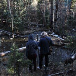
    Carson National Forest - Hiking by a stream

    Hiking by a stream

    Carson National Forest - Moss

    Moss

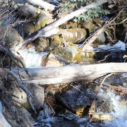
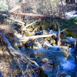
    Carson National Forest - Stream in Carson

    See all

    Stream in Carson

    Sugarite Canyon State Park

    Sugarite Canyon State Park

    4.3(3 reviews)
    56.9 mi

    An Afternoon Well Spent !!…read more It has been many years since I've been to the Raton area and typically whenever I was in the area it was just a quick to use the bathroom or get gas. On this visit, it was on a Friday afternoon and I had a few hours to kill and wanted to actually see some of the area. I remembered from years past that there were some lakes up in the mountains that I had always wanted to see and now was my chance. The Park is only about 20 miles from Raton and the roads were not that busy. The drive up is really nice as you see mountains, hills ranches, and some great scenery. On the way to Lake Maloya I stopped at one of the smaller lakes, Lake Alice and spent about half an hour checking it out. There really isn't access to that lake but you can tell its frequented by anglers. It is a nice small scenic lake. I then made my way up to Lake Maloya which is a reservoir for the area and right on the Colorado border. The lake is magnificent!! On a nice warm summer day, there was a nice breeze and no bugs. There were boaters on the lake, some people canoeing and some campers but it was not that busy at all. I spent a good two hours stopping and driving farther up the lake until I came to the gate that takes you to Dorothy Lake ( for another time). The views are just amazing, I suggest bringing a canoe or kayak and spending a good day there. I'm not sure if there is swimming since I didn't see anyone swimming in the water. Next up was Sugarite Canyon, and when you stop at the main entrance they use the honour system where you pay, so please pay!!! I made my way to the visitors center and got a map of the trails. The canyon is a great place to hike and I saw no one else on the trail and felt like I had the place to myself. I can't describe how nice it was walking through the canyon, and all there is to see. I highly recommend hiking with a buddy since it is in a remote area and I saw a few different animal tracks as I made my way through the trails. In short, this area is worth a visit, you can spend a few hours there or a few days, its truly part of the magnificence that is New Mexico.

    Google know all about this place but not yelp? We are fixing…read morethat right now. As the parks service says "The nature enthusiast will appreciate the abundance of wildlife, birds, butterflies, and wildflowers among the lakes, creeks, forests, and meadows. Nearly all outdoor recreation activities are possible: Fishing, boating, hiking, horseback riding, hunting, and camping." All true. This is a huge park. Full of lakes, trails & wildlife. We took a 6 mile loop trail starting at the dam yesterday and saw NO ONE else. Lots of scat indicate there lots of moose and bear around, so be aware. There are numerous other trails as well add the aforementioned activities. Definitely worth a visit if you're in the area.

    Photos
    Sugarite Canyon State Park - Ponderosa Trail

    Ponderosa Trail

    Sugarite Canyon State Park
    Sugarite Canyon State Park

    See all

    Trinidad Lake State Park - South shore camping

    Trinidad Lake State Park

    4.3(20 reviews)
    57.5 mi

    Great Lake with camping spots and Beautiful views. A little on the windy side. The lake is long so…read moregood for wakeboarding or tubing. Bathrooms are clean and have lots of toilet paper! South shore camping is known to have more nature. There was a mountain lion spotted in the area before our arrival. There are critters so make sure food is secure when you leave the site for the day. Not good if you want your dog off leash. Even well behaved dogs, they are very strict.

    We stayed at this campground, in Colorado but close to the New Mexico border, for one night in our…read moresmall Class B camper van in late April, 2024. We actually had reservations further along at a national park but decided to shorten our driving distances for the day. We were able to make our reservation online. This is a very nice campground, with sites nicely spaced out and some nice amenities. We were in the Carpios Ridge campground which has 63 sites for RVs, trailers, and tents on a ridge 150' above the lake. We're actually pleased that our mapping app took us on an indirect route to the campground as our site did not have a water-view and we might have missed the lake otherwise! My understanding is that this is an Army Corps of Engineers (COE) campground that is managed by the state of Colorado. In April, 2024, the seven sites with full hookups were $41, with only 50 amp electricity: $36, and basic: $28. You also need to purchase a state of Colorado daily vehicle pass for $10. (This is expensive as we've stayed at other COE campgrounds for 1/2 off as holders of the NPS interagency senior pass, and without the need for a vehicle pass. $46 with state of Colorado management vs $18 were it COE management -- plus we had already paid for a site at Zapata Falls Campground that we wouldn't be using. The campground has clean restrooms and free showers (for campers only), as well as laundry facilities (in theory) and a book exchange. There are shared water spigots, as well as walking trails in the vicinity. There is also a shared dump station. The Visitors Center was already closed when we arrived and wasn't open yet when we left the following morning but we were able to buy our vehicle pass at a kiosk. We saw rangers patrolling the area. Only two concerns are worth noting. First, as already mentioned, the discrepancy between pricing of state and COE campgrounds. Also, the washing machine ate my $2 without the machine starting. More than the irritation of losing the $2, we really needed to do laundry after having been on the road for few week.

    Photos
    Trinidad Lake State Park - Campsite 35

    Campsite 35

    Trinidad Lake State Park - View from campsite 35 when you walk past a couple trees
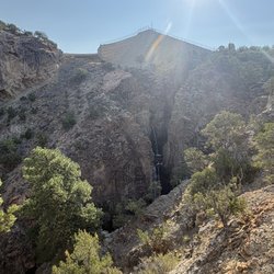
    View from campsite 35 when you walk past a couple trees

    Trinidad Lake State Park

    See all

    Kasha-Katuwe Tent Rocks National Monument - Pretty slot canyon

    Kasha-Katuwe Tent Rocks National Monument

    4.7(179 reviews)
    87.8 mi

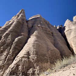
    Visiting is a little more complicated than some other parks/monuments, but if you just read the…read morewebsite you'll get it figured out! The key is that reservations are required, both from the NPS and from the Cochiti Pueblo. Get the NPS reservation first, and only then get the Cochiti Pueblo one (link to that is on the NPS site!). Don't drive to the trailhead, drive to the Cochiti Pueblo visitor center first, check in there, then follow the guide car (runs pretty much continuously all day) to the NPS entrance. The trailhead has multiple pit toilets, all of which were well maintained. The hike through the slot canyon and up onto the ridge is absolutely stunning. There really aren't words to do justice, nor do the pictures really convey things either. The hike into and through the slot canyon isn't steep, although there are some pretty big steps required to clamber over some rocks here and there, and it can be narrow and is often sandy. There's not a lot of elevation change though until you get through the slot canyon, then you just switchback straight up a couple hundred feet onto the ridge. That section isn't terribly long though, and the views from the top are well worth it. The first third of the hike and the last third are pretty exposed to the sun, so make sure you apply that sunscreen and bring plenty of water!

    Incredible. Reservation was easy. Gov Rec Ticket and Cochiti Tribal Pass, so two tickets. Worth…read moreevery penny. We got our tickets about 5 days out from visit. Check in at Visitor Center on arrival to check off your name on the list. Visitor centre has good restrooms, snacks and a few gifts and some very pleasant staff. Next Line up behind the white pilot vehicle and he will guide you in for a few miles where they will check your pass. After that its another few miles to a small carpark with restrooms and then off your go. We did slot canyon. Half a mile walk through amazing scenery/narrow passages through the stone and some climbing over rocks. I found it quite easy but do go before the sun comes out. We started at 9.30 am. After this section, which took us about 40 minutes due to lots of photo ops you will see another sign saying 1 mile to overlook. We almost gave up as the first climb looked hard - its not, just go on. We are in our 60's with dicky knees and it was not issue, just use your bottom when you have to. A light pair of garden gloves would be handy for when your hands scrape the boulders. All practical stuff here, the views speak for themselves. it's stunning and because of the limited access you meet few people along the way. As always with State Parks, check the website for any passes required or closures.

    Photos
    Kasha-Katuwe Tent Rocks National Monument - Kind of a tight squeeze at times along the trail

    Kind of a tight squeeze at times along the trail

    Kasha-Katuwe Tent Rocks National Monument - The first .5 mile

    The first .5 mile

    Kasha-Katuwe Tent Rocks National Monument

    See all

    West Lake Rv Park - parks - Updated September 2026

    Loading...
    Loading...
    Loading...