Wet Beaver Creek Trail Photos


You might also consider


More like Wet Beaver Creek Trail
Recommended Reviews - Wet Beaver Creek Trail
Start your review...


Reviews With Photos


Parking - I highly suggest to get early because this is popular place and it quickly fills up. While they do have extra space at other lots for parking it just gets very jammed up. Hike- Put lots of sunscreen on, bring a hat, lots of water, some snacks of food, and the right shoes! The hike itself is not bad, it's pretty much flat for the most part. It does have some incline, but nothing an average person can't handle. I think the only reason people complain because the heat drains out a lot of energy and water in your body. If you do feel tired they do have a couple shaded areas by trees to rest. Keep following the signs that say Bell Trail. You do have options to stop and check out other smaller cliffs and little river pools but we chose to see the big cliff. Take it slow, enjoy the view and make it all the way to end of bell trail and jump of the cliff! It's amazing . You can spend basically the whole day there if you want but have what you will need in your backpack for that day.


Honestly this hike was a bit interesting. It's not clear where you should hike or where the trails are. At times you're found walking on the mostly dried up creek. There are some areas where you have to figure it out and hope for the best. The good thing is there isn't really a way to get lost here. And at the end, or what I thought was the end, is a nice area to sit on the rocks and look at a pooled area of water surrounded by nature. Bring something to sit on as the rocks are very hot and there isn't much for shading. There are tons of pretty butterfly's and bunnies along the way as well. Note: if you have a lower riding vehicle, be careful of all of the holes on the dirt road. Bottoming out is very possible.


Worth every mile! Bring at least a gallon of water per person, sunscreen, hat and food. Hiking, swimming then hiking uses a shit ton of calories!


From the trailhead to the swimming pond took me 1 hour and 20 minutes on a relatively easy trail. If you are looking for a low-cost alternative to Fossil Creek I would highly recommend this location. The trail is less arduous, does not require a pass, and has a large swimming hole as a pay-off. The down side is that it is free so there is more foot traffic. There are various places that you can leave the designated trail and follow the creek, although it is mostly large river rock and boulders and a large amount of poison oak. The drive in is paved and only a small section of road off the 618H is unimproved. There is a main parking lot and also an overflow with a decent amount of spots. There is an outhouse at the trailhead.


This place has it all -- the long-ish hike, the ample parking (get there early though!), the deep swimming hole and rocks from which to dive. Endless fun awaits at Wet Beaver Creek and the spot locally known as "The Crack." -There are stunning views on the way to the creek via the trail, with red rock cliffs and visible layers in the rock to show periods of time. -When you reach the wood forest sign, be sure to stick to the left at the fork! -The hike from the parking lot to The Crack is roughly 3.5 miles each way, so if you're bringing kids make sure they're up for something like that. There's not that much of an uphill climb but it can feel long especially on the way back. -There are two pool areas to enjoy swimming and cliff jumping. Some areas in the pools are more shallow than others, so jump at your own risk and know how to land properly! Belly flops will leave a lasting sting hehe... -The water is pretty cold even in the heat of summer, but you get used to it once you're in. I would recommend just jumping in as if forces your body to adjust quicker vs. easing your way in. Have fun and PLEASE pack in what you pack out!! Otherwise I could see permitting in this place's future.


Easy accessibility and beautiful views make this Bell Trail hike a no brainer. The elevation change is not all too challenging and the trail is wide making it nice when you're doing a group hike. Most people hike this to reach "The Crack," which is about 3 1/2 miles in, but if you wanted to get a longer distance in, you can continue on with the hike. "The Crack" features multiple areas that you can jump in. The obvious protruding ledge that has water beneath it appears to be the safest to jump from. Other areas, it was hard to tell with the dark shadowing during early morning so I waited for frequent Wet Beaver Creek cliff jumpers to assure where the "safe" areas were. Some of my friends did kind of touch rock when jumping in, so naturally I took more precautions. This area is so amusing for hikers that it doesn't take long for the Crack to become crowded. Some favorite jump areas had a line to even jump in after a certain point. Regardless, it was great to relax and picnic and enjoy nature. It was a bit hot anyway hiking out since there are not really shaded areas on the 3 1/2 mile trail back to the parking area. I definitely recommend taking water since the sun can beat on you pretty heavily during the summer. Obviously the area is more crowded during the summer since it's a favorite local swimming hole.


This was a fun, less crowded hike. The water/swimming/cliff diving is what makes it special. It is not as "red" as the rest of Sedona compared to cathedral rock/devils bridge, etc if that's what you're looking for. It was a pretty straight forward 3.3 mike hike to "the crack"with cliff diving, fishing, cooling off in the swimming hole if you are brave enough with the cold water. It was little hard to find but here are my directions: From phoenix: I-17 N exit 298 onto AZ 179N. Instead if turning left to Sedona, Turn RIGHT/East and follow signs for Bell trail. Continue signs to Bell Trail and you'll see a sign that says "work center" to the left - turn left and you'll see the gate, parking space, and trailhead for Bell trail. (If you see wet beaver day use area to the left you've gone too far) The hike in continue following signs to Bell trail (pass white Mesa trail on the left, pass Apache mead trail on the left) you'll see sign that says wet beaver wilderness and a fork in the road between Bell trail on left and Weir trail on right-keep LEFT on Bell trail. You're 1.5 Miles away. Continue walking until you see a no camping sign and it will fork left or right. You'll be tempted to go right because that's towards the creek but Turn left to get to "the crack" and swimming holes. (If you happen to make a right at the no camping sign you'll cross the creek and do the 11 mi trail incline for Bell Trail until it ends FYI) Oh and dogs were allowed!


Reviewing the Bell Trail, just east of the 17 Freeway near Sedona. The trail is roughly two miles from the freeway and provides ample parking and offers a restroom before you begin the 7 mile round trip hike. For the hike, I must state I was a little disappointed. Book reviews and a few yelpers loved the hike and views and I just was not blown away. The trek takes you 3.5 miles in to the Bell Crossing. The family and I were hopeful of a large watering hole at the end, and even though it was a nice, it was not anything amazing. Maybe I have been spoiled by a few other awesome hikes, but this one was just okay is my book. The difficulty level overall was easy with a moderately strenuous portion going up the rim. The family hike included a few middle schoolers who made the round trip fine but were ready for it to be over halfway back down the rim. For those families with children, there are paths at the beginning of the hike that will take you down to the creek and out of the 7 mile hike. The views during the hike were decent and included rim views. Unfortunately, even though the temperatures today were to be ideal, if the sun is out during your hike like ours was, the heat can take a little toll on a hiker. As said, overall I was not super impressed in today's hike and would pick another spot in the future. Seven mile trip with limited excitement.


This spot is great to take a swim from the heat or set up and relax. Families and dogs welcome! Great resting spot!


This is another absolute gem of Arizona! This hike is relatively short and easy with a magnificent reward once you make it to the "Crack." This trail can be accessed by everyone as the trailhead is reachable by any type of vehicle. Not to repeat what everyone has already said, I'll stress sime things to remember. -From the Bell Trailhead it is advertised as a 3.8 mile trek to The Crack. The first half is fairly easy going and the last half begins to climb. When you reach the Wet Beaver Creek Wilderness sign, go left or up. -This trail is not shady by any means, so leave early to beat the heat. -The trail is dog friendly and we bring ours. They are hiking beasts and have been all over Arizona. For some reason this trail has literally exhausted them both and the heat has affected them both. So please remember their paws and bring water for them. -This place can get wild and college kids will take over very quickly. So if you are bringing small kids, PG friendly is earlier in the day. As the alcohol kicks in you may soon find yourself in a clothing optional environment. -This is a fun place. But remember beer alone will not keep you hydrated. Bring plenty of water. -Unless it has recently rained, the water is generally clear. If you've never been, don't immediately go cliff jumping as shadows will hide the depth. Check depth at all locations before jumping. -There are plenty of places to swim as well as jump. 5', 10', 15', 20' heights to choose from. Just make sure you know depth. -Bring your hammock. Plenty of places to set up and relax in between the fun. -Sunscreen. It works, use it. -Tents are heavy. Bring tarps and set up shade in certain locations. -Bring cheap water shoes. Barefoot is fine, but rains carry debris and thorns and they will find your feet. -Watch your dogs. They do accidentally knock people into water, or down on rocks. I've seen it happen and is usually not good. -Pick up your trash. This is still a free place to visit. Let's keep it that way.


22 days ago

2 months ago

4 years ago
Very beautiful and relaxing, we creek walked the opposite direction of The Crack, heading South down the creek, there still was pockets of people we encountered. Very tranquil place. Saw a few fish. read more


Parking - I highly suggest to get early because this is popular place and it quickly fills up. While they do have extra space at other lots for parking it just gets very jammed up. Hike- Put lots of sunscreen on, bring a hat, lots of water, some snacks of food, and the right shoes! The hike itself is not bad, it's pretty much flat for the most part. It does have some incline, but nothing an average person can't handle. I think the only reason people complain because the heat drains out a lot of energy and water in your body. If you do feel tired they do have a couple shaded areas by trees to rest. Keep following the signs that say Bell Trail. You do have options to stop and check out other smaller cliffs and little river pools but we chose to see the big cliff. Take it slow, enjoy the view and make it all the way to end of bell trail and jump of the cliff! It's amazing . You can spend basically the whole day there if you want but have what you will need in your backpack for that day. read more


6 years ago
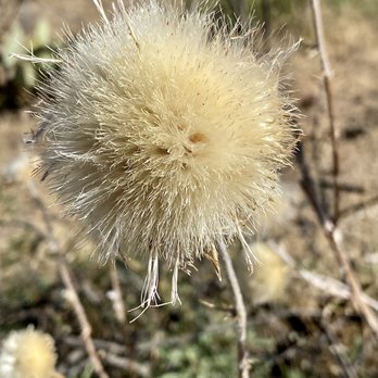
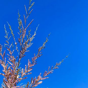
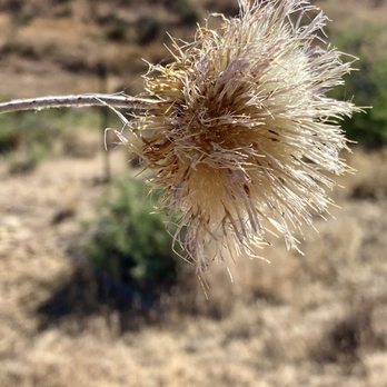
Honestly this hike was a bit interesting. It's not clear where you should hike or where the trails are. At times you're found walking on the mostly dried up creek. There are some areas where you have to figure it out and hope for the best. The good thing is there isn't really a way to get lost here. And at the end, or what I thought was the end, is a nice area to sit on the rocks and look at a pooled area of water surrounded by nature. Bring something to sit on as the rocks are very hot and there isn't much for shading. There are tons of pretty butterfly's and bunnies along the way as well. Note: if you have a lower riding vehicle, be careful of all of the holes on the dirt road. Bottoming out is very possible. read more





3 years ago
Worth every mile! Bring at least a gallon of water per person, sunscreen, hat and food. Hiking, swimming then hiking uses a shit ton of calories! read more

From the trailhead to the swimming pond took me 1 hour and 20 minutes on a relatively easy trail. If you are looking for a low-cost alternative to Fossil Creek I would highly recommend this location. The trail is less arduous, does not require a pass, and has a large swimming hole as a pay-off. The down side is that it is free so there is more foot traffic. There are various places that you can leave the designated trail and follow the creek, although it is mostly large river rock and boulders and a large amount of poison oak. The drive in is paved and only a small section of road off the 618H is unimproved. There is a main parking lot and also an overflow with a decent amount of spots. There is an outhouse at the trailhead. read more

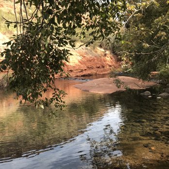
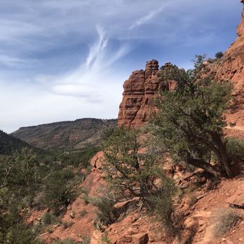


This place has it all -- the long-ish hike, the ample parking (get there early though!), the deep swimming hole and rocks from which to dive. Endless fun awaits at Wet Beaver Creek and the spot locally known as "The Crack." -There are stunning views on the way to the creek via the trail, with red rock cliffs and visible layers in the rock to show periods of time. -When you reach the wood forest sign, be sure to stick to the left at the fork! -The hike from the parking lot to The Crack is roughly 3.5 miles each way, so if you're bringing kids make sure they're up for something like that. There's not that much of an uphill climb but it can feel long especially on the way back. -There are two pool areas to enjoy swimming and cliff jumping. Some areas in the pools are more shallow than others, so jump at your own risk and know how to land properly! Belly flops will leave a lasting sting hehe... -The water is pretty cold even in the heat of summer, but you get used to it once you're in. I would recommend just jumping in as if forces your body to adjust quicker vs. easing your way in. Have fun and PLEASE pack in what you pack out!! Otherwise I could see permitting in this place's future. read more


10 years ago
Easy accessibility and beautiful views make this Bell Trail hike a no brainer. The elevation change is not all too challenging and the trail is wide making it nice when you're doing a group hike. Most people hike this to reach "The Crack," which is about 3 1/2 miles in, but if you wanted to get a longer distance in, you can continue on with the hike. "The Crack" features multiple areas that you can jump in. The obvious protruding ledge that has water beneath it appears to be the safest to jump from. Other areas, it was hard to tell with the dark shadowing during early morning so I waited for frequent Wet Beaver Creek cliff jumpers to assure where the "safe" areas were. Some of my friends did kind of touch rock when jumping in, so naturally I took more precautions. This area is so amusing for hikers that it doesn't take long for the Crack to become crowded. Some favorite jump areas had a line to even jump in after a certain point. Regardless, it was great to relax and picnic and enjoy nature. It was a bit hot anyway hiking out since there are not really shaded areas on the 3 1/2 mile trail back to the parking area. I definitely recommend taking water since the sun can beat on you pretty heavily during the summer. Obviously the area is more crowded during the summer since it's a favorite local swimming hole. read more


8 years ago
This was a fun, less crowded hike. The water/swimming/cliff diving is what makes it special. It is not as "red" as the rest of Sedona compared to cathedral rock/devils bridge, etc if that's what you're looking for. It was a pretty straight forward 3.3 mike hike to "the crack"with cliff diving, fishing, cooling off in the swimming hole if you are brave enough with the cold water. It was little hard to find but here are my directions: From phoenix: I-17 N exit 298 onto AZ 179N. Instead if turning left to Sedona, Turn RIGHT/East and follow signs for Bell trail. Continue signs to Bell Trail and you'll see a sign that says "work center" to the left - turn left and you'll see the gate, parking space, and trailhead for Bell trail. (If you see wet beaver day use area to the left you've gone too far) The hike in continue following signs to Bell trail (pass white Mesa trail on the left, pass Apache mead trail on the left) you'll see sign that says wet beaver wilderness and a fork in the road between Bell trail on left and Weir trail on right-keep LEFT on Bell trail. You're 1.5 Miles away. Continue walking until you see a no camping sign and it will fork left or right. You'll be tempted to go right because that's towards the creek but Turn left to get to "the crack" and swimming holes. (If you happen to make a right at the no camping sign you'll cross the creek and do the 11 mi trail incline for Bell Trail until it ends FYI) Oh and dogs were allowed! read more


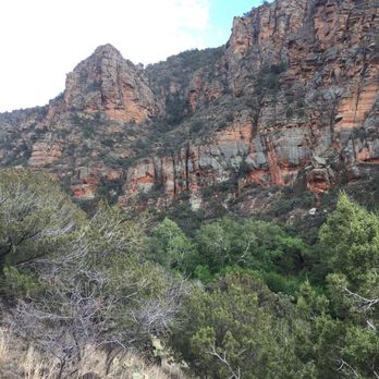


Reviewing the Bell Trail, just east of the 17 Freeway near Sedona. The trail is roughly two miles from the freeway and provides ample parking and offers a restroom before you begin the 7 mile round trip hike. For the hike, I must state I was a little disappointed. Book reviews and a few yelpers loved the hike and views and I just was not blown away. The trek takes you 3.5 miles in to the Bell Crossing. The family and I were hopeful of a large watering hole at the end, and even though it was a nice, it was not anything amazing. Maybe I have been spoiled by a few other awesome hikes, but this one was just okay is my book. The difficulty level overall was easy with a moderately strenuous portion going up the rim. The family hike included a few middle schoolers who made the round trip fine but were ready for it to be over halfway back down the rim. For those families with children, there are paths at the beginning of the hike that will take you down to the creek and out of the 7 mile hike. The views during the hike were decent and included rim views. Unfortunately, even though the temperatures today were to be ideal, if the sun is out during your hike like ours was, the heat can take a little toll on a hiker. As said, overall I was not super impressed in today's hike and would pick another spot in the future. Seven mile trip with limited excitement. read more


6 years ago
This spot is great to take a swim from the heat or set up and relax. Families and dogs welcome! Great resting spot! read more

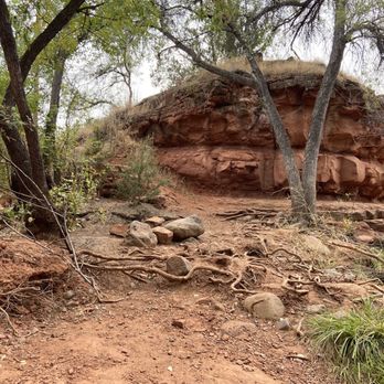


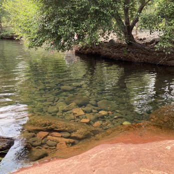

This is another absolute gem of Arizona! This hike is relatively short and easy with a magnificent reward once you make it to the "Crack." This trail can be accessed by everyone as the trailhead is reachable by any type of vehicle. Not to repeat what everyone has already said, I'll stress sime things to remember. -From the Bell Trailhead it is advertised as a 3.8 mile trek to The Crack. The first half is fairly easy going and the last half begins to climb. When you reach the Wet Beaver Creek Wilderness sign, go left or up. -This trail is not shady by any means, so leave early to beat the heat. -The trail is dog friendly and we bring ours. They are hiking beasts and have been all over Arizona. For some reason this trail has literally exhausted them both and the heat has affected them both. So please remember their paws and bring water for them. -This place can get wild and college kids will take over very quickly. So if you are bringing small kids, PG friendly is earlier in the day. As the alcohol kicks in you may soon find yourself in a clothing optional environment. -This is a fun place. But remember beer alone will not keep you hydrated. Bring plenty of water. -Unless it has recently rained, the water is generally clear. If you've never been, don't immediately go cliff jumping as shadows will hide the depth. Check depth at all locations before jumping. -There are plenty of places to swim as well as jump. 5', 10', 15', 20' heights to choose from. Just make sure you know depth. -Bring your hammock. Plenty of places to set up and relax in between the fun. -Sunscreen. It works, use it. -Tents are heavy. Bring tarps and set up shade in certain locations. -Bring cheap water shoes. Barefoot is fine, but rains carry debris and thorns and they will find your feet. -Watch your dogs. They do accidentally knock people into water, or down on rocks. I've seen it happen and is usually not good. -Pick up your trash. This is still a free place to visit. Let's keep it that way. read more


15 years ago


6 years ago

8 years ago

9 years ago
First couple miles are fairly easy terrain but a little boring scenery, once you reach the trail head is when it starts to get a bit tougher with gorgeous scenery. Be careful you are walking the edge of the mountain the remainder of the trail. Once you are there it's breathtaking. I suggest getting there early if you want peace and quiet. Hiked in without seeing one hiker, but after an hour of relaxing at the crack for an hour it was packed full of hikers. Make sure you take plenty of H2O, hiked the last weekend in Sept and was still a bit warm. Seen a lot of hikers while heading back out with only a 12oz bottle of water....no bueno!!! read more


6 years ago
7 years ago

9 years ago

9 years ago

10 years ago
I found this hike in my AZ Highways hiking guide, and wished I'd read these reviews first! The guide calls this the Bell Trail--it is the same. The guide describes the hike following along the shady Wet Beaver Creek, where you can get relief from the hot sun. OK, 98% of the trail is in the open, hot, no shade, desert sun! Sure, there are a couple (only a couple) side trails for you to go down to the creek- nothing as anticipated. We took this on during a July afternoon---a major mistake, and we know better! (but I trusted the book- hoping for a 1/2 mile hike, play in water, another 1/2 mile, play in the water....NOPE!) We did have enough water- but enough to 'survive'- I was amazed at the teens heading down in their bathing suits and bikinis with just a jug to share. NOT SMART. It is a 3.3 mile hike one way. Towards the end you climb some cliff sides yet remain on a well marked path--but there are a couple spots that have a pretty steep drop. (For those of you who like to let your little ones run on ahead..be warned!) Many people were disapointed to find the end spot (the Crack) full of loud teens, kids, and folks who acted as if this was SplashLand. Fun can be had without respecting the beautiful area for what it is! We will be back, but in the Fall or Spring. And agreed...parking lot fills up! So when you are done with your hike, could you please pull out into the side road to picnic, so others can pull in! THANKS. read more


11 years ago
9 years ago
16 years ago
More info about Wet Beaver Creek Trail
Coconino National Forest
8375 State Rte 179
Sedona, AZ 86351
Directions
(928) 282-4119
Call Now
Hours
Indoor Amenities
Outdoor Amenities
Ask the Community - Wet Beaver Creek Trail
Review Highlights - Wet Beaver Creek Trail










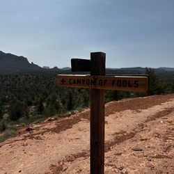
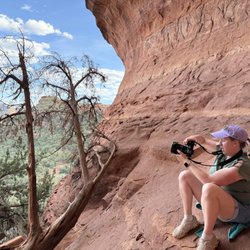


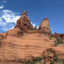


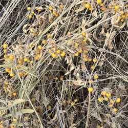
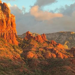
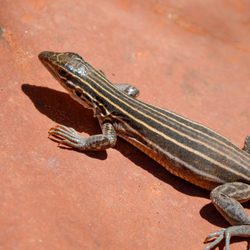




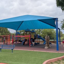


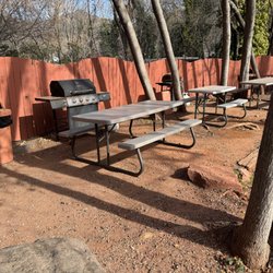
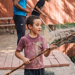
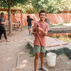






Wet Beaver Creek Trail - hiking - Updated August 2026
Best of Sedona
People found Wet Beaver Creek Trail by searching for…
Trending Searches in Sedona, AZ
Antiques near Wet Beaver Creek Trail
Barbershop For Men near Wet Beaver Creek Trail
Bike Shop near Wet Beaver Creek Trail
Cliff Jumping near Wet Beaver Creek Trail
Consignment Shops near Wet Beaver Creek Trail
Creeks near Wet Beaver Creek Trail
Cruising Spots near Wet Beaver Creek Trail
Dog Friendly Things To Do near Wet Beaver Creek Trail
Ear Piercing near Wet Beaver Creek Trail
Eyebrow Threading near Wet Beaver Creek Trail
Flower Fields near Wet Beaver Creek Trail
Kids Haircut near Wet Beaver Creek Trail
Lakes near Wet Beaver Creek Trail
Lookout Points near Wet Beaver Creek Trail
Mini Golf near Wet Beaver Creek Trail
Parks near Wet Beaver Creek Trail
Pedicure near Wet Beaver Creek Trail
Permanent Makeup near Wet Beaver Creek Trail
Picnic Areas near Wet Beaver Creek Trail
Preschools near Wet Beaver Creek Trail
Public Golf Courses near Wet Beaver Creek Trail
Public Pools near Wet Beaver Creek Trail
Scenic Night View near Wet Beaver Creek Trail
Scenic Overlook near Wet Beaver Creek Trail
Sunrise View near Wet Beaver Creek Trail
Swimming Holes near Wet Beaver Creek Trail
Trading Card Shops near Wet Beaver Creek Trail
Used Furniture Stores near Wet Beaver Creek Trail
Browse Brands
Related Searches in Sedona, AZ
Affordable Kayak Rental Services in Sedona, Arizona
Affordable Paddle Board Rental in Sedona, Arizona
Best Dog Hiking Trails Around Sedona, Arizona
Best Fishing Locations and Guides in Sedona, Arizona
Best Places for Horseback Riding in Sedona, Arizona
Best Sightseeing Experiences Available in Sedona, Arizona
Check Out Off Road Trails in Sedona, Arizona
Discover Dog Friendly Trails to Explore in Sedona, Arizona
Discover Easy Hiking Trails Near Sedona, Arizona
Discover Kid Friendly Hiking Trails in Sedona, Arizona
Discover Popular Bike Trails in Sedona, Arizona
Discover Top State Parks to Visit in Sedona, Arizona
Discover a Hiking Trail in Sedona, Arizona
Discover the Best Night Hike Trails in Sedona, Arizona
Dog-Friendly Hikes With Dogs in Sedona, Arizona
Enjoy Camping Adventures Around Sedona, Arizona
Enjoy Kayaking Adventures in Sedona, Arizona
Enjoy Off Leash Dog Hikes in Sedona, Arizona
Enjoy Scenic Places to Walk in Sedona, Arizona
Enjoy Tent Camping Spots Around Sedona, Arizona
Enjoy the Best Walking Trails in Sedona, Arizona
Explore Beautiful Parks and Green Spaces in Sedona, Arizona
Explore Easy Hikes Perfect for All in Sedona, Arizona
Explore Fun Activities to Do in Sedona, Arizona
Explore Popular Campgrounds Near Sedona, Arizona
Explore Popular State Park Destinations in Sedona, Arizona
Explore Top Dog Parks in Sedona, Arizona Near You
Explore the Best Swimming Holes Around Sedona, Arizona
Family Friendly Hiking With Kids in Sedona, Arizona
Find Beautiful Views in Sedona, Arizona
Find Parks and Recreation Activities in Sedona, Arizona
Find Popular Ziplining Spots Around Sedona, Arizona
Find the Best Parks BBQ Grills in Sedona, Arizona
Find the Best Parks for Picnics in Sedona, Arizona
Hiking Trails With Waterfalls in Sedona, Arizona
Off Leash Dog Hiking Trails in Sedona, Arizona
Picnic Areas With BBQ Pits Available in Sedona, Arizona
Popular Outdoor Activities to Try in Sedona, Arizona
Popular Picnic Spots to Visit in Sedona, Arizona
Safe River Swimming Areas in Sedona, Arizona
Safe and Fun Parks for Kids in Sedona, Arizona
Top Hiking Trails to Explore in Sedona, Arizona
Top Playgrounds for Kids to Enjoy in Sedona, Arizona
Top Running Trails to Explore in Sedona, Arizona
Top Swimming Spots and Pools in Sedona, Arizona
Top Things to Do With Kids in Sedona, Arizona
Top-Rated Camping Sites in Sedona, Arizona


