Cancel

    Open app

    Search

    York County Rail Trail Authority

    4.5 (2 reviews)

    York County Rail Trail Authority Photos

    You might also consider

    More like York County Rail Trail Authority

    Recommended Reviews - York County Rail Trail Authority

    Your trust is our priority, so businesses can't pay to alter or remove their reviews. Learn more about reviews.
    Yelp app icon
    Browse more easily on the app
    Review Feed Illustration
    Photo of Justin W.
    9
    523
    9119

    8 years ago

    Helpful 1
    Thanks 0
    Love this 0
    Oh no 0

    18 years ago

    Helpful 1
    Thanks 0
    Love this 1
    Oh no 0

    Verify this business for free

    People searched for Hiking 621 times last month within 15 miles of this business.

    Verify this business

    Koser Park

    Koser Park

    4.6(5 reviews)
    16.9 mi

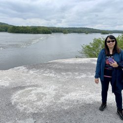
    Along the water in Bainbridge is a small park with a covered area and a small lot where many hikers…read moreand bikers park to use the nearby trail. Personally, I parked to walk 1.5 miles to the White Cliffs of Conoy, an old quarry along the water with stunning views and photo opps.

    The white cliffs of conoy is located here, which is roughly a 3 mile trek round trip (1.5 miles one…read moreway). Parking is limited in Koser Park. When heading towards the paved trail that is tree lined, take the paved path opposite of the side the picnic tables (on your right if your back is to the Susquehanna river). The trail can get quite busy, numerous people bike down the trails, others are just walking &/or walking their dogs. You eventually cross a small bridge, once you hit the 1.5 mile mark you will come up on a port a potty on your right. You can enter the first mound by walking through the overgrown brush/trees. The view from the first mound doesn't have as much impressive views as the second mound. When we arrived there were two kids biking on the first mound. The white cliffs of conoy was named after the resemblance of the white cliffs of Dover, however these mounds are actually industrial waste from crushed excess limestone & dolomite fused from an old limestone quarry that was once private land, but is now publicly owned. The second mound can be accessed if you walk a few feet past the port a potty, take caution as there are old metal rods etc poking out through the mound in various areas. There are also signs to take caution away from the ledge, as some of the areas can be unstable. The view of the Susquehanna River is beautiful. Are the white cliffs of conoy impressive? Not necessarily, but it's something unique, & quirky to see in person. It's also a popular spot for engagement/proposal photos for the locals. I wouldn't say it's a must see, but if you are out of state visiting, it's a nice short, paved easy hike that will probably last roughly an hour or so, dependent upon your speed & physical fitness level. You can combine this hike with the Chickies rock overlook trail, as it is only a 15 minute drive from one another. When leaving to head back to Hershey, we drove pass Three Mile Island, where the unit 2 reactor partial meltdown caused roughly 2 million people living nearby to be exposed to small amounts of radiation.

    Photos
    Koser Park
    Koser Park
    Koser Park

    See all

    Samuel S. Lewis State Park

    Samuel S. Lewis State Park

    4.9(7 reviews)
    15.1 mi

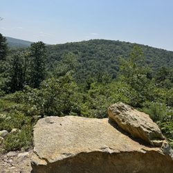
    Let me tell you something. During this time of Covidiousness, we've certainly done our fair share…read moreof outdoorsy types of things. While coming to a state park like this in York County may not seem like an obvious choice, it's actually been the perfect place. I'm not going to go in to any history or backstory (I covered that in my initial musings several years ago) but what sets this park apart from most PA state parks is its size. While the park is only 85 acres (PA has 121 state parks and some of them clock in at north of 15K acres just for a sense of scope) it's layout allows for things to feel more spread out than you would assume. The main road that wraps around the park is great for walking but there are also two miles of trails which if done in a clockwise direction are actually somewhat challenging with how it'll be mostly uphill. There is also a disc gold course, a rock formation that kids will love to climb on, a few small swing sets placed at different spots and a large open field at the top of hill with one hell of a view towards the Susquehanna River, Wrightsville and Columbia. The best part about this place is that it's rural enough so that it's never too busy. We've made trips to some state parks closer to us (Jacobsburg-Nockamixon-Lehigh Gorge) recently and they have been consistently packed. Here, not so much. The drive here is easy. There is an amazing view. There is usually more than enough space for everyone to spread out and do whatever they want. Sounds perfect to me and we'll be back this weekend.

    Samuel S. Lewis State Park does not offer you a bunch of amenities. There's no amazing new…read moreplayground for the kiddies (although there are some swings and such throughout). There's very few short trails around the park (but enough to satisfy my dogs and if you go the "right" way, you get quite a workout hiking uphill). However, what you DO get is gorgeous views of the river and landscape from atop Mt. Pisgah. You also get open space to roam and run around. And my son's favorite part are the rocks! He loves to climb and explore. It's almost possible for me to give any park less than five stars--especially one with such a beautiful view. You won't regret the trip to visit this park. I'm just lucky that it's only 15 minutes from home. P.S. Go read Christopher C.'s review--it's very thorough and well-written.

    Photos
    Samuel S. Lewis State Park
    Samuel S. Lewis State Park
    Samuel S. Lewis State Park

    See all

    Gifford Pinchot State Park

    Gifford Pinchot State Park

    3.4(50 reviews)
    16.4 mi

    We had a wonderful stay at Gifford Pinchot State Park!…read more The camping area at GP is separated into A loop and B loops with approximately 300 sites. All sites had a paved pad, varying in size depending on the location, with tent site being smaller. Most sites have electric and there are 22 full hookup sites in the camping area. Both loops are peninsulas into the lake, which is convenient to launching boats directly from many sites. Loop A is closer to the designated swimming area with a sandy beach and playground. B loop is closer to many of the hiking trails and also several boat launch areas. It is nice that the camping area and amenities are separated from the public day use area. At the entrance to the camping area there are three dump stations. During our stay we were at a full hookup site which was very spacious and often hard to find in PA State Parks. Our site was #299 and for some reason the entire site was paved/blacktop, which was different than all the other sites where the pad was paved and the picnic table area was gravel/grass. While this site made it easy to level our camper, it became quite hot in the afternoon/evening after the sun had baked it all day. Overall, we thoroughly enjoyed GP and couldn't believe we hadn't visited before because it is a great state park. Wood is available for purchase at the campground hosts' sites and ice at the park office. As with most PA state parks, quiet hours are at 9:00PM, which is a bit early, and there is no alcohol allowed in the park. We look forward to returning to GP in the future.

    First stay here while traveling and it is a fine spot to stay while passing through. They did have…read morea camp host in our area, A, though we never saw them even when we went looking b/c of a question we had. Never saw them the entire time we were there. The park is fine, needs a little TLC which the volunteers are doing a great job taking care of.

    Photos
    Gifford Pinchot State Park
    Gifford Pinchot State Park
    Gifford Pinchot State Park - Paved path but too short

    See all

    Paved path but too short

    Northwest Lancaster County River Trail

    Northwest Lancaster County River Trail

    4.4(8 reviews)
    16.6 mi

    We biked from Koser Park to the Decatur Street Access in Marietta. It's a very well maintained and…read morepaved trail.  Great condition good enough for skates though we only saw mostly bikers and one skateboarder during our visit.  The trail must be relatively new because the donated benches are still in mint condition.  There are placards along the trail providing background on various subjects.  The trail offers many nice amenities. Among others, Porta-Johns are available at 4 locations and bike repairing stations at 2. The 6.5 mile trail offers good variety in terms of views and terrains. Though mostly flat and straight, there are short sections that are windy or sloppy.  There are open fields and woody areas. The trail is near the Susquehanna River and you can see the water in many sections of the trail which is great. There are even a few spots where you can gain access to the river. We crossed 2-3 small bridges and had a great view of the Shocks Mills Bridge. Around the midpoint is the River Front Park which offers a great view of the river and well maintained picnic area for large groups, and 2 vending machines! We were surprised to see a sign to Columbia when we reached Decatur Street access, our destination.  Per Google Maps the trail ended right there.  We asked a couple who just came from that direction and they said the trail doesn't go all the way and riding on public roads would be required to make the connections.   So we stuck with our plan and did not continue. Overall I'm absolutely impressed with how well the trail is maintained, all the amenities it offers, and its vicinity to the river. UPDATE: Google Maps is not to be trusted! I have since found out the trail continues 3 miles north of Koser Park access, and 4.5 miles south of the Decatur Street access. From the Decatur Street access, you can continue 2 miles of nice windy trail before having to venture out onto S Bank St in Marietta. At this point you can either cross the railroad and turn right to eventually get to Furnace Rd where the off-road trail resumes, or if you're adventurous, you can continue with the unpaved trail which will end up in the parking lot of the Chickies Rock County Park and when you come out through the tunnel you will end up with the same Furnace Rd connection to the River Trail. This gap is well worth it because the next 1.5 mile towards Columbia is such a delight to ride through. Once in Columbia, you can head back, unless you want to visit the Columbia Crossings Trails Center, in which case, you'll have to ride the sidewalks and cross busy Rt 441 twice.

    Fun day on this trail today, then we hopped off the trail and did some boulder hopping. The trail…read moreeventually becomes to complicated since you can't tell where it stops and begins the closer you get to TMI. The 'hunger rocks' were exposed today due to low river levels. Yahoo!!

    Photos
    Northwest Lancaster County River Trail
    Northwest Lancaster County River Trail
    Northwest Lancaster County River Trail

    See all

    Highpoint Scenic Vista & Recreation Area - Sumit view of the Susquehanna River

    Highpoint Scenic Vista & Recreation Area

    4.2(6 reviews)
    16.7 mi

    After my Yelp friend David H. posted about this small gem last month, I had to take a look myself…read moreas I have been in the area numerous times but had honestly never heard about this place. Just to keep the history lesson short, it was built by York County in 2007 and it is one of a series of ten overlooks that are at different points in the county all of which give views of the Susquehanna River. susquehannariverlands.com/the-great-outdoors/scenic-overlooks/highpoint-scenic-vista-rec-area/ The set up is fairly simple. There is a small parking lot at the base of the overlook on Hilt Road. At the base there is a picnic bench and a port-a-blaster along with some literature about York County parks/area trails. From there it's up and around the trail which is a 1/2 mile loop with five way point stops that I guess are made to have you appreciate the view from different angles? At the top the view is very nice. It's literally the same as if you were over at Samuel S. Lewis State Park except that now you're two-ish miles closer to the river. The overlook from Samuel S. Lewis is higher and is visible from here and the top of the vista here is very visible from Sam Lewis. We were here around 35 minutes and the parking lot was packed but people were at different point of the incline and on other trails nearby so things never felt cramped or rushed. While I'm not necessarily sure that this place needs a return visit, I'm glad we came and I appreciate David putting this one on my/everyone's Yelp radar as it is a unique spot worth a brief stop.

    An absolute and positive must! It's an inclined walk but beautifully and impeccably paved -…read morecouldn't be easier. And it literally feels like you're in the clouds. Truth be told we went on a cloudy day, but if it's sunny I would avoid since there is absolutely no shade. There are rocks positioned to take a break during the five points.

    Photos
    Highpoint Scenic Vista & Recreation Area - Beautiful view.

    Beautiful view.

    Highpoint Scenic Vista & Recreation Area - Same one

    Same one

    Highpoint Scenic Vista & Recreation Area - View of York county

    See all

    View of York county

    Kings Gap State Park - Lookout from black gum trail

    Kings Gap State Park

    4.2(18 reviews)
    31.1 mi

    It's no wonder Kings Gap was named PA's Park of the Year! It's so peaceful, beautiful, and less…read morethan 30 minutes from Carlisle. There are walking and hiking trails everywhere and the crown jewel of course is the mansion, the view, and the gardens. There are activities year round including music festivals, tours of the mansion, and you can even rent out the mansion or just rooms. There's truly something for everyone. I wish there was a small store in the education center that offered drinks, coffee, and snacks, but there is the general store at the bottom of the hill that offers sandwiches, take-out meals, and beverages so hit up Kings Gap General Store before heading up to the mansion. We're so fortunate to have this park so close to us and if it's not my favorite state park, it's in the top five at least.

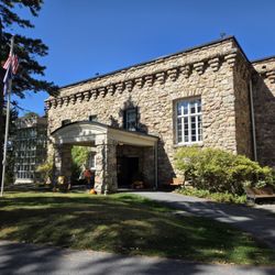
    I headed up to Cameron-Masland Mansion on a warm, sunny October Sunday, planning just to check out…read morethe scenic overlook... and accidentally stumbled into the Friends of Kings Gap Annual Garden Harvest Day. Food, crafts, live music, crowds, and enough traffic to require Park Rangers directing cars--definitely more than I bargained for, but sometimes that's half the fun. The mansion itself is a gorgeous 32-room stone villa perched on the mountaintop, built in 1908. On this day, the inside was open to wander through, though I admit I was a little disappointed to find vendor booths set up in many of the rooms. Not exactly ideal for soaking in the mansion's character or snapping quality photos, especially when another full field of vendors was set up right across the street. Still, it was cool to step inside and imagine what life here must have been like in the early 1900s--quiet, peaceful, with endless valley views. Speaking of views: the terrace overlook is the true star here. On this bright, cloudless day, with the leaves just beginning to turn, it was absolutely stunning. The terrace even had two velvet chairs and some pumpkins set up for a fun fall photo op. I spent the most time here, just taking in the sights and thinking about how many people have stood in that same spot over the last century. I also popped by the Education Center and wandered through the mansion garden (though the garden seemed like it could use a little love). All told, it was a fun stop that combined history, nature, and a little unexpected festival energy. I don't know that I need to go back, but it was definitely worth visiting once--and that view alone is bucket-list worthy.

    Photos
    Kings Gap State Park - Blueberry

    Blueberry

    Kings Gap State Park
    Kings Gap State Park - Water Tower

    See all

    Water Tower

    York County Rail Trail Authority - hiking - Updated August 2026

    Loading...
    Loading...
    Loading...