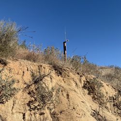
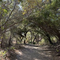
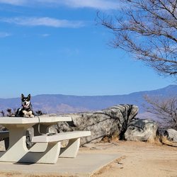
12 Hours of Temecula Photos


You might also consider
More like 12 Hours of Temecula
Recommended Reviews - 12 Hours of Temecula
Start your review...

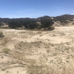
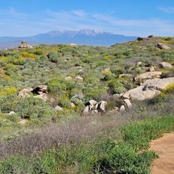
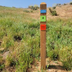
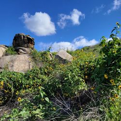
The 12 Hours of Temecula is a fantastic mountain biking event put on by So Cal Endurance in the hills east of Temecula 3 times a year. The race is a 6 hour or 12 hour relay format, with each person running about a 10 mile loop before handing off the "baton" to the next rider, unless you are going solo. Teams can be anywhere from 1 to 5 people, with special classes for older and younger riders, women, and juniors. I did the November 2013 event for my first mountain bike race ever, with a team of three friends in the Salty Dog category (or as I called it, Old Fart, with a combined tam age of 180), and another group of friends was there as a 3 man team. We all had a blast on the course. The organizers do a great job in keeping everything flowing smoothly, making sure all the riders are safe, and updating the standings throughout the day. There are lots of vendors there with bike demos, light demos, parts, and repair help. We camped the night before and after the race at the resort, which worked out great. We are already getting ready to put together our team for the January event. read more


More info about 12 Hours of Temecula
40500 California 79
Temecula, CA 92591
Directions
Hours
Outdoor Amenities
You might also consider


12 Hours of Temecula - mountainbiking - Updated June 2026
Best of Temecula
People found 12 Hours of Temecula by searching for…
Pump Track in Temecula, California
Bike Repair in Temecula, California
Things to Do in Temecula, California
Bicycle Repair in Temecula, California
Specialized Bikes in Temecula, California
Electric Bike Rental in Temecula, California
Bicycle Shop in Temecula, California
Bike Trail in Temecula, California
Stuff to Do in Temecula, California
BMX Bike Shops in Temecula, California
Trending Searches in Temecula, CA
Atv Rental near 12 Hours of Temecula
Beaches near 12 Hours of Temecula
Bike Fitting near 12 Hours of Temecula
Black Owned Nail Salons near 12 Hours of Temecula
Boat Rental near 12 Hours of Temecula
Bounce House Rentals near 12 Hours of Temecula
Dog Friendly Things To Do near 12 Hours of Temecula
Jet Ski Rental near 12 Hours of Temecula
Movie Theatre near 12 Hours of Temecula
Parks near 12 Hours of Temecula
Pick Your Own Farms near 12 Hours of Temecula
Picnic Areas near 12 Hours of Temecula
Public Pools near 12 Hours of Temecula
Pump Track near 12 Hours of Temecula
River Swimming near 12 Hours of Temecula
Scenic View near 12 Hours of Temecula
Secluded Spots near 12 Hours of Temecula
Splash Pad near 12 Hours of Temecula
Star Gazing near 12 Hours of Temecula
Strawberry Picking near 12 Hours of Temecula
Summer Camps near 12 Hours of Temecula
Swimming Holes near 12 Hours of Temecula
Swimming Lakes near 12 Hours of Temecula
Swimming Pools near 12 Hours of Temecula
Watch Sunset near 12 Hours of Temecula
Browse Articles
Browse Nearby
BEST of Temecula, California Restaurants near 12 Hours of Temecula
BEST of Temecula, California Coffee near 12 Hours of Temecula
BEST of Temecula, California Things to Do near 12 Hours of Temecula
BEST of Temecula, California Breakfast near 12 Hours of Temecula
BEST of Temecula, California Horseback Riding near 12 Hours of Temecula
BEST of Temecula, California Shopping near 12 Hours of Temecula
BEST of Temecula, California Campgrounds near 12 Hours of Temecula
Browse Brands
Related Searches in Temecula, CA
Affordable Bike Repair Services in Temecula, California
Affordable Bike Tune Up Services in Temecula, California
Affordable Kayak Rental Services in Temecula, California
Affordable Mobile Bike Repair in Temecula, California
Affordable Road Bike Rental in Temecula, California
Best Dog Hiking Trails Around Temecula, California
Best Electric Bike Rental Services in Temecula, California
Best Fishing Locations and Guides in Temecula, California
Best Nature Trails for Hiking in Temecula, California
Best Places for Horseback Riding in Temecula, California
Best Sledding Spots and Fun in Temecula, California
Best Used Bikes for Sale Near Temecula, California
Check Out Off Road Trails in Temecula, California
Discover Dog Friendly Trails to Explore in Temecula, California
Discover Popular Bike Tours in Temecula, California
Discover Popular Bike Trails in Temecula, California
Discover Scenic Bike Paths in Temecula, California
Discover Scenic Mountain Bike Trails Near Temecula, California
Dog-Friendly Hikes With Dogs in Temecula, California
Enjoy Biking Adventures Around Temecula, California
Enjoy Hiking Adventures in Temecula, California
Enjoy a Beautiful Waterfall Hike in Temecula, California
Enjoy the Best Tubing Experiences in Temecula, California
Enjoy the Best Walking Trails in Temecula, California
Explore BMX Bike Shops Near Temecula, California
Explore Beautiful Parks and Green Spaces in Temecula, California
Explore Bike Rentals Throughout Temecula, California
Explore Easy Hikes Perfect for All in Temecula, California
Explore Electric Bikes Available in Temecula, California
Explore Popular Scenic Overlook Points in Temecula, California
Explore Scenic Lakes to Visit in Temecula, California
Explore Secret Spots Worth Visiting in Temecula, California
Explore the Best Beach Spots in Temecula, California
Explore the Best Trail Options in Temecula, California
Family Friendly Hiking With Kids in Temecula, California
Find Top Mountain Bike Rental Options in Temecula, California
Find Top-Rated Waterfalls in Temecula, California Now
Find the Best Bikes Available in Temecula, California
Find the Best Scenic View Locations in Temecula, California
Hiking Trails With Waterfalls in Temecula, California
Off Leash Dog Hiking Trails in Temecula, California
Plan a Scenic Drive Route Near Temecula, California
Shop for Mountain Bikes at Local Stores in Temecula, California
Top Hiking Trails to Explore in Temecula, California
Top Running Trails to Explore in Temecula, California
Top-Rated Camping Sites in Temecula, California
Trusted Electric Bike Repair in Temecula, California
Trusted Kids Bike Shop Locations in Temecula, California