Indian Truck Trail Photos


You might also consider
More like Indian Truck Trail
Recommended Reviews - Indian Truck Trail
Start your review...

1 year ago


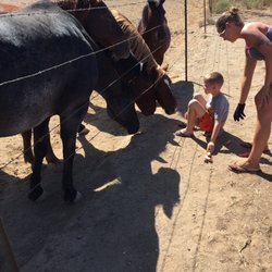
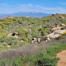
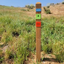
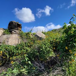
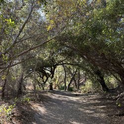
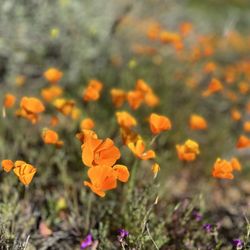
Great trail for mountain biking. Takes several hours all up hill to reach the fork. About 7 miles total and about 2700 feet elevation. So bring water and a snack. The road is a fire trail that as you get towards the top it's rocky and sandy. But as you can see from my pictures the climb is well worth it read more


9 years ago
10 years ago
More info about Indian Truck Trail
Santiago Canyon Rd
Corona, CA 92883
Directions
Hours
Outdoor Amenities
Ask the Community - Indian Truck Trail
You might also consider


Indian Truck Trail - hiking - Updated June 2026
Best of Corona
People found Indian Truck Trail by searching for…
Hiking Trails in Corona, California
Beautiful Views in Corona, California
Things to Do in Corona, California
Dirt Bike Riding in Corona, California
Places to Take Pictures in Corona, California
Waterfall Hike in Corona, California
Scenic Drive in Corona, California
Walking Trails in Corona, California
Off Road Trails in Corona, California
National Parks in Corona, California
Easy Hikes in Corona, California
Lakes & Ponds in Corona, California
View Points in Corona, California
Places to Go in Corona, California
Hiking With Kids in Corona, California
Waterfalls in Corona, California
Pump Track in Corona, California
Trending Searches in Corona, CA
Black Owned Nail Salons near Indian Truck Trail
Boat Rental near Indian Truck Trail
Cliff Jumping near Indian Truck Trail
Creeks near Indian Truck Trail
Day Trips near Indian Truck Trail
Dog Friendly Things To Do near Indian Truck Trail
Dog Friendly Trails near Indian Truck Trail
Easy Hikes near Indian Truck Trail
Fishing Spots near Indian Truck Trail
Jet Ski Rental near Indian Truck Trail
Kayak Rental near Indian Truck Trail
Lakes & Ponds near Indian Truck Trail
Nature Trails near Indian Truck Trail
Off Road Trails near Indian Truck Trail
Outdoor Activities near Indian Truck Trail
Parks For Picnics near Indian Truck Trail
Pick Your Own Farms near Indian Truck Trail
Picnic Spots near Indian Truck Trail
Places To Walk Around near Indian Truck Trail
Public Shower near Indian Truck Trail
River Swimming near Indian Truck Trail
Rock Quarry near Indian Truck Trail
Scenic Night View near Indian Truck Trail
Scenic Overlook near Indian Truck Trail
Secluded Spots near Indian Truck Trail
Soccer Store near Indian Truck Trail
Splash Pad near Indian Truck Trail
Star Gazing near Indian Truck Trail
Strawberry Picking near Indian Truck Trail
Sunrise View near Indian Truck Trail
Swimming Holes near Indian Truck Trail
Swimming Lakes near Indian Truck Trail
Watch Sunset near Indian Truck Trail
Browse Nearby
BEST of Corona, California Restaurants near Indian Truck Trail
BEST of Corona, California Coffee near Indian Truck Trail
BEST of Corona, California Things to Do near Indian Truck Trail
BEST of Corona, California Parks near Indian Truck Trail
BEST of Corona, California Lakes near Indian Truck Trail
BEST of Corona, California Breakfast near Indian Truck Trail
BEST of Corona, California Campgrounds near Indian Truck Trail
BEST of Corona, California Hot Springs near Indian Truck Trail
Browse Brands
Related Searches in Corona, CA
Affordable Bike Repair Services in Corona, California
Affordable Bike Tune Up Services in Corona, California
Affordable Kayak Rental Services in Corona, California
Affordable Road Bike Rental in Corona, California
Best Dog Hiking Trails Around Corona, California
Best Electric Bike Rental Services in Corona, California
Best Fishing Locations and Guides in Corona, California
Best Nature Trails for Hiking in Corona, California
Best Places for Horseback Riding in Corona, California
Best Sledding Spots and Fun in Corona, California
Best Used Bikes for Sale Near Corona, California
Check Out Off Road Trails in Corona, California
Discover Dog Friendly Trails to Explore in Corona, California
Discover Kid Friendly Hiking Trails in Corona, California
Discover Popular Bike Tours in Corona, California
Discover Popular Bike Trails in Corona, California
Discover Scenic Bike Paths in Corona, California
Discover Scenic Hiking Trails in Corona, California
Discover Scenic Mountain Bike Trails Near Corona, California
Discover Scenic Waterfall Spots in Corona, California
Discover Top Nature Parks to Visit in Corona, California
Discover Walking Parks in Corona, California Near You
Discover a Hiking Trail in Corona, California
Discover the Best Night Hike Trails in Corona, California
Dog-Friendly Hikes With Dogs in Corona, California
Enjoy Biking Adventures Around Corona, California
Enjoy Camping Adventures Around Corona, California
Enjoy Exciting Mountain Biking Adventures in Corona, California
Enjoy Hiking Adventures in Corona, California
Enjoy Kayaking Adventures in Corona, California
Enjoy Tent Camping Spots Around Corona, California
Enjoy a Beautiful Waterfall Hike in Corona, California
Enjoy a Peaceful Nature Walk in Corona, California
Enjoy the Best Picnic Spots and Ideas in Corona, California
Enjoy the Best Tubing Experiences in Corona, California
Enjoy the Best Walking Path in Corona, California
Enjoy the Best Walking Trails in Corona, California
Exciting Cliff Jumping Spots in Corona, California
Explore BMX Bike Shops Near Corona, California
Explore Beautiful Mountains and Hiking Spots in Corona, California
Explore Beautiful Parks and Green Spaces in Corona, California
Explore Bike Rentals Throughout Corona, California
Explore Easy Hikes Perfect for All in Corona, California
Explore Electric Bikes Available in Corona, California
Explore Fun Activities to Do in Corona, California
Explore Popular Campgrounds Near Corona, California
Explore Popular Scenic Overlook Points in Corona, California
Explore Scenic Lakes to Visit in Corona, California