4T Trail Photos


You might also consider

More like 4T Trail
Recommended Reviews - 4T Trail
Start your review...


Reviews With Photos


Has your relationship with Portland hit a bit of a slump? Not sure how you feel about each other? Wondering if it's still for you? Sounds like you need a four-course therapy session with your city, and pronto! You can do it in any order or direction, but here's the most prescribed route: T 1: the Train. Get a $5 Day pass if you don't already have a TriMet pass, and hop on the MAX from the east side, or wherever takes you toward downtown. Head up to Washington Park. This is the super cool subway stop with the elevator up to the zoo. T 2: the Trail. It's a weird transition, but follow the signs, and once you locate the trailhead, you'll be on your way. It's around 4 miles of canyon hike on the Marquam Trail. Follow the 4T signs, and allow yourself about 3 hours. You'll make a mid-hike stop at the scenic Council Crest, apparently once the site of an old-timey amusement park. It's now a great place to stop for water and photos before the next switchback-filled leg of the hike. It's a moderate hike, so be ready for some steep stretches down and equally steep ascents. Take your time, but don't dally TOO long, because -- the only real time-sensitive part of the trip -- you'll need to get to OHSU before the Tram stops running at 5pm. Speaking of which... T 3: the Tram. Fun space pods! Free going downhill! You might need to ask someone for general directions toward the Tram, but at some point you'll see signs. There are restrooms right there in the hospital, and a nice patio with panoramic views of city and bridges and mountains. Important note: the Tram closes at 5pm (as noted above), and doesn't run on Sundays between September and May. T 4: the Trolley. Yeah, it's technically the Streetcar, but TTTS just isn't as poetic. You can grab a bite at the Gantry food pod, or just get yourself a well-deserved beverage at the Scout Beer Garden there at the base of the Tram before picking up the "Trolley" for your ride back to the beginning and completing your loop. You'll find plenty of opportunities to sidetrack along the way and smell the roses (literally, at Washington Park), play a piano, stroll through [insert Powell's / Pioneer Square / Saturday Market here], and take many pretty pictures. We added a bus ride and and underground tour (B-U-T4), plus a Benson Bubbler drinking challenge to make a very full day. So give it a try! Spice up that relationship with your city. If the 4T Loop doesn't make you fall in love with your city all over again, it sure as rain can't hurt.


5 months ago
A fun way to explore the city whether you live here or not. The website does not have very helpful information, keeps going in circles and most links are expired. But starting from the Oregon Zoo could be good idea since there is a lot of signage out there. Look for the 4T sign and keep following it. All Trails has the route too. The Zoo entrance has the entire map as well. The hike up to Council Crest and then to OHSU was great! Very shaded and great elevation. Taking the tram was so fun, the view of city was so beautiful and I fell in love with Portland all over again. The trolleycar has a frequency of 30 mins from OHSU commons so if you miss that one there is a long wait or you could take the bus or train. Getting back to the zoo is easy with a lot of options. The beautiful day was an added bonus. All in all a GREAT day playing tourist in my own city! read more

10 years ago
An off track way of seeing the wonderful city of Portland. We started at the Pioneer Courthouse bought a $5 adult ticket for adults and $2.50 ticket for kids (all day pass) for MAX - we got off at the Oregon Zoo and walked the trails to Columbia Crest - we had a small picnic there before proceeding to OHSU ( about 4 miles of walking) and then took the aerial tram (free downhill )to South Water Front. We took the street car (covered in the all day pass) and did the outer city loop - the trail took us about 4 hours and gave us a wonderful sense of what the city was about. If you want to take a bus to a specific destination for a happy hour afterwards ( your bus ride is covered in your all day pass) - highly recommended !!! The 4 T's - trails, train, trolley and tram ( if you were wondering) read more


If you have 4-5 hours to spare, the weather is beautiful, and you're looking for a good workout, I highly recommend the 4T trail! In short it comprises of Trail, Tram, Trolley (streetcar) and Train (TriMet MAX). You can start at any point. I started from the Oregon Zoo - public parking is only 6.50 for a whole day - and started the Trail up to the Tram at OHSU. There are signages located throughout the trail. They can be a tad hidden at some points, but we only had to really look around a few times throughout our 4 hour adventure. I recommend taking the Trail first. Suffer first, enjoy later. The Trail kicked my butt. I'm a little out of shape. My husband had no issues. But there is an easier, urban trail you can take if you don't want to have your butt kicked. More on that later. First you trek up to Council Crest from the Oregon Zoo. What you do is walk along the Oregon Zoo entrance AWAY from the gift shop. Follow Trail signs and cross the road. Youll have to walk along the road shoulder for abit, but only for 3 minutes or so. You'll find signs pointing into forest. Take the trail up, up, up. This uphill hike isn't too strenuous. I managed it well. Once you get to Council Crest, take in the beautiful views of Portland. Then cross the circular park to continue the trail. (We got lost for a bit here because we didn't know we had to cross the circular grass field.) At some point after Council Crest, you'll have the option to take the forest trail or urban trail. This is where your fitness level comes into play. If you're moderately fit, take the forest trail. It goes down for a bit, then it goes up, up, UP. I'm not very physically active so this part kicked my butt. I was panting like a fish out of water and had to take breaks. My legs burned. So yeah, if you're not fit, or don't fancy a workout, take the urban trail. You'll be walking along a road, but I heard there's no uphill trek. Once you get to OHSU, follow the signs to the tram, or ask a friendly staff member. A staff member noticed we were a little lost so he led us to the tram. Once you get into the correct building there will be signs pointing towards the tram. Then you'll be in good hands. The tram is free downhill (but costs money uphill.) Simply get in line and wait for the next tram. They come quite frequently. The tram ride was easily the highlight of the trail. It offers amazing views of the city. When passing a tower there will be an announcement that the tram might rock. And rock it did! It felt like a mini rollercoaster ride because it went up and then made a small dive. Then rock, rock, rock. It was so much fun!! After you can off the tram, walk to your left and you'll see a MAX station. Purchase an all-day pass for $5 or a 2.5 hour pass for $2.50. We got the all-day pass in case we ended up spending more time in downtown Portland, which we did. Take the train to Central Library station. There will be signs towards the MAX station that will take you back to the Oregon Zoo. Take the blue/red line towards Hillsboro/Beaverton (I believe it's westbound). It'll only be 4 stops and you'll pass the deepest tunnel in the USA. Get off at Oregon Zoo and explore the tunnel, which features fun facts about its construction and earth geology. Then take the elevator back up to ground level where your car is parked. Or you can explore downtown Portland before going home! It was peak hour when we got to downtown and the trains and roads were crowded. So we decided to explore and escape traffic. I'm so glad we did! From here you are within walking distance of Powells City of Books, Voodoo Doughnuts, and so much more! We explored Powell's and got a Voodoo donut and had so much fun. Then we used google maps to find the closest MAX station and took the train back to the Oregon Zoo. It was a super fun adventure that took 5-6 hours, maybe more. A beautiful day well spent in Portland! I highly recommend this to people who have a full day in Portland and want to explore both the natural and urban side of this city. The trail is about 8 miles: half in nature and the other half in the urban side. Feel free to message me if you have any questions! I'll be happy to guide you through :) read more


10 years ago
Has your relationship with Portland hit a bit of a slump? Not sure how you feel about each other? Wondering if it's still for you? Sounds like you need a four-course therapy session with your city, and pronto! You can do it in any order or direction, but here's the most prescribed route: T 1: the Train. Get a $5 Day pass if you don't already have a TriMet pass, and hop on the MAX from the east side, or wherever takes you toward downtown. Head up to Washington Park. This is the super cool subway stop with the elevator up to the zoo. T 2: the Trail. It's a weird transition, but follow the signs, and once you locate the trailhead, you'll be on your way. It's around 4 miles of canyon hike on the Marquam Trail. Follow the 4T signs, and allow yourself about 3 hours. You'll make a mid-hike stop at the scenic Council Crest, apparently once the site of an old-timey amusement park. It's now a great place to stop for water and photos before the next switchback-filled leg of the hike. It's a moderate hike, so be ready for some steep stretches down and equally steep ascents. Take your time, but don't dally TOO long, because -- the only real time-sensitive part of the trip -- you'll need to get to OHSU before the Tram stops running at 5pm. Speaking of which... T 3: the Tram. Fun space pods! Free going downhill! You might need to ask someone for general directions toward the Tram, but at some point you'll see signs. There are restrooms right there in the hospital, and a nice patio with panoramic views of city and bridges and mountains. Important note: the Tram closes at 5pm (as noted above), and doesn't run on Sundays between September and May. T 4: the Trolley. Yeah, it's technically the Streetcar, but TTTS just isn't as poetic. You can grab a bite at the Gantry food pod, or just get yourself a well-deserved beverage at the Scout Beer Garden there at the base of the Tram before picking up the "Trolley" for your ride back to the beginning and completing your loop. You'll find plenty of opportunities to sidetrack along the way and smell the roses (literally, at Washington Park), play a piano, stroll through [insert Powell's / Pioneer Square / Saturday Market here], and take many pretty pictures. We added a bus ride and and underground tour (B-U-T4), plus a Benson Bubbler drinking challenge to make a very full day. So give it a try! Spice up that relationship with your city. If the 4T Loop doesn't make you fall in love with your city all over again, it sure as rain can't hurt. read more


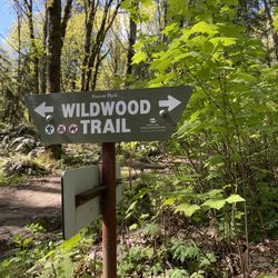
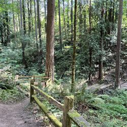
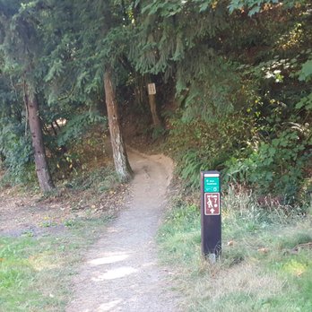
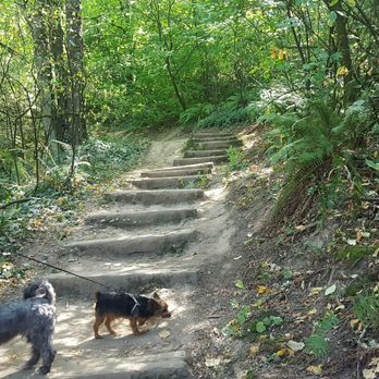
It was an interesting adventure with our dogs and a dog stroller! We started the 4T (trail, tram, trolley, train) trail at Washington Park and paid for all day parking for only $6.40 on a Sunday. Not Bad! Hourly parking is about $1.60? I was confused as to where the trail started but ask any visitor information staff and they'll be able to point you in the right direction. The 4T trail takes you over the highway and into the woods. Be on the lookout for signage that has the 4T logo, they may be difficult to spot but I was always able to find the sign whenever I started to question if I was going the right way or not. I don't recommend doing this hike with a stroller. We had no other choice since we needed a carrier for our pets when we rode the air tram, trolley and train. But luckily for us, our stroller wasn't that heavy. The Marquam trail started out a little steep and narrow, just like hiking uphill. It wasn't too difficult- I would say beginner to intermediate level, and definitely a nice workout with a stroller. Some areas were somewhat leveled and others had tree roots in the way. After getting out of the woods 1.2 miles later you reach a neighborhood that's another .5 miles away until you reach the top of Council Crest Park. Nice views of the city, the mountains and a water break! Also a nice area to have a picnic! The next trail gives you an option to continue through the woods or take the urban trail, we opted for the urban trail since we really didn't want to hike with the stroller anymore. When you leave Council Crest Park, you continue down the Marquam trail 0.5 miles until you reach the neighborhood roads for the urban trail that you take a right at, or go straight to continue onto the Marquam Trail for I don't know how many miles. If we didn't have the dog stroller, we would have opted to take the scenic route and also the air tram closes by 5pm on Sunday, so we were on a time crunch. We walked opposite of traffic because a nice local stopped and told us it was much safer that way! And it is, there's more space to walk. Otherwise, you'll be sharing the road with the cars. We walked for about 30 minutes until we reached OHSU and OMG WERE MY LEGS HAPPY. Continue to follow the signs to the aerial tram, which is just straight ahead. Once you reach the aerial tram, the view of the city is amazing and it makes the hike worth it! The downhill air tram ride is free. The air tram comes about every six minutes, so you're not waiting long. It's a nice ride down to the OSHU Commons where you can purchase your Streetcar/ TriMet tickets. As soon as you exit the air tram, make a left and you'll see the streetcar station to purchase your tickets. I purchased the $5.00 for all-day Streetcar/TriMet which I totally think is worth it. They offer other options as well. TriMet covers buses and trains. We took the Streetcar around downtown, made a couple of stops for food and then took the train back to our beginning location at Washington Park! Overall, our 4T trail lasted about 6.5 hours including stops in downtown. It's a great way to see the city, do as the locals do or something to do when you don't have concrete plans when visiting Portland. It's estimated about 9500 steps, which is pretty darn close. read more




9 years ago

More info about 4T Trail
Portland, OR 97086
Directions
Hours
Outdoor Amenities