André Michaux Historical Marker Photos


More like André Michaux Historical Marker
Recommended Reviews - André Michaux Historical Marker
Start your review...

This marker is along the main street that runs through the Black Mountain Downtown Historic District, so you can't miss it. And there's parking nearby which makes it easy to stop and read. It is marker P-21 and it reads, "French botanist, pioneer in studying flora of western North Carolina, visited Black Mountains, August, 1794." It was erected in 1949 by the There is more information online. Michaux traveled across North Carolina's mountains on multiple expeditions, discovering notable species including the Carolina Lily and collecting the first known specimen of the Oconee Bell. Political turmoil during the French Revolution ended his funding, and after further travels he died of fever in Madagascar in 1802. His writings and the later work of his son, François André Michaux, helped document the early natural history of the American frontier. [Review 541 of 2026 - 4636 in North Carolina - 25723 overall] read more


More info about André Michaux Historical Marker


André Michaux Historical Marker - landmarks - Updated July 2026
Best of Black Mountain
People found André Michaux Historical Marker by searching for…
Scenic Overlook in Black Mountain, North Carolina
Things to Do in Black Mountain, North Carolina
Photo Spots in Black Mountain, North Carolina
Parking in Black Mountain, North Carolina
Public Services & Government in Black Mountain, North Carolina
Things to See in Black Mountain, North Carolina
Parks for Picnics in Black Mountain, North Carolina
Picnic Spots in Black Mountain, North Carolina
Field Trips in Black Mountain, North Carolina
Trending Searches in Black Mountain, NC
Black Owned Nail Salons near André Michaux Historical Marker
Boat Rental near André Michaux Historical Marker
Caves near André Michaux Historical Marker
Cliff Jumping near André Michaux Historical Marker
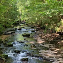
Creeks near André Michaux Historical Marker
Day Trips near André Michaux Historical Marker
Fireworks near André Michaux Historical Marker
Flower Fields near André Michaux Historical Marker
Hidden Gems near André Michaux Historical Marker
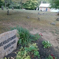
Historical Sites near André Michaux Historical Marker
Jet Ski Rental near André Michaux Historical Marker
Kayak Rental near André Michaux Historical Marker
Landmarks & Historical Buildings near André Michaux Historical Marker
Picnic Areas near André Michaux Historical Marker
Places To Visit near André Michaux Historical Marker
Places To Walk Around near André Michaux Historical Marker
Public Pools near André Michaux Historical Marker
River Swimming near André Michaux Historical Marker
Scenic Restaurants near André Michaux Historical Marker
Secluded Spots near André Michaux Historical Marker
Sightseeing near André Michaux Historical Marker
Soccer Store near André Michaux Historical Marker
Splash Pad near André Michaux Historical Marker
Strawberry Picking near André Michaux Historical Marker
Swimming Holes near André Michaux Historical Marker
Swimming Lakes near André Michaux Historical Marker
Things To See near André Michaux Historical Marker
U Pick Farms near André Michaux Historical Marker
Browse Articles
Browse Nearby
BEST of Black Mountain, North Carolina Restaurants near André Michaux Historical Marker
BEST of Black Mountain, North Carolina Coffee near André Michaux Historical Marker
BEST of Black Mountain, North Carolina Things to Do near André Michaux Historical Marker
BEST of Black Mountain, North Carolina Breakfast near André Michaux Historical Marker
BEST of Black Mountain, North Carolina Hotels near André Michaux Historical Marker
BEST of Black Mountain, North Carolina Photo Spots near André Michaux Historical Marker
BEST of Black Mountain, North Carolina Museums near André Michaux Historical Marker
BEST of Black Mountain, North Carolina Campgrounds near André Michaux Historical Marker
BEST of Black Mountain, North Carolina Visitor Centers near André Michaux Historical Marker
Browse Brands
Related Searches in Black Mountain, NC
Best Fun Things to Do in Black Mountain, North Carolina
Best Lookout Points to Visit in Black Mountain, North Carolina
Book Engaging Historical Tours in Black Mountain, North Carolina
Discover Charming Historic Homes in Black Mountain, North Carolina
Discover Famous Monuments in Black Mountain, North Carolina
Discover Historic Sites and Places in Black Mountain, North Carolina
Discover Popular Photo Spots in Black Mountain, North Carolina
Discover Top State Parks to Visit in Black Mountain, North Carolina
Discover the Best Interactive Museum in Black Mountain, North Carolina
Enjoy Arts & Entertainment in Black Mountain, North Carolina
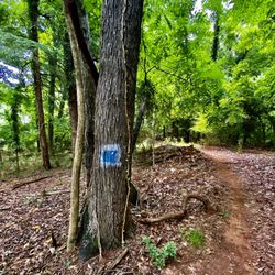
Enjoy the Best Walking Trails in Black Mountain, North Carolina
Explore Beautiful Botanical Gardens in Black Mountain, North Carolina
Explore Beautiful Castles and Landmarks in Black Mountain, North Carolina
Explore Beautiful Parks and Green Spaces in Black Mountain, North Carolina
Explore Free Things to Do Around Black Mountain, North Carolina
Explore Fun Activities to Do in Black Mountain, North Carolina
Explore Fun Field Trips in Black Mountain, North Carolina
Explore Nature Spots Around Black Mountain, North Carolina
Explore Popular Scenic Overlook Points in Black Mountain, North Carolina
Explore Popular Scenic Views Near Black Mountain, North Carolina
Explore Popular View Points Around Black Mountain, North Carolina
Explore Secret Spots Worth Visiting in Black Mountain, North Carolina
Explore Top Art Galleries Located in Black Mountain, North Carolina
Explore Top Haunted Places Near Black Mountain, North Carolina
Explore Venues & Event Spaces in Black Mountain, North Carolina
Explore the Rich History in Black Mountain, North Carolina
Explore the Top Car Museum in Black Mountain, North Carolina
Find Beautiful Views in Black Mountain, North Carolina
Find Exciting Tours to Take in Black Mountain, North Carolina
Find Top Art Museums in Black Mountain, North Carolina
Find Top-Rated Waterfalls in Black Mountain, North Carolina Now
Find Visitor Centers to Explore in Black Mountain, North Carolina
Find the Best Bridge Spots in Black Mountain, North Carolina
Find the Best Playgrounds to Visit in Black Mountain, North Carolina
Great Things to See and Do in Black Mountain, North Carolina
Must-See Tourist Attractions Around Black Mountain, North Carolina
Popular Picnic Spots to Visit in Black Mountain, North Carolina
Popular Places to Take Pictures in Black Mountain, North Carolina
Popular Things to Do in Black Mountain, North Carolina
Popular Things to See in Black Mountain, North Carolina
Top Hiking Trails to Explore in Black Mountain, North Carolina
Top Historic Restaurants to Try in Black Mountain, North Carolina
Top-Rated Plantation Tours Near Black Mountain, North Carolina
Tour Famous Lighthouses Located in Black Mountain, North Carolina
Tour Popular Historical Sites in Black Mountain, North Carolina
Visit Beautiful Gardens in Black Mountain, North Carolina
Visit Popular Museums in Black Mountain, North Carolina Now
Visit a Free Museum Near You in Black Mountain, North Carolina
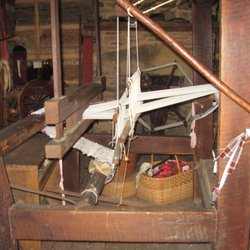
Visit the Train Museum in Black Mountain, North Carolina
Where to Catch the Best Sunrise View in Black Mountain, North Carolina
People who viewed André Michaux Historical Marker also viewed
Newton Academy
1 review
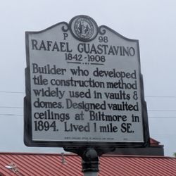
Rafael Guastavino Historical Marker
1 review
Flood of 1916 Historical Marker
1 review
Jimmie Rodgers Historical Marker
1 review
Young Men's Institute Historical Marker
1 review
Jeter C Pritchard Historical Marker
1 review
Anne Penland Historical Marker
1 review
Martin Luther King Jr Statue
1 review
James Adair Historical Marker
1 review
Spruce Pine Mining District
1 review