Black Creek Preserve Photos


You might also consider


More like Black Creek Preserve
Recommended Reviews - Black Creek Preserve
Start your review...



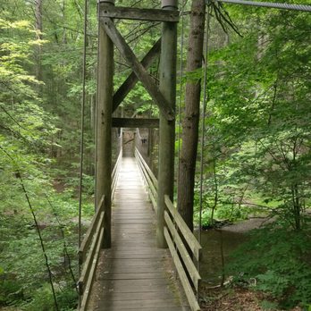
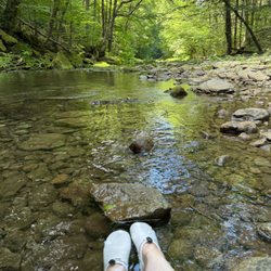
If you're like us, it would be easy enough to drive accidentally into a unit complex which come right before the turnoff for the parking lot. The lot is big enough for a good two dozen vehicles, and the entrance and the beginning of the Black Creek trail comes right off the far end of the parking lot. The suspension bridge is pretty and gives a great view of the creek, and leads right into yellow trail, which we didn't pick. Black Creek trail has a mostly gentle slope, fully paved, and is about 0.6 mile long, and it culminates in Cedar Point Outlook with a gazebo and a large open field with several benches where the creek really opens up. There's a restroom next to what looks like a caretaker's cottage. We couldn't figure out how to get to the other outlooks from Cedar Point, so if anyone knows, please share. I appreciate this space being maintained and open for all to enjoy. **You can only enter and exit the parking lot one way, so please watch for the signs. read more

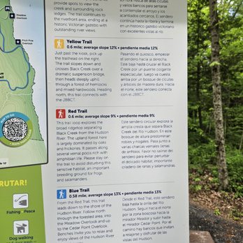


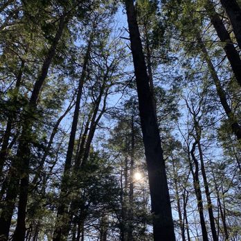
I absolutely love this preserve! The trails are great and challenging. Perfect place to go alone or with family or dogs or all of the above! Lots of opportunities for beautiful nature shots. It's a really good spot to hike if you are dealing with anxiety or PTSD. If you want a beautiful setting and some nature time then this is your spot. read more

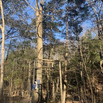


Signage at the road and parking area is clear, ample parking. Proceed past the map/information kiosk, cross the small road to the wooden arch. This is the yellow trail, which is the out and back portion. You'll pass the gurgling waters, then cross an amazing suspension bridge. There is a steep, rocky, tree root ridden trail, with a rope and post "fence" to guide you. Do not count on that fence for support or to break your fall. Watch your steps carefully, use imbedded stones and sturdy roots as footholds. You'll come downhill on your way back, and while that is less strenuous, it is more painstaking. Catch the red trail (which is mostly flat and easy) and take it to the blue trail or Hudson River Trail. This trail also has some steep grades, covered in fallen leaves. It is worth it for the water views and especially the overlook point. Take the blue loop back, catch the red trail, and take the same yellow trail back to the bridge and parking area. This big loop is about 2 miles total. Well marked, lovely trails. Wear bug spray, mosquitoes are out (warm October day.) You Can hear traffic and trains along the yellow trail, but as you get farther in, it's a lot more peaceful. read more




More info about Black Creek Preserve

















Black Creek Preserve - hiking - Updated August 2026
Best of New Paltz
People found Black Creek Preserve by searching for…
Hiking Trails With Waterfalls in New Paltz, NY
Places to Take Pictures in New Paltz, NY
Public Running Track in New Paltz, NY
Scenic Overlook in New Paltz, NY
River Swimming in New Paltz, NY
Easy Hiking Trails in New Paltz, NY
Walking Trails in New Paltz, NY
Fishing Spots in New Paltz, NY
Lakes & Ponds in New Paltz, NY
Waterfalls and Swimming Holes in New Paltz, NY
Swimming Lakes in New Paltz, NY
Trending Searches in New Paltz, NY
Antiques near Black Creek Preserve
Barbershop For Men near Black Creek Preserve
Bike Shop near Black Creek Preserve
Cliff Jumping near Black Creek Preserve
Consignment Shops near Black Creek Preserve
Cruising Spots near Black Creek Preserve
Dog Friendly Beaches near Black Creek Preserve
Dog Friendly Things To Do near Black Creek Preserve
Ear Piercing near Black Creek Preserve
Eyebrow Threading near Black Creek Preserve
Fishing Spots near Black Creek Preserve
Kids Haircut near Black Creek Preserve
Lakes near Black Creek Preserve
Lookout Points near Black Creek Preserve
Mini Golf near Black Creek Preserve
Parks near Black Creek Preserve
Pedicure near Black Creek Preserve
Permanent Makeup near Black Creek Preserve
Picnic Areas near Black Creek Preserve
Playgrounds near Black Creek Preserve
Preschools near Black Creek Preserve
Public Beaches near Black Creek Preserve
Public Golf Courses near Black Creek Preserve
Public Pools near Black Creek Preserve
Public Running Track near Black Creek Preserve
Rock Quarry near Black Creek Preserve
Scenic Night View near Black Creek Preserve
Scenic Overlook near Black Creek Preserve
Sunrise View near Black Creek Preserve
Swimming Holes near Black Creek Preserve
Tennis Courts near Black Creek Preserve
Things To Do With Kids near Black Creek Preserve
Trading Card Shops near Black Creek Preserve
Used Furniture Stores near Black Creek Preserve
Browse Nearby
BEST of New Paltz, New York Coffee near Black Creek Preserve
BEST of New Paltz, New York Restaurants near Black Creek Preserve
BEST of New Paltz, New York Things to Do near Black Creek Preserve
BEST of New Paltz, New York Parks near Black Creek Preserve
BEST of New Paltz, New York Breakfast near Black Creek Preserve
BEST of New Paltz, New York Horseback Riding near Black Creek Preserve
Browse Brands
Related Searches in New Paltz, NY
Affordable Kayak Rental Services in New Paltz, New York
Best Dog Hiking Trails Around New Paltz, New York
Best Fishing Locations and Guides in New Paltz, New York
Best Parks for Parties and Events in New Paltz, New York
Best Places for Horseback Riding in New Paltz, New York
Best Water Parks for Kids in New Paltz, New York
Best Waterfalls and Swimming Holes in New Paltz, New York
Check Out Great Playgrounds in New Paltz, New York
Check Out Off Road Trails in New Paltz, New York
Discover Baseball Fields Around New Paltz, New York
Discover Dog Friendly Trails to Explore in New Paltz, New York
Discover Easy Hiking Trails Near New Paltz, New York
Discover Kid Friendly Hiking Trails in New Paltz, New York
Discover Lakes & Ponds to Explore in New Paltz, New York
Discover Popular Bike Trails in New Paltz, New York
Discover Soccer Fields in New Paltz, New York Near You
Discover Top Nature Parks to Visit in New Paltz, New York
Discover a Hiking Trail in New Paltz, New York
Discover the Best Beaches in New Paltz, New York
Discover the Best Night Hike Trails in New Paltz, New York
Dog-Friendly Hikes With Dogs in New Paltz, New York
Enjoy Camping Adventures Around New Paltz, New York
Enjoy Exciting Mountain Biking Adventures in New Paltz, New York
Enjoy Hiking Adventures in New Paltz, New York
Enjoy Kayaking Adventures in New Paltz, New York
Enjoy Off Leash Dog Hikes in New Paltz, New York
Enjoy Tent Camping Spots Around New Paltz, New York
Enjoy a Beautiful Waterfall Hike in New Paltz, New York
Enjoy the Best Walking Trails in New Paltz, New York
Explore Beautiful Parks and Green Spaces in New Paltz, New York
Explore Easy Hikes Perfect for All in New Paltz, New York
Explore Family-Friendly Zoos and Wildlife in New Paltz, New York
Explore Free Picnic Areas Around New Paltz, New York
Explore Fun Activities to Do in New Paltz, New York
Explore Nature Spots Around New Paltz, New York
Explore Parks With Pull Up Bars in New Paltz, New York
Explore Picnic Parks Near New Paltz, New York
Explore Popular Campgrounds Near New Paltz, New York
Explore Popular Picnic Areas Around New Paltz, New York
Explore Popular RV Parks Around New Paltz, New York
Explore Scenic Lakes to Visit in New Paltz, New York
Explore Top Dog Parks in New Paltz, New York Near You
Explore Top Trampoline Parks in New Paltz, New York
Explore Top Water Parks in New Paltz, New York Today
Explore the Best Swimming Holes Around New Paltz, New York
Family Friendly Hiking With Kids in New Paltz, New York
Find Great Places to Feed Ducks in New Paltz, New York
Find Parks and Recreation Activities in New Paltz, New York


