Wallkill Valley Rail Trail Photos


You might also consider


More like Wallkill Valley Rail Trail
Recommended Reviews - Wallkill Valley Rail Trail
Start your review...


Reviews With Photos
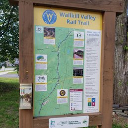

This is a wonderful hiking trail, especially in this area. The surroundings are lovely to view along the way, although, the trail is unpaved and has stones along the journey. Bike riding may be a challenge to some, so do take caution with pedestrians walking. The Wallkill Valley trail covers from Kingston to Gardiner and much more exploring will soon come. To my observation, the section in Gardiner I've explored seems to be pretty quiet and not crowded with a lot of people around. I'm sure in other areas it will vary. Explore and enjoy!
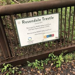

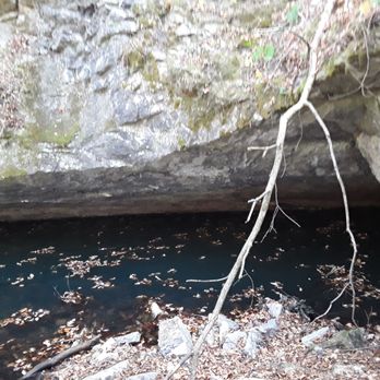
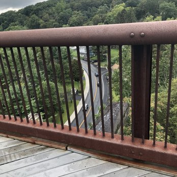
We took a hike on the rail trail the other day. Walkers and bikers galore. We saw a large cave where cold air emanated, very interesting. We went down as far as we could. The Trestle was the high point of the hike. Very scenic and very pretty. You can see the Catskills on the horizon. We didn't get to the café.


My coworker and I decided to venture out and go site seeing. The views from this trail are beautiful! Would recommend taking a walk through this trail. If you have a bike you can cover a lot more ground! Park at the binnewater parking area and it's only about a 5 minute walk to the bridge.


Went hiking with a group of friends and some doggies. We hiked a total of about 5 miles. The incline wasn't too bad and right when I started ferried tired we reached the top and the view was totally worth it.


I am giving this 4 stars primarily for the bucolic views of flowers, far off hills, the Gunks, farmland, apple orchards, the very short ride through the sweet, little town of Gardiner, but not for the trail itself (check out my pictures) I believe that it is best suited for mountain bikes & walkers because of its very rough, not particularly well-maintained surface. We started southward from New Paltz & for a short period, the trail is all loose & small stones & then becomes hard-packed dirt with both large & sharp rocks & more smaller stones but with a stable feel to it, although it was necessary to keep our eyes peeled for those jutting stones. The width of the trail varies greatly from about ten feet wide down to maybe four inches wide. South of Gardiner, the trail is hardly maintained at all & this is where it narrows down to two side by side, super narrow, 4" wide tracks. Still, we enjoyed the challenge & the views.


This was one of the nicest trails that I have found for horseback riding. It was perfect for our geriatric horses (they are 25 and 35 years old). This trail meets our needs perfectly because it was mostly flat, impeccably maintained, and the footing was perfect. There were no large rocks or anything unexpected on the trails. There was a lot of foot traffic with many dogs and children and many bicyclists. Everybody was very respectful of the horses. The parking lot at 720 Binnewater Rd. in Rosendale is very easily accessible from the road with plenty of room to turn a horse trailer around. Also very easy access to the trail. If I could give this trail six stars for horseback riding I definitely would.


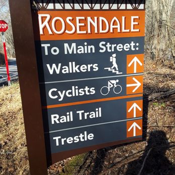
I've walked this trail a few times from the Binnewater Kiln parking lot. The highlights are the view from the Rosendale Trestle and stopping at the Rail Trail Cafe for a bite to eat. After the cafe it can get a little boring because there isn't too much to see, but it's still enjoyable. This trail is perfect for bikers and horseback riders.


16 days ago
Found this trail originally by accident in 2022 by seeing the Rosendale Trestle Bridge. We knew we had to go back and quickly found that we wnt to walk as far as we can on this. For now, since we were with friends, we have only done a full day walk and the path between New Paltz and Rosendale is lovely! Easy to walk, places to stop and have a snack or drink, beautiful forest. Can tell it's easy to bike, walk, or horseback ride on these trails. read more
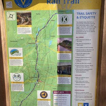


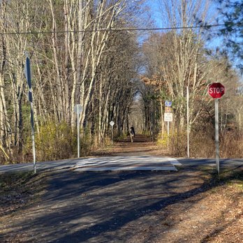


It was an absolutely beautiful day, where the attire du jour was t-shirts and shorts (as long as his wife has no say). Met best friend, Hopalong Casualty. After parking in a big dirt lot just past Rosendale, we walked south for about a half mile (over the trestle over the Rondout River). Then NOBO for a bit over 3 miles past an old abandoned outhouse (2-seater). Past William's Lake on the left, and past an area about 100' long where the temp suddenly drops a good 10 degrees. Weird, but it happens every time we walk past this area. Must be an aura or vortex. At the 18 mile mark (there are posts marked every half-mile), a lunch break. Sal, Kris and Charlie's deli hero. Best of the best. HC brought the brandy, but forgot to decant it. WVRT is absolutely beautiful. Cinder surface. Very gentle terrain. The part north of Rosendale is lightly trafficked. Bring fluids, and please practice Leave No Trace principles. 5 stars read more



11 months ago
I hit this trail up for an early morning hike and it was such a solid way to start the day. I started from the southernmost point and walked about 2.5 miles north to the Gardiner Library. FYI, that southern start point has zero parking, so you're better off finding a spot near the Gardiner Library and going from there--it'll give you options for heading north or south. The path itself is wide and super chill. It was covered in leaves when I went, which was pretty, with big trees lining both sides. You can actually see some beautiful houses tucked in beyond the trees, which was a fun little treat as you walk. Heads up, though, it's not all nature; you do cross some streets, so stay aware of traffic. This thing is huge--the entire trail is over 20 miles and connects a bunch of towns like Wallkill, Gardiner, and New Paltz. It's a true multi-use path for walkers, runners, cyclists, and equestrians (no motorized vehicles, thank goodness). Quick tips for hitting the trail: Parking: Skip the southern end. Park around the Gardiner Library area; it's the smarter move. The Path: Remember, this is a linear trail, not a loop, so be ready to turn around and backtrack or arrange a ride back! Weather: If it's sunny out, you're set. It's an easy, flat walk. If you're looking for a relaxing, easy walk or ride with some nice scenery and want to knock out a few miles, this trail is a winner. Great for a Saturday morning coffee walk! read more


This is a wonderful hiking trail, especially in this area. The surroundings are lovely to view along the way, although, the trail is unpaved and has stones along the journey. Bike riding may be a challenge to some, so do take caution with pedestrians walking. The Wallkill Valley trail covers from Kingston to Gardiner and much more exploring will soon come. To my observation, the section in Gardiner I've explored seems to be pretty quiet and not crowded with a lot of people around. I'm sure in other areas it will vary. Explore and enjoy! read more


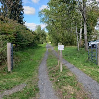



We took a hike on the rail trail the other day. Walkers and bikers galore. We saw a large cave where cold air emanated, very interesting. We went down as far as we could. The Trestle was the high point of the hike. Very scenic and very pretty. You can see the Catskills on the horizon. We didn't get to the café. read more



4 years ago
My coworker and I decided to venture out and go site seeing. The views from this trail are beautiful! Would recommend taking a walk through this trail. If you have a bike you can cover a lot more ground! Park at the binnewater parking area and it's only about a 5 minute walk to the bridge. read more


4 years ago
Went hiking with a group of friends and some doggies. We hiked a total of about 5 miles. The incline wasn't too bad and right when I started ferried tired we reached the top and the view was totally worth it. read more


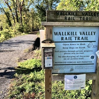
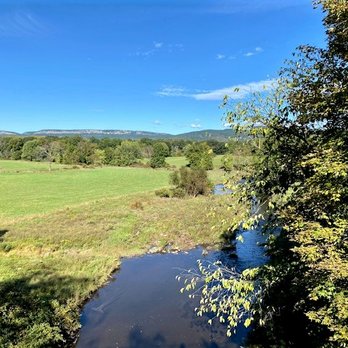
I am giving this 4 stars primarily for the bucolic views of flowers, far off hills, the Gunks, farmland, apple orchards, the very short ride through the sweet, little town of Gardiner, but not for the trail itself (check out my pictures) I believe that it is best suited for mountain bikes & walkers because of its very rough, not particularly well-maintained surface. We started southward from New Paltz & for a short period, the trail is all loose & small stones & then becomes hard-packed dirt with both large & sharp rocks & more smaller stones but with a stable feel to it, although it was necessary to keep our eyes peeled for those jutting stones. The width of the trail varies greatly from about ten feet wide down to maybe four inches wide. South of Gardiner, the trail is hardly maintained at all & this is where it narrows down to two side by side, super narrow, 4" wide tracks. Still, we enjoyed the challenge & the views. read more




5 years ago
This was one of the nicest trails that I have found for horseback riding. It was perfect for our geriatric horses (they are 25 and 35 years old). This trail meets our needs perfectly because it was mostly flat, impeccably maintained, and the footing was perfect. There were no large rocks or anything unexpected on the trails. There was a lot of foot traffic with many dogs and children and many bicyclists. Everybody was very respectful of the horses. The parking lot at 720 Binnewater Rd. in Rosendale is very easily accessible from the road with plenty of room to turn a horse trailer around. Also very easy access to the trail. If I could give this trail six stars for horseback riding I definitely would. read more


3 years ago

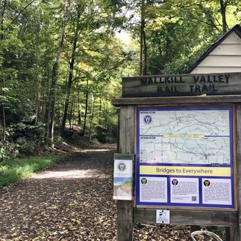
I've walked this trail a few times from the Binnewater Kiln parking lot. The highlights are the view from the Rosendale Trestle and stopping at the Rail Trail Cafe for a bite to eat. After the cafe it can get a little boring because there isn't too much to see, but it's still enjoyable. This trail is perfect for bikers and horseback riders. read more



7 years ago
We loved biking this trail. We parked in Kingston and rode to Rosendale and back passing interesting caves with a surprising swoosh of cool air, old cement company buildings, a lake and the beautiful Rosendale Trestle. We didn't see any other walkers or bikers until we got close to Rosendale. It was an early Spring Sunday so I was expecting muddy conditions and there were some but not bad at all. A fun ride that we want to do again and explore the southern part of the trail and the Rail Trail Café. read more


9 years ago
More info about Wallkill Valley Rail Trail
Ask the Community - Wallkill Valley Rail Trail
Review Highlights - Wallkill Valley Rail Trail
You might also consider






Wallkill Valley Rail Trail - parks - Updated September 2026
Best of New Paltz
People found Wallkill Valley Rail Trail by searching for…
Hiking Trails in New Paltz, NY
Places to Take Pictures in New Paltz, NY
Waterfall Hike in New Paltz, NY
Walking Trails in New Paltz, NY
Off Road Trails in New Paltz, NY
Senior Centers in New Paltz, NY
Clothes Donation Drop Off in New Paltz, NY
Nature Trails in New Paltz, NY
Romantic Picnic Secluded in New Paltz, NY
Stroller Friendly Hikes in New Paltz, NY
Basketball Court With Lights in New Paltz, NY
Public Shower in New Paltz, NY
Trending Searches in New Paltz, NY
Animal Sanctuary near Wallkill Valley Rail Trail
Auto Detailing near Wallkill Valley Rail Trail
Auto Repair near Wallkill Valley Rail Trail
Body Shops near Wallkill Valley Rail Trail
Charity Shops near Wallkill Valley Rail Trail
Cliff Jumping near Wallkill Valley Rail Trail
Cruising Spots near Wallkill Valley Rail Trail
Dog Friendly Things To Do near Wallkill Valley Rail Trail
Dog Swimming near Wallkill Valley Rail Trail
Furniture Donation near Wallkill Valley Rail Trail
Garage Door Repair near Wallkill Valley Rail Trail
Goodwill Bins near Wallkill Valley Rail Trail
Goodwill Drop Off near Wallkill Valley Rail Trail
Hand Car Wash near Wallkill Valley Rail Trail
Hiking near Wallkill Valley Rail Trail
Indoor Track near Wallkill Valley Rail Trail
Junkyards near Wallkill Valley Rail Trail
Laundry Services near Wallkill Valley Rail Trail
Lookout Points near Wallkill Valley Rail Trail
Machine & Tool Rental near Wallkill Valley Rail Trail
Mobile Mechanic near Wallkill Valley Rail Trail
Painters near Wallkill Valley Rail Trail
Parks near Wallkill Valley Rail Trail
Parks With Pull Up Bars near Wallkill Valley Rail Trail
Pest Control near Wallkill Valley Rail Trail
Picnic Areas near Wallkill Valley Rail Trail
Playgrounds near Wallkill Valley Rail Trail
Public Running Track near Wallkill Valley Rail Trail
Public Shower near Wallkill Valley Rail Trail
Rock Quarry near Wallkill Valley Rail Trail
Roofing near Wallkill Valley Rail Trail
Scenic Night View near Wallkill Valley Rail Trail
Scenic Overlook near Wallkill Valley Rail Trail
Sewing & Alterations near Wallkill Valley Rail Trail
Star Gazing near Wallkill Valley Rail Trail
Sunrise View near Wallkill Valley Rail Trail
Tires near Wallkill Valley Rail Trail
Used Car Dealers near Wallkill Valley Rail Trail
Browse Articles
Browse Nearby
BEST of New Paltz, New York Restaurants near Wallkill Valley Rail Trail
BEST of New Paltz, New York Playgrounds near Wallkill Valley Rail Trail
BEST of New Paltz, New York Coffee near Wallkill Valley Rail Trail
BEST of New Paltz, New York Things to Do near Wallkill Valley Rail Trail
BEST of New Paltz, New York Picnic Areas near Wallkill Valley Rail Trail
BEST of New Paltz, New York Breakfast near Wallkill Valley Rail Trail
BEST of New Paltz, New York Caves near Wallkill Valley Rail Trail
BEST of New Paltz, New York Star Gazing near Wallkill Valley Rail Trail
BEST of New Paltz, New York Campgrounds near Wallkill Valley Rail Trail
Browse Brands
Related Cost Guides
Related Searches in New Paltz, NY
Adopt Free Kittens Available in New Paltz, New York
Adopt Your New Pet With Dog Adoption in New Paltz, New York
Adopt a Kitten From Shelters in New Paltz, New York
Affordable Kayak Rental Services in New Paltz, New York
Best Animal Shelters for Pets in New Paltz, New York
Best Dog Hiking Trails Around New Paltz, New York
Best Fishing Locations and Guides in New Paltz, New York
Best Parks for Parties and Events in New Paltz, New York
Best Places for Horseback Riding in New Paltz, New York
Best Spots to Donate Toys in New Paltz, New York
Best Water Parks for Kids in New Paltz, New York
Best Waterfalls and Swimming Holes in New Paltz, New York
Blood & Plasma Donation Centers Near New Paltz, New York
Browse Cheap Thrift Stores Throughout New Paltz, New York
Browse Top Consignment Shops in New Paltz, New York
Browse Used Furniture Stores Near New Paltz, New York
Buy Thrift Store Furniture in New Paltz, New York
Charities That Pick Up Donations in New Paltz, New York
Check Out Great Playgrounds in New Paltz, New York
Check Out Off Road Trails in New Paltz, New York
Clothes Donation Drop Off Box Locations in New Paltz, New York
Clothes Donation Drop Off Points in New Paltz, New York
Discover Baseball Fields Around New Paltz, New York
Discover Dog Friendly Trails to Explore in New Paltz, New York
Discover Easy Hiking Trails Near New Paltz, New York
Discover Kid Friendly Hiking Trails in New Paltz, New York
Discover Lakes & Ponds to Explore in New Paltz, New York
Discover Popular Bike Trails in New Paltz, New York
Discover Soccer Fields in New Paltz, New York Near You
Discover Top Nature Parks to Visit in New Paltz, New York
Discover Vintage Furniture Styles in New Paltz, New York
Discover a Hiking Trail in New Paltz, New York
Discover the Best Beaches in New Paltz, New York
Discover the Best Night Hike Trails in New Paltz, New York
Dog-Friendly Hikes With Dogs in New Paltz, New York
Donate Furniture Easily in New Paltz, New York Locations
Enjoy Camping Adventures Around New Paltz, New York
Enjoy Exciting Mountain Biking Adventures in New Paltz, New York
Enjoy Hiking Adventures in New Paltz, New York
Enjoy Kayaking Adventures in New Paltz, New York
Enjoy Off Leash Dog Hikes in New Paltz, New York
Enjoy Tent Camping Spots Around New Paltz, New York
Enjoy a Beautiful Waterfall Hike in New Paltz, New York
Enjoy the Best Walking Trails in New Paltz, New York
Explore Beautiful Parks and Green Spaces in New Paltz, New York
Explore CPR Classes Available in New Paltz, New York
Explore Community Centers Available in New Paltz, New York
Explore Easy Hikes Perfect for All in New Paltz, New York
Explore Family-Friendly Zoos and Wildlife in New Paltz, New York


