Cancel

    Open app

    Search

    Blanche Russell Rock House Photos

    You might also consider

    Recommended Reviews - Blanche Russell Rock House

    Your trust is our priority, so businesses can't pay to alter or remove their reviews. Learn more about reviews.
    Yelp app icon
    Browse more easily on the app
    Review Feed Illustration
    Photo of Annette J.
    4955
    2404
    14363

    3 years ago

    Helpful 5
    Thanks 0
    Love this 7
    Oh no 0

    Verify this business for free

    Get access to customer & competitor insights.

    Verify this business

    The Wave at Coyote Buttes - Not crowded but some people hog this area for hours

    The Wave at Coyote Buttes

    4.8(31 reviews)
    27.1 mi

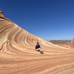
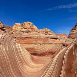
    After years of trying to apply for a permit, our group finally got picked! Highly recommend hiking…read moreat least once. I wouldn't do it again though, mainly because of how hard it was to get a permit. We visited in April and the weather was fantastic. It was actually freezing in the morning but as the sun rose, it warmed up to the point where we would sweat a little when hiking. I can't even imagine doing this in the summer but if you win the lottery then, make sure everyone brings plenty of water. To get to the trailhead, I'd recommend having a high-clearance vehicle, especially if it just recently rained. The road off of the freeway becomes unpaved and there are some ditches that can be flooded. Download an offline map of the trail and area for when you lose service. It gets spotty but you'll find reception every now and then. At the beginning, there are a couple of vault toilets. The trail itself is difficult to follow without an offline map. There's only a handful of signs pointing in a general direction. And until the Wave, we were pretty much the only people around. Considering only about 60 people are approved each day, it wasn't surprising, and honestly, kind of nice to be alone in nature. The Wave was everything we hoped for. We had clear, blue skies and that contrast with the red and orange rocks was beautiful. It looked exactly like the Windows background! There was even a pond further up with a ton of tadpoles. Besides the Wave, there's other neat waypoints to stop by but because we were tired, we didn't try for many of them. The only one we went out of our way for was the dinosaur tracks but it was anti-climatic. They just looked like larger chicken feet prints. Despite this hike being only about 6 miles round trip, it took pretty much the entire day. We stopped a lot to take pictures but also the landscape was difficult to hike. Lots of sand to walk through and lots of weird inclines to walk across, which kept our feet, knees, and legs at weird angles. There might have been easier pathways but as I said earlier, there's no clear indications of a trail. There was also a BLM worker at the Wave asking for the permit holders. If you hike without one and get caught, you'll get slapped with some steep fines. Drones are also not allowed!

    My friend won the online lottery for the permit 4 months in advance but after talking to the…read moreranger, it seems that there's a good chance you can win the daily lottery since a lot of people cancel every day. It's easier if you have less people (like two people). Anyways, the orientation the day before was useful for weather and road conditions. The hike wasn't too bad, can be a bit steep in some parts but for the most part, not too much incline. It's moderate for the novice hiker but easy for an experienced hiker. For experienced hikers, probably can get to the Wave in 1 to 1.5 hours. For the inexperienced, it might take 2.5 to 3 hours. Either way, if you're planning to spend a lot of time at the Wave (some people take 2-3 hours for their extensive Instagram photoshoots haha), definitely go there early and spend all day there. I would definitely come back if I win the lottery!

    Photos
    The Wave at Coyote Buttes
    The Wave at Coyote Buttes
    The Wave at Coyote Buttes

    See all

    Bright Angel Trail - The water here tastes so good and minerally ;)

    Bright Angel Trail

    4.7(124 reviews)
    47.7 mi

    If one thinks hiking nine miles in or out of the Grand Canyon is as easy as walking to the store,…read morethink again. Located a few hundred yards from where we are staying, the Bright Angel Trail is one of the superhighways, with its heavenly name making it the most well-known trail. It follows an old Native American route zigzagging down a vertical wall and then cuts across the flat plateau to the river from the South Rim. Early this morning while the temperature was still cool, my partner and I took only a short distance. The trail was safe. We've seen hikers of all shapes, sizes, ages, and fitness levels. It was well-maintained, easy to follow, consistently about 4 feet wide, and has wider sections for passing. The steepness of the trail is very misleading on the way down. Plan on taking twice as long to hike up as it took to hike down. We enjoyed the views, which can be more spectacular in the canyon than from the rim. There is something about actually being in the canyon that is more memorable and moving than being on the rim.

    This is the most popular hiking trail into Grand Canyon! Even though it is well-traversed, this is…read morealso a dangerous trail for people who are not prepared, as it's wayy easier hiking down...but you have to contend with the hike up. Also, there is limited water on the trail (and sometimes there are pipeline breaks), with not a lot of shade. With hot weather, this could be a deadly hike. The trail head has bathrooms and a water filling station. Definitely use them before hiking down. This hike is well maintained, with mules sharing the trail. You can see them...or at least smell them as they leave poop on the trail. I hiked down to the Second Tunnel (1.8 miles) and it wasn't too bad, but I was unfortunately limited on time. It seems past this point the crowds thinned out. Havasupai Gardens at 9 miles round trip is the most the rangers recommend as a day trip. I loved how the view of the Canyon changed as I descended the trail!

    Photos
    Bright Angel Trail
    Bright Angel Trail - Two very happy tourists from Iowa.

    Two very happy tourists from Iowa.

    Bright Angel Trail - TEAM

    See all

    TEAM

    Vermilion Cliffs National Monument

    Vermilion Cliffs National Monument

    4.7(3 reviews)
    27.1 mi

    This place is so underrated on social media--I only discovered it while randomly exploring the map…read more When I checked the Bureau of Land Management's website, I got even more confused because it mentioned that the dirt road requires an AWD and a high-clearance vehicle. As a national monument, I expected there to be an entrance ticket booth. I was traveling from Zion to Flagstaff. but this place was nowhere to be found the yelp map pointer we are taking you to a vista spot where later I realized you can see the whole vermillion from there in the distance. So how did I find it? I want to keep driving. And all the sudden I saw something stunning from the window... if there wasn't and a car parked there selling tribe souvenirs I wouldn't even know I could drive in there... It was a weekday and barely anyone there . The lady that was supposed to be selling the souvenirs was probably sleeping in the car and didn't bother to come out. I don't have high clearance vehicle , so I tried to park at a more flat area... but if you have high clearance vehicle, I think you can drive around all the rock formations without any problem. If not, you can also explore on foot!
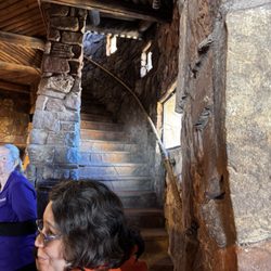
    Holy smokes, 280,000 acres! So much to see including a growing number of endangered California…read moreCondors. A lot of the condors are hatched and raised in a breeding program and then released. Although you can get some great shots from the main highway, most of the trails/roads you do need a high clearance vehicle/four wheel drive due to sand being so deep. Most of the roads are all dirt so be cautious if raining etc. if venturing in Coyote Buttes (the wave) you need a permit. Camping is allowed. While you could spend literal days here backpacking etc you still won't see it all. Take your time. I'm bummed we didn't see a condor or two. Maybe on our next trip.

    Photos
    Vermilion Cliffs National Monument - We got to touch California Condor feathers! They're huge! This was part of the 2025 California Condor release event.

    We got to touch California Condor feathers! They're huge! This was part of the 2025 California Condor release event.

    Vermilion Cliffs National Monument - Posing as a California Condor

    Posing as a California Condor

    Vermilion Cliffs National Monument

    See all

    South Kaibab Trail - Mules

    South Kaibab Trail

    4.7(90 reviews)
    48.0 mi

    If you really want to understand the Grand Canyon, you don't stand at the rim. You step off it…read more South Kaibab Trail is not subtle about what it is. There's no easing into it, no gentle introduction. Within minutes, you're descending through tight switchbacks, the rim already pulling away behind you, and that comfortable "overlook" perspective is gone. You're in it now. What makes this trail different is the exposure. It rides out along a ridge, not tucked away or hidden, so the views are constant. There's no point where it closes in or gives you a break. Every step opens something new. Layers of rock stacked like pages, colors shifting depending on where the sun hits, distances that feel close until you realize they're anything but. Early on, you hit that first real vantage point where everything just drops away in front of you. It's the kind of moment that interrupts whatever you were thinking about. You stop, not because you planned to, but because you don't really have a choice. And then you keep going. The trail pulls you downward at a steady, unapologetic grade. It's not technical, but it demands attention. Your footing matters. Your pacing matters. Knees start to take notice on the way down, and somewhere in the back of your mind, you're already aware that every step you're taking is one you'll have to reverse later. There's almost no shade. That's not an exaggeration. Once the sun is up, it owns this trail. That's why going early isn't just a good idea, it's the difference between a great hike and a brutal one. In the early hours, the light cuts across the canyon at an angle, pulling out depth and contrast you just don't get later. Shadows stretch, colors deepen, and the entire landscape feels more alive. By midday, it flattens out and the heat starts pressing down in a way that changes the tone completely. As you descend, the canyon shifts around you. The rock underfoot changes color and texture, walls rise and fall, and the sense of scale keeps slipping just out of reach. You try to make sense of distance, but it doesn't behave the way you expect. What looks like a short stretch can take far longer than it should. Landmarks move. Perspectives lie. There's a point where the noise fades out. Fewer people, more space, just the sound of your own steps and the occasional wind moving through the canyon. It's quiet in a way that feels earned. Not empty, just stripped down to what matters. And then there's the reality check. Going down is the easy part. It always is. The climb back up is where this trail makes its case. The grade doesn't soften. The exposure doesn't change. It's you, the incline, and however well you managed your energy on the way down. It's not impossible, not even close, but it demands respect. You feel it in your legs, your lungs, your pace slowing whether you like it or not. But that's also where something shifts. You're not just looking at the canyon anymore. You're moving through it, working against it, understanding it in a physical way that no overlook can give you. The scale stops being abstract. It becomes something you measure in effort, in time, in breath. By the time you reach the top again, you've earned a completely different perspective than the one you started with. This trail doesn't offer comfort. It offers clarity. It strips things down to effort, environment, and awareness. And in return, it gives you one of the most direct, honest ways to experience the Grand Canyon. Five stars, no hesitation.

    I have done Bright Angle Trial a couple of times in the past to the bottom of the Grand Canyon…read more South Kaibab is the other big trail into the Canyon. Over the summer, we camped at the rim and decided to hike South Kaibab a little ways early in the morning before it got too hot. We ended up hiking all the way to Skeleton Point and back. As it approached afternoon, it started to get a little warm. I ended drinking all the water in my CamelBak just before I got to the top. The temperature was climbing fast and I had to use my cooling towel to stay cool. I got to say that I really gained a lot of respect for this Canyon during this short summer hike that I did. The South Kaibab Trail is a 7 mile hiking trail in Grand Canyon National Park that leads to the Colorado River. I like this trail because you get 360-degree views of the canyon after you pass Skeleton Point. The trail is mostly shaded until you reach Ooh Aah Point. Then you are out in the open. Up next is Cedar Ridge at 1.5 miles and then Skeleton Point at 3 miles. After that is the Tipoff and Black Suspension Bridge as you are descending into the Canyon. There is no water on the trail until you get to the bottom of the canyon at Bright Angel Campground and Phantom Ranch. So bring plenty of it along with snacks, sunscreen, etc. The hike is 15 miles (24 km) roundtrip to Phantom Ranch and will take at least 2 days to complete. If you get to the beginning of the trail early enough, you can probably find parking in the parking lot or on the side of the road. But it fills up quick. Another option is to take the free shuttle to the trailhead from the South Rim Visitor's Center. Both water and restrooms are located at the beginning of the trail. The hike is usually a little busy with people to start off with, but many turn around after reaching Ooh Aah Point. It is also fairly steep with lots of switchbacks, so bring poles if you need them for assistance. Be prepared for a climb on the way back to the parking lot during that last mile. Also keep an eye out for Mules as they use this trail regularly. My recent hike was in June and I saw many people with little or no water. I also saw people with footwear that should not be worn on this trail. It blew me away how uneducated and naive people are about doing these hikes into the canyon. I understand lots of tourists come here, but people need to be a little more careful when hiking the Grand Canyon. Many of the deaths that occur every year in this Canyon can be avoided. On the day that I visited and hiked this trail, they reported several heat related incidents that evening and one death. South Kaibab Trail is a great hike. Enjoy, make a plan and be responsible.
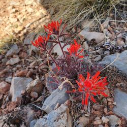
    Photos
    South Kaibab Trail - Shuttle Pickup/Drop-off

    Shuttle Pickup/Drop-off

    South Kaibab Trail
    South Kaibab Trail

    See all

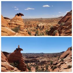
    The Wave - 4/9/2022 (top) compared to 4/20/2025 (bottom).  Not much has changed, including where the shrubs grow.

    The Wave

    4.9(15 reviews)
    18.2 mi

    Everyone raves about this place, we hike a lot have done Angels and Half dome so gotta "Wave" right…read more? Took us 3 tries and scored hit early summer, bummer as you do need to plan your hydration carefully as it is dangerous out there when in the 90s We live close enough about a 4 hour drive to Page and overnight and early start to the trail head. Get a rental, you don't want to put your car thru the 9 rough miles and don't even think of doing it if it rains! Higher ground clearance is nice but not necessary but saw mostly SUV, drive your sedan at your own risk, we rented a compact SUV. Watch the weather carefully as for the two days we were there saw afternoon thunderstorms come in and the area did get a little rain the past day, saw some mud and standing water. As to the hike - summer is brutal! Start early, we did at 6am and did 8 miles but not all the attractions as we had to get back to Phoenix. Would it be worth the exhausting 13 miles to see it all, personal decision and gotta have the time. We've done 13 miles but wouldn't consider it here in summer or winter unless you are an Ironman Of course The Wave and Second Wave are amazing as does the arches and others look. We climbed past the second wave and ran outta time Must do, AllTrails or other offline map, the provided map and pictures are not enough. Consider a guide if you are a novice, but the guided tours were grouped and held back by what looked like the older crowd, YMMV. Four stars as between the difficulty with weather the slog the beauty not like Delicate Arch, Half Dome or Angels IMHO

    I've heard the lottery permit for The Wave is one of the hardest to win. I had previously missed…read moreout on the advanced lottery for 3 dates I submitted for mid-May and sorta planned out my 9-day roadtrip in AZ without visiting here. I really only had 1 day to fit in a trip to The Wave while I was staying in Page for 4 days and took a shot with the daily lottery permit and won! I was super pumped when I got the email notification! The 2-day advance daily lottery permit can only be applied for while you are in a nearby geofenced area and you have to pick up the permit and go through orientation/training at either Page, AZ or Kanab, UT. One tricky thing about the permit application hours is that it is based on UT and Navajo time, not AZ time. If you are in Page, you'll have to ignore the local time and make sure you are 1 hour ahead of the daily application closing time. Anyways, this was one of the most jaw-dropping other-worldy places I've hiked. The journey to reach The Wave features some of the most unique terrains and landscapes I've seen. There are geologic features all around, everywhere you look. Once you reach The Wave area, you almost can't believe what you are seeing. Some areas look like the rings of Saturn. Some areas look like huge ocean waves. I was in awe the entire time I was there. I can't even explain everything I saw, as words can't describe the scenery. Just look at the pictures. I didn't really explore past the main area because I was on a tight schedule and needed to head back. I would have to say this hike may be too challenging if you only rely on the paper map provided during orientation. I would highly recommend GPS tracking app, I used AllTrails to track my hike and even then I went off trail a few times, as this is definitely not a straight forward hike. Not a long hike at about 3.3 mile each way, but I would start early as it can get quite hot in this area. Also, there was a gentleman from BLM that was checking for permits at The Wave, if you were curious about enforcement.

    Photos
    The Wave
    The Wave
    The Wave - Beautiful scenery

    See all

    Beautiful scenery

    Grand Staircase - Escalante National Monument - Willis Creek Narrows

    Grand Staircase - Escalante National Monument

    4.8(32 reviews)
    49.9 mi

    The Toadstool Hoodoos are cool rock formations formed by differential erosion. They look like…read moremushrooms, as the harder rock caps and protects the softer rock underneath. The hike is an easy 1.5 miles. The views at the end are worth it, and you can get close to the rock formations as you like (although don't topple the rocks!). It's suitable for families with small children. If you don't mind driving on an unpaved road (I did it in a 2WD sedan), check out House Rock Valley Road for unparalleled views of the landscape with swirling sandstone, painted hills, and other cool rock formations. Check out the Wire Pass Trail for amazing slot canyons, although check the weather. If there's any chance for rain, do not enter the slot canyons since the formations channel water and form deadly floods in the canyon. The visitor center in Kanab is huge, with lots of good pamphlets and displays about the geology and archaeology of the area.

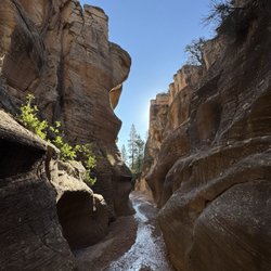
    This feels like a review in progress because the area is so large - but was pleasantly surprised by…read morehow much more I want to explore this region. We did Willis Creek Narrows and Lower Calf Creek Falls - both incredible. Now adding to the wish list for return trips. The drive along US 12 is just spectacular. Definitely recommend a high clearance vehicle with 4WD to access some of the more remote locations. Be prepared to adventure and bring what you need as this is not a manicured national park, but more a haven for those looking for an off-grid escape.
    Photos
    Grand Staircase - Escalante National Monument - Visitor center

    Visitor center

    Grand Staircase - Escalante National Monument - Visitor center

    Visitor center

    Grand Staircase - Escalante National Monument

    See all

    Toadstool Trailhead

    Toadstool Trailhead

    4.8(14 reviews)
    27.9 mi

    The Toadstool Hoodoos are cool rock formations formed by differential erosion. They look like…read moremushrooms, as the harder rock caps the softer rock underneath. The trailhead is marked by a sign on the side of the road, with a small parking lot. It was pretty busy when I went, with only a few spots remaining, although there was a good number of people arriving and leaving at the same time. The hike is an easy 1.5 miles that is well marked - although since this is a quite popular trail you can just follow the people ahead of you if you're worried about getting lost. Huge families with little children were walking this trail with ease. The views at the end are worth it, and you can get close to the rock formations as you like (although don't topple the rocks!).

    This little hike is so random -- I saw it by chance looking ahead on the map while driving from…read morePage, AZ back toward Hurricane, UT by way of Zion NP. There is a dust/sand and gravel parking lot with a state sign denoting where this trail is just off the freeway, so it's very easy to find. I took off one star solely because it was very windy the day I came and because there is so much sand it will absolutely kick up into your eyes, nose and mouth unless you wear a mask and sunglasses/eye protection. Come prepared! The trail itself isn't long though, maybe 1-2 miles I think? And the view at the end of the toadstools is nice; it's not like goblin valley, but there are some cool formations and you can get some nice pics. Most of the trail is pretty flat, but there is a bit of a hill toward the end. There are also some rocks but it's not too bad, you could make it fine in tennis shoes rather than full hiking boots. The trail wasn't crowded the day I came, but there were enough other folks I ran into 3-5 groups each way, and a couple folks that were hanging out at the end of the trail. Of note, it is not a loop, it's out and back the way you came so plan accordingly if you're short on time! That said, if you want a nice detour/walk for an hour or so (depending on how fast you go), it's a nice, easy, and free stop.

    Photos
    Toadstool Trailhead
    Toadstool Trailhead - What's a HooDoo you ask?  Those spires of one stone capped with a different stone!

    What's a HooDoo you ask? Those spires of one stone capped with a different stone!

    Toadstool Trailhead

    See all

    Blanche Russell Rock House - landmarks - Updated July 2026

    Loading...
    Loading...
    Loading...