Brasstown Bald Observation Tower
Brasstown Bald Observation Tower Photos


More like Brasstown Bald Observation Tower
Recommended Reviews - Brasstown Bald Observation Tower
Start your review...


Reviews With Photos


Free admission with your National Park pass! There's a fee if you want to take the shuttle to the top of the lookout area, which we did because we hiked a lot earlier and hiking up a hill did not sound appealing. Really pretty view.of the mountains and they say you can see four states at once. Not that you could tell, but they have it all labeled on the side of the walls of the observation deck.


Purportedly the highest point in Georgia, this is a federally owned spot (which was not obvious to me before I arrived), which requires either an entrance fee or a national parks pass. A shuttle bus will take you to the top for a small additional charge. You might think that hiking is the point, but even the hike from the parking lot to the observatory is a significant exertion. The area is paved, but steep. Wondrous views were promised by signage, but I arrived on a foggy day where there was not much visibility. The mountain itself offers the sort of fascinatingly twisted foliage one sees at this height in the Appalachians. The center at the peak has a watchtower where the forest service apparently monitors the surrounding terrain for forest fires as well as a small museum and an introductory film. Restrooms were available at the parking lot, but were quite limited with some parts being shut down for the winter (in November) and the ones at the peak being out entirely. The climate in this area was purportedly more typical for Massachusetts than it is for Georgia, which is perhaps a reason in and of itself to make a visit. The windy road to the top is in good condition and well worth a drive, probably more so on a day where you can actually see the distant sights.


2 0 0 0 0 I got high for my 20,000th review. Brasstown Bald is the highest point in the state of Georgia and I really enjoyed my visit. The Sprinter van did amazingly well climbing the curving switchback roads to get to the parking area and I managed to find a spot where I could get some cell phone coverage for a few calls before heading up to the peak. (It's in the far corner next to some picnic tables.) For $8 per person, that includes the shuttle to the peak. A 12 passenger van does the job in about three minutes and it's worth it for someone like me who doesn't climb well. At the peak, the visitor's center has displays that discuss the park rangers, history of the local area and a 14 minute movie that shows the weather up here. Then you can climb the steps to the observation tower and look out over the area. Restrooms at the peak and at the shuttle waiting area adjacent to a gift shop where I bought a fridge magnet and some postcards. I lucked out with weather. Within a few minutes of my getting to the peak, the clouds rolled in and apparently stayed there for an hour or two until the Sun burned them off. There isn't much you can do about that! I got some great views. Totally worth the journey. ----- Yes, this is my 20,000th review. As far as I know, I am the first on Yelp to achieve this milestone. And sure, there's some ballot box stuffing in there. I've reviewed Little Free Libraries and sculptures and even EV charging stations. But if Yelp is going to give us categories for "Community Book Box" and "Public Art" and "EV Chargers" then we should be using them. There are also 21 countries in those 20,000 that include trips to Chile and Japan and Italy. 57 reviews from my trip to Taiwan but none from my trip to Mainland China as Yelp isn't there. I went to Switzerland in 2011 before Yelp launched in the country so I missed out. And it's the friends we met along the way - great fellow Yelpers at UYEs and meetups in Fort Myers (*waves to Dawne and Ariel*) and Charleston (*waves to Amy-Lauren*) and Düsseldorf (*waves to Klaus-Dieter*) and New York City (*waves to Marianne*). It's been 14 years since my one star review of Dollar Rent-A-Car at LAX https://www.yelp.com/biz/dollar-car-rental-los-angeles-3?hrid=FIDNeI3VXfhUW9Df5JMnCw. One review every 1000 lands here: https://www.yelp.com/collection/3OO1cec6shsewk5ZzNLW8Q and that's a lot of reviewing. 1,000 reviews back was the Elevado do Lavra in Lisbon https://www.yelp.com/biz/elevado-do-lavra-lisboa?hrid=olfsX3u9AAq6V4iNiiW-Sw 10,000 reviews back was the SkyWalk Observatory in Boston https://www.yelp.com/biz/skywalk-observatory-boston?hrid=Re-40RPWm45juh2gdhPHAw. Where will the 30,00th review be? Stay tuned and SYOY! [Review 20000 overall - 624 in Georgia - 975 of 2023.]


What a wonderful place to visit in Georgia. Apparently it's the highest point of Georgia and overlooks 4 states - Tennessee, South Carolina, North Carolina, and Alabama. It helps to go when the weather is nice for best visibility. The observatory is full of interesting things to see for the kids and the surrounding area is dog friendly but be aware that dogs are not allowed in the observatory itself or theater. Dogs are allowed in the shuttle and the hike from the parking area to the observatory is .6 of a mile but it's pretty steep so it does take a while to get to the top. There are bathrooms at the start or bottom of the trail and top of the observatory itself. Current price is $8 per adult and free for children. Well maintained and clean. This is a beautiful gem of Georgia. 5 stars!


I was climbing the million steps at Amicalolla Falls before it was cool so of course when I learned about Brasstown Bald, I leapt at the opportunity. I'm not sure it's worth the $7 per person price-point but you'll definitely feel like you've accomplished something! Admission includes the shuttle,10 am to 4:30 pm with a break from 12:30 - 1:10 pm. Brasstown Bald is open 24 hours and year-round, if you can find your way in the dark you could go watch the stars! It's $5 per person at night. The Visitor Information Center is the highest point in Georgia, rising 4,784 feet above sea level and just a short drive from Blairsville, Hiawassee, and Helen! Even though the paved foot trail from the parking area to the top is only 6- 10ths of a mile, you will feel every inch! It's super steep, tree-lined and there are also benches along the way for a much-needed rest. And there are signs where you can learn fun facts. I prefer to come during the winter for less bugs & crowds, although it can get chilly at the top! There are 4 hiking trails ranging from 1/2 to 6 miles. Dogs must be leashed. If you can make it to the top, there's a forgettable, small natural science and history museum where you can learn about the land lottery, rocks and an oversimplified version of the Trail of Tears. But at least it has A/C! There's an outside observation deck where you can observe 360-degree views of four states (GA, TN, NC, & SC). But there are also lots of tiny, annoying gnats during the Spring. I didn't stay long! If you're headed to ATL afterwards, I recommend Vogel State Park (25-minute drive, $5 per car) which has a beautiful lake & small waterfall. If you're headed to Hiawasee or North Carolina, I recommend Chatuge Dam & Bell Mountain (33 minutes). Unlike GA, state parks in NC are FREE.
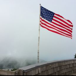

Brasstown Bald in Hiawassee, GA is the highest point in the state of GA. It's in the beautiful Blue Ridge mountains. I have visited and lived in the state of GA and I always find time to go to Brasstown Bald. I actually walked to the top once and vowed to never walk it again! Luckily they have a van that runs people up and down the mountain. It's very pretty up at the top. Most of the time it's cloudy, but if you catch the weather on a good day the views are spectacular.


My family likes to go hiking, and we decided to visit Brasstown Bald because we heard that it is the tallest point in Georgia. It was also our first time taking our puppy on a hike. The hike to the top is less than a mile, and it is paved. It is a good workout on the way up and down, and it was the perfect intro hike for our pup because of the pavement (he's still in the eating sticks and leaves phase). The views at the top of the observation deck are stunning and vast! I also really loved that they have signs up to tell you what some of the mountains in the view are. I think they have a shuttle to take you to the top if you don't want to hike, but all of the facilities were closed on the day we went. I would like to come back in the spring when all of the trees are green to see a different view!


We were not lucky to have a good day. It rained (pretty heavy at times) and was very foggy. Couldn't see anything. The hike to the top from the welcome center is under a mile. They also offer a bus to the top, if you don't want to hike it. There is a museum and observation deck at the top. Museum is okay. Takes about 30 minutes to view. No wifi (was shared) and the cell signal is pretty weak. There are about 4 trails that emanate from the top, but they are quite long and are quite strenuous (we were told). Maybe another day.


Brasstown Bald is the highest point in Georgia. Located in the northeast Georgia city of Hiawassee. The mountain was home to the native Cherokee Indians. One of the US national parks, there is a $3 per person entrance fee. Parking is located at the bottom of the trail. Hike to the top is short, just a little over 1/2 mile. It is steep but not hard. The entire trail is paved and safe. Some people were huffing and puffing on the way up but there are bench's and rocks to sit if needed. As you approach the top of the trail you will see the summit with it's beautiful 360 degree views of the Chattahoochee National Forest . On a clear day you can see four states and there is good signage on the observation deck showing where to look. One of the nicest hikes I've taken. Oh, and Incase you're not a hiker, there's a road you can drive up that takes you directly to the summit and the observation deck! At the top of the trail is a beautiful


A must-see location in the Georgia area. This location has a lot of reasons that you should see it. It is key to the history of the area. It is the highest point and it has a very nice visitor center. Please check the opening times prior to your arrival. It opens at 10 am on weekdays. If you get there early, you will have to wait for them to open. There is a lot of parking at a lot a few hundred feet below the visitor's center. We got there early on a weekday but I was told that this location has a lot of traffic and can get very busy. I would recommend getting there early. There are 2 ways to reach the higher observation point and visitor's center. Either, you can walk up a steep path or you can take the shuttle for $3 per person. I highly recommend the shuttle as it pays for a ride up and down and is well worth it. The view from the top is spectacular. The visitors center is a little dated but extremely informative. The observation deck is open but the tower is closed. There is a 14-minute movie that describes the area through the seasons. The center has many hands-on displays that show the history of the area and are very interesting and informative. The staff was very helpful and friendly and I highly recommend this as one of your stops if you are in the area. Enjoy.
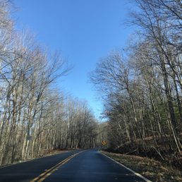

Brasstown Bald is the highest point in the state of Georgia (4,784 ft) and from up there you can appreciate the Southern Appalachian Mountains and valleys... but if you're lucky enough you could see four states from one peak! (GA, TN, NC, & SC). How amazing is that? Once you arrive you need to pay $5 per person and that includes parking, and shuttle ride if you decide not to hike it. When we visited it was raining so we decided not to hike it since the trails were muddy. The shuttle comes up and down every 15 min or so, and it was very convenient. Once up there, there's multiple things to do. You can visit the museum, or you can watch a 30 min movie and learn about Brasstown Bald. It was actually very interesting. This is a must stop no doubt. The views were incredible, and the site was very well maintained. I totally recommend coming here. ESPAÑOL Brasstown Bald es el punto más alto del estado de Georgia (4,784 pies) y desde allí puedes apreciar las montañas y los valles de los Apalaches del Sur ... ¡pero si tienes la suerte de ver cuatro estados desde un pico! (GA, TN, NC y SC). ¿Qué tan asombroso es eso? Una vez que llegue, debe pagar $ 5 por persona y eso incluye estacionamiento y traslado en autobús si decide no caminar. Cuando visitamos estaba lloviendo, así que decidimos no caminar porque los senderos estaban embarrados. El transbordador sube y baja cada 15 minutos más o menos, y fue muy conveniente. Una vez allí, hay varias cosas que hacer. Puede visitar el museo, o puede ver una película de 30 minutos y aprender sobre Brasstown Bald. En realidad fue muy interesante. Esta es una parada obligada, sin duda. Las vistas eran increíbles, y el sitio estaba muy bien mantenido. Recomiendo totalmente venir aquí.


Some really great views from up here. You can ride or walk up. The walk is steep so be prepared. We road up and walked down. A neat movie that shows a year on the bald. Really well organized and fun


This was a beautiful location to go to! As the highest point in Georgia, you get fantastic views of the surrounding, no matter what direction you are looking at. I did not get a chance to hike all the way to to top this time. But even then, everything about this park is well maintained. This place has ample parking and lots of picnic tables and spots to have a good time looking at the scenery. The path up to the observation tower is fully paved, making for a more leisurely climb to the top. All in all, a good location to go to if you are in the mountains of North Georgia :)


Came to Brasstown Bald Observation Tower for the views and it was a sight to see! It's not everyday (at least where I live) that you can stand in such a high place and be able to see mountains spanning across 4 different states. The entry fee was 8 per adult (kids are free) which also includes a van ride to the overlook. Or you can choose to hike which wasn't a long hike but steep from what I saw. A must do for anyone visiting the area! Ohh... and make sure you watch the little movie at the top, it's very cool to see how one place is its own little world in different seasons and the history behind the place. read more


The current Brasstown Bald observation tower was built in 1965, replacing an earlier stone tower that was constructed by the Civilian Conservation Corps (CCC) in 1935. The original 1935 stone tower was torn down in 1947 and replaced with a steel tower before the current structure was built - we'll folks looks like it's time to build another tower this one is in a state of disrepair. I came here to observe 4 states from the highest point in Georgia, but apparently the observation tower is in such bad shape that it is now closed to the public and your adventure will end after climbing a few flights of stairs ending at the base of the observation deck yeah there's a view from the lower level but in my opinion not worth the price of admission. Thankfully there's a shuttle van that takes you from the parking lot level to the top it runs about ever 10 minutes, our driver was very friendly and tried his best to entertain us during the short drive to the top but there's not much to say - the museum at the top is okay and takes about 2 minutes to tour it then time you walk the lower deck and wait for the shuttle back down - I purchased a refrigerator magnet for the RV from the gift shop and headed for the truck. I guess I am fortunate that I came and saw this, although it was never on my bucket list, I'm still trying to figure out why there's an old train engine in the museum it's quite the anachronism... read more


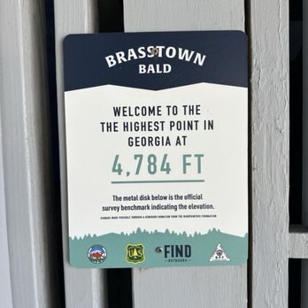

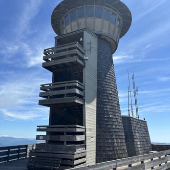

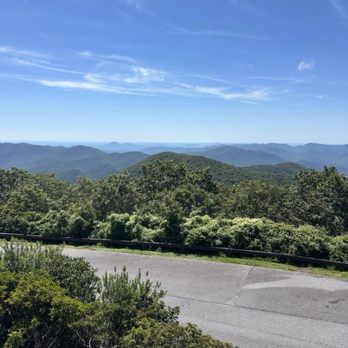

We went by here on a whim, and certainly didn't regret it! It is a very slow, twisty ride to get to the top, but well worth it. It was only $8/person to get in, and kids 15 and under are free. You can pay cash at the booth or they take cards in the gift shop. There is a 0.6mi trail from the parking lot to the observation tower, but with storms rolling in we opted for the quicker shuttle bus to the top. It runs about every 10-15 minutes. The 360° view from the top was breathtaking, and I only wish we would've planned for some more time to hike around and just relax at the top. We only spent about 30 minutes up there, and didn't get to fully explore the museum. We will certainly go back. read more

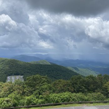

Free admission with your National Park pass! There's a fee if you want to take the shuttle to the top of the lookout area, which we did because we hiked a lot earlier and hiking up a hill did not sound appealing. Really pretty view.of the mountains and they say you can see four states at once. Not that you could tell, but they have it all labeled on the side of the walls of the observation deck. read more


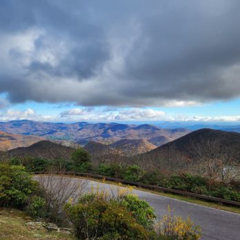

Purportedly the highest point in Georgia, this is a federally owned spot (which was not obvious to me before I arrived), which requires either an entrance fee or a national parks pass. A shuttle bus will take you to the top for a small additional charge. You might think that hiking is the point, but even the hike from the parking lot to the observatory is a significant exertion. The area is paved, but steep. Wondrous views were promised by signage, but I arrived on a foggy day where there was not much visibility. The mountain itself offers the sort of fascinatingly twisted foliage one sees at this height in the Appalachians. The center at the peak has a watchtower where the forest service apparently monitors the surrounding terrain for forest fires as well as a small museum and an introductory film. Restrooms were available at the parking lot, but were quite limited with some parts being shut down for the winter (in November) and the ones at the peak being out entirely. The climate in this area was purportedly more typical for Massachusetts than it is for Georgia, which is perhaps a reason in and of itself to make a visit. The windy road to the top is in good condition and well worth a drive, probably more so on a day where you can actually see the distant sights. read more

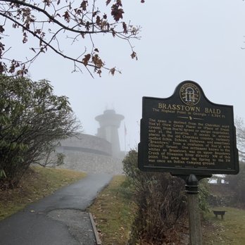


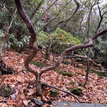


2 0 0 0 0 I got high for my 20,000th review. Brasstown Bald is the highest point in the state of Georgia and I really enjoyed my visit. The Sprinter van did amazingly well climbing the curving switchback roads to get to the parking area and I managed to find a spot where I could get some cell phone coverage for a few calls before heading up to the peak. (It's in the far corner next to some picnic tables.) For $8 per person, that includes the shuttle to the peak. A 12 passenger van does the job in about three minutes and it's worth it for someone like me who doesn't climb well. At the peak, the visitor's center has displays that discuss the park rangers, history of the local area and a 14 minute movie that shows the weather up here. Then you can climb the steps to the observation tower and look out over the area. Restrooms at the peak and at the shuttle waiting area adjacent to a gift shop where I bought a fridge magnet and some postcards. I lucked out with weather. Within a few minutes of my getting to the peak, the clouds rolled in and apparently stayed there for an hour or two until the Sun burned them off. There isn't much you can do about that! I got some great views. Totally worth the journey. ----- Yes, this is my 20,000th review. As far as I know, I am the first on Yelp to achieve this milestone. And sure, there's some ballot box stuffing in there. I've reviewed Little Free Libraries and sculptures and even EV charging stations. But if Yelp is going to give us categories for "Community Book Box" and "Public Art" and "EV Chargers" then we should be using them. There are also 21 countries in those 20,000 that include trips to Chile and Japan and Italy. 57 reviews from my trip to Taiwan but none from my trip to Mainland China as Yelp isn't there. I went to Switzerland in 2011 before Yelp launched in the country so I missed out. And it's the friends we met along the way - great fellow Yelpers at UYEs and meetups in Fort Myers (*waves to Dawne and Ariel*) and Charleston (*waves to Amy-Lauren*) and Düsseldorf (*waves to Klaus-Dieter*) and New York City (*waves to Marianne*). It's been 14 years since my one star review of Dollar Rent-A-Car at LAX https://www.yelp.com/biz/dollar-car-rental-los-angeles-3?hrid=FIDNeI3VXfhUW9Df5JMnCw. One review every 1000 lands here: https://www.yelp.com/collection/3OO1cec6shsewk5ZzNLW8Q and that's a lot of reviewing. 1,000 reviews back was the Elevado do Lavra in Lisbon https://www.yelp.com/biz/elevado-do-lavra-lisboa?hrid=olfsX3u9AAq6V4iNiiW-Sw 10,000 reviews back was the SkyWalk Observatory in Boston https://www.yelp.com/biz/skywalk-observatory-boston?hrid=Re-40RPWm45juh2gdhPHAw. Where will the 30,00th review be? Stay tuned and SYOY! [Review 20000 overall - 624 in Georgia - 975 of 2023.] read more


What a wonderful place to visit in Georgia. Apparently it's the highest point of Georgia and overlooks 4 states - Tennessee, South Carolina, North Carolina, and Alabama. It helps to go when the weather is nice for best visibility. The observatory is full of interesting things to see for the kids and the surrounding area is dog friendly but be aware that dogs are not allowed in the observatory itself or theater. Dogs are allowed in the shuttle and the hike from the parking area to the observatory is .6 of a mile but it's pretty steep so it does take a while to get to the top. There are bathrooms at the start or bottom of the trail and top of the observatory itself. Current price is $8 per adult and free for children. Well maintained and clean. This is a beautiful gem of Georgia. 5 stars! read more


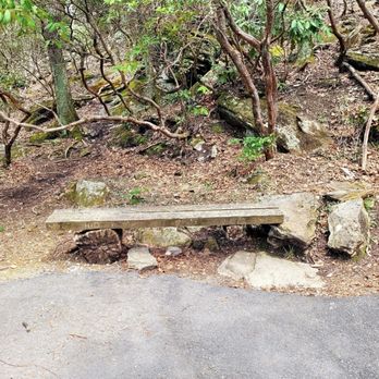
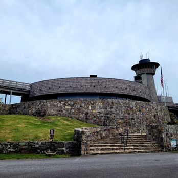
I was climbing the million steps at Amicalolla Falls before it was cool so of course when I learned about Brasstown Bald, I leapt at the opportunity. I'm not sure it's worth the $7 per person price-point but you'll definitely feel like you've accomplished something! Admission includes the shuttle,10 am to 4:30 pm with a break from 12:30 - 1:10 pm. Brasstown Bald is open 24 hours and year-round, if you can find your way in the dark you could go watch the stars! It's $5 per person at night. The Visitor Information Center is the highest point in Georgia, rising 4,784 feet above sea level and just a short drive from Blairsville, Hiawassee, and Helen! Even though the paved foot trail from the parking area to the top is only 6- 10ths of a mile, you will feel every inch! It's super steep, tree-lined and there are also benches along the way for a much-needed rest. And there are signs where you can learn fun facts. I prefer to come during the winter for less bugs & crowds, although it can get chilly at the top! There are 4 hiking trails ranging from 1/2 to 6 miles. Dogs must be leashed. If you can make it to the top, there's a forgettable, small natural science and history museum where you can learn about the land lottery, rocks and an oversimplified version of the Trail of Tears. But at least it has A/C! There's an outside observation deck where you can observe 360-degree views of four states (GA, TN, NC, & SC). But there are also lots of tiny, annoying gnats during the Spring. I didn't stay long! If you're headed to ATL afterwards, I recommend Vogel State Park (25-minute drive, $5 per car) which has a beautiful lake & small waterfall. If you're headed to Hiawasee or North Carolina, I recommend Chatuge Dam & Bell Mountain (33 minutes). Unlike GA, state parks in NC are FREE. read more





2 years ago
Brasstown Bald in Hiawassee, GA is the highest point in the state of GA. It's in the beautiful Blue Ridge mountains. I have visited and lived in the state of GA and I always find time to go to Brasstown Bald. I actually walked to the top once and vowed to never walk it again! Luckily they have a van that runs people up and down the mountain. It's very pretty up at the top. Most of the time it's cloudy, but if you catch the weather on a good day the views are spectacular. read more
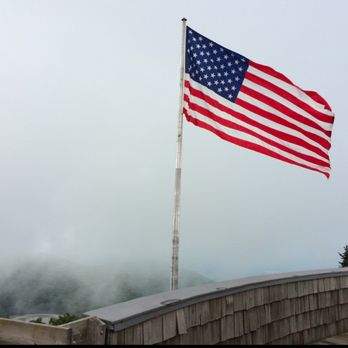


My family likes to go hiking, and we decided to visit Brasstown Bald because we heard that it is the tallest point in Georgia. It was also our first time taking our puppy on a hike. The hike to the top is less than a mile, and it is paved. It is a good workout on the way up and down, and it was the perfect intro hike for our pup because of the pavement (he's still in the eating sticks and leaves phase). The views at the top of the observation deck are stunning and vast! I also really loved that they have signs up to tell you what some of the mountains in the view are. I think they have a shuttle to take you to the top if you don't want to hike, but all of the facilities were closed on the day we went. I would like to come back in the spring when all of the trees are green to see a different view! read more


We were not lucky to have a good day. It rained (pretty heavy at times) and was very foggy. Couldn't see anything. The hike to the top from the welcome center is under a mile. They also offer a bus to the top, if you don't want to hike it. There is a museum and observation deck at the top. Museum is okay. Takes about 30 minutes to view. No wifi (was shared) and the cell signal is pretty weak. There are about 4 trails that emanate from the top, but they are quite long and are quite strenuous (we were told). Maybe another day. read more



10 months ago

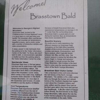
Brasstown Bald is the highest point in Georgia. Located in the northeast Georgia city of Hiawassee. The mountain was home to the native Cherokee Indians. One of the US national parks, there is a $3 per person entrance fee. Parking is located at the bottom of the trail. Hike to the top is short, just a little over 1/2 mile. It is steep but not hard. The entire trail is paved and safe. Some people were huffing and puffing on the way up but there are bench's and rocks to sit if needed. As you approach the top of the trail you will see the summit with it's beautiful 360 degree views of the Chattahoochee National Forest . On a clear day you can see four states and there is good signage on the observation deck showing where to look. One of the nicest hikes I've taken. Oh, and Incase you're not a hiker, there's a road you can drive up that takes you directly to the summit and the observation deck! At the top of the trail is a beautiful read more


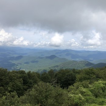

3 years ago
A must-see location in the Georgia area. This location has a lot of reasons that you should see it. It is key to the history of the area. It is the highest point and it has a very nice visitor center. Please check the opening times prior to your arrival. It opens at 10 am on weekdays. If you get there early, you will have to wait for them to open. There is a lot of parking at a lot a few hundred feet below the visitor's center. We got there early on a weekday but I was told that this location has a lot of traffic and can get very busy. I would recommend getting there early. There are 2 ways to reach the higher observation point and visitor's center. Either, you can walk up a steep path or you can take the shuttle for $3 per person. I highly recommend the shuttle as it pays for a ride up and down and is well worth it. The view from the top is spectacular. The visitors center is a little dated but extremely informative. The observation deck is open but the tower is closed. There is a 14-minute movie that describes the area through the seasons. The center has many hands-on displays that show the history of the area and are very interesting and informative. The staff was very helpful and friendly and I highly recommend this as one of your stops if you are in the area. Enjoy. read more

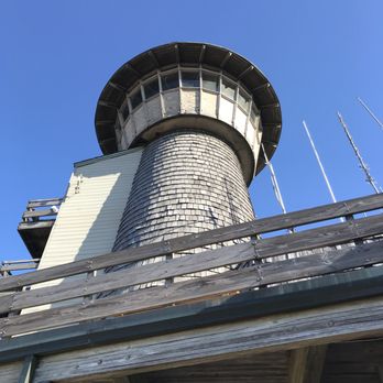

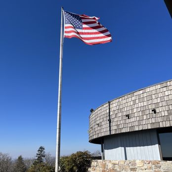


Brasstown Bald is the highest point in the state of Georgia (4,784 ft) and from up there you can appreciate the Southern Appalachian Mountains and valleys... but if you're lucky enough you could see four states from one peak! (GA, TN, NC, & SC). How amazing is that? Once you arrive you need to pay $5 per person and that includes parking, and shuttle ride if you decide not to hike it. When we visited it was raining so we decided not to hike it since the trails were muddy. The shuttle comes up and down every 15 min or so, and it was very convenient. Once up there, there's multiple things to do. You can visit the museum, or you can watch a 30 min movie and learn about Brasstown Bald. It was actually very interesting. This is a must stop no doubt. The views were incredible, and the site was very well maintained. I totally recommend coming here. ESPAÑOL Brasstown Bald es el punto más alto del estado de Georgia (4,784 pies) y desde allí puedes apreciar las montañas y los valles de los Apalaches del Sur ... ¡pero si tienes la suerte de ver cuatro estados desde un pico! (GA, TN, NC y SC). ¿Qué tan asombroso es eso? Una vez que llegue, debe pagar $ 5 por persona y eso incluye estacionamiento y traslado en autobús si decide no caminar. Cuando visitamos estaba lloviendo, así que decidimos no caminar porque los senderos estaban embarrados. El transbordador sube y baja cada 15 minutos más o menos, y fue muy conveniente. Una vez allí, hay varias cosas que hacer. Puede visitar el museo, o puede ver una película de 30 minutos y aprender sobre Brasstown Bald. En realidad fue muy interesante. Esta es una parada obligada, sin duda. Las vistas eran increíbles, y el sitio estaba muy bien mantenido. Recomiendo totalmente venir aquí. read more






5 years ago
This was a beautiful location to go to! As the highest point in Georgia, you get fantastic views of the surrounding, no matter what direction you are looking at. I did not get a chance to hike all the way to to top this time. But even then, everything about this park is well maintained. This place has ample parking and lots of picnic tables and spots to have a good time looking at the scenery. The path up to the observation tower is fully paved, making for a more leisurely climb to the top. All in all, a good location to go to if you are in the mountains of North Georgia :) read more


4 years ago
The views on a clear day are spectacular! Great shuttle service! Nice gift shop. Worth the drive! read more


2 years ago
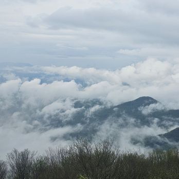
We went today. It is a pretty steep climb on the way up. Wouldn't recommend for the elderly unless they do the shuttles that take you up, but they only run until a certain time. Beautiful views once you reach the observation area at the top. There is a fee to go but not that bad of one. Beautiful views!! read more





6 years ago

6 years ago
This place is must go. while we were visiting from Dahlonega we took the relaxing scenic drive uphill. The parking lot is vast, but we visited off season. $5 per person, with the mini bus ride to the top. Amazing views with a clear day. We visited with my toddler we enjoyed the museum and the rocking chairs outside while snacking. We also stopped for lunch at some Winery on our way back. read more


always wanted to come here. got there about 430p and parking lot was mostly empty, huge parking lot. the restroom and gift shop were closed but there are some restroom. if you don't wanna hike there are shuttles (not sure when they work or how often) to the very top. there is a 6/10 mile hike, straight uphill to the very top. there are signs for rattlesnakes (we didn't see any but i'm sure they are everywhere). to the top took about 15-20 mins up bc it's a little burn going up. the top is pretty! everything was closed when we got there. we walked around and it's gorgeous 360 views! there are posted signs with details of all the peaks is nice! it was a little hazy when we went but still gorgeous. they do need to replace some of the woodboards and my opinion- some of them are a little creeky and loose. going down is easy and all downhill. It's definitely worth going there to see one of the highest peaks in Georgia. There are some picnic tables and areas to sit. Since going up straight uphill is a little hard, even though it's short, there's a few rest stops around the way with benches. nothing was open and the vending machines weren't working so bring your own water. it's a good short work out. Don't go if it's rainy or super cloudy because you won't be able to see very much at the very top. But if you're looking for a quick 15 minute uphill work out with some nice views and a quick 10 minute down this is definitely a good place! read more



7 years ago
Great place to hike and explore. Bring snacks and food and water if you plan to hike jacks knob. It's 4.5 down hill and uphill. Definitely need moderate hiker experience. Will at the info desk was super nice and personable and chatted with us and even let us see Atlanta about 87 miles out we could see because it was a clear day. He said that only happens 20 days out of the year so we felt fortunate to get to check that out. This was through his binoculars of course. read more



4 years ago
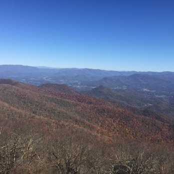
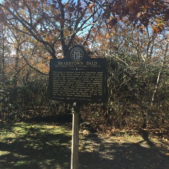
Beautiful views of four states from the oberservation deck. In April the climate is about 25 degrees difference from the surrounding lower elevations.FYI - the road up to the top is the steepest road in the State of Georgia. The Parnk Rangers are very informative and friendly. read more


5 years ago
Great spot to see mountains and valleys. We drove up and took the shuttle up to the top. Sadly the tower was closed. We enjoyed the museum and they do have the stamp at the desk or you can get the stamp on postit in the gift shop at the bottom. The top is a great place for pictures. read more


4 years ago
We drove to Brasstown Bald today and were anticipating a short walk from the parking lot. However, the road was closed, so we opted to walk 2.5 hours up to the top via the snowy trail called Jack's Knob then walk back down the closed roadway. About 7.5 miles all in, and the views were absolutely worth it! read more


3 years ago
Definitely a place to visit! Great views! Of The Beautiful Blue Ridge mountains. Can see Atlanta from here! read more


Very well manicured trail. Super clean and paved the entire way up. Pretty steep but once you get to the top you can take in the best views in Georgia. We went during sunset and it was amazing! The time of year we went was at the end of September so make sure to take a jacket. Lovely experience and can't wait to go back and hike some of the other trails that are around it! read more

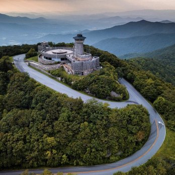


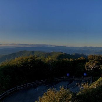

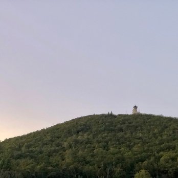


6 years ago
This is definitely a must see when you are in the area. I'm out of shape but the hike is a serious trek. It doesn't take long and I also stopped many times to catch my breath read more
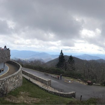


Amazing beautiful views for miles. The drive to the parking lot is fun. There is a general store in the parking lot and restroom facilities. We love to walk the paved path, but you can always pay a small fee to ride the shuttle. The paved path is a nice sloping path with several benches along the way to the observation tower. The path is shaded and you can bring pets! At the observation tower you can visit a nice museum and see a very "dated" movie. Climb some steps to the top of the tower and get even more amazing views! read more


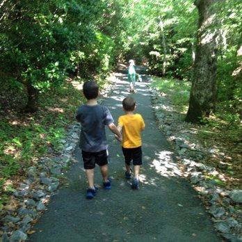


7 years ago
This is a great attraction! There is a lot of history of the area to learn there and they teach it well. They have a great scavenger hunt for the kids and a lot of educational exhibits. Try to go on a clear day. When we got there the clouds were rolling past the tower and you couldn't see anything, but after a bit it started to clear and the views were AMAZING! I wouldn't bother dropping a quarter in the telescopes, we did and it didn't work. I saw other patrons that brought their own binoculars and that looks like the way to go. We rode the bus up to the summit and hiked the path on the way down, we saw a lot of different wildlife on the hike and took our time. read more


The admission fee was $5 per person and well worth it to be seeing the view from the tallest peak in Georgia. There was also a mini 15 minute movie that was very informative about the mountain and area. There were plenty of parking spots, restrooms, and a general store. You have the option of riding the shuttle up to the Observation Tower or walk the 6/10 of the mile hike. Though the hike was less than a mile, it was hilly and windy. I was taking super long strides because I was excited, and it exhausted me to say the least. Though short in length, it was strenuous. The trail was paved and shaded all the way up so no worries of being in the blinding sun. The atmosphere up here was quite different (and will be pointed out in the movie); the air was breezy and cooler. read more


Wow - these views. My friend and I visited Helen, Georgia, for a quick weekend trip, and we decided to check out Brasstown Bald on our way back to Nashville. It's the highest peak in Georgia, and you can either walk .5 miles straight up or get a shuttle to the observation deck at the top. The museum and the film are very dated, but the views are spectacular! Visibility can be an issue, but as we arrived, it started to clear up. On clear days, you can see four states. If you're in this part of Georgia, the Brasstown Bald Observation Tower is well worth a quick stop! read more

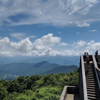


4 years ago

9 years ago
Have you not heard??? At 4,784 feet, Brasstown Bald is the highest elevation in all of Georgia, which also happens to be one of the largest states East of the Mississippi. Technically, at 97,716 square miles, Michigan is the largest Eastern state because it also includes a HUGE section of Lake Michigan within its borders (which contributes more than 1/3rd to its size). However, Michigan only has a land mass of 57,324 square miles while Georgia's land mass is 59,425 square miles, second only to Florida when comparing eastern states!!! 4,784 feet tall might not be impressive to the Rocky Mountain peaks of the West, but it's not too shabby for the neighboring lower plains states of the southeast. It's actually not far off the tallest peak in the United States east of the Mississippi, which is Mount Mitchell (6,684 feet) just outside Asheville. Alabama's peak elevation is 2,413 feet, Mississippi is 807 feet, South Carolina is 3,560 feet, Louisiana is 535 feet and Florida's tallest peak is a pitiful 345 feet above sea level. THE EXPERIENCE The name Brasstown comes from a mistranslation of a Cherokee name, which historically happened a lot. Either intentionally or arbitrarily, early settlers butchered a great many Indian names we are familiar with today throughout the South. When you arrive, you must first pay the attendant located in the cozy booth prior to parking. The fee here is $5 per person... not per car like at many state parks!!! That didn't make me very happy. You will be given a sticker to place on your person, which will also be your ticket to use the shuttle to the observation tower. Depending on how busy they are, two shuttles may be running every 8-10 minutes that can hold about 16 American-sized people each. The driver gave a us a brief overview of the park and informed us that if we had chosen to walk the trail to the tower, it would have been a little over a half mile in length and an elevation gain of 428 feet. That's some good cardio for all you health nuts that want every step to count! There are soda/water vending machines and restrooms located near the parking shuttle pick-up and the museum at the top of the mountain. Once to the top you will disembark the shuttle at a set of stone stairs leading to the museum, tower and theater. The theater features a film about the four seasons of the mountain and how harsh the winters can be. It also highlights the height of the mountain and how Fall and Winter FIRST overtake Georgia starting here on the bald. It was interesting to know because of the elevation difference (when spring arrives) flowers can be in bloom @ lower elevations a full three weeks before life begins to burst forth on the mountaintop. Winter & Fall start atop the mountain and creeps down, while Spring starts in the valleys below and creeps up the mountain. Love how nature has a strong hold on the mountains schedule. The observation tower is no longer open to visitors (bummer), but there are plenty of surrounding decks for mostly unobstructed 360 degree views. NORTH and SOUTH are defined on two of the railings. Inside, the museum shows various wild life critters and gives a bit of the mountains history with trains, the Cherokee and Ranger Arthur Woody. He really took personal responsibility for the wellbeing of the mountain and became its biggest advocate often using his own money to bring back animals and fish to the mountains ecosystem. While many things about the tower and museum seem dated, the animatronics of Ranger Woody inside the museum were actually very lifelike! I enjoyed the 14 minute movie very much. I'm a nerd for history and how it relates to a specific location as well as a fan of showing how the seasons effect the mountain. The views are stunning, but according to the driver, views are best in the winter months. He said the faint haze we saw rises from gasses of dead vegetation on the mountain floor and limits the potential of viewing distance. TIP - Cold weather clears out these gasses, so colder months have the clearest views! FINAL THOUGHTS Surprisingly, most of the people I met today were not from Georgia. Most actually were from Florida and were up visiting since the 2017 eclipse "path of totality" came right across the mountain. The area of Georgia I live only experienced 97% totality, which I was impressed with until I saw their eclipse pictures! The next total eclipse is coming to the United States in 2024, and after seeing the amazing pics of the people I met @ Brasstown Bald... I'm definitely going to put myself in the path! BTB indeed has a fantastic view, but for an even more spectacular view that doesn't require a $5 per person fee, visit nearby Bell Mountain (review coming soon). 2017/120 read more


Went here back in Nov 2012.. It was a nice drive to this place past Helen, during the fall season.. You have to park your car and then hike up about 1/2 a mile.. its a little steep at couple of areas... but it is paved.. Anyways it was nice and cold out there since we visited in winter.. We were a bit unlucky as when we reached the top it was covered with clouds.. You are supposed to see 3 states from the top of the tower in 3 directions.. but we could just stare into the mist.. Planning to go here another day just at the start of fall to have a better view... There is a small museum also inside the tower.. More of wildlife and trains.. etc.. it was good.. There was also a video session about the surrounding natural habitat and animals etc which was good read more


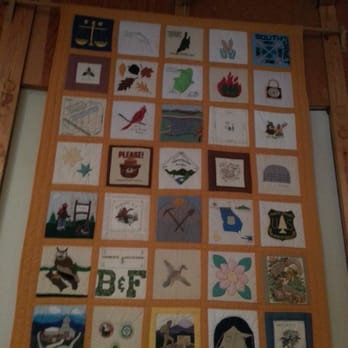

4 years ago
great view.. hike up for sunet worth the hike and the wait. after sunset gurried down as i didnt want to hike a night ... easy on the way down pretty steep on tje way up but doable read more


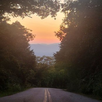

6 years ago
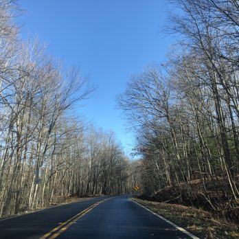
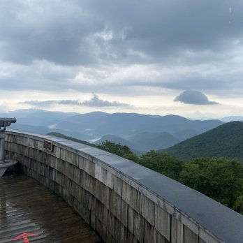
I had an awesome time at the observation deck. Though it was cloudy and lightly raining, I was still able to get good photos. If you drive up to the parking area, your phones GPS may end near an intersection but just keep following the narrow road up to parking. Once you're there, it's a short .6 mile hike to the observation deck. Highly recommend it! read more


6 years ago
Very cool! Worth a quick stop for the breathtaking views. Worth the $5 entrance fee just make sure you ask for the shuttle braclet. read more


Page 1 of 2
More info about Brasstown Bald Observation Tower
Ask the Community - Brasstown Bald Observation Tower
Are there any picnic tables in the area?
Yes in the parking lot and also up at the top
Is the entry fee cash only?
I apologize, but I not know. We had a National Park tag and got in free. I can only guess that they only accept cash.
Can a Prius make it up the road to the parking area?
Yes it's a windy road but any car can navigate it
Review Highlights - Brasstown Bald Observation Tower















Why does Yelp recommend reviews?


Brasstown Bald Observation Tower - landmarks - Updated August 2026
Best of Hiawassee
People found Brasstown Bald Observation Tower by searching for…
Scenic Overlook in Hiawassee, GA
Hiking Trails With Waterfalls in Hiawassee, GA
Places to Take Pictures in Hiawassee, GA
Lookout Points in Hiawassee, GA
Things to Do on a Rainy Day in Hiawassee, GA
Beautiful Views in Hiawassee, GA
Public Services & Government in Hiawassee, GA
Trending Searches in Hiawassee, GA
Antiques near Brasstown Bald Observation Tower
Barbershop For Men near Brasstown Bald Observation Tower
Bike Shop near Brasstown Bald Observation Tower
Caves near Brasstown Bald Observation Tower
Cliff Jumping near Brasstown Bald Observation Tower
Consignment Shops near Brasstown Bald Observation Tower
Ear Piercing near Brasstown Bald Observation Tower
Eyebrow Threading near Brasstown Bald Observation Tower
Gold Panning near Brasstown Bald Observation Tower
Hiking near Brasstown Bald Observation Tower
Kids Haircut near Brasstown Bald Observation Tower
Lookout Points near Brasstown Bald Observation Tower
Mini Golf near Brasstown Bald Observation Tower
Pedicure near Brasstown Bald Observation Tower
Permanent Makeup near Brasstown Bald Observation Tower
Photo Spots near Brasstown Bald Observation Tower
Places To Visit near Brasstown Bald Observation Tower
Preschools near Brasstown Bald Observation Tower
Public Golf Courses near Brasstown Bald Observation Tower
Public Pools near Brasstown Bald Observation Tower
Trading Card Shops near Brasstown Bald Observation Tower
Browse Articles
Browse Nearby
BEST of Hiawassee, Georgia Restaurants near Brasstown Bald Observation Tower
BEST of Hiawassee, Georgia Parks near Brasstown Bald Observation Tower
BEST of Hiawassee, Georgia Things to Do near Brasstown Bald Observation Tower
BEST of Hiawassee, Georgia Coffee near Brasstown Bald Observation Tower
BEST of Hiawassee, Georgia Hiking near Brasstown Bald Observation Tower
BEST of Hiawassee, Georgia Hotels near Brasstown Bald Observation Tower
BEST of Hiawassee, Georgia Breakfast near Brasstown Bald Observation Tower
BEST of Hiawassee, Georgia Campgrounds near Brasstown Bald Observation Tower
Browse Brands
Related Searches in Hiawassee, GA
Best Lookout Points to Visit in Hiawassee, Georgia
Best Things to Do on a Rainy Day in Hiawassee, Georgia
Best Waterfalls and Swimming Holes in Hiawassee, Georgia
Book Engaging Historical Tours in Hiawassee, Georgia
Discover Charming Historic Homes in Hiawassee, Georgia
Discover Famous Monuments in Hiawassee, Georgia
Discover Popular Landmarks in Hiawassee, Georgia
Discover Popular Photo Spots in Hiawassee, Georgia
Discover Stunning Skyline View Spots in Hiawassee, Georgia
Discover the Best Caves to Explore in Hiawassee, Georgia
Enjoy a Beautiful Waterfall Hike in Hiawassee, Georgia
Enjoy the Best Family Activities in Hiawassee, Georgia
Enjoy the Best Night View Spots in Hiawassee, Georgia
Enjoy the Best Walking Trails in Hiawassee, Georgia
Explore Beautiful Botanical Gardens in Hiawassee, Georgia
Explore Beautiful Castles and Landmarks in Hiawassee, Georgia
Explore Beautiful Parks and Green Spaces in Hiawassee, Georgia
Explore Free Things to Do Around Hiawassee, Georgia
Explore Fun Activities to Do in Hiawassee, Georgia
Explore Fun Field Trips in Hiawassee, Georgia
Explore Popular Scenic Overlook Points in Hiawassee, Georgia
Explore Popular Scenic Views Near Hiawassee, Georgia
Explore Popular View Points Around Hiawassee, Georgia
Explore Secret Spots Worth Visiting in Hiawassee, Georgia
Explore Top Art Galleries Located in Hiawassee, Georgia
Explore Venues & Event Spaces in Hiawassee, Georgia
Explore the Scenic River Walk in Hiawassee, Georgia
Explore the Top Car Museum in Hiawassee, Georgia
Find Exciting Tours to Take in Hiawassee, Georgia
Find the Best Bridge Spots in Hiawassee, Georgia
Find the Best Playgrounds to Visit in Hiawassee, Georgia
Fun Rainy Day Activities to Try in Hiawassee, Georgia
Fun Teen Activities to Do in Hiawassee, Georgia
Fun Things for Kids in Hiawassee, Georgia
Hiking Trails With Waterfalls in Hiawassee, Georgia
Must-See Tourist Attractions Around Hiawassee, Georgia
Plan a Scenic Drive Route Near Hiawassee, Georgia
Popular Outdoor Activities to Try in Hiawassee, Georgia
Popular Picnic Spots to Visit in Hiawassee, Georgia
Popular Places to Take Pictures in Hiawassee, Georgia
Popular Things to Do in Hiawassee, Georgia
Popular Things to See in Hiawassee, Georgia
Stair Climbing Activities and Gyms in Hiawassee, Georgia
Top Hiking Trails to Explore in Hiawassee, Georgia
Top Places to Visit in Hiawassee, Georgia for Sightseeing
Tour Famous Lighthouses Located in Hiawassee, Georgia
Tour Popular Historical Sites in Hiawassee, Georgia





