Cancel

    Open app

    Search

    Brooks Falls

    4.0 (2 reviews)

    Brooks Falls Photos

    You might also consider

    Recommended Reviews - Brooks Falls

    Your trust is our priority, so businesses can't pay to alter or remove their reviews. Learn more about reviews.
    Yelp app icon
    Browse more easily on the app
    Review Feed Illustration
    Photo of H K.
    54
    1298
    186

    14 years ago

    Helpful 2
    Thanks 0
    Love this 0
    Oh no 1
    Photo of Sarah O.
    41
    46
    18

    15 years ago

    Helpful 0
    Thanks 0
    Love this 0
    Oh no 0

    You might also consider

    Mori Point - Mori Point

    Mori Point

    4.7(332 reviews)
    2.7 mi

    This has got to be one of my favorites trials/ hikes in Pacifica so far! The weather was beautiful…read morewhen we went and a majority of the trails are quite wide so it doesn't feel crowded. The trails vary in difficulty and steepness, but the views are beautiful all around. Parking is very limited and there was a bit of traffic due to the one lane road, but it was worth it. After your hike you can talk a walk or picnic on the beach and drive down to one of the nearby restaurants.

    Mori Point is absolutely amazing on a clear warm day...which is not that common in Pacifica. Hence…read morethe missing star... Not to mention the arduous task of dealing with parking when one does stumble upon that perfect day. I would still bring a light jacket if you think you will still be here around sunset. The coastal breeze brings a nice chill in the evening no matter how warm the day is. The hiking trail is not hard at all, perhaps a bit challenging for some older folks or someone very out of shape. "Located on a promontory just south of the city of Pacifica, the 110 acres of Mori Point are one of the newest additions to the Golden Gate National Recreation Area. High up above the cold waves, the site boasts sweeping views from Point Reyes all the way to Pedro Point. It protrudes several hundred feet out into the Pacific and is plainly visible from any high point in the City of Pacifica." - https://www.nps.gov/goga/planyourvisit/moripoint.htm I feel like a cheat; cut and paste...lol. Then again, I didn't know all this information about Mori Point. I didn't pay attention and actually thouth it was called Maori point and was somehow related to the Maori folks from the land of the long white cloud (aka New Zealand). "Restoration activities have helped the area recover from invasive species infestation and centuries of use by humans. In the 1700s, the Spanish mined a nearby limestone quarry to supply whitewash for San Francisco's Presidio buildings. An Italian immigrant, Stefano Mori, purchased 19 acres of farmland here in 1888. Mori built a guesthouse/restaurant, the Mori Point Inn, which developed a notorious reputation during the Prohibition days and was operated by the family until the 1940s. Mori Point was a site of gravel and sand extraction during World War II; quarrying and later off-road vehicle use left the landscape scarred. In 2000, with the help of the Pacifica Land Trust, the Coastal Conservancy, and concerned community members, Mori Point was purchased by the Trust for Public Land and added to the Golden Gate National Parks." - https://www.parksconservancy.org/parks/mori-point History "For nearly a century, Mori Point served as a haven for settlers, travelers, boot-leggers and diners. Today, after a generation of development battles, this spectacular place serves as a haven for walkers and wildlife and is a link to national parklands on Sweeney Ridge and Milagra Ridge along the San Mateo coast." - https://www.nps.gov/goga/planyourvisit/moripoint.htm " * The terrain here is varied; walks around Mori Point range from a level and easy 0.5-mile stroll to a steep and challenging 1.5-mile hike. * Beautiful wildflower blooms are at their peak in the springtime, with the most flowers usually present in April and May. * Parking is available on Mori Point Road or Bradford Way. * Walk to the tip of the promontory for stunning views; it's quite windy on the bluffs so dress accordingly. * Stroll down to Laguna Salada and listen for the croaking of the red-legged frog. * Walk barefoot on the black sands of Sharp Park Beach. * During WWII, workers used a pulley system of long cables attached to cement anchors to pull buckets of sand ashore. Several of these crumbling blocks remain on the western hillside." ~ "Tips and Highlights" - https://www.parksconservancy.org/parks/mori-point Wish I had read this before. Some good tips and helpful information
    Photos
    Mori Point - Mori Point

    Mori Point

    Mori Point - Mori Point Golden Gate National Recreation Area

    Mori Point Golden Gate National Recreation Area

    Mori Point - Mori Point

    See all

    Mori Point

    Devil's Slide Coastal Trail

    Devil's Slide Coastal Trail

    4.6(146 reviews)
    1.8 mi

    One of the most enjoyable hikes and trails I've been on. It runs along the coast on the old…read morehighway. Very scenic the whole way, paved walking path, some moderate inclines nothing too crazy pretty much anybody should be able to do the hike. There are restrooms on each side of the hike at the start and trip back around to the finish. Basically a step up from a porta potty, there is hand sanitizer in there they were pretty clean could be a lot worse than what it was, kind of nice to find one there if you need it. The hike was extremely enjoyable. I highly recommend.

    We got there a little later than we wanted, knowing parking could be an issue, but we got lucky and…read morefound a spot in the north parking lot around 10:30 AM. I didn't count the spaces, but I'd guess there are maybe 15-20, including a small unmarked parking area just before you get to the main lot. The walk starts with about five minutes of a slight uphill climb before you start heading downhill toward the south parking lot. It's about 1.3 miles each way. Once you get past that first little climb, the rest of the walk is pretty easy and right along the water with some great views. One of the coolest parts is that you're actually walking along the old Highway 1. Once you reach the south parking lot, which looked like it had around 25-30 spaces, you can see the Devil's Slide bunker up on the hill. It's another 10-minute walk or so if you want to go check it out. Parking is really the only downside. Both the north and south lots are pretty small, and there aren't many other options nearby. If they're full, you can continue south on Highway 1 for about a mile to Gray Whale Cove, where there's additional parking. Overall, it's a really nice walk. Not difficult, great ocean views almost the entire way, and walking along the old highway makes it a little more interesting than your typical coastal trail.

    Photos
    Devil's Slide Coastal Trail - Devil's Slide Historical Landmark (bunker)

    Devil's Slide Historical Landmark (bunker)

    Devil's Slide Coastal Trail - Anyone know what this is?

    Anyone know what this is?

    Devil's Slide Coastal Trail - Tunnel near the south parking lot entrance

    See all

    Tunnel near the south parking lot entrance

    Sweeney Ridge - Sweeney Ridge in mid March

    Sweeney Ridge

    4.3(190 reviews)
    3.0 mi

    This is a nice enough spot to go for a hike. It was easy to find my way to the Sneath Lane Trail…read moreParking using google maps, a small lot within a residential neighborhood, that fits about 10-15 vehicles. It was foggy, cold, and incredibly windy during my visit last week, and of course, there's an incline as the trail wraps around the mountain. But it wasn't too bad, the actual climb up didn't feel as difficult as it looked from a distance, starting with the sneath lane trail then connecting to other trails higher up. In fact, there are many options for different trails to take. The Baquiano Trail had a dirt pathway while the Notch Trail toward the Nike Missile Control Site was paved. Near the SF Bay Discovery Site, there's a small restroom building (it was pretty clean for a park facility, on a Thursday afternoon). The gorgeous foliage lining the various paths was captivating, along with lovely views of the hills, lake (san andreas reservoir), and sunlit scenery in the distance. Too foggy to enjoy the views the higher you get though, just a giant cloud of fog everywhere. I barely made it three miles out before turning back. It was just far too windy and foggy to wanna be out there very long (I'm sure hot days would be even worse with zero shade to be found). Plus my legs definitely had a workout from the uphill trek. Luckily the jog back down was a breeze. And I did slow down to appreciate the vegetation and vast array of plant species, once again, before leaving.

    There are a few entrances, but I think the most popular one is on Sneath Lane. This trail is paved…read moreand pretty steady and not too difficult for about a mile but then gets a bit steeper for the next mile to the top. On the way up you can see views of the San Andreas Reservoir Lake. After the rain you can hear the water flowing and see some little streams and wild mushrooms. To the ridge is a little under 2 miles. I like the fact there is a small bathroom which I find quite rare on trails like this. To the left is the San Francisco Discovery Site which has a plaque with some information. Apparently, this was the place the Spanish settlers first saw the San Francisco Bay. To the right the trail goes along the ridge to the remains of the old Nike missile site. The views are stellar, and one can see for miles on end, Marin, the city, Pacifica Mount Diablo, etc. I love watching all the planes coming in and out from nearby SFO. From Sneath the hike is about 5 miles and 2 hrs. I've also gone the Mori Trail route which is nice because it's not paved but this trail is steeper. It's worth checking out the funky Shelldance Orchid Gardens which is located at the trailhead but they are only open on the weekends.

    Photos
    Sweeney Ridge - Sweeney Ridge in mid March

    Sweeney Ridge in mid March

    Sweeney Ridge - Sweeney Ridge in mid March

    Sweeney Ridge in mid March

    Sweeney Ridge - Plants and flowers along the trail

    See all

    Plants and flowers along the trail

    Pacifica's Secret Waterfall - View from the beach, hard to get close because lots of debris.

    Pacifica's Secret Waterfall

    4.4(10 reviews)
    5.8 mi

    For an impressive waterfall it's pretty mid. But the area around has some trails with nice views of…read morethe ocean and beyond. Yelpers have mentioned the trail to the waterfall starts where Westline Dr. and Skyline Dr. meet. From here it's fairly intuitive on where to go. I felt the trail down to the falls seemed too steep to attempt so I opted out. I'm not sure if it was better a few years ago but when I went it felt dangerous and easy to lose footing. I wouldn't recommend this part for someone hiking alone, with kids, or with inexperienced hikers. The trail continues in the other direction along Westline Avenue with views of the ocean. If you continue you can see the top of the waterfall from here. You have to walk a little off the main trail in the ice plant but it's worth it if you want to see the falls. Another way is you can see this waterfall is by walking from Esplanade Beach. From the top of the stairs there the waterfall is about .6 miles. It's so much easier to get to this way and it's a nice beach walk. From here you can't see the waterfall as clear because there is a lot of debris in the way. In this sense it's almost a better view from above. The waterfall comes out of a storm drain which isn't as nice and only flows after a big rain. I wouldn't come out of my way to see this waterfall. But I think it's worth coming to see if you are already at Esplanade Beach or live in the neighborhood and are walking the trail alongside Westline Dr. From the start point to the beach and back it's about a 3.4 mile hike.

    Very cute little water fall. Emphasize on the little. It is a nice beach to picnic at, chill, read…read morea book, etc. Pro Tip: Walk all the way to the left side of the beach & away from the hotels, during low tide you can find sea animals! Please pack in and pack out. Protect our beaches

    Photos
    Pacifica's Secret Waterfall
    Pacifica's Secret Waterfall - View of the treacherous trail

    View of the treacherous trail

    Pacifica's Secret Waterfall - View from on top of the hill.

    See all

    View from on top of the hill.

    San Pedro Valley Park - San Pedro Valley Park

    San Pedro Valley Park

    4.4(108 reviews)
    0.2 mi

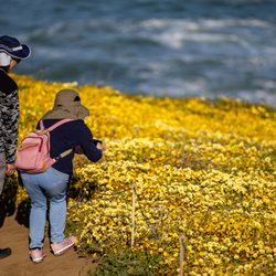
    I thought Pacific was just beaches but San Pedro Valley Park lies 2 miles inland away from all the…read morebeach action. I like it for its hiking trails. There are many different trails, the longest all-encompassing loop in the park is around 10 miles but you can go even further all the way up to Montara Mountain and beyond. I like the like Brooks Fall Loop (2.4 miles) and the Hazelnut and Weiler Ranch Loop (4.6 miles). Brooks Falls is fairly easy with a view of a waterfall in the distance. Keep in mind it only flows after a heavy rain and is rather far away looking through the canyon so you can't hear it flow. Someone with a nice camera lens might be able to get a good close up but otherwise in photos it looks very far away. For a waterfall hike where you can get up close, I'd go to Marin. Parking is $6 and it's cash in an envelope like it's year 2000. I don't understand why they don't have credit card machines because I've been to some other San Mateo parks that have them. The weekends there is a person where you can pay credit card. Lots of manzanita trees, iris, and yellow flower daisies.

    Deer Factor…read more ±1,050-acre park located in Pacifica's "Back of the Valley" neighborhood and is situated at the base of the area's impressive Montara Mountain, which peaks at ±1,900' above sea level. I can't believe I've never reviewed this place, as I used to visit at least several times a month when I lived here in P-Town. But, as they say, better late than never. ¯\_(ツ)_/¯ The Good: *Multiple restrooms *Paid parking lot (see The Ugly below) as well as free street parking outside the park along Oddstad Rd. *Visitor Center *Campsites for Youth Camps *Beach Volleyball court *Horses OK on marked trails *Always lots of deer and wild bunnies at this park, especially in the lower bowl area by the VC. *Approx nine-miles of trails, with options ranging from flat (Weiler Ranch Trail) to hilly (Montara Mountain Trail) and everything in-between, including some loops. *The uphill on the trails we did (±4.5-miles) weren't very steep but nice and gradual, including the Montara Mountain Trail. *Ocean views and the entire Pacifica area *You can take the Montara Mountain Trail into McNee State Park, but beware you're looking at an elevation gain of ±1,800' so be prepared. The Meh: *No dogs *Most of the trails were in pretty good shape, but a few of them were a little rough-and-ready--so wear good ankle supports! The Ugly: *There's a waterfall (Brooks Falls)along Brooks Creek Trail but unless it's rained recently, it won't even be a trickle. *Parking lot requires a paymentof $6, which is whatever I'm happy to contribute, but it's cash only in the envelope kinda deal. Not everyone carries cash these days and it's time to switch to a system that accepts CCs. Conclusion:

    Photos
    San Pedro Valley Park - San Pedro Valley Park

    San Pedro Valley Park

    San Pedro Valley Park - San Pedro Valley Park

    San Pedro Valley Park

    San Pedro Valley Park - San Pedro Valley Park

    See all

    San Pedro Valley Park

    Mussel Rock Park

    Mussel Rock Park

    4.3(98 reviews)
    6.2 mi

    Wow - finding places like this really inspire me to find new trails and hikes in the Bay Area…read more The views along the coastal bluffs were just so breathtaking . The trails are family friendly - mild incline, wide and safe. That being said , we had a blast climbing down the rocky cliff to go down to the small beach . I'm not an expert on tides and sea life - but when we went there were just shelves and shelves of mussels that people were picking into buckets . We also saw tons of juicy sea anemones . Another stranger showed us all the crabs he had fished out ! Super fun spot for a lovely beautiful easy (but possibly chilly) walk or adventure on the mini beach ! Dog friendly !

    This is less of a park and more of hiking/waking trails but there are a few picnic benches in the…read moreparking lot that overlook the ocean. There's a decent amount of parking in the lot, much better space than nearby Thornton Beach and parking along the street coming in. I like this hike because it's not too long or not too short. The ocean is always in the background and it's a nice ocean walk without having to get sand in your shoes from the beach. I think there is a technical way to get down to the beach, but you have to climb down numerous rocks, and it didn't seem the safest. The southernmost end where you are at the actual Mussel Rock seemed a bit easier and there was a cool looking beach cave, but this would only be possible to get there in low tide. The walk is a little over 2 miles. If I wanted to go for a walk along a beach or go on a serious hike there are better places in Pacifica for that but I like it here to just get out for a walk and see the ocean.

    Photos
    Mussel Rock Park
    Mussel Rock Park - 1/20/25

    1/20/25

    Mussel Rock Park - Some joker sweets wanted to sniff

    See all

    Some joker sweets wanted to sniff

    Brooks Falls - hiking - Updated September 2026

    Loading...
    Loading...
    Loading...