Bair Island Photos


You might also consider


More like Bair Island
Recommended Reviews - Bair Island
Start your review...


Reviews With Photos - Bair Island
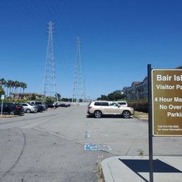

Visited the Bair Island Wildlife Refuge and Trail on a Sunday afternoon, and absolutely loved the environment. You can easily walk/run both trails since the longer one is only about 1.7 miles one way (these aren't loops, so you get to an observation deck/platform at the end of each trail, then turn around and backtrack toward the entrance). Flat running trails are all good for me... I ran both, encountering birds and squirrels along the way. On a good day, you may also find a rabbit or two (or jackrabbit, to be exact, which is not the same thing). And it wasn't crowded, like some other parks get during the summer, quite the opposite actually. Sure, you can see and hear the traffic of the 101 freeway, parallel to the trails, but you still get to be among nature with a view of the salt marsh for miles in the distance, a feeling which drowns out the aforementioned noise. The free parking lot (4 hours max) and public restrooms (located at the entrance of the parking lot) add to the convenience and appeal of this place.


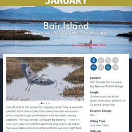

I decided to participate in POST (Peninsula Open Space Trust) hike/trail of the month. January starts off at Bair Island. Living here in the Bay Area for most of my life, I am surprised that I haven't actually been to this trail before. The trail is dirt/gravel and mainly flat. I think my watch recorded 11 feet of elevation, but that just might have been from going up the ramp on the observation deck at the end of the trail. If it rains, the trail is going to be wet with puddles; however, when I went, it had not rained for several days so it was mostly dry with a few muddy spots. This trail is nice as it runs along the bay; however, it also runs parallel to the freeway, and at the beginning of the trail there is major construction currently going on, so not that peaceful when you are thinking of walking/hiking. Overall, I thought it was a nice trail to run along, not many people and I didn't have a problem finding parking.


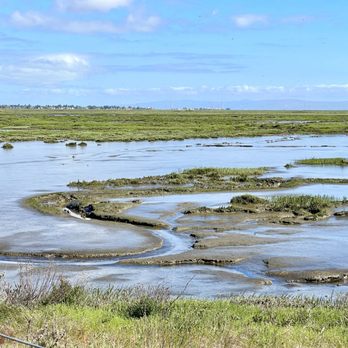
This is the "other side" of the Don Edwards National Wildlife Refuge. I personally prefer the Newark side. The Redwood City side pales in comparison but if you live in this city and don't want to drive to Newark for the better scenery and changes in elevation, then this will do for a daily hike. You'll see the marsh and occasional plane overhead, some water birds, and experience the interesting island concept where it takes a short walk across a bridge and you've set foot on an island. There are a few overlooks but for the most part, the hike will be flat and there's no shade overhead so plan accordingly if you decide to do this hike during the summer.


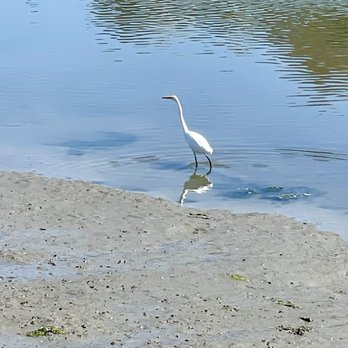
As a result of the arrival of the European immigrants in 18th century , much of the wet lands /marshes in California has been lost (90%) due to agriculture and development. Native American relied on salt, fish , wild games in/around wetlands for food and medicinal sources for thousands of years. Loss of wetlands /marshes has caused many native species to extinct or endangered; Salt Marsh Harvest Mouse, Steelheads , Ridgeway Rail , Red Legged Frogs , Kit Foxes, etc. The refuge, created in 1972, was largely the result of grassroots efforts by the local community to protect the San Francisco Bay ecosystem. Major changes occurred in the San Francisco Bay Area following the California gold rush in 1849, creating a population boom explosive growth and development on sensitive lands surrounding the bay. The newly introduced salt industry, for example, converted tens of thousands of acres of salt marsh into commercial salt ponds. Conversion of wetlands to support development continued well into the 20th century, and today, nearly 85% of the bay's original marshes and shorelines have been altered ( read - lost ). Congressman Don Edwards, responding to local citizens who made up the South San Francisco Baylands Planning, Conservation and National Wildlife Refuge Committee, worked with Congress to create the San Francisco Bay National Wildlife Refuge. This group later became the Citizens Committee to Complete the Refuge and in 1988 helped add additional 20,000 acres, doubling the size of the refuge. The Citizens Committee to Complete the Refuge along with other Bay Area organizations work tirelessly to protect and enhance the Bay's remaining wetlands. The refuge was later renamed to Don Edwards San Francisco Bay National Wildlife Refuge in 1995 to honor Congressman Edwards' dedication to the refuge and its mission, which is to preserve and enhance wildlife habitat; protect migratory birds and threatened and endangered species; and provide opportunities for wildlife-oriented recreation and nature study for the surrounding communities. Reference: https://www.fws.gov/refuge/Don_Edwards_San_Francisco_Bay/about.html


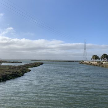
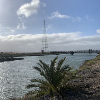
We had a bit of a blip on our way to Bair Island; my driving directions took me to a "Bair Island neighborhood" rather to Bair Island itself. We soon got on the correct road, but we passed the parking lot, which was not clearly marked. Eventually, we parked! I was a bit disappointed at the lack of wildlife on the August day we visited. I give it four stars because I am glad it exists, but the walk was not particularly interesting. Maybe it was the wrong time of year, but the closest I got to wildlife was this hawk-like bird that flew rather close overhead. Beware that dogs are prohibited here!


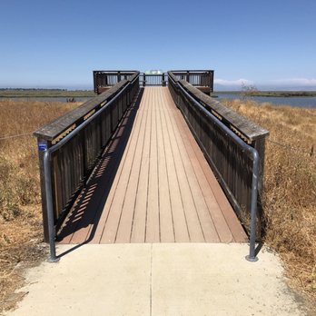
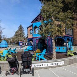
It does seem like sacrilege to complain about a walking trail, doesn't it? I mean what has a trail done to me that would cause such rancor other than the random blister under my foot. Actually, as a conservation effort, Bair Island is exemplary as it is being restored to a tidal marsh to sustain the migrating birds that land there. It's also saving the salt marsh harvest mouse, and who doesn't love a rodent? But as a place to take a walk, how do I put this? OK, it's boring and flat...and kinda loud because it's right next to the 101. You are definitely challenged to feel like you're part of nature. There are two trails from the entrance at the end of a footbridge which is gated to prevent dogs from entering. The one on the left is the longer one, but both end up on platforms where you hope you see something interesting (photo: http://bit.ly/2NBPKM4). I didn't but I wish you better luck. It's a cinch to get here. Just take the Whipple Avenue exit toward the bay and drive on the frontage road until you reach the end on Uccelli Drive. If you think you've mistakenly landed in a condo complex, you're there. There are a few open parking spaces next to the playground. Just walk to the footbridge from there. You'll get FitBit steps but no floors. What can I say? RELATED - Up for a hike? Here are the places around the Bay Area where I have trod: bit.ly/2OsCCsK


Kayaked on New Year's Day and thought I was going to be the only one out there. Alas, I saw several other kayaks as well as other water craft including a racing shell and a paddle boarder. Although the place is huge, be careful of shallow areas. Apparently, the current is not as strong during high and low tides; therefore, Peninsula Open Trust recommends consulting a tide chart. If you like to watch birds, bring your binoculars. The egrets are particularly shy. Address of port of Redwood City: 601 Chesapeake Dr, Redwood City, CA Launch Fee is $5, CASH only, no change, pay at machine, leave ticket on dash Tide Chart: https://tidesandcurrents.noaa.gov/noaatidepredictions.html?id=9414523&legacy=1


We road our bikes here and it's a nice place to do a short hike/walk. It's off highway 101. There isn't much shady area. There is a lot to park near the apartments and you can walk across the street to get to this trail. I liked how the community got together to save this trail . See my photos.


Bair It All Located in Redwood City, this former salt pond has now been rehabilitated into a 3k-acre tidal marsh area that lies within the Don Edwards SF Bay National Wildlife Refuge. The Good: * Easy walking trails that are good for any and all ages. * Lots of benches to stop and admire the views. * Free to visit. * Parking lot (more on this below). * Restroom in parking lot (more on this below). * Great place to see shorebirds and just birdwatching in general. * Good for plane spotting as the marsh is right in the flight line for the nearby San Carlos Airport. * Bikes OK. The Meh: * Lots of mosquitoes. * Parking lot is suspect as f***. Make sure to not leave any valuables in sight, and lock up! * No dogs allowed. * Only about 3.5 miles of trails, and it's an out and back. The Ugly: * The park is in disrepair, as the restroom was not operational on our visit and one of the main observation decks was closed. * Zero shade on the trail. Not ideal on warm days. Conclusion: Normally I love these types of parks because they're a nice, easy walk with tons of nature, but this place just didn't do it for me. Between the noise of the freeway, general disrepair of the place, and suspect location, I doubt we'll be back. read more


3 years ago
Visited the Bair Island Wildlife Refuge and Trail on a Sunday afternoon, and absolutely loved the environment. You can easily walk/run both trails since the longer one is only about 1.7 miles one way (these aren't loops, so you get to an observation deck/platform at the end of each trail, then turn around and backtrack toward the entrance). Flat running trails are all good for me... I ran both, encountering birds and squirrels along the way. On a good day, you may also find a rabbit or two (or jackrabbit, to be exact, which is not the same thing). And it wasn't crowded, like some other parks get during the summer, quite the opposite actually. Sure, you can see and hear the traffic of the 101 freeway, parallel to the trails, but you still get to be among nature with a view of the salt marsh for miles in the distance, a feeling which drowns out the aforementioned noise. The free parking lot (4 hours max) and public restrooms (located at the entrance of the parking lot) add to the convenience and appeal of this place. read more
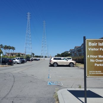


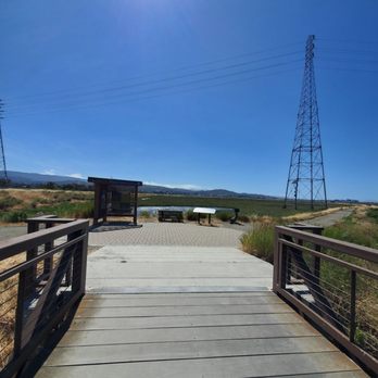


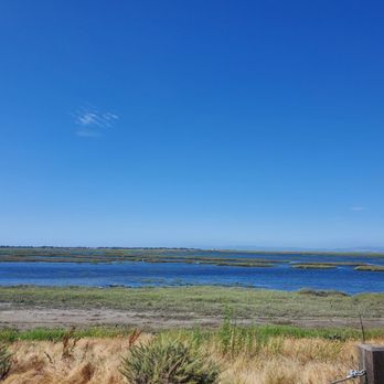


What an enjoyable, flat dirt road meandering through a protected marsh area. 2 wooden lookouts at each end with 2 different entrances. There is a dedicated parking lot with restrooms. Located right next to a marina and condos. No shade. read more


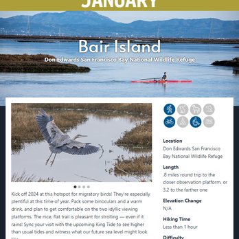
I decided to participate in POST (Peninsula Open Space Trust) hike/trail of the month. January starts off at Bair Island. Living here in the Bay Area for most of my life, I am surprised that I haven't actually been to this trail before. The trail is dirt/gravel and mainly flat. I think my watch recorded 11 feet of elevation, but that just might have been from going up the ramp on the observation deck at the end of the trail. If it rains, the trail is going to be wet with puddles; however, when I went, it had not rained for several days so it was mostly dry with a few muddy spots. This trail is nice as it runs along the bay; however, it also runs parallel to the freeway, and at the beginning of the trail there is major construction currently going on, so not that peaceful when you are thinking of walking/hiking. Overall, I thought it was a nice trail to run along, not many people and I didn't have a problem finding parking. read more


2 years ago
This is the "other side" of the Don Edwards National Wildlife Refuge. I personally prefer the Newark side. The Redwood City side pales in comparison but if you live in this city and don't want to drive to Newark for the better scenery and changes in elevation, then this will do for a daily hike. You'll see the marsh and occasional plane overhead, some water birds, and experience the interesting island concept where it takes a short walk across a bridge and you've set foot on an island. There are a few overlooks but for the most part, the hike will be flat and there's no shade overhead so plan accordingly if you decide to do this hike during the summer. read more





As a result of the arrival of the European immigrants in 18th century , much of the wet lands /marshes in California has been lost (90%) due to agriculture and development. Native American relied on salt, fish , wild games in/around wetlands for food and medicinal sources for thousands of years. Loss of wetlands /marshes has caused many native species to extinct or endangered; Salt Marsh Harvest Mouse, Steelheads , Ridgeway Rail , Red Legged Frogs , Kit Foxes, etc. The refuge, created in 1972, was largely the result of grassroots efforts by the local community to protect the San Francisco Bay ecosystem. Major changes occurred in the San Francisco Bay Area following the California gold rush in 1849, creating a population boom explosive growth and development on sensitive lands surrounding the bay. The newly introduced salt industry, for example, converted tens of thousands of acres of salt marsh into commercial salt ponds. Conversion of wetlands to support development continued well into the 20th century, and today, nearly 85% of the bay's original marshes and shorelines have been altered ( read - lost ). Congressman Don Edwards, responding to local citizens who made up the South San Francisco Baylands Planning, Conservation and National Wildlife Refuge Committee, worked with Congress to create the San Francisco Bay National Wildlife Refuge. This group later became the Citizens Committee to Complete the Refuge and in 1988 helped add additional 20,000 acres, doubling the size of the refuge. The Citizens Committee to Complete the Refuge along with other Bay Area organizations work tirelessly to protect and enhance the Bay's remaining wetlands. The refuge was later renamed to Don Edwards San Francisco Bay National Wildlife Refuge in 1995 to honor Congressman Edwards' dedication to the refuge and its mission, which is to preserve and enhance wildlife habitat; protect migratory birds and threatened and endangered species; and provide opportunities for wildlife-oriented recreation and nature study for the surrounding communities. Reference: https://www.fws.gov/refuge/Don_Edwards_San_Francisco_Bay/about.html read more





We had a bit of a blip on our way to Bair Island; my driving directions took me to a "Bair Island neighborhood" rather to Bair Island itself. We soon got on the correct road, but we passed the parking lot, which was not clearly marked. Eventually, we parked! I was a bit disappointed at the lack of wildlife on the August day we visited. I give it four stars because I am glad it exists, but the walk was not particularly interesting. Maybe it was the wrong time of year, but the closest I got to wildlife was this hawk-like bird that flew rather close overhead. Beware that dogs are prohibited here! read more


It does seem like sacrilege to complain about a walking trail, doesn't it? I mean what has a trail done to me that would cause such rancor other than the random blister under my foot. Actually, as a conservation effort, Bair Island is exemplary as it is being restored to a tidal marsh to sustain the migrating birds that land there. It's also saving the salt marsh harvest mouse, and who doesn't love a rodent? But as a place to take a walk, how do I put this? OK, it's boring and flat...and kinda loud because it's right next to the 101. You are definitely challenged to feel like you're part of nature. There are two trails from the entrance at the end of a footbridge which is gated to prevent dogs from entering. The one on the left is the longer one, but both end up on platforms where you hope you see something interesting (photo: http://bit.ly/2NBPKM4). I didn't but I wish you better luck. It's a cinch to get here. Just take the Whipple Avenue exit toward the bay and drive on the frontage road until you reach the end on Uccelli Drive. If you think you've mistakenly landed in a condo complex, you're there. There are a few open parking spaces next to the playground. Just walk to the footbridge from there. You'll get FitBit steps but no floors. What can I say? RELATED - Up for a hike? Here are the places around the Bay Area where I have trod: bit.ly/2OsCCsK read more




5 years ago
By no means is this the most scenic part of the Bay Area. This is a hike around a saltwater marsh on reclaimed land. It was supposed to be a hike, however I ended up running a good part of the 4.4 miles. It was more like a run-walk. Day 2 of being very nice to myself. read more


Kayaked on New Year's Day and thought I was going to be the only one out there. Alas, I saw several other kayaks as well as other water craft including a racing shell and a paddle boarder. Although the place is huge, be careful of shallow areas. Apparently, the current is not as strong during high and low tides; therefore, Peninsula Open Trust recommends consulting a tide chart. If you like to watch birds, bring your binoculars. The egrets are particularly shy. Address of port of Redwood City: 601 Chesapeake Dr, Redwood City, CA Launch Fee is $5, CASH only, no change, pay at machine, leave ticket on dash Tide Chart: https://tidesandcurrents.noaa.gov/noaatidepredictions.html?id=9414523&legacy=1 read more


4 years ago

7 years ago
We road our bikes here and it's a nice place to do a short hike/walk. It's off highway 101. There isn't much shady area. There is a lot to park near the apartments and you can walk across the street to get to this trail. I liked how the community got together to save this trail . See my photos. read more


16 years ago
Right now you can't hike on Inner Bair Island and the Whipple entrance is closed. But you can still get to a trail to view the Island and Smith Slough from the Whipple entrance if you're walking or on a bike. You can park and come to the trail from the other side if you go further down Bair Island Road to the public shore access trail. From the trail there are a couple of natural history information signs that highlight the plants and bird life of the wetlands. You can see egrets, great blue herons, cormorants, Canada geese, Western grebes, terns, and lots of little sandpipers from the trail. Also some large trucks bringing dredged up harbor mud to fill in the central salt pond of Inner Bair -- so that birds won't nest there right in the path of the aerial approach to San Carlos airport. For a better view of Middle and Outer Bair islands you will have to go by boat! read more


8 years ago

9 years ago

10 years ago

10 years ago


19 years ago

9 years ago
8 years ago
9 years ago
11 years ago
10 years ago
More info about Bair Island
Whipple Ave And E Bayshore Rd
Redwood City, CA 94062
Directions
Hours
Outdoor Amenities
Ask the Community - Bair Island
Review Highlights - Bair Island
You might also consider



















Why does Yelp recommend reviews?

Bair Island - parks - Updated August 2026
Best of Redwood City
People found Bair Island by searching for…
Fishing Spots in Redwood City, CA
Walking Trails in Redwood City, CA
Beautiful Views in Redwood City, CA
Hiking Trails in Redwood City, CA
Running Trails in Redwood City, CA
Scenic Drive in Redwood City, CA
Campgrounds in Redwood City, CA
Sunrise View in Redwood City, CA
Watch Sunset in Redwood City, CA
Attractions in Redwood City, CA
Scenic Views in Redwood City, CA
Free Parking in Redwood City, CA
Things to Do With Kids in Redwood City, CA
Places to Take Pictures in Redwood City, CA
Playgrounds in Redwood City, CA
Scenic Places to Walk in Redwood City, CA
Dog Swimming in Redwood City, CA
Swimming Holes in Redwood City, CA
Sunset Views in Redwood City, CA
Trending Searches in Redwood City, CA
Blueberry Picking near Bair Island
Cliff Jumping near Bair Island
Cruising Spots near Bair Island
Dog Friendly Beaches near Bair Island
Flower Fields near Bair Island
Indoor Dog Park near Bair Island
Kids Activities Indoor near Bair Island
Peach Picking near Bair Island
Public Running Track near Bair Island
Rainy Day Activities near Bair Island
Shopping Malls near Bair Island
Sports Card Shops near Bair Island
Swimming Holes near Bair Island
Things To Do On A Rainy Day near Bair Island
Things To Do With Kids near Bair Island
Trading Card Shops near Bair Island
Browse Articles
Browse Nearby
BEST of Redwood City, California Coffee near Bair Island
BEST of Redwood City, California Restaurants near Bair Island
BEST of Redwood City, California Playgrounds near Bair Island
BEST of Redwood City, California Things to Do near Bair Island
BEST of Redwood City, California Breakfast near Bair Island
BEST of Redwood City, California Picnic Areas near Bair Island
BEST of Redwood City, California Star Gazing near Bair Island
BEST of Redwood City, California Campgrounds near Bair Island
BEST of Redwood City, California Sightseeing near Bair Island
Browse Brands
Related Searches in Redwood City, CA
Best Off Leash Dog Parks in Redwood City, California
Best Parks for Parties and Events in Redwood City, California
Best Water Parks for Kids in Redwood City, California
Check Out Great Playgrounds in Redwood City, California
Discover Baseball Fields Around Redwood City, California
Discover Fun Toddler Parks in Redwood City, California for Your Little One
Discover Lakes & Ponds to Explore in Redwood City, California
Discover Popular Bike Trails in Redwood City, California
Discover Popular Photo Spots in Redwood City, California
Discover Soccer Fields in Redwood City, California Near You
Discover Top Nature Parks to Visit in Redwood City, California
Discover Top State Parks to Visit in Redwood City, California
Discover Walking Parks in Redwood City, California Near You
Discover the Best Beaches in Redwood City, California
Discover the Best Kids Park Spots in Redwood City, California
Enjoy Scenic Places to Walk in Redwood City, California
Enjoy the Best Picnic Spots and Ideas in Redwood City, California
Enjoy the Best Walking Trails in Redwood City, California
Explore Free Picnic Areas Around Redwood City, California
Explore Fun Activities to Do in Redwood City, California
Explore Parks With Pull Up Bars in Redwood City, California
Explore Picnic Parks Near Redwood City, California
Explore Popular Campgrounds Near Redwood City, California
Explore Popular Kids Parks Throughout Redwood City, California
Explore Popular Picnic Areas Around Redwood City, California
Explore Popular RV Parks Around Redwood City, California
Explore Scenic Lakes to Visit in Redwood City, California
Explore Top Dog Parks in Redwood City, California Near You
Explore Top Water Parks in Redwood City, California Today
Find Great Places to Feed Ducks in Redwood City, California
Find Parks and Recreation Activities in Redwood City, California
Find Top Dog Friendly Parks to Visit in Redwood City, California
Find Top Skate Parks in Redwood City, California for All Skill Levels
Find a Kids Birthday Party Park in Redwood City, California
Find a Park With BBQ Pits in Redwood City, California
Find the Best Parks BBQ Grills in Redwood City, California
Find the Best Parks for Picnics in Redwood City, California
Find the Best Playgrounds to Visit in Redwood City, California
Have Fun at a Splash Pad in Redwood City, California
Locate Tennis Courts Around Redwood City, California
Picnic Areas With BBQ Pits Available in Redwood City, California
Play at a Splash Pad Park in Redwood City, California
Popular Picnic Spots to Visit in Redwood City, California
Relax in Parks With Shade Areas in Redwood City, California
Safe and Fun Parks for Kids in Redwood City, California
Top Hiking Trails to Explore in Redwood City, California
Top Playgrounds for Kids to Enjoy in Redwood City, California
Top Running Trails to Explore in Redwood City, California


