
Cedar Mountain Battlefield Photos


More like Cedar Mountain Battlefield
Recommended Reviews - Cedar Mountain Battlefield
Start your review...

Reviews With Photos

So the kids and I have been hitting all the Civil War trails and sites we can this year. We live in a truly historic area. (and a beautiful one). This trail we walked last weekend. Moderate hike. shady and sunny spots. Tall grass but path well maintained. Lots of beautiful flower fields buzzing with bees and lovely golden butterflies. Sounds like a fairy tale I know and what a beautiful site for the Memorial. Paths intersect and take you to Monuments, Grave stones ETC. Benches placed in shady spots for lunches or what have you. Notes - porta potties- yes Resting benches - yes Trash cans - no - Please pick up after yourself. Free to roam - No, this location is backed to private properties/multiple. You are even parking in the driveway of a residence. Please be considerate of the land and land owner. Enjoy your experience! Give thought to the battle.

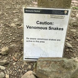
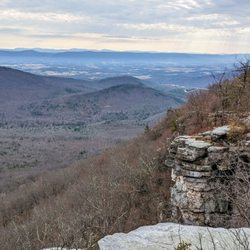
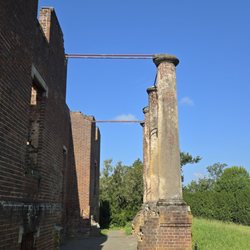
Throw a rock near Culpeper, Virginia and you'll hit a landmark of Civil War significance. Thanks to a non-profit that fights to preserve the country's earliest memories, Cedar Mountain Battlefield is a place for all to visit for free. Stopping by while at a nearby cabin, here's my experience: 1) Parking: Follow the signs to free parking near the visitor center. By the picnic table in the yard, you'll see a trailhead with maps and info on the battlefield. Follow the trails to find old gravestones and places where the battle took place. 2) Points of Interest: Markers along the trail talk about the significance of the battle. Confederate General Stonewall Jackson drew his sword during this battle for the only time during the Civil War. It was also his last battle led by him. 3) Amenities: There are benches along the trails looking out over the fields. Two cannons can be seen near one field with two outhouses nearby as the only restrooms on the grounds. It is worth noting that three historic markers put up by the Culpeper Calvary Museum clearly glorify the Confederacy over the Union. Even though erected almost 100 years ago, the fact that they remain standing shows the gap between an equitable society in this country. read more


Enjoyed the trails today with my hiking partner, Pookie-the-dog. The trails are in great shape, with mulch throughout the wooded area. The trails are well marked. There are historic gravesites, markers, and memorials. Today the site was quiet, with only 1 other hiking couple that after they left the visitor center parking, I didn't cross paths with them again. The caretaker was welcoming and engaged in lively conversation and recommended other nearby points of interest as well. read more


11 years ago
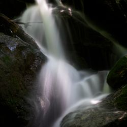
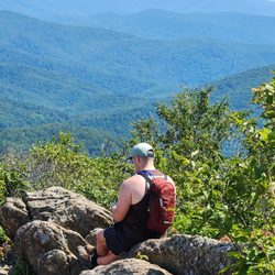
I'd been to the nearby battlefields of Kelly's Ford & Brandy Station, but never knew this one even existed until recently! It's a shame because this offers an actual hike and good number of historical markers. The battle was fought in Aug 1862, when the Union tried to push south while Lee was distracted with the Peninsula campaign. Despite an early good start, the Confederates ultimately prevailed, setting the stage for the Second Battle of Manassas not long afterwards. Once again, Gen Jackson saved the day for the rebels. The hike is less than 2 miles long, but seemed to take longer because I kept stopping to read the markers. It starts at an empty field where the initial artillery duel took place. The path consists of mowed hiking trails thru the forest. One stop is a graveyard for a Confederate who died during the battle, alongside and a Union soldier and his family who died years later (don't know what his connection to this place is). http://www.civilwar.org/battlefields/cedar-mountain.html read more


11 years ago
So the kids and I have been hitting all the Civil War trails and sites we can this year. We live in a truly historic area. (and a beautiful one). This trail we walked last weekend. Moderate hike. shady and sunny spots. Tall grass but path well maintained. Lots of beautiful flower fields buzzing with bees and lovely golden butterflies. Sounds like a fairy tale I know and what a beautiful site for the Memorial. Paths intersect and take you to Monuments, Grave stones ETC. Benches placed in shady spots for lunches or what have you. Notes - porta potties- yes Resting benches - yes Trash cans - no - Please pick up after yourself. Free to roam - No, this location is backed to private properties/multiple. You are even parking in the driveway of a residence. Please be considerate of the land and land owner. Enjoy your experience! Give thought to the battle. read more


4 years ago
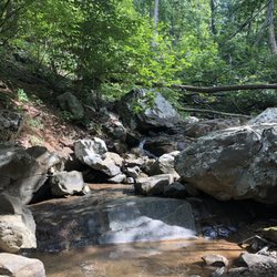
For years I have driven on Route 15 and seen the sign for this battlefield. I was always in a rush and never stopped. Yesterday, I decided to visit. I wish I had visited sooner. There is a small parking area on someone's property tucked away around a bend from Route 15. From there you take a short trail through the woods and arrive at the historic signs that tell you about the battle. There is a big field to your right that abuts Route 15. Head out on the scenic trail to your left that winds through old trees with views of a farm. The trail is about 1.5 and is peaceful and an easy hike. There are a couple of benches on the trail. I enjoyed my hike here more than in the battlefields further North because it was quieter. The other ones have lots of airplane noise and often noise from nearby roads. There are no facilities here just an outhouse that I avoided. This battlefield makes for a nice 1-2 meandering casual hike. You could see most of in in about a half an hour at a fast past though. Worth the stop even if it is a quick one. read more


More info about Cedar Mountain Battlefield
Ask the Community - Cedar Mountain Battlefield


Cedar Mountain Battlefield - hiking - Updated July 2026
Best of Rapidan
People found Cedar Mountain Battlefield by searching for…
Browse Nearby
Browse Brands
Browse Articles
People who viewed Cedar Mountain Battlefield also viewed
Lake Pelham Connector Trail - Yowell Park Entrance
2 reviews
Old Rag Mountain
137 reviews
White Oak Canyon Trail
27 reviews
Dark Hollow Falls Trail
21 reviews
Rapidan Camp Area
3 reviews
John Marshall Birthplace Park
2 reviews
Burial Place of Stonewall Jackson's Arm
6 reviews
Skyline Drive
97 reviews
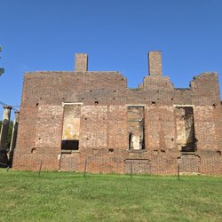
Barboursville Plantation Ruins
3 reviews
Lake Arrowhead Recreation Park
22 reviews