Cancel

    Open app

    Search

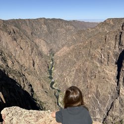
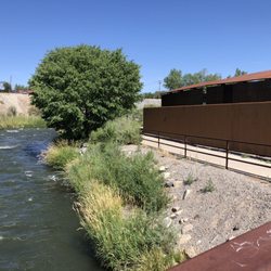
    Chasm View Nature Trail

    5.0 (2 reviews)

    Chasm View Nature Trail Photos
    Recommended Reviews - Chasm View Nature Trail

    Your trust is our priority, so businesses can't pay to alter or remove their reviews. Learn more about reviews.
    Yelp app icon
    Browse more easily on the app
    Review Feed Illustration

    11 months ago

    Helpful 2
    Thanks 0
    Love this 2
    Oh no 0

    9 months ago

    Helpful 0
    Thanks 0
    Love this 0
    Oh no 0

    Verify this business for free

    Get access to customer & competitor insights.

    Verify this business

    Black Canyon Of The Gunnison National Park - Sunkissed gamble oak.

    Black Canyon Of The Gunnison National Park

    4.7(97 reviews)
    2.3 mi

    Lotta rock. If you like rocks, this is the place to be. Despite the unfortunate fire last year,…read morethey still had a lot of cool rock

    I didn't have the highest expectations going into our trip to Black Canyon of the Gunnison National…read morePark. I didn't know too much about the park and was a bit disappointed that we had to nix the plans to do our large hike in the North Rim of the park. That being said, BCGNP far surpassed all expectations on just our very first overlook - Tomichi Point - within minutes of driving into the South Rim. I was not prepared for the sheer beauty of the canyons. The South Rim is so very different from the North Rim, so if you only have time to go to one, make sure to do your research. The South Rim is much more developed, more popular, has plenty of tiny hikes and overlooks, and brings the easy, classic beauty. The South Rim drive is an easy 7 miles and features 12 overlooks with the longest hike to the overlook being about 0.5 of a mile. And most of the hikes are more like walks. Stunning views, perfect for sunset. You'll also find the BCGNP visitor center on the South Rim drive. The North Rim is much more underdeveloped and less visited. We visited in the late afternoon and only ran into one other group of people while driving their scenic North Rim drive. I believe it's about 4.5 miles, and it is unpaved - that being said, we drove it in a Toyota Corolla without any issues. These overlooks are equally gorgeous but give you a different perspective of the canyon. You'll find a lot of the bigger hikes in the North Rim. While we weren't able to fit one into our schedule, we did do part of the North Vista Trail to see Exclamation Point - wonderful hike, wish we had been able to do the full trail. Overall, I wasn't sure what I was expecting when I visited Black Canyon of the Gunnison, but it definitely wasn't how breathtakingly beautiful this park is. 100% worth a stop, and if all you do is stop at their overlooks, you will still get to experience so much beauty.

    Photos
    Black Canyon Of The Gunnison National Park
    Black Canyon Of The Gunnison National Park - Just another beautiful day of snowshoeing in our backyard!

    Just another beautiful day of snowshoeing in our backyard!

    Black Canyon Of The Gunnison National Park - Ice crystal formations along the trail!

    See all

    Ice crystal formations along the trail!

    Handies Peak

    Handies Peak

    5.0(4 reviews)
    36.4 mi

    Handies peak is a beautiful and easy class 1 in the San Juan's. My group and I did this one the day…read moreafter Redcloud & Sunshine, so it was nice to have a shorter day. It's less than 3K elevation and I clocked 6 miles round trip, granted the elevation builds quickly during those 3 miles to the summit. It was so beautiful that my two friends declared it was one of their top three favorite 14ers that they've done! The view at the top is stunning, with gorgeous scenery and breathtaking vistas along the way. You can make a very short detour and even visit a lovely alpine lake. The hardest part of the hike is accessing it. We were already parked along cimaron pass at our campsite, but it took an additional 40 minutes or so to drive from Redcloud trailhead to Handies. I made it in my Crosstrek but there were a couple of truly sketchy spots and a very very bumpy ride. No bathrooms at the trailhead and not much coverage to duck into the woods so keep that in mind. A must do for every 14er fanatic or ambitious hiker!

    Handies peak! I have dreamed about hiking this one for several years in the summer when…read morewildflowers are blooming but distance kept me away. Planned a 5 day stay up in the lake city/san juan area so we could knock it out. I finally did it and it did not disappoint. We took the Handies via grizzly gulch which is the non standard route and it is longer than the american basin route. The road getting to grizzly gulch from lake city was rough. lots of pot holes and jutting rocks. Also narrow stretches with drop offs on the side. ATVs and jeeps like to zip down the road at the speed of light and there are not a lot of pull offs along the way. I made it with my honda pilot but it was SLOW going. plan extra time for this road. (cimmaron pass) We were initially going to go to american basin but after the long drive to get to grizzly gulch i just didn't have it in me to do another 4-5 miles on even rougher road. There is a bathroom at the Trailhead. There are no trash cans or dog poop bags however so be sure to pack out whatever you pack in (including your dog poop)! This trail is a class 1. Though that does not mean it is "easy" by any means. However we did enjoy the first half or little more of the trail that had dirt trails and step ups. The trail was very well maintained. Currently in july there are fields of lovely wildflowers that are so abundant and in a variety of colors. Also there is a stream for a chunk of it that you will walk near. As you ascend further up, it begins to get rocky and there is scree near the top. As you merge on to the peak, you will meet up with all the hikers from american basin standard approach which is substantially more. So the peak may seem a little crowded. On our trek, we only saw maybe 6 other people. The flowers along the way and then the view at the top was all breathtaking! So thankful to have finally gotten to complete this peak!

    Photos
    Handies Peak
    Handies Peak
    Handies Peak

    See all

    Marble Point

    Marble Point

    4.0(1 review)
    42.6 mi

    "Experience this 4.4-mile out-and-back trail near Carbondale, Colorado. Generally considered a…read morechallenging route, it takes an average of 3 h 41 min to complete. This trail is great for backpacking and hiking, and it's unlikely you'll encounter many other people while exploring. The best times to visit this trail are July through October. Dogs are welcome and may be off-leash in some areas. This is a steep hike with spectacularly rewarding views of the Ragged Mountain Range. Start at Yule Creek trailhead. At about half mile at the Y, stay right until you reach a 4 way intersection (with Anthricite). Go straight and start climbing. Once you reach the ridge, follow the to the highest point; that is Marble Point. The ridge trail continues on to Raspberry Creek Loop at the second valley." 1. be sure to have the trail mapped before going. There is no service in marble. (there is no service from carbondale to paonia. So be sure to have all trails pulled up and also directions also pulled up or screen shotted. 2. There is not really a parking lot. Its more like road side parking and its not really obvious where the trailhead is. There are not any signs. Its only a handful of spots. 3. There are no bathrooms or dog poop bags or trash cans. Be sure to plan on packing out what you pack in (including trash, dog poop. human waste......) 4. The trail is remote. The weeds are tall in areas if you struggle with allergies you may want to wear long pants. 5. It is definitely steep! 6. There is a small sign on a tree where the trail forks. Watch for that or you will end up on the wrong trail. 7. The beginning of the trail is in rough shape. You might want some poles for it. Beautiful view at the top! Was a steep climb but worth it! Hung out at the top for a bit and just took it all in. this area is so lovely.

    Ouray Perimeter Trail - View from the west near Fellin Park

    Ouray Perimeter Trail

    4.1(7 reviews)
    37.8 mi

    Did the entire Perimeter Trail the other day...clocked 6.2 miles in just under 4 hours…read more Started in the am at the trailhead located in the parking lot across from the Ouray Visitor's Center (which I highly recommend). You'll understand as you begin your final descent. As you start your initial ascent and climb the wood stairs into the hillside, enter the cliff path...a .8 mile slightly narrower trail than I'd prefer and a drop-off...but hey, the views are stunning! You can see the Ouray Hot Springs and more! As you keep on trekkin' on you'll start to "hear" before you make it to the gorgeous Cascade Falls!!! Chill, explore...even hike up behind the falls if that's your thing! I think I was pretty "ok" until we passed through the tunnel after the upper Box Canyon Bridge. We almost took a bail-out trail back into town along the way but persevered. There are actually a few bail-outs along the trail. Anyway, there were some sketchy narrow, steep, rocky-dusty-slidy, drop-off sections along the trail that gave me the heebie-jeebies. If you have a fear of heights, this may not be for you. For the majority of hikers out there I'm sure it's easy, but nonetheless make sure you go prepared. 1. Depending on what time you hike, be sure to eat a healthy meal before you go and bring some extra snacks just in case. 2. Signage isn't the best and is lacking "you are here", so I'd recommend taking a photo of the trail map before you head out. 3. Staying properly hydrated is key along the trail. If you've got a camelback that's great! 4. Take breaks when needed and don't feel pressured by any of your overzealous hiking buddies...it's supposed to be fun, safe and not a competition. 5. A walking stick or trekking poles can prove very helpful! Many people leave sticks at the trailhead(s). If you use one be sure to leave it behind for the next person. 6. Wear appropriate shoes for hiking. Yeah some peeps can hike in Croc's or Chaco's, but not highly recommended. Enjoy the trail, be safe, and take some pix! The views are beautiful! Be Happy Outside!

    This is a must do hike, plan to take about 5 hours or more if you take side trips. You will have…read moregreat views of the city, mountain ranges on all sides, Canyon views, waterfalls, an aspen grove, a tunnel, various bridges, some narrow heart pumping areas on the west side, and views of the rock climbers along the via Ferrata

    Photos
    Ouray Perimeter Trail
    Ouray Perimeter Trail
    Ouray Perimeter Trail

    See all

    Chasm View Nature Trail - hiking - Updated May 2026

    Loading...
    Loading...
    Loading...