Handies Peak Photos


More like Handies Peak
Recommended Reviews - Handies Peak
Start your review...



3 years ago
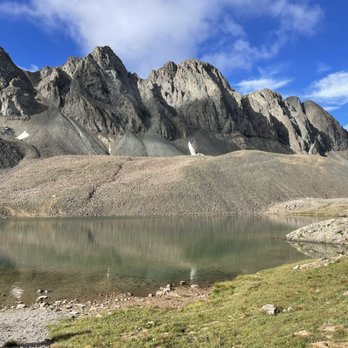
Handies peak is a beautiful and easy class 1 in the San Juan's. My group and I did this one the day after Redcloud & Sunshine, so it was nice to have a shorter day. It's less than 3K elevation and I clocked 6 miles round trip, granted the elevation builds quickly during those 3 miles to the summit. It was so beautiful that my two friends declared it was one of their top three favorite 14ers that they've done! The view at the top is stunning, with gorgeous scenery and breathtaking vistas along the way. You can make a very short detour and even visit a lovely alpine lake. The hardest part of the hike is accessing it. We were already parked along cimaron pass at our campsite, but it took an additional 40 minutes or so to drive from Redcloud trailhead to Handies. I made it in my Crosstrek but there were a couple of truly sketchy spots and a very very bumpy ride. No bathrooms at the trailhead and not much coverage to duck into the woods so keep that in mind. A must do for every 14er fanatic or ambitious hiker! read more



4 years ago
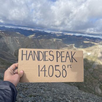
Handies peak! I have dreamed about hiking this one for several years in the summer when wildflowers are blooming but distance kept me away. Planned a 5 day stay up in the lake city/san juan area so we could knock it out. I finally did it and it did not disappoint. We took the Handies via grizzly gulch which is the non standard route and it is longer than the american basin route. The road getting to grizzly gulch from lake city was rough. lots of pot holes and jutting rocks. Also narrow stretches with drop offs on the side. ATVs and jeeps like to zip down the road at the speed of light and there are not a lot of pull offs along the way. I made it with my honda pilot but it was SLOW going. plan extra time for this road. (cimmaron pass) We were initially going to go to american basin but after the long drive to get to grizzly gulch i just didn't have it in me to do another 4-5 miles on even rougher road. There is a bathroom at the Trailhead. There are no trash cans or dog poop bags however so be sure to pack out whatever you pack in (including your dog poop)! This trail is a class 1. Though that does not mean it is "easy" by any means. However we did enjoy the first half or little more of the trail that had dirt trails and step ups. The trail was very well maintained. Currently in july there are fields of lovely wildflowers that are so abundant and in a variety of colors. Also there is a stream for a chunk of it that you will walk near. As you ascend further up, it begins to get rocky and there is scree near the top. As you merge on to the peak, you will meet up with all the hikers from american basin standard approach which is substantially more. So the peak may seem a little crowded. On our trek, we only saw maybe 6 other people. The flowers along the way and then the view at the top was all breathtaking! So thankful to have finally gotten to complete this peak! read more


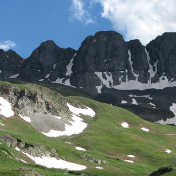
Handies Peak... *sigh*. That's the sound of appreciation for the magnificent beauty that surrounds this mountain. Our just-above-treeline campsite in the gorgeous American Basin was as picturesque as one could possibly wish for as an introduction to the San Juans in July 2011. My jaw dropped when we emerged from the trees and entered this lush, rolling meadow that is abruptly walled in on the opposite side by a long spine of towering gray rock. Its ruggedness juxtaposed the delicate carpet of wildflowers, and in this basin, there were all kinds: Parry's Clover, Parry's Primrose, Marsh Marigold, Bluebells, Blue Columbine, Whiskbroom Parsley, Wild Candytuft, American Bistort, Larkspur, etc. Up higher towards Sloan Lake, we found Alpine Avens, Alpine Sunflowers, Roseroot, Moss Campion, Silky Phacelia, Dusky Penstemon, Fairy Candelabra... I could go on and on! Handies (14,048ft) was my 23rd Fourteener. The standard route trail is easy to follow as it winds its way past pretty Sloan Lake and crawls up the west-facing slopes. It eventually ascends to heights above the Basin's walls where one would be able to turn around and drink in the spectacular scenery of an endless series of peaks. It's not a long hike, so that'll allow plenty of time for enjoyment. My suggestion is to start early, like 4-4:30AM. Not only will this be safer (see second-to-last paragraph), but you'll be rewarded with an incredible sunrise. "Purple mountain majesties..." - damn straight. I recommend County Road 30 be driven during the day: sections of this dirt road are unforgettable, especially as it narrows into an unguarded shelf road with sheer drops off one side and sheer walls on the other. There is a real danger of driving off the cliff or having a rock tumble down upon you. Once you make it to the Silver Creek/Grizzly Gulch TH, leave lower clearance cars parked here (there is a restroom), or drive up the now rocky and rougher road - but be prepared to pull off. For higher clearance vehicles, shortly ahead is a major stream-crossing where we witnessed a newer-model Subaru Outback having problems. He eventually made it after several attempts of backing up and re-entering, but not without white knuckles, I'm sure. Late season and a drier year like 2012 will probably be much easier. Finally, general notes: Afternoon thunderstorms appear like clockwork in this state during monsoon season, so I suggest hikers plan to BE ABLE TO GET OFF THE SUMMITS BY 10-11AM. Also, dog owners, PLEASE LEASH YOUR DOGS. I am not opposed to dogs on 14ers; HOWEVER, I don't care how friendly or trained they are, over the years I've seen many of these "friendly" but unleashed pets trample willy-nilly on the delicate alpine tundra, take dumps where you can't get pick up after them (human & canine poop does not break down easily above treeline!), trip other hikers, and chase down and even CATCH wildlife (pika, marmot, ptarmigan, etc) which are hardy enough to survive up here but cannot survive your dogs. Thank you. read more


More info about Handies Peak
San Juan Mountain Range
Lake City, CO 81235
Directions
Visit Website
http://www.14ers.com
Hours
Outdoor Amenities







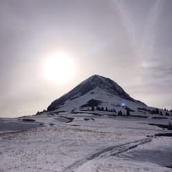
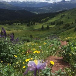
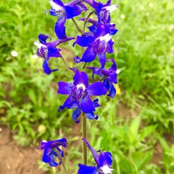
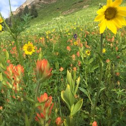



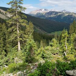


Handies Peak - hiking - Updated September 2026
Best of Lake City
People found Handies Peak by searching for…
Hiking Trails in Lake City, CO
Scenic Overlook in Lake City, CO
Hikes With Dogs in Lake City, CO
Fishing Spots in Lake City, CO
Walking Trails in Lake City, CO
Running Trails in Lake City, CO
Waterfall Hike in Lake City, CO
Dog Friendly Hiking Trails in Lake City, CO
Off Leash Dog Hikes in Lake City, CO
Camping With Showers in Lake City, CO
Public Shower in Lake City, CO
Flower Fields in Lake City, CO
Trending Searches in Lake City, CO
Browse Articles
Browse Nearby
BEST of Lake City, Colorado Parks near Handies Peak
BEST of Lake City, Colorado Restaurants near Handies Peak
BEST of Lake City, Colorado Coffee near Handies Peak
BEST of Lake City, Colorado Things to Do near Handies Peak
BEST of Lake City, Colorado Campgrounds near Handies Peak
BEST of Lake City, Colorado Caves near Handies Peak
BEST of Lake City, Colorado Waterfalls near Handies Peak
BEST of Lake City, Colorado Breakfast near Handies Peak
BEST of Lake City, Colorado Visitor Centers near Handies Peak
Browse Brands
Related Searches in Lake City, CO
Best Fishing Locations and Guides in Lake City, Colorado
Best Nature Trails for Hiking in Lake City, Colorado
Best Places for Horseback Riding in Lake City, Colorado
Best Sledding Spots and Fun in Lake City, Colorado
Best Spots for Star Gazing in Lake City, Colorado
Best Waterfalls and Swimming Holes in Lake City, Colorado
Check Out Off Road Trails in Lake City, Colorado
Discover Popular Bike Trails in Lake City, Colorado
Discover Top Boat Tours in Lake City, Colorado for All Ages
Discover the Best Night Hike Trails in Lake City, Colorado
Enjoy Camping Adventures Around Lake City, Colorado
Enjoy Off Leash Dog Hikes in Lake City, Colorado
Enjoy the Best Walking Trails in Lake City, Colorado
Explore Bike Rentals Throughout Lake City, Colorado
Explore Easy Hikes Perfect for All in Lake City, Colorado
Explore Free Things to Do Around Lake City, Colorado
Explore Popular Campgrounds Near Lake City, Colorado
Explore Popular RV Parks Around Lake City, Colorado
Explore Popular Scenic Overlook Points in Lake City, Colorado
Explore Popular State Park Destinations in Lake City, Colorado
Explore Scenic Lakes to Visit in Lake City, Colorado
Explore Summer Camps for All Ages in Lake City, Colorado
Explore the Best Swimming Holes Around Lake City, Colorado
Family Friendly Hiking With Kids in Lake City, Colorado
Find Exciting Tours to Take in Lake City, Colorado
Find Popular Ziplining Spots Around Lake City, Colorado
Find Top-Rated Waterfalls in Lake City, Colorado Now
Find the Best Scenic View Locations in Lake City, Colorado
Locate a Public Shower Facility in Lake City, Colorado
Must-See Tourist Attractions Around Lake City, Colorado
Perfect Spots to Watch Sunset in Lake City, Colorado
Plan a Scenic Drive Route Near Lake City, Colorado
Popular Fishing Spots to Explore in Lake City, Colorado
Popular Things to Do in Lake City, Colorado
Popular Things to See in Lake City, Colorado
Relax at Natural Hot Springs Near Lake City, Colorado
Safe River Swimming Areas in Lake City, Colorado
Top Hiking Trails to Explore in Lake City, Colorado
Top Paddleboarding Activities in Lake City, Colorado
Top RV Campgrounds to Visit in Lake City, Colorado
Top Running Trails to Explore in Lake City, Colorado
Top Things to Do With Kids in Lake City, Colorado
Top-Rated Camping Sites in Lake City, Colorado
Uncover the Best Secluded Spots Around Lake City, Colorado
Visit Popular BBQ Park Locations in Lake City, Colorado


