Cancel

    Open app

    Search

    Chattahoochre National Forest

    3.5 (2 reviews)

    Chattahoochre National Forest Photos

    More like Chattahoochre National Forest

    Recommended Reviews - Chattahoochre National Forest

    Your trust is our priority, so businesses can't pay to alter or remove their reviews. Learn more about reviews.
    Yelp app icon
    Browse more easily on the app
    Review Feed Illustration
    Photo of Dave B.
    1982
    398
    2588

    6 years ago

    Helpful 28
    Thanks 0
    Love this 24
    Oh no 0

    4 years ago

    Helpful 0
    Thanks 0
    Love this 0
    Oh no 0

    Verify this business for free

    People searched for Hiking 323 times last month within 15 miles of this business.

    Verify this business

    Cohutta Overlook - Street sign

    Cohutta Overlook

    4.7(3 reviews)
    9.8 mi

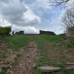
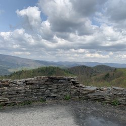
    Found in the Chattahoochee National Forest is the Cohutta Overlook. We paid this hidden in plain…read moresite overlook a visit while driving into the city of Ellijay from Fort Mountain State Park. Being a shade under 5 miles from Fort Mountain along GA-2/GA-52, i'm hesitant to say you can't miss this area because you can. Only a sign and a road going into a wooded area are all that alerts you. I'd advise you to turn on in. This lone road has parking spots along it, and loops around back out to GA-2/GA-52. Very close to the entrance of this road is a very small dirt trail, marked by a small wooden sign listed as "overlook", that goes up. Yea it can be sketchy looking, but if you head on up the trail, you'll be met with a stone circular clearing that gives you a nice view. On a clear day, it's beautiful, and while I wasn't here at night, I can only imagine that stargazing here at night must be out of this world. The actual trail is barely a quarter of a mile and is more a nature walk than any sort of a hike. There are a few wooden/stone stairs, but practically anyone can make it to the top. Very little foot traffic here, as my girlfriend and I had the place to ourselves for several minutes, which was nice. There is no physical address, but there are coordinates entered (34.785218, -84.626853). Nice little find that you probably weren't looking for. Hope you enjoy it as much as we did!

    April 4, 2014, Tony and I was driving the back roads of Georgia on our way to Helen, GA to visit…read morethe Bavarian Village. We passed Fort Mountain State Park, which we love by the way. We visited there a few weeks back, but this time ON TO HELEN....on down the road towards Elijay, Ga I noticed a sign "COHUTTA OVERLOOK"...I said...BRAKE..side trip.. My husband is used to this..that is why I travel the back roads so I can find interesting sites, old homes and buildings and overlooks...I do this quite regularly...Glad I am the driver. I also Brake for Yard Sales...lol I drove out the side road and parked along the narrow ONE WAY road..and we started to climb up the side of the small mountain via a trail and some stairs...its a nice little HEART POUNDING hike..but once you are at the top...oh WOW !!! the View is AWESOME...STUNNING..the adjectives keep going on, on and on...You have to take the 10-15 minutes out of your schedule to check out this great vista. I loved it. I took several photos ( of course ) And AGAIN..I can't say it enough....FREE FREE FREE !!!!

    Photos
    Cohutta Overlook - Overlook from the bottom

    Overlook from the bottom

    Cohutta Overlook
    Cohutta Overlook - The view

    See all

    The view

    Emery Creek Trail

    Emery Creek Trail

    5.0(4 reviews)
    12.8 mi

    I've never had such difficulty following a trail to the point I felt like giving up, but I almost…read moredid today. - - - I've come to face some hard facts in the last few weeks that has put me in a sort of funk. A) I'm getting older B) my body isn't responding the way it used to C) I've gained more weight in the last year than the past 5 years combined D) I'm tired all the time E) Aches & pains have become full time occurrences F) I am slowly losing my will to hike (which I love) or to work out (which I hate) In an effort to lose 60 lbs before the end of the year, I have embarked on a campaign to hike off my weight. This will also include biking when I get down a few more pounds and running once I've shed 40. Why mention that? So you would know my determination to complete this trail was unwavering, although I got lost and bruised trying to follow the nearly impossible to read faded map at the parking entrance. I spent nearly an hour trying to forage my way through the woods once I missed my turn. I lost the trail as I followed the wrong path along Holly Creek and I wasn't the only one! I met two couples also lost that were coming back from where I was headed. It was treacherous, and I lost my footing several times, nearly broke my camera. I should have known the trail shouldn't be this hard, but I kept searching anyway. Scraped, battered and bruised I returned to my car feeling defeated and frustrated. "You're smarted than this Richard! Don't let this trail defeat you" I said to myself. It was then I decided to take one more look at that map, and that's when I noticed a faint white line outlining the trail, which was different that the dark dotted line I was trying to follow before. After I learned the correct path, the trail was much easier to follow. So, here's what you need to know in a nutshell: - - - FOLLOW THE CORRECT TRAIL * From the parking area, follow the trail uphill. Downhill just leads to the river. * You will come to a point in about half a mile where the creek clearly splits. As the path takes you towards the creek, look for a green blaze marker on a tree near the shore. This is where you MUST cross through the creek. * Emery Creek Trail is unlike any other trail I've been on. THERE ARE NO FOOTBRIDGES to cross water. YOU MUST go directly through the creek, which means you might want to wear shorts & water shoes with grip. Most of the crossings will bring the water just a few inches above your ankle, but there was one crossing that was practically thigh high. * The stones in the creek bed are SLIPPERY!!! BE CAREFUL!!! You can easily lose your balance. * You will cross the river again 8 times, not counting a few low volume streams. The trail is clearly visible once you know how to follow it. JUST REMEMBER that each time the trail seems to end at the river, look to the other side and you will see the trail picks up again. Sometimes you will also see a green blaze attached to the tree, but sometimes you will not. * Once you see the old abandoned truck shell, you are about 1 mile from the falls. On the last creek crossing, there will be a sign on the other side directing you to turn left for the falls or keep straight towards the overlook. * Overall it is approximately 2.5 miles one way to the lower falls and 3.1 to the upper falls. I was exhausted and running out of daylight, so I didn't spend the extra energy to see the upper falls. 6.2 miles (round trip) - - - FINAL THOUGHTS What a BEAUTIFUL waterfall. The only truly way to get a good pic will require walking through the pool at the base, but this shouldn't be a problem since you'll already be soaking wet anyway. Although there were several teens lounging near the beginning of the trail, I walked to the falls and back without ever seeing another soul. I must admit that when I got to the final crossing (which I didn't know was the final) I felt defeated. I thought maybe I'd gone too far & missed the falls. I sat on a stone contemplating turning around. I listened for the fall, but could not hear or see it. I decided to cross the creek but had made up my mind I was definitely turning around in 100 yards if I didn't see or hear anything. No sooner than I crossed the creek did I see a hidden sign directing me left to the falls. Within 200 feet of that sign the falls came into view and I could finally hear that familiar waterfall sound. I thought to myself, how many times in my life have I battled to accomplish something, only to feel defeated & turn away because I couldn't see the finish... which was closer than I thought! I love nature because it brings clarity. So, if you are reading this & you are fighting a hard battle that has you feeling defeated... take heart. Our life map can sometimes be hard to read and we make wrong turns that leave us bruised. Even on the right trail we still encounter obstacles that must be overcome. It's a long walk but don't give up. You are closer to reaching your goal than you think! 2018/30

    We loved this trail! Like the other reviews say, be prepared for a moderate intensity and to most…read morelikely get your feet wet. We crossed the river several times by managing to jump the rocks to the other side and several times by just breaking down, taking our shoes off and walking straight through the creek bed. Also once you get to the falls, we had to do what seemed like some vertical rock climbing to get to the upper levels. It can be steep! Ran into a few other hikers on the trail or camping up by the falls but for the most part it was a peaceful hike. Would only have been better if there were a few more trail markers! We were unsure where to cross at some points and had to double back a few times to find the right path. We wore our FitBits and estimated that the trail was approximately 8 miles round trip. I also brought my 12 pound Long hair Chihuahua Loki because he loves to hike. He did great even with his little legs and jumping over fallen trees. He had to be carried over the streams but otherwise he wanted to lead the way! If he can do it, we all can!

    Photos
    Emery Creek Trail
    Emery Creek Trail
    Emery Creek Trail

    See all

    Rich Mountain Wildlife Management Area

    Rich Mountain Wildlife Management Area

    5.0(1 review)
    12.2 mi

    December 13, 2020…read more Approximately 8 miles north of Elijah, GA on highway 76 shortly before entering the town of Cherry Log, you'll turn right onto Rock Creek Connector which takes you to a regular looking two lane road called Rock Creek Rd. Almost immediately upon making the right hand turn on Rock Creek road is the sign "Rich Mountain Wildlife Management Area" and my cell reception (meteo PCS) dropped again. Following Rock Creek Road eventually turns into a crushed gravel road with a stream running next to it and past several farms including a small horse farm. This was my third time to this area in the past month, and thankfully my final time. My goal was to summit Tickanately Bald, a peak that was nearly 4000 ft tall and nestled 0.7 miles south of Rich Mountain. This time I went up FS295 to the end and hiked the rest of the way. The 4000 ft challenge led by the Appalachian Trail Club has less than 10 members who have ever climbed all 32 peaks. And there is a good reason why. You might think...hey, these peaks aren't Mt Everest. What's the big deal? You wouldn't be wrong, however, plan accordingly, if you want to attempt it. Be warned: this activity is not without risk. Climbing walls of vegetation only to encounter brambles that want to cut you, is definitely not everyone's cup of tea. In many cases, there is no good footing. Especially after a rain. Stream crossings or hopping is a skill and balancing yourself across rocks to ford a small spring also is an art form, especially if your heart is pounding out of your chest from climbing 1000 ft. And finally, it's very easy to get yourself turned around. If your phone dies, runs out of battery, or you simply smash it while slipping on a patch of leaves covering a slick rock, well you are SOL, especially without cell phone service to call for help. And better have a back up plan. Don't go out there without a secondary GPS device. Pack water, pack a snack. Put something on your windshield in writing notifying people you are out for a walk and expect to be back. Give someone a clue where you are going too. Weather can change quickly, and the terrain difficult to navigate. While these mountains aren't huge, they are still fairly remote compared to the usual urban park you may have encountered. Plan ahead an be safe! Suffice it to say, I had fantastic weather. (Winter is the best season to get out and conquer your Georgia 4K peaks! And Limited Vegetation). I brought my phone and my GPS watch and a bottle of water and although the distance to the peak was 2.5 miles I gave myself 6-7 miles and plenty of daylight to climb this peak by leaving at noon. FS295 is approximately 4 miles from the beginning of Rock Creek Road and begins steadily up for 2 miles right at the Hunter Checkin Station. It's fairly navigable and I managed it in my Prius at 4-6 mph! There are a couple of nice choice camping spots along the way. At the top, I parked and ran 1.2 miles down to Little Rock Creek. From there I picked a line and started hiking up, and pretty much kept this up for 1300 ft or 1.5 miles till I reached the top of Rich Mt where there is an old chimney from an old house that once was. There is no benchmark (the geodesic marker often installed by the US Forest Service to denote the high point) to be found anywhere on Rich Mountain, unfortunately. There is an old unmaintained trail to the West (facing south) which leads you directly to Tickanately. Unfortunately, I went down the wrong side of Rich Mountain and had to adjust. Translation...climb back up to the top of Tickanately, then stumbled upon the path which I took back to Rich, before descending the same 1300 ft I had climbed----this time it was weeeeehaww and nimbly bounding down hill till I got back to Little Rock Creek. The total elevation gain was 2400 ft in 2.5 hours and my glutes got worked big time. The feeling of accomplishment was overwhelming. Seven 4K peaks done and 25 to go!

    Photos
    Rich Mountain Wildlife Management Area
    Rich Mountain Wildlife Management Area
    Rich Mountain Wildlife Management Area

    See all

    Aska Mining Company - Aska Mining * Blue Ridge, GA

    Aska Mining Company

    4.8(17 reviews)
    18.4 mi

    We had a wonderful gem mining experience! The pricing was very reasonable, and the quality of the…read moregems exceeded our expectations. It was a fun and engaging activity for all ages. The gift shop offered a great selection of unique items, and the staff was friendly, knowledgeable, and happy to answer questions throughout our visit. Overall, it was an enjoyable experience, and we would gladly return.

    We initially found another gem mining place close by. Both options had great reviews but Aska…read moreMining Company was rated slightly higher so we opted for Aska. THE PRICING: I really appreciate that they cater to all budgets by providing a WIDE range of options - buckets range from $10 to $100. We opted for the mid-ish range $35 bucket and crossed our fingers. THE PROCESS: Pick and pay for your bucket, walk outside to find your little sifting station. Shovel a few scoops of sand into the sifter and dip it into the water to separate small particles from large stones, fossils, shark teeth, etc. The gems/fossils seem to magically appear as the small bits of sand is washed away. The kiddos in our group ranged from 11-14 yrs and all left with nearly a full bag of treasures each. A ziplock bag along with a handy reference guide is provided to help identify your goodies as you're sifting. Overall, we were more than pleasantly surprised with the experience and buckets our kiddos selected and sifted through. Yes, the adults in our group even took turns sifting too! We would 100% recommend Aska. I'm kinda curious of the haul you'll get with the $100 bucket - perhaps that's a good option to share with a family/small group. THE STAFF: Friendly and funny. They literally walked us through the process and checked up on us a few times too. THE PARKING: We had no issues parking in front of the store but it's along a main road so keep your kiddos close if they tend to wander & scurry off. Although, you really shouldn't have that problem because I can almost guarantee those kiddos will be engrossed in the sifting. THE SNACKING: Iron Bridge General Store and Cafe is steps away if you're hungry before or after. You can also grab some souvenirs or supplies. TIP: According to their website, they also cater to groups and birthday parties. Enjoy!
    Photos
    Aska Mining Company - Here's what to expect. It's as easy as 1-2-3 !

    Here's what to expect. It's as easy as 1-2-3 !

    Aska Mining Company - A reference of the Gemstones & Fossils you may find as you sort and sift through your bucket

    A reference of the Gemstones & Fossils you may find as you sort and sift through your bucket

    Aska Mining Company - A reference of the Gemstones & Fossils you may find as you sort and sift through your bucket

    See all

    A reference of the Gemstones & Fossils you may find as you sort and sift through your bucket

    Chattahoochre National Forest - hiking - Updated September 2026

    Loading...
    Loading...
    Loading...