Fall Branch Falls Photos


You might also consider

More like Fall Branch Falls
Recommended Reviews - Fall Branch Falls
Start your review...


Reviews With Photos


If you're looking for a short hike this is it but beware plus have proper shoes and take your time! The tree roots come up and are a major trip hazard. My mother fell and broke her arm. The hike up is worth the beautiful view but please be careful.


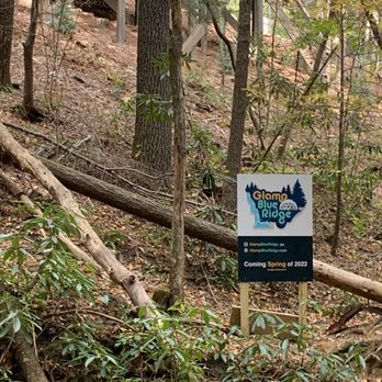
This was a great easy-moderate hike which took about 30/45mins ea way to the waterfalls. The trail has small benches to sit and take breaks. Wear proper shoes and clothes along with water. There is a glammping camp right by the falls too.


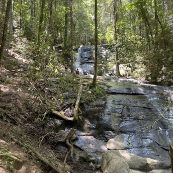
Beautifully vegetated smooth hike. Around the end of September the waterfall was more like water trickling down sloped rocks. If you're looking for a very chill, relaxed hike then this is a nice place to visit. I definitely would not go here to see a beautiful waterfall through. My husband and I brought our 5, 8 and 14 year old and let's just say they were tempted to veer off trail for more thrill. But this really isn't the place for that because off trail, the rocks and dirt slopes are slippery. Be mindful and be safe and enjoy the gorgeous smooth hike.

Beautiful calming falls. The weather was so perfect that I wanted to stay for a couple of hours. But the landscape was short lived there were these glamour tents that made the views appear meh. The walk up to the falls needs tending to the rope to safely guide adventurers are torn off and poses a safety risk. Met plenty of nice people. I will return.


Not a hiker but you want to say you went hiking? This is perfect! It's a short hike, with some incline so you can get a workout. It's not challenging unless you have trouble walking or like my mom, and have bad knees. If you can make it, the falls are a beautiful reward. It's quaint and close, perfect for a couple who wants a selfie spot. I recommend it if you are visiting Blue Ridge and want a quick adventure.

This was such a great hike! I will say the hike is a bit more challenging than some others so keep that in mind. The path is steep and there are many rocks and roots so caution is a must. The falls itself were nice to see. Tall but not a ton of water running (at least not this time of year) but still beautiful. This stop was pretty busy and parking is limited to areas off the side of the road. I wish it were a bit less crowded for some more time and better pictures but can definitely understand. There are a few other longer trails that are accessible from here as well. We took one for a while, this again was pretty steep and had a challenging grade. Bring water and wear good shoes and you'll really enjoy yourself!


Great hike that's not too long.. I think it's 1 mile in and out. Pet friendly trail and parking is on the gravel road and no fees to park. Our Honda Fit made it just fine. We went on a weekday so the foot traffic wasn't bad. Lots of canopy above you during most of the trail so no need to slather on the sunblock:)


Thank you IG for bringing me awareness to this great hike and waterfall! It's easy to get to but you will be on nice gravel road for several miles. The road is narrow but everyone is accommodating and make sure to allow each other to pass. Everyone who we met there were super sweet and outgoing. There is an incline going to the waterfalls but it gets steady and level out a bit towards the end. On the way you see benches to rest if you need to. You never know. There are a total of 3 benches. Once you get to the third bench, you know you are 3/4 there! You can hear the waterfall and there is an observation deck there too so you can check it out. If you want to get close to the waterfalls, you are able to do that also! It's not dangerous or slippery. Makes for great IG photos. It was a great way to start off my Sunday morning. I would definitely come again!! The hike is short. Only 1/2 a mile but 1 mile overall. You could go to Blue Ridge and hang out later. 81/2020


Great local m hiking spot in the Blue Ridge area. It's about a two mile loop up and back so easily done without a pack but definitely bring water and non-slip shoes. The rocks and some of the ledges are a bit steep but we saw a lot of families with kids hike this. Even a mom carrying her toddler with a baby pack did it so suck it up! The falls are so relaxing. We managed to figure out how to get tot the top of the falls and sat with our feet in the freezing water (in May) but it was awesome to be so close to nature. We don't have this kind of nature in south Florida! Sadly, we didn't see any cool wildlife besides a few birds but definitely watch out for poison oak/ivy. There was a few spots that looked questionable. The trail leading up to the falls was a bit narrow in some spots and they do have some benches spaced out along the way. Loved this trail and would absolutely return to hike it again.


We followed Apple maps and were able to find this place no problem! While the roads are both paved and gravel, you shouldn't have any trouble in a car - 4x4 not necessary. Windy roads abound so take it slow on your drive up to the trail. There is a small parking lot at the head of the trail but you are able to park along the side of the road as well. The trail itself is not too challenging and can be completed within 45 minutes, including time to stop and admire the falls. It's about a mile round trip and you just follow the white diamonds painted on the trees to keep the route. While it is dog friendly, the paths are very narrow so keep that in mind for any timid or anxious pups. The falls are pretty and there's a nice landing you can snap some great photos at the bottom. Easy, fun-for-everyone hike in the Blue Ridge area!


Definitely recommend this hike! It's short & easy half mile hike to a beautiful waterfall. Our cabin was in Mineral Bluff, so this hike was about 20 minutes from where we were staying. It's also dog friendly, which was great because a lot of trails in the Blue Ridge area are not.


The drive up was on mostly paved road, but I could see smaller/lower vehicles having some slight difficulties with the maneuverability of the roads. After a winding,scenic ride up the mountain you'll park your car and take off on foot up towards the cascading waterfall. I saw people of all ages making the trek. Wear sneakers or hiking boots for best results.... and find a make shift walking stick to help keep balance. There is a little platform at the foot of the falls where you can take some photos and admire the nature of it all. So glad we made the visit.


We really enjoyed this hike. I took on this hike with my 3 kids and in-laws. It was a beautiful hike with the stream of water as your scenery. The hike is relatively easy and you are met by a beautiful waterfall at the end.


2 months ago
Great trail! Great hike! The longest part is the gravel 5 mile road leading to trail. Fine in our suv but it would have been rough on a car or my smaller suv. read more

3 years ago
Relatively easy hiking trail to a waterfall in the Cherry Log/Blue Ridge area. Kids as young as 3 can walk the trail. It's a pretty short trail to the waterfall approximately 1/2 mile. The cell service is poor getting to the trail so map it out before hand. Along the trail you will see a Glamping camp, which is very cute. Definitely would recommend as a family outing. read more


2 years ago
If you're looking for a short hike this is it but beware plus have proper shoes and take your time! The tree roots come up and are a major trip hazard. My mother fell and broke her arm. The hike up is worth the beautiful view but please be careful. read more


2 years ago
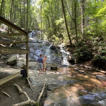
This was a great easy-moderate hike which took about 30/45mins ea way to the waterfalls. The trail has small benches to sit and take breaks. Wear proper shoes and clothes along with water. There is a glammping camp right by the falls too. read more




4 years ago
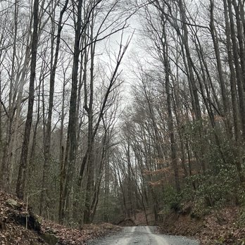
Beautifully vegetated smooth hike. Around the end of September the waterfall was more like water trickling down sloped rocks. If you're looking for a very chill, relaxed hike then this is a nice place to visit. I definitely would not go here to see a beautiful waterfall through. My husband and I brought our 5, 8 and 14 year old and let's just say they were tempted to veer off trail for more thrill. But this really isn't the place for that because off trail, the rocks and dirt slopes are slippery. Be mindful and be safe and enjoy the gorgeous smooth hike. read more


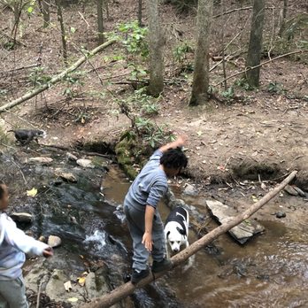

Beautiful calming falls. The weather was so perfect that I wanted to stay for a couple of hours. But the landscape was short lived there were these glamour tents that made the views appear meh. The walk up to the falls needs tending to the rope to safely guide adventurers are torn off and poses a safety risk. Met plenty of nice people. I will return. read more

4 years ago
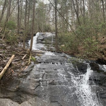
Not a hiker but you want to say you went hiking? This is perfect! It's a short hike, with some incline so you can get a workout. It's not challenging unless you have trouble walking or like my mom, and have bad knees. If you can make it, the falls are a beautiful reward. It's quaint and close, perfect for a couple who wants a selfie spot. I recommend it if you are visiting Blue Ridge and want a quick adventure. read more

5 years ago
This was such a great hike! I will say the hike is a bit more challenging than some others so keep that in mind. The path is steep and there are many rocks and roots so caution is a must. The falls itself were nice to see. Tall but not a ton of water running (at least not this time of year) but still beautiful. This stop was pretty busy and parking is limited to areas off the side of the road. I wish it were a bit less crowded for some more time and better pictures but can definitely understand. There are a few other longer trails that are accessible from here as well. We took one for a while, this again was pretty steep and had a challenging grade. Bring water and wear good shoes and you'll really enjoy yourself! read more
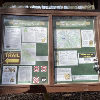
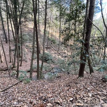

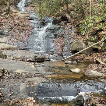


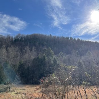


Great hike that's not too long.. I think it's 1 mile in and out. Pet friendly trail and parking is on the gravel road and no fees to park. Our Honda Fit made it just fine. We went on a weekday so the foot traffic wasn't bad. Lots of canopy above you during most of the trail so no need to slather on the sunblock:) read more
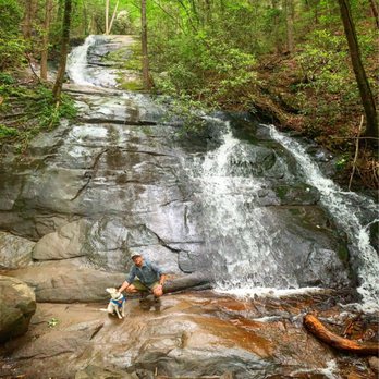

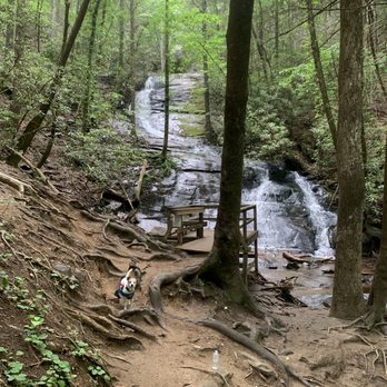

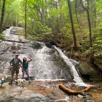

2 years ago

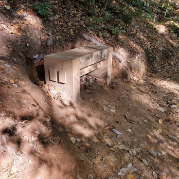
Thank you IG for bringing me awareness to this great hike and waterfall! It's easy to get to but you will be on nice gravel road for several miles. The road is narrow but everyone is accommodating and make sure to allow each other to pass. Everyone who we met there were super sweet and outgoing. There is an incline going to the waterfalls but it gets steady and level out a bit towards the end. On the way you see benches to rest if you need to. You never know. There are a total of 3 benches. Once you get to the third bench, you know you are 3/4 there! You can hear the waterfall and there is an observation deck there too so you can check it out. If you want to get close to the waterfalls, you are able to do that also! It's not dangerous or slippery. Makes for great IG photos. It was a great way to start off my Sunday morning. I would definitely come again!! The hike is short. Only 1/2 a mile but 1 mile overall. You could go to Blue Ridge and hang out later. 81/2020 read more


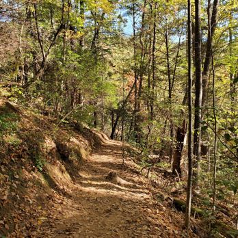


4 years ago
2 years ago

5 years ago
Great local m hiking spot in the Blue Ridge area. It's about a two mile loop up and back so easily done without a pack but definitely bring water and non-slip shoes. The rocks and some of the ledges are a bit steep but we saw a lot of families with kids hike this. Even a mom carrying her toddler with a baby pack did it so suck it up! The falls are so relaxing. We managed to figure out how to get tot the top of the falls and sat with our feet in the freezing water (in May) but it was awesome to be so close to nature. We don't have this kind of nature in south Florida! Sadly, we didn't see any cool wildlife besides a few birds but definitely watch out for poison oak/ivy. There was a few spots that looked questionable. The trail leading up to the falls was a bit narrow in some spots and they do have some benches spaced out along the way. Loved this trail and would absolutely return to hike it again. read more

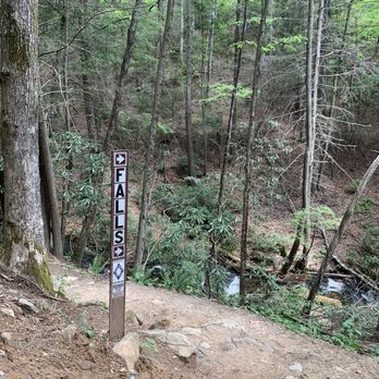


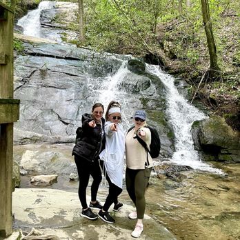


We followed Apple maps and were able to find this place no problem! While the roads are both paved and gravel, you shouldn't have any trouble in a car - 4x4 not necessary. Windy roads abound so take it slow on your drive up to the trail. There is a small parking lot at the head of the trail but you are able to park along the side of the road as well. The trail itself is not too challenging and can be completed within 45 minutes, including time to stop and admire the falls. It's about a mile round trip and you just follow the white diamonds painted on the trees to keep the route. While it is dog friendly, the paths are very narrow so keep that in mind for any timid or anxious pups. The falls are pretty and there's a nice landing you can snap some great photos at the bottom. Easy, fun-for-everyone hike in the Blue Ridge area! read more


3 years ago

Definitely recommend this hike! It's short & easy half mile hike to a beautiful waterfall. Our cabin was in Mineral Bluff, so this hike was about 20 minutes from where we were staying. It's also dog friendly, which was great because a lot of trails in the Blue Ridge area are not. read more


8 years ago
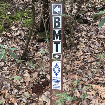
The drive up was on mostly paved road, but I could see smaller/lower vehicles having some slight difficulties with the maneuverability of the roads. After a winding,scenic ride up the mountain you'll park your car and take off on foot up towards the cascading waterfall. I saw people of all ages making the trek. Wear sneakers or hiking boots for best results.... and find a make shift walking stick to help keep balance. There is a little platform at the foot of the falls where you can take some photos and admire the nature of it all. So glad we made the visit. read more



3 years ago

7 years ago
We really enjoyed this hike. I took on this hike with my 3 kids and in-laws. It was a beautiful hike with the stream of water as your scenery. The hike is relatively easy and you are met by a beautiful waterfall at the end. read more


A great place to hike! The hike is short and sweet. It is a little steep in the beginning but you get to the water fall pretty fast!! The water fall was absolutely beautiful and the water was so clear! When you arrive there is a small parking lot and if you can't park there you can park on either side of the road. The trail begins across from the little parking area. Definitely worth going! The trail leads you to the bottom of a small water fall and it is well worth the hike! It is a beautiful trail, and any level hiker can manage it! If you are visiting Ellijay or Blue Ridge and like the outdoors you definitely need to check out these falls:) read more

5 years ago

We went to Fall Branch Falls on a rainy day, after days of rain, so it was wet. The falls were flowing strongly and it was beautiful. It is an easy hike, about a one mile hike in. There is a nice viewing platform. The trail continues beyond the falls and leads to the top of the falls. Beautiful views from below. read more


5 years ago
4 years ago
5 years ago

6 years ago
7 years ago
7 years ago
8 years ago
8 years ago
8 years ago
More info about Fall Branch Falls
Ask the Community - Fall Branch Falls
Review Highlights - Fall Branch Falls




















Fall Branch Falls - hiking - Updated August 2026
Best of Cherry Log
People found Fall Branch Falls by searching for…
Things to Do in Cherry Log, GA
Hiking Trails With Waterfalls in Cherry Log, GA
Places to Take Pictures in Cherry Log, GA
Off Road Trails in Cherry Log, GA
Scenic Overlook in Cherry Log, GA
Scenic Views in Cherry Log, GA
Scenic Drive in Cherry Log, GA
Watch Sunset in Cherry Log, GA
Secret Spots in Cherry Log, GA
Stroller Friendly Hikes in Cherry Log, GA
Nature Walks in Cherry Log, GA
Parks With Lakes in Cherry Log, GA
Walking Groups in Cherry Log, GA
Parks With Pull Up Bars in Cherry Log, GA
Parks With Basketball Courts in Cherry Log, GA
Open Fields Trails in Cherry Log, GA
Trending Searches in Cherry Log, GA
Barbershop For Men near Fall Branch Falls
Bike Shop near Fall Branch Falls
Cliff Jumping near Fall Branch Falls
Consignment Shops near Fall Branch Falls
Dog Friendly Beaches near Fall Branch Falls
Ear Piercing near Fall Branch Falls
Eyebrow Threading near Fall Branch Falls
Fishing Spots near Fall Branch Falls
Lookout Points near Fall Branch Falls
Mini Golf near Fall Branch Falls
Peach Picking near Fall Branch Falls
Pedicure near Fall Branch Falls
Permanent Makeup near Fall Branch Falls
Picnic Areas near Fall Branch Falls
Playgrounds near Fall Branch Falls
Preschools near Fall Branch Falls
Public Golf Courses near Fall Branch Falls
Running Trails near Fall Branch Falls
Scenic Overlook near Fall Branch Falls
Sunflower Field near Fall Branch Falls
Swimming Holes near Fall Branch Falls
Things To Do With Kids near Fall Branch Falls
Uniforms near Fall Branch Falls
Used Furniture Stores near Fall Branch Falls
Browse Articles
Browse Nearby
BEST of Cherry Log, Georgia Parks near Fall Branch Falls
BEST of Cherry Log, Georgia Restaurants near Fall Branch Falls
BEST of Cherry Log, Georgia Coffee near Fall Branch Falls
BEST of Cherry Log, Georgia Things to Do near Fall Branch Falls
BEST of Cherry Log, Georgia Breakfast near Fall Branch Falls
BEST of Cherry Log, Georgia Campgrounds near Fall Branch Falls
BEST of Cherry Log, Georgia Playgrounds near Fall Branch Falls
Browse Brands
Related Searches in Cherry Log, GA
Affordable Kayak Rental Services in Cherry Log, Georgia
Best Dog Hiking Trails Around Cherry Log, Georgia
Best Fishing Locations and Guides in Cherry Log, Georgia
Best Parks for Parties and Events in Cherry Log, Georgia
Best Places for Horseback Riding in Cherry Log, Georgia
Best Water Parks for Kids in Cherry Log, Georgia
Best Waterfalls and Swimming Holes in Cherry Log, Georgia
Check Out Great Playgrounds in Cherry Log, Georgia
Check Out Off Road Trails in Cherry Log, Georgia
Discover Baseball Fields Around Cherry Log, Georgia
Discover Dog Friendly Trails to Explore in Cherry Log, Georgia
Discover Lakes & Ponds to Explore in Cherry Log, Georgia
Discover Popular Bike Trails in Cherry Log, Georgia
Discover Public Beaches to Visit in Cherry Log, Georgia
Discover Soccer Fields in Cherry Log, Georgia Near You
Discover Top Nature Parks to Visit in Cherry Log, Georgia
Discover a Hiking Trail in Cherry Log, Georgia
Discover the Best Beaches in Cherry Log, Georgia
Discover the Best Night Hike Trails in Cherry Log, Georgia
Dog-Friendly Hikes With Dogs in Cherry Log, Georgia
Enjoy Camping Adventures Around Cherry Log, Georgia
Enjoy Exciting Mountain Biking Adventures in Cherry Log, Georgia
Enjoy Hiking Adventures in Cherry Log, Georgia
Enjoy Kayaking Adventures in Cherry Log, Georgia
Enjoy Off Leash Dog Hikes in Cherry Log, Georgia
Enjoy Tent Camping Spots Around Cherry Log, Georgia
Enjoy the Best Tubing Experiences in Cherry Log, Georgia
Enjoy the Best Walking Trails in Cherry Log, Georgia
Experience Thrilling White Water Rafting in Cherry Log, Georgia
Explore Beautiful Parks and Green Spaces in Cherry Log, Georgia
Explore Easy Hikes Perfect for All in Cherry Log, Georgia
Explore Family-Friendly Zoos and Wildlife in Cherry Log, Georgia
Explore Free Picnic Areas Around Cherry Log, Georgia
Explore Fun Activities to Do in Cherry Log, Georgia
Explore Parks With Pull Up Bars in Cherry Log, Georgia
Explore Picnic Parks Near Cherry Log, Georgia
Explore Popular Campgrounds Near Cherry Log, Georgia
Explore Popular Picnic Areas Around Cherry Log, Georgia
Explore Popular RV Parks Around Cherry Log, Georgia
Explore Popular Scenic Overlook Points in Cherry Log, Georgia
Explore Scenic Lakes to Visit in Cherry Log, Georgia
Explore Top Dog Parks in Cherry Log, Georgia Near You
Explore Top Water Parks in Cherry Log, Georgia Today
Explore Volleyball Courts Available in Cherry Log, Georgia
Explore the Best Swimming Holes Around Cherry Log, Georgia
Family Friendly Hiking With Kids in Cherry Log, Georgia
Find Beautiful Views in Cherry Log, Georgia


