China Camp State Park Photos


You might also consider


More like China Camp State Park
Recommended Reviews - China Camp State Park
Start your review...


Reviews With Photos


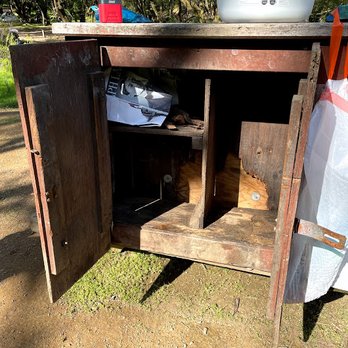
China Camp State Park in Marin County, CA commemorates an historical (1880s) Chinese American shrimp fishing village. We visited in early August, 2024. The state park, situated on the shore of San Pablo Bay, offers 1,500 acres with a museum of exhibits of an early Chinese settlement, a family-friendly beach, an easy launch for kayaks, a salt marsh, scenic views, picnic areas, well-maintained hiking and biking trails, and a campground. The rest of this review is specifically about the campground. We stayed there on a Sunday night in early August, 2024. We made reservations for the campground through the California State Parks website (reservecalifornia.com); extensive information is also available on the website of FOCC: Friends of China Camp. Note that non-reserved sites are sometimes available on a first-come, first-serve basis, particularly midweek and off-season. All sites are walk-in or tent only, without any hook-ups. There is no "regular" RV parking though en-route camping is available for one night only. Each site is $35, plus a non-refundable $7.99 reservation fee if made online. Campers need to carry all of their camping equipment to their campsite, anywhere from 50-300 yards from the parking lot. For lower numbered sites, tge path veers to the left and is relatively flat. Sites with higher numbers (we were 25) are to the right, up a paved but uneven and steep path. Carts with wheels were available to help schlep your gear to the site. The actual sites are mostly flat, and relatively spaced out. Each had a picnic table, a wooden food locker (to keep those raccoons away!), an outdoor grill, and fire ring (but a fire ban was in effect). The restroom was on the older side but had flush toilets and was clean. The restroom near the historic area was newer, and had pay showers. Potable water is available. The campground felt safe, with a camp host on site. The gate is closed at sunset through 8 am. The campground was quiet, with many empty sites on a Sunday night.


China Camp is beautiful. It's the site of many fond childhood memories, and somewhere I still like to visit and hike. The park has 15 miles of multi-use trails, and they vary in terms of how challenging they are. There's something here for everyone. One rule worth noting is dogs are only allowed in developed areas, not trails. So, as much as I love hiking out here, China Camp is somewhere I visit less frequently now due to those restrictions. The museum is interesting, and the park hosts events frequently, which is great. Overall, China Camp is a solid spot for good hiking and views of Marin County.


We stayed over nigh on the campground for one night . Check in is at 2pm and check out is next day at 12pm . The campground is seven minutes away from the park and offers bathrooms right in the parking lot. To unload there is a trail path that leads to the campsites to take all your gear they provide bins , they can be a bit dusty so be prepared if you're bringing things that you prefer not to get dusty before use. I heard there were coin operated showers but we were unable to find them. The campsite that you reserve has a bench and a pit for fires, they also provide a food storage locker that you can lock if you bring your own lock . We placed a four person tent and still had plenty of space for more . Only issue we had that was nearly too much is the amount of yellow jackets that were about , we could not bring food out in the daytime without them buzzing by our faces and nearly getting in our mouths, we did see however that there were yellow jacket traps that were all filled up with dead ones so it must be really bad without them. The bathrooms are okay , I encountered a cockroach- not a waterbug, in the bathroom in the campsite which just made me make sure I don't bring any along on the trip back home . We walked some of the trails and encountered some deer with her fawns and plenty of maps around the park so you always have a way to know where you are. Across from the visitors center is a small pebble beach that was nice to sit at (if you didn't have food because the Yellowjacket's would swarm even before you open your dish). They also sell fire wood for $10 .


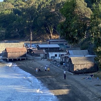
Explored China Camp for the first time on Sat, 6/4/22, National Trails Day. Saw many facets of this big State Park. Beautiful trails for biking and hiking I joined a volunteer event with Friends Of China Camp who organized clearing 3 trails - Ridge Fire Trail, Oak Ridge Trail, and Bay View Trail. We trimmed back vegetation that grew out to the trail as well as low-hanging branches. This was my first experience with the McLeod tool which has teeth rake on one side and a flat sharpened hoe on the other side, heavy duty for clearing hiking trails. I was thankful to be fully covered to protect myself from the large population of poison oaks. Here is their volunteer link https://friendsofchinacamp.org/get-involved/ Historic China Camp Village As I talked down the hill, open views of rustic wooden cottages and a picturesque old pier and pilings transported me to imaginary olden times. Docent Clair was hosting the museum, great to chat with. I learned about the shrimping life of early Chinese immigrants. There were a bunch of families enjoying the calm waters of this cove. Camping Scouted the campsites which were a bit tight but all were shaded and facilities well maintained. Booked a $35 night for 8/27, Heritage Day Festival at the China Camp Village. Looking forward to an after dinner sunset hike to nearby Turtle Back Hill.


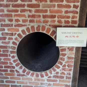
Great historical spot that should be a must on everyone's to go list. Museum tells you everything from the day one family landed and started the shrimp farm. Expo has all the tools used to grow, feed, harvest and dry the shrimp. Even shows you the current tights schedule. Than on you for keeping the place so well. Park has a nice beach, picnic tables and few bathrooms available. You will enjoy your stay here!


I have been hiking all over the Bay Area for the past 8 years and this is the worst trail I have been on. The trail is so rocky and these rocks are sharp. The last 2 miles of the 10 mile hike I wanted to cry because the bottom of my feet were hurting. There were many bikers are well.


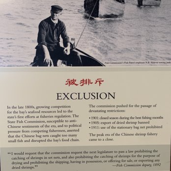
Need some get away time from the hustle and bustle of the big city? CCSP is around half hour north of San Francisco and is a tranquil respite sitting on the west side of San Francisco Bay. Named after a Chinese Fishing Village that sprang up after the 1849 gold rush, the site has: - Hiking Trails (lots of these) - BBQ Pits - Paved Rolling Roads for Bicyclists - Fishing Spots (caution as to whether you should eat anything caught from the Bay) - Restrooms - Simple Museum in the Old Fishing Village - Small fee for park usage (A California State Park) - And Best of all plenty of Contemplative Vistas Historically the native Miwok people were here when Sir Franco's Drake landed in his namesake Bay. After that, the Spanish, Irish, and Chinese moved through this area. The Chinese, Cantonese people from Pearl Bay region of Canton, had a shrimp harvesting and drying camp here. Wonder if my Grandfather ever shrimped here in the 1900s? Sad to say there's not a shrimping industry in the Bay anymore. Although there still is a herring run annually. Tranquil is the word for this park.


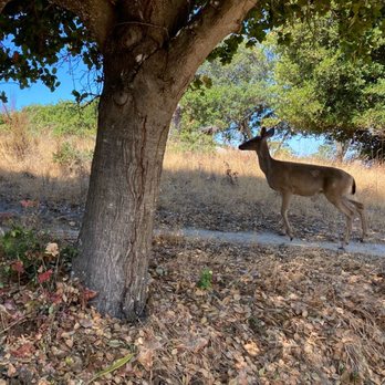
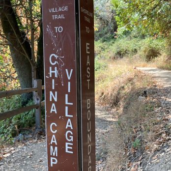
FINDING THE PARK. China Camp State Park can be accessed by North San Pedro Road or by Point San Pedro Road. North San Pedro Road begins near Banh Mi Zon restaurant, which serves perfect banh mi sandwiches in baguette-style buns. I recommend that hikers stop here after their morning hike. Point San Pedro Road begins a half mile east of the intersection of Route 101 and 3rd Street. 3rd Street takes you east for a half mile, and then the name of this street changes to Point San Pedro Road. Point San Pedro Road continues to McNears Beach, where it connects with North San Pedro Road. GRAND VISTAS. Some of my photographs show grand vistas. The grand vistas provide a magical quality to China Camp State Park. One grand vista takes the form of a huge marsh at the edge of San Pablo Bay, with Sonoma Mountain twenty miles to the north. Another grand vista takes the form of two isolated hills, separated by a deep valley with a trail running down the middle of the deep valley. Cute-looking trees resembling huge mushrooms grow on these trees. FINDING THE TRAILHEADS. Most of Shoreline Trail runs parallel to nearby North San Pedro Road. Three parking areas (you need to pay to park) occur along North San Pedro Road. From these parking areas, you have easy access to Shoreline Trail. During today's hike, we parked at the lot, located across San Pedro Rd. from the Ranger Station, and took a big counterclockwise loop hike, which consisted of Peacock Gap Trail, Oak Ridge Trail, Bay View Trail, and finally Shoreline Trail, which brought us back to the parking lot near the Ranger Station. The northern-most third of Shoreline Trail provides a view of a huge marsh, and a view of Sonoma Mountain, 20 miles to the north. One of my photos shows the huge marsh and Sonoma Mountain. Between the Ranger Station and San Pedro Rd. is a little marsh. Attached are two of my photos of the Ranger Station and a photo of the cattails in the little marsh. TRAIL MARKERS. One of my photos shows a trail marker with arrows, and names of four trails: Shoreline Trail, Peacock Gap Trail, Oak Ridge Trail, and McNears Fire Trail. Another photo shows a marker indicating Village Trail and Shoreline Trail. Yet another photo shows a huge sign reading PEACOCK GAP TRAIL and, below that, names of nine destinations and the hiking distance to each of them. These destinations include Miwok Meadows, Ranger Station, and Chicken Coop Hill. ANIMALS. We saw deer at two places. Within several minutes of starting out on Peacock Gap Trail, we saw a mommy deer with a baby deer. Then, we left the forested area and found ourselves on Oak Ridge Trail, where the view to the south was of a golf course and San Francisco Bay. Then, Bay View Trail took us to Shoreline Trail, where we encountered forested areas and shaded valleys were filled with ferns, with a dried creek running down the middle of each valley. In one of these shaded areas, we saw several male deers. One of them was missing an antler. Also, in this shaded area we saw several huge turkeys, marching along to the side of the trail. I posted my photographs of the mommy deer, the lizard, one of the male deer, and of the turkey parade. TREES. Many of the trees are gnarly, and about one out of a 100 trees was severely deteriorated. Manzanita trees, which are orangey red-colored, provide cheerful counterpoints to the gnarly trees. Manzanita trees have been described as, "But it's the peeling, cinnamon-kissed, red bark on architecturally fascinating shapes that so appeals." (see, Paula Panich (2021) Manzanita. Pacific Horticulture magazine). One of my photos shows a massive oak tree, with thick branches sprouting from the humongous trunk, all of these enshrouded with a canopy of leaves.


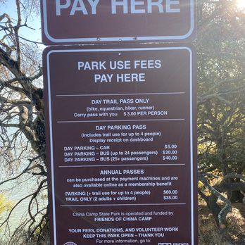
I'd been wanting to go to China Camp to hike for over 5 years, but for some reason or another, I never got around to it. Fast forward to our current Covid situation, and I finally got a chance to visit, this time on my mountain bike! On to the park! First off, we went on a weekday morning, because I know a place like this gets super packed on the weekends. There are several parking lots and trailheads, but we chose to park at the bigger lot near the Ranger's Station. Parking is $5 per car, per day, cash only. We then proceeded to get our MTB on through this beautiful area! The terrain you'll see varies from gravel roads in open spaces, to dirt trails through the forest. It is absolutely beautiful! And depending on what part of the park you're in, you'll have a beautiful view of San Pablo Bay. The trails here vary from beginner/intermediate to black diamond. I've been riding for a couple years, but still definitely feel like a novice, so we stayed on the beginning/intermediate trails accordingly. The trail we took was the Shoreline Trail. It had a decent amount of climbing, and some rocks in some parts. Not too many roots, however. We wound up getting about 9 miles round trip, and it was a hell of a workout. I will definitely be back soon to sharpen my MTB skills!


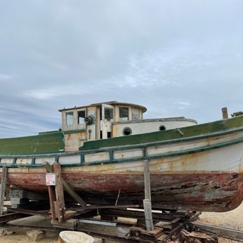
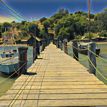
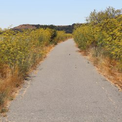
Wasn't this the name of a Doobie Brothers song? Oh wait, that was China Grove, wasn't it? Now I know China Cove is a couple of hours away just south of Carmel in Point Lobos, but I knew next to nothing about China Camp except that it was on the shutdown list back in 2011 when Jerry Brown was running into a significant budget shortfall. It's good to see that it has survived as it turned out to be one of the more interesting places I've recently discovered for a couple of hours of light hiking. Driving up on 101, I exited on the 2nd Street exit in Central San Rafael and drove about five miles until I saw the park entrance. I had no idea where I was supposed to stop, so I ended up in the parking lot adjacent to the park ranger station. It costs $5 to park for the day, and there's a ticket printing machine next to the Shoreline Trail. Interestingly the trail is not literally on the shore but instead hugs the ridge above the road weaving in and out of ravines and offering scenic views of San Pablo Bay at almost every turn. About a mile or so in, I saw a detour trail that took me across a picnic ground down to China Camp Village. It sits on a still-inviting beach where there are remnants of an old shrimp fishing village (photo: http://bit.ly/2PcBRnR). There's an old wooden pier with historically significant boats tied to it (photo: http://bit.ly/2MDgE9I) as well as an unattended museum which gives a brief history explaining the importance of this site to the Chinese-American community in the past couple of centuries. I headed back to the main trail where I continued toward the suburban edge of the park before heading back. Take a look while you still can. RELATED - Up for a hike? Here are the places around the Bay Area where I have trod: bit.ly/2OsCCsK
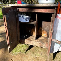

This is a review of the China Camp State Park campground, Back Ranch Meadows. It's a hike-in campground. Sites 1-15 are the ground level; sites 16-30 are up a short, but steep hill. The furthest "hike in" would be about 10 minutes. All of the sites are large. We stayed in #4 which looked like one of the smallest and it could easily fit two big family tents. Most of these sites could fit 6-8 small (4 person) tents. Despite the large campsites, there is little privacy - there are not many trees so you are exposed. It looked like campsites #7 and #14 had the most privacy. #11 and #12 would be nice in the evenings but they are right along the main hiking & biking trail. We didn't have any raccoon trouble (mid-March) but we kept a clean camp and we kept the cooler and food in our tent. We had friends in the upper loop who lost marshmallows and steak (in the cooler) to the raccoons. Most of the critter boxes are too small to hold food and the raccoons can swat them open. Next time I will bring bungie cords for the cooler and food storage. Bathrooms were clean enough and for the most part, the campground was quiet. The first night our neighbors were up drinking and signing loudly until 2:30am. The camp host never came by. I didn't hear anyone complain but the entire campground heard it and was talking about it the rest of the weekend. There are biking and hiking trails going through the middle of the campground, so there is a lot of traffic all day. Firewood is $6/bag and sold from 4-6pm only. It burns fast so purchase double what you think you need. They take credit cards! I posted a pic of the garbage cans that you can use to carry your stuff to/from the parking lot. I would definitely camp here again.


1 year ago
This is by far our favorite camp site. We booked 6 months out. There was 12 of us in our group so we reserved 2 camp sites next to each other. Each site can accommodate up to 8 people. It's $35/night + $8.25 reservation fee. 1 free parking per site and $5/day for each additional car. We had 8 tents set up and there was still room to put up more. There was so much space. I was afraid as we've never done a walk in camp site before but the parking lot was so close. There was plenty of garbage totters to help carry stuff to the camp site. We did it in just 1 trip. Bathrooms were ok. The toilet seats have seen better days. There are coin operated showers. $1 for 10 mins. The sign for firewood says sold between 4-6pm but when we arrived after 6pm we could still get some from the camp host. Bring cash. We appreciated the food storage cabinets as they were all in great condition. We did run into raccoons at 5:45 in the morning. Just had to make sure all the food was put away in the cabinets. Saw a cat and a family of deers too. There are some yellow jackets but also traps for them at each site. We didn't do any hikes this time but we went to China Camp beach. It's only 8 minutes drive from camp. The location of the camp site is great too. Just 15 minutes drive from the nearest Safeway and restaurants too. Yet far enough to be with nature. Note, even though there was lots of trees we were told that hammocks were not allowed. read more


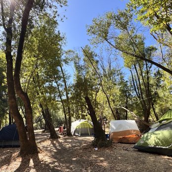


A great place for hiking and mountain bike riding is just a few miles from our home and from many in the Bay Area. China Camp State Park has a number of trails that we enjoy. These are primarily single track trails that take you through the oak woodlands. One of our favorites is the Shoreline Trail. It winds around the campground and then rides like a roller coaster as you follow the terrain of the hills beside the Bay. You'll often see black tail deer, grey squirrel, and if you're lucky - a flock of Turkey. If you're adventurous and have the energy, pedal (or hike) up to the ridge of . You can travel up either Powerline Trail or Oak Ridge Trail and the views at top are beautiful. In 2012, the State of California suspended funding for 70 state parks including China Camp State Park. Locals founded a. Non-profit called Friends of China Camp who keep the park maintained and in good shape. Be sure to purchase a Day Pass (or an annual pass like we have) to support the park and ensure it will be here for us to enjoy in the future. read more


1 year ago
I discovered China Camp back in 2009 when my daughter was in college. Her roommate was an avid mountain biker and told me about this hidden gem when I asked her what was her favorite place to ride. Even though it's 50 Miles from me, it's worth the drive. I want to give a shout out to volunteer Gail for helping this morning with an annual pass. The volunteers keep the trails manicured, so a $40 trail pass is worth every penny to support them. I rode the Bay View to Shoreline trail this morning and it was amazing! Single track with rock beds and all kinds of technical challenges. I'll definitely will be coming back again! read more


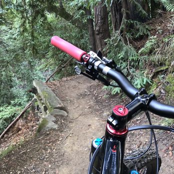


China Camp State Park in Marin County, CA commemorates an historical (1880s) Chinese American shrimp fishing village. We visited in early August, 2024. The state park, situated on the shore of San Pablo Bay, offers 1,500 acres with a museum of exhibits of an early Chinese settlement, a family-friendly beach, an easy launch for kayaks, a salt marsh, scenic views, picnic areas, well-maintained hiking and biking trails, and a campground. The rest of this review is specifically about the campground. We stayed there on a Sunday night in early August, 2024. We made reservations for the campground through the California State Parks website (reservecalifornia.com); extensive information is also available on the website of FOCC: Friends of China Camp. Note that non-reserved sites are sometimes available on a first-come, first-serve basis, particularly midweek and off-season. All sites are walk-in or tent only, without any hook-ups. There is no "regular" RV parking though en-route camping is available for one night only. Each site is $35, plus a non-refundable $7.99 reservation fee if made online. Campers need to carry all of their camping equipment to their campsite, anywhere from 50-300 yards from the parking lot. For lower numbered sites, tge path veers to the left and is relatively flat. Sites with higher numbers (we were 25) are to the right, up a paved but uneven and steep path. Carts with wheels were available to help schlep your gear to the site. The actual sites are mostly flat, and relatively spaced out. Each had a picnic table, a wooden food locker (to keep those raccoons away!), an outdoor grill, and fire ring (but a fire ban was in effect). The restroom was on the older side but had flush toilets and was clean. The restroom near the historic area was newer, and had pay showers. Potable water is available. The campground felt safe, with a camp host on site. The gate is closed at sunset through 8 am. The campground was quiet, with many empty sites on a Sunday night. read more


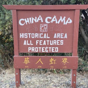




China Camp is beautiful. It's the site of many fond childhood memories, and somewhere I still like to visit and hike. The park has 15 miles of multi-use trails, and they vary in terms of how challenging they are. There's something here for everyone. One rule worth noting is dogs are only allowed in developed areas, not trails. So, as much as I love hiking out here, China Camp is somewhere I visit less frequently now due to those restrictions. The museum is interesting, and the park hosts events frequently, which is great. Overall, China Camp is a solid spot for good hiking and views of Marin County. read more


1 year ago
We stayed over nigh on the campground for one night . Check in is at 2pm and check out is next day at 12pm . The campground is seven minutes away from the park and offers bathrooms right in the parking lot. To unload there is a trail path that leads to the campsites to take all your gear they provide bins , they can be a bit dusty so be prepared if you're bringing things that you prefer not to get dusty before use. I heard there were coin operated showers but we were unable to find them. The campsite that you reserve has a bench and a pit for fires, they also provide a food storage locker that you can lock if you bring your own lock . We placed a four person tent and still had plenty of space for more . Only issue we had that was nearly too much is the amount of yellow jackets that were about , we could not bring food out in the daytime without them buzzing by our faces and nearly getting in our mouths, we did see however that there were yellow jacket traps that were all filled up with dead ones so it must be really bad without them. The bathrooms are okay , I encountered a cockroach- not a waterbug, in the bathroom in the campsite which just made me make sure I don't bring any along on the trip back home . We walked some of the trails and encountered some deer with her fawns and plenty of maps around the park so you always have a way to know where you are. Across from the visitors center is a small pebble beach that was nice to sit at (if you didn't have food because the Yellowjacket's would swarm even before you open your dish). They also sell fire wood for $10 . read more


Explored China Camp for the first time on Sat, 6/4/22, National Trails Day. Saw many facets of this big State Park. Beautiful trails for biking and hiking I joined a volunteer event with Friends Of China Camp who organized clearing 3 trails - Ridge Fire Trail, Oak Ridge Trail, and Bay View Trail. We trimmed back vegetation that grew out to the trail as well as low-hanging branches. This was my first experience with the McLeod tool which has teeth rake on one side and a flat sharpened hoe on the other side, heavy duty for clearing hiking trails. I was thankful to be fully covered to protect myself from the large population of poison oaks. Here is their volunteer link https://friendsofchinacamp.org/get-involved/ Historic China Camp Village As I talked down the hill, open views of rustic wooden cottages and a picturesque old pier and pilings transported me to imaginary olden times. Docent Clair was hosting the museum, great to chat with. I learned about the shrimping life of early Chinese immigrants. There were a bunch of families enjoying the calm waters of this cove. Camping Scouted the campsites which were a bit tight but all were shaded and facilities well maintained. Booked a $35 night for 8/27, Heritage Day Festival at the China Camp Village. Looking forward to an after dinner sunset hike to nearby Turtle Back Hill. read more




Great historical spot that should be a must on everyone's to go list. Museum tells you everything from the day one family landed and started the shrimp farm. Expo has all the tools used to grow, feed, harvest and dry the shrimp. Even shows you the current tights schedule. Than on you for keeping the place so well. Park has a nice beach, picnic tables and few bathrooms available. You will enjoy your stay here! read more




6 years ago

2 years ago
I have been hiking all over the Bay Area for the past 8 years and this is the worst trail I have been on. The trail is so rocky and these rocks are sharp. The last 2 miles of the 10 mile hike I wanted to cry because the bottom of my feet were hurting. There were many bikers are well. read more


Need some get away time from the hustle and bustle of the big city? CCSP is around half hour north of San Francisco and is a tranquil respite sitting on the west side of San Francisco Bay. Named after a Chinese Fishing Village that sprang up after the 1849 gold rush, the site has: - Hiking Trails (lots of these) - BBQ Pits - Paved Rolling Roads for Bicyclists - Fishing Spots (caution as to whether you should eat anything caught from the Bay) - Restrooms - Simple Museum in the Old Fishing Village - Small fee for park usage (A California State Park) - And Best of all plenty of Contemplative Vistas Historically the native Miwok people were here when Sir Franco's Drake landed in his namesake Bay. After that, the Spanish, Irish, and Chinese moved through this area. The Chinese, Cantonese people from Pearl Bay region of Canton, had a shrimp harvesting and drying camp here. Wonder if my Grandfather ever shrimped here in the 1900s? Sad to say there's not a shrimping industry in the Bay anymore. Although there still is a herring run annually. Tranquil is the word for this park. read more


4 years ago

FINDING THE PARK. China Camp State Park can be accessed by North San Pedro Road or by Point San Pedro Road. North San Pedro Road begins near Banh Mi Zon restaurant, which serves perfect banh mi sandwiches in baguette-style buns. I recommend that hikers stop here after their morning hike. Point San Pedro Road begins a half mile east of the intersection of Route 101 and 3rd Street. 3rd Street takes you east for a half mile, and then the name of this street changes to Point San Pedro Road. Point San Pedro Road continues to McNears Beach, where it connects with North San Pedro Road. GRAND VISTAS. Some of my photographs show grand vistas. The grand vistas provide a magical quality to China Camp State Park. One grand vista takes the form of a huge marsh at the edge of San Pablo Bay, with Sonoma Mountain twenty miles to the north. Another grand vista takes the form of two isolated hills, separated by a deep valley with a trail running down the middle of the deep valley. Cute-looking trees resembling huge mushrooms grow on these trees. FINDING THE TRAILHEADS. Most of Shoreline Trail runs parallel to nearby North San Pedro Road. Three parking areas (you need to pay to park) occur along North San Pedro Road. From these parking areas, you have easy access to Shoreline Trail. During today's hike, we parked at the lot, located across San Pedro Rd. from the Ranger Station, and took a big counterclockwise loop hike, which consisted of Peacock Gap Trail, Oak Ridge Trail, Bay View Trail, and finally Shoreline Trail, which brought us back to the parking lot near the Ranger Station. The northern-most third of Shoreline Trail provides a view of a huge marsh, and a view of Sonoma Mountain, 20 miles to the north. One of my photos shows the huge marsh and Sonoma Mountain. Between the Ranger Station and San Pedro Rd. is a little marsh. Attached are two of my photos of the Ranger Station and a photo of the cattails in the little marsh. TRAIL MARKERS. One of my photos shows a trail marker with arrows, and names of four trails: Shoreline Trail, Peacock Gap Trail, Oak Ridge Trail, and McNears Fire Trail. Another photo shows a marker indicating Village Trail and Shoreline Trail. Yet another photo shows a huge sign reading PEACOCK GAP TRAIL and, below that, names of nine destinations and the hiking distance to each of them. These destinations include Miwok Meadows, Ranger Station, and Chicken Coop Hill. ANIMALS. We saw deer at two places. Within several minutes of starting out on Peacock Gap Trail, we saw a mommy deer with a baby deer. Then, we left the forested area and found ourselves on Oak Ridge Trail, where the view to the south was of a golf course and San Francisco Bay. Then, Bay View Trail took us to Shoreline Trail, where we encountered forested areas and shaded valleys were filled with ferns, with a dried creek running down the middle of each valley. In one of these shaded areas, we saw several male deers. One of them was missing an antler. Also, in this shaded area we saw several huge turkeys, marching along to the side of the trail. I posted my photographs of the mommy deer, the lizard, one of the male deer, and of the turkey parade. TREES. Many of the trees are gnarly, and about one out of a 100 trees was severely deteriorated. Manzanita trees, which are orangey red-colored, provide cheerful counterpoints to the gnarly trees. Manzanita trees have been described as, "But it's the peeling, cinnamon-kissed, red bark on architecturally fascinating shapes that so appeals." (see, Paula Panich (2021) Manzanita. Pacific Horticulture magazine). One of my photos shows a massive oak tree, with thick branches sprouting from the humongous trunk, all of these enshrouded with a canopy of leaves. read more





I'd been wanting to go to China Camp to hike for over 5 years, but for some reason or another, I never got around to it. Fast forward to our current Covid situation, and I finally got a chance to visit, this time on my mountain bike! On to the park! First off, we went on a weekday morning, because I know a place like this gets super packed on the weekends. There are several parking lots and trailheads, but we chose to park at the bigger lot near the Ranger's Station. Parking is $5 per car, per day, cash only. We then proceeded to get our MTB on through this beautiful area! The terrain you'll see varies from gravel roads in open spaces, to dirt trails through the forest. It is absolutely beautiful! And depending on what part of the park you're in, you'll have a beautiful view of San Pablo Bay. The trails here vary from beginner/intermediate to black diamond. I've been riding for a couple years, but still definitely feel like a novice, so we stayed on the beginning/intermediate trails accordingly. The trail we took was the Shoreline Trail. It had a decent amount of climbing, and some rocks in some parts. Not too many roots, however. We wound up getting about 9 miles round trip, and it was a hell of a workout. I will definitely be back soon to sharpen my MTB skills! read more




Wasn't this the name of a Doobie Brothers song? Oh wait, that was China Grove, wasn't it? Now I know China Cove is a couple of hours away just south of Carmel in Point Lobos, but I knew next to nothing about China Camp except that it was on the shutdown list back in 2011 when Jerry Brown was running into a significant budget shortfall. It's good to see that it has survived as it turned out to be one of the more interesting places I've recently discovered for a couple of hours of light hiking. Driving up on 101, I exited on the 2nd Street exit in Central San Rafael and drove about five miles until I saw the park entrance. I had no idea where I was supposed to stop, so I ended up in the parking lot adjacent to the park ranger station. It costs $5 to park for the day, and there's a ticket printing machine next to the Shoreline Trail. Interestingly the trail is not literally on the shore but instead hugs the ridge above the road weaving in and out of ravines and offering scenic views of San Pablo Bay at almost every turn. About a mile or so in, I saw a detour trail that took me across a picnic ground down to China Camp Village. It sits on a still-inviting beach where there are remnants of an old shrimp fishing village (photo: http://bit.ly/2PcBRnR). There's an old wooden pier with historically significant boats tied to it (photo: http://bit.ly/2MDgE9I) as well as an unattended museum which gives a brief history explaining the importance of this site to the Chinese-American community in the past couple of centuries. I headed back to the main trail where I continued toward the suburban edge of the park before heading back. Take a look while you still can. RELATED - Up for a hike? Here are the places around the Bay Area where I have trod: bit.ly/2OsCCsK read more



6 years ago
This is a review of the China Camp State Park campground, Back Ranch Meadows. It's a hike-in campground. Sites 1-15 are the ground level; sites 16-30 are up a short, but steep hill. The furthest "hike in" would be about 10 minutes. All of the sites are large. We stayed in #4 which looked like one of the smallest and it could easily fit two big family tents. Most of these sites could fit 6-8 small (4 person) tents. Despite the large campsites, there is little privacy - there are not many trees so you are exposed. It looked like campsites #7 and #14 had the most privacy. #11 and #12 would be nice in the evenings but they are right along the main hiking & biking trail. We didn't have any raccoon trouble (mid-March) but we kept a clean camp and we kept the cooler and food in our tent. We had friends in the upper loop who lost marshmallows and steak (in the cooler) to the raccoons. Most of the critter boxes are too small to hold food and the raccoons can swat them open. Next time I will bring bungie cords for the cooler and food storage. Bathrooms were clean enough and for the most part, the campground was quiet. The first night our neighbors were up drinking and signing loudly until 2:30am. The camp host never came by. I didn't hear anyone complain but the entire campground heard it and was talking about it the rest of the weekend. There are biking and hiking trails going through the middle of the campground, so there is a lot of traffic all day. Firewood is $6/bag and sold from 4-6pm only. It burns fast so purchase double what you think you need. They take credit cards! I posted a pic of the garbage cans that you can use to carry your stuff to/from the parking lot. I would definitely camp here again. read more


GREAT PLACE FOR DOGS!!! Dogs are allowed on leash at the village and beach areas. China Camp has become our safe place and go-to nature haven. My husband and I have become Friends of China Camp and are proud supporters of this amazing piece of history. Every time we visit we see wildlife. Our pup gets so excited as we enter China Camp, she knows where she's at and truly enjoys her time there. China Camp offers trails, hiking, biking, camping, picnic areas, beach area, BBQs, museum of history and a cute little snack shop open on the weekends. Trash cans, recycling and Beach TLC Stations are all available so please take care of this gem because it's a privilege not a right. It is run by private donations so please do your part! read more





3 years ago

We camped here during the 4th of July weekend. We had to carry out stuff few yards up to the campsite. (If you get the hike in campsite, make sure you pack less because it's a little uphill walking for your knees). Pretty cool hiking, biking, walking trails around. But most trails don't allow dogs so make sure to check that. Dogs are allowed in the campsite. Be aware of racoons during nighttime. You have to pack food in the night time to not attract racoons stealing your food. read more


3 years ago


I have been visiting China Camp for close to 20 years and still love coming here. The fact that the park has preserved so much of the rich history here is remarkable. There is something so nostalgic about the village. I was in the village a few years ago for the heritage festival and was happy that some of the culture has been kept alive. I have camped, hiked, road & mountain biked, swam, kayaked, fished, picnicked and just recently paddle boarded here and that's what's I really like- the variety of activities one can enjoy here. The San Pablo Bay isn't the most beautiful, but it's safe for the kids and the water is not too cold. And then there's Frank- who has lived there all his life and is an original China Camp resident. Frank is 89 now and still runs the little snack bar there! read more
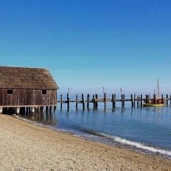

China Camp is nestled along the Marin side of the San Pablo Bay. The park seems to have something for everyone: campgrounds, beaches, picnic areas, wildlife, and hiking trails. What attracted me to this park are the remains of the Chinese shrimp-fishing village that thrived along the shore in the 1880s The visitor center and a museum are located in a weathered wooden building that looks as though it has been there a long time. It is filled with interesting artifacts and tells the store of the fisherman who once lived and worked here. There is a snack bar in another old building that I guess is only open on the weekends. Next to that building is a wonderful old gas tank. I'm not sure if it is okay to open the gate and walk out on the wooden pier. I did and no one stopped me. I wanted to see if I could line up the village with places on the opposite shore. If you worry about trespassing, I don't, there are tables and benches where you can sit and relax. read more


I was rather disappointed with this State Park. I went with the intention of going on a lovely walk along the trails, approximately 10 to 12 miles. This trail is overrun with mountain bikers who have a little to no social etiquette. No one uses the bell on their bike and they will ride up right behind you and expect you to move out of the way. I feel that if you will be on a mountain bike you should be polite to the people who are walking on foot and request that they move out of the way -- it should not be expected that people just move for you. Many mountain bikers were also not wearing masks as they passed our group or whenever they stopped. It made my friends and I feel uncomfortable. There were also young boys without any parental guidance. There isn't a lot of room for hikers to pull over for bikers either, so we were stuck pressing ourselves against narrow areas so bikers could pass. This park should have certain days for bikers vs. hikers to ensure safety and an enjoyable time for all. Additionally, you have to pay $3 per person instead of by the car (although car parking is $5 if you park in the parking lot). I think they should have a different fee for bikers vs hikers. The views were gorgeous but we had to stop and pull over so many time since biker groups were distanced out and it prevented us from being able to stop and appreciate the views. It also really reduced our speed. I was disappointed since we drove out over 1.5 hours to see this park. read more


-Clean bathrooms (no soap), nice Rangers, showers 50cents for 5 mins, windy (sometimes dusty), saw bees, deers and a snake and parking $5 for an extra car. -Since the parking lot is 0.2mi from the campsite, they will give you clean trash bins to bring you camp gears in. -Went for one night (Saturday night) and it was fun and relaxing to be with friends drinking and eating. I slept well where I slept through the night. read more


The bike trails here are perfect if you have a downhill bike like I do and don't want to die trying to make it up some of the hills. The trails do not have steep inclines and the inclines are very gradual and not very hard to climb. My friend who is not an experience mt biker love the trail. Although she did get tired but that was just from being out of shape. I would definitely go back and do the entire loop. We only stayed on shoreline and decided to head back when we got to the golf course. read more


9 years ago
Went to checkout China Camp State Park yesterday. I drive by the sign posted on Hwy 101 every time I'm heading into the 'City'. I've always been curious about the park. So I made the Park visit happen. The park has several hiking trails w/endless beautiful sights of San Pablo Bay. "Bellevue" There is a camping area, they take reservations for campsites. Currently $35/night. Few people in the Park. My favorite area is the historic fishing camp. Park your car & get out to walk the Camp area. That's what I did. I walked the grounds & smelled the Bay salt water, heard the crunch of fallen leaves under my feet - which gave way to wet sand on the beach. Grey day & temp in the 50's did not hinder my appreciation of the old, rustic Camp buildings. I let my imagination reenact the previous days gone by; between 1860 and 1910 AD. During those times, it was Chinese owned dried shrimp industry. I could imagine the hustle & bustle of Chinese workers placing piles of shrimp out to dry in the sun - to now, a quiet day where I stood alone. read more


7 years ago
What a deal, only $5 to park all day. Be sure to bring your picnic and shoes you want to wear hiking and in the water. What a beautiful spot to spend the day relaxing. There are several parking option and clean bathrooms. read more


6 years ago
Back Meadow's Ranch for camping. It's our second year camping here. I enjoy the hiking, the nature, and everything else. The bathroom is clean. I don't shower here. The camp site can be a bit loud read more




3 years ago

5 years ago
Had a great day doing a photo shoot there today amazing place great for portraits so many spots to enjoy here read more


Page 1 of 6
More info about China Camp State Park
1898 N San Pedro Rd
San Rafael, CA 94901
Directions
(415) 456-0766
Call Now
Visit Website
http://www.parks.ca.gov
Hours
Indoor Amenities
Outdoor Amenities
Other Amenities
From the Business
Ask the Community - China Camp State Park
Can you swim here?
Yes, you can swim in China Camp State Park. It's best to take your swim at China Camp Village, 100 China Camp Village Road, San Rafael, CA. Keep an eye on the tide chart, since at low tide, there is a mud flat that extends about 300 feet offshore.
Can you fish off the pier?
Yes, you can fish off the pier. Keep an eye on the tide charts!
What does it cost to camp overnight in this park?
35/night + fees through ReserveAmerica
Is it a nice place to see a sunrise?
Yes, China Camp Park is a nice place but nothing special. Yosemite Valley is the best place in California to see the sunrise. The view of the golden glow of the sun illuminating the tall granite cliffs is a GLORIOUS WONDER TO BEHOLD. Regarding…
Review Highlights - China Camp State Park
You might also consider














Why does Yelp recommend reviews?
8 reviews that are not currently recommended
The reviews below are not factored into the business's overall star rating.

14 years ago

6 years ago

16 years ago

6 years ago

17 years ago

19 years ago

11 years ago

14 years ago


