Cancel

    Open app

    Search

    City of Lebec Photos
    Recommended Reviews - City of Lebec

    Your trust is our priority, so businesses can't pay to alter or remove their reviews. Learn more about reviews.
    Yelp app icon
    Browse more easily on the app
    Review Feed Illustration

    8 years ago

    Very handicapped-accessible City super friendly people a really good place to go clear your mind and get in touch with yourself and nature

    Helpful 0
    Thanks 0
    Love this 1
    Oh no 0

    10 years ago

    Basically a pit stop haven. Lots of places to get food and gas, but it's in the middle of nowhere.

    Helpful 0
    Thanks 0
    Love this 1
    Oh no 0

    Verify this business for free

    Get access to customer & competitor insights.

    Verify this business

    Frazier Mountain Lookout

    Frazier Mountain Lookout

    3.7(3 reviews)
    4.4 mi

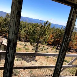
    If you're driving up for the sole purpose of seeing the tower, it's not worth the drive. You'll be…read moredone with it in about 10-min. However, if you're going to make a day of it, maybe a nice hike where this is your summit, then the views are good, although not the best I've seen from a Lookout. I'd bring a truck if you have one. The rough paved road is passable by most vehicles, but when it gets to the rough dirt/rock road you don't want to be sitting low or you'll have to drive very slow to save your car and your butt. I wish they hadn't built the new stuff right next to the tower as it kinda diminishes its existence and looks more like a crack house as opposed to a worn out and abused former lookout.

    This historic Forest Service lookout tower is located on top of Frazier Mountain (elevation 8,013…read morefeet). The mountain is named after Willian T. Frazier who was a miner in the 1850s. The site has been a lookout ever since 1905. The original building burned down in 1952 and was quickly replaced the same year by the current structure. The lookout was decommissioned in the 90s. The structure is abandoned and in pretty bad shape. I would use extreme caution if you decide to explore it. There's not much left to see. The lookout is surrounded by a number of tall communication towers. When you're done checking out the building you can hike the pine-covered mountain and take in the panoramic views. To get to the site take Interstate-5 and exit at Frazier Park Mountain Road. Drive west on Frazier Park Road about 5 miles through town. Turn left on Lockwood Valley Road. After another mile turn left at Frazier Mountain Road. From the Chucupate Ranger station drive 7 miles up a steep dirt road. You will encounter a number of signs that will point you in the right direction.

    Photos
    Frazier Mountain Lookout
    Frazier Mountain Lookout
    Frazier Mountain Lookout

    See all

    The Old Ridge Route - Dead Man's Curve

    The Old Ridge Route

    4.0(3 reviews)
    9.7 mi

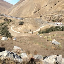
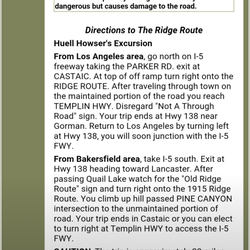
    100 years ago, before the 5 fwy, people drove along the Ridge Route to get from LA to Bakersfield…read more It was was a 44 mile, two-lane, highway. It opened in 1915 and was in use until 1968 after it was replaced by the 5 fwy. Much of the road runs through the Angeles National Forest and passes by many historical landmarks. It's interesting to read about it's history and to view some of the old ruins. One of it's more distinctive sections is Deadman's Curve, located at the base of the grapevine. The Ridge Route is also listed in the National Register of Historic Places. There two access points that allow you to drive along southern sections of the road. From Los Angeles head north on I-5 freeway. Exit at Castaic and take Parker Rd to the Ridge Route. This route only lets you experience a small portion of the road. It was blocked off after storm damage in 2005. I recommend continuing along 5 fwy north and exiting at Hwy 138 heading toward Lancaster. You'll pass a reservoir on the left and you will eventually see a sign for "Old Ridge Route" located on the right. This route provides some nice views of the area and also allows you to see some of the locations of the historic hotels. Sections of the road can be a little rocky since it's no longer maintained.

    In this time of coronavirus isolating, this is a nice getaway. We found an entrance off of 138 just…read moreeast of Quail Lake and headed south. It is very remote and in places the one hundred year old road bed is covered with dirt and rocks from slides. Most of the people we saw were on touring type motorcycles, SUVs and trucks hauling bicycles, and a few off road enthusiasts. It is beautiful country to travel thru, everyone we saw was driving very carefully and respectfully. There was a huge locked gate after a while and we turned around and went back to 138. Then we went back south on I 5 to Templin highway east. After a few miles we hooked back onto the Ridge Route and followed it all the way into Castaic. The first section off of 138 was much more scenic and beautiful. We saw a few cars, but it is better to be in a vehicle with good ground clearance. In the bad spots there are very many sharp rocks, there is a need for good tires too. We had a great afternoon and were able to get away during this time, while still practicing the social distancing. Our trip was taken in a two wheel drive half ton Silverado, we had no trouble. I can see that if there was bad weather, this would not be a good road to be exploring.

    Photos
    The Old Ridge Route - Directions on how to get there.
 Very accurate.

    Directions on how to get there. Very accurate.

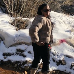
    The Old Ridge Route - Big Bear

    Big Bear

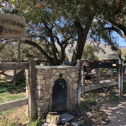
    The Old Ridge Route - More scenery.

    See all

    More scenery.

    South Portal Elizabeth Tunnel

    South Portal Elizabeth Tunnel

    4.3(3 reviews)
    28.6 mi

    Camped there as a child with my family over 50 years ago we called it Echo Tunnel. At that time it…read morejust had a chain link fence in front of it and a nice creek running from it. Sometimes there would be a hole cut in the chain link fence and we could go in but me and my brothers were never brave enough to go in very far. That's probably why they buried it. Good time for sure

    This is the site of the south portal entrance of the Elizabeth Tunnel. Even though the entrance has…read morebeen filled-in with dirt and barely recognizable, you can still stand in it's presence and appreciate it's history. If you do a little searching you can even locate remnants of some the structures that were located nearby. It took four years and seven months to complete in 1911. The tunnel was an important part of the LA Aqueduct and an engineering feat in it's day. The northern and southern crews battled it out to see who could be the first to reach the middle. They finally met 250 ft below Lake Elizabeth through an 1 1/2 inch hole. The two tunnels were remarkably accurate, meeting at about the same level and almost perfectly aligned. The south portal crew also set an American record for hardrock distance tunneled in a single month. To get to the site from Santa Clarita, take San Francisquito Canyon Rd north to the Forest Service Rd and take a left. If you've reached Green Valley then you've gone too far. Take it north for 1.6 miles. I recommend ditching the car and hiking at least part of the way there.

    Photos
    South Portal Elizabeth Tunnel - Classic photo from LADWP Historic Archive.

    Classic photo from LADWP Historic Archive.

    South Portal Elizabeth Tunnel - Another photo from LADWP Historic Archive.

    Another photo from LADWP Historic Archive.

    South Portal Elizabeth Tunnel - How it looks today.

    See all

    How it looks today.

    Bowers Cave - Then and now.

    Bowers Cave

    5.0(2 reviews)
    31.7 mi

    Bowers Cave, also known as Cave of the San Martins, is a little-known cave that sits high near the…read moretop of a steep mountain at the northeastern border of the Chiquita Canyon Landfill located in Castaic. It has been described as the most significant archaeological site on the North American continent. In 1884 two brothers, McCoy and Everette Pyle, discovered a "treasure trove" of Native American artifacts that had been hidden away by Tataviam Indians hundreds of years earlier. Shortly after the discovery the items were sold to Stephen Bowers who later resold most of the collection to the Peabody Museum at Harvard where it is still kept today. Why the cave is named after the person who purchased the artifacts and not the people who discovered them is beyond me. Nevertheless, it is still an interesting piece of history in the most unexpected place. The location can be seen from a distance from inside the landfill. I would never advise visiting the site without permission, but if you did, I would hike from a northern approach, preferably on a Sunday. Make your way towards the large water tanks and you will eventually spot a path that will take you to the backside of the mountain. The climb to the cave looked way too steep for me so I chose to appreciate it from a distance. I am really curious whether or not the sandstone carvings seen in historic photographs are still present. You can read a lot more about the cave on SCVTV's web site and there is also a very odd 20 minute documentary that you can find online.

    Thank you for the information. My great-grandfather was McCoy Pyle, so it was interesting to find…read moreout why he didn't get credit for the collection at Harvard. I didn't realize the artifacts were sold first!

    Photos
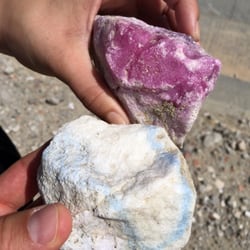
    Bowers Cave - Cool rocks founds near the site.

    Cool rocks founds near the site.

    Bowers Cave
    Bowers Cave - Path that takes you to the backside of the mountain.

    See all

    Path that takes you to the backside of the mountain.

    "The Grapevine" I-5 South - Tejon Pass, California

    "The Grapevine" I-5 South

    4.3(13 reviews)
    7.4 mi

    Oh Wow, I found a listing for the Grapevine hill on the 5, amazing! IMe and the crew are headed to…read moreLong Beach from Nor Cal and driving over the Grapevine. I let one of my crew take over driving this big gas guzzling Suburban. It must be really drinking the gas climbing up this hill. I've driven this Grapevine many times, being originally a southern Cal girl from San Diego. I'm sitting in back writing this review! This hill takes you up and over Tejon Pass at over 4000 feet elevation. This road even gets snowed in sometimes in the winter. They have special routes just for the big rigs to use, I guess maybe it a less steep way or something. I see they do have those runaway truck ramps if they get outta control. I've never seen one being used ... that would be exciting! It's good this freeway is here and this hill is famous. I think we better use a lower gear to keep the speed down on this rig on the long downhill we're on now! I never reviewed a freeway before!

    Review #851 2025-023…read more What goes up, must come down... right? I oddly reviewed "The Grapevine" I-5 North (refer to Review #247) but didn't comment on the south. LOL It's the return from my happy place where I frequently visit my aunt & uncle, especially meaningful after my parents passing. My son never had the opportunity to meet his great uncle, so he was especially doted on by my aunt. This last visit was to my cousin's, their youngest daughter & it was a very different road trip because my beloved aunt & uncle have joined my parents. I no longer have to pay tuition for my mahjong sessions (because I frequently lose to them), receive hugs & affection, enjoy delish home-cooked comfort foods & soups. I was intentional in my road trips to visit them after I settled in my work schedule; the I-5 South always brings a little heartache when I have to leave. I have yet to see snow until after my kids were born, & finally understood what my uncle meant about the perils of trying to drive through the mountain pass when the roads became icy. On this recent visit to my cousins, it was bittersweet because my Aunt & Uncle are no longer with us. (T-T) And we went up as a family of 4, & returned home as a family of 5, adopted a fur baby (her name is Snow, a Siamese mixed kitten) because my cousin & his wife are helping a family friend control the kitty population near her home by spaying/neutering the feral kittens & their mommas. I repeat what I wrote about its northbound: "Driving through the pass during the holidays can be a nightmare when traffic just stops; careless drivers may misjudge the steep downgrades & sharp turns as well as steep inclines leading to the many accidents on the I-5. And heavy rain or winds, & fog are major weather hazards. :-( But after a good season of rain, the hillsides are lush & bright with vegetation & wildflowers. =) When you're driving through The Grapevine during the winter, rainy months, be sure to check The I-5 weather advisory for any intermittent road closures or to add snow chains if you attempt to drive the pass. The only thing you can still be sure of... you have to yawn, chew gum, or suck on a lollipop to relieve the pressure on your ears." Whether you're coming or going... wish you happy & safe driving folks!

    Photos
    "The Grapevine" I-5 South
    "The Grapevine" I-5 South
    "The Grapevine" I-5 South - It was super foggy out  11-30-2025

    See all

    It was super foggy out 11-30-2025

    Three Sisters Rock - This is the very first part of the trail; keep going straight until you reach the railroad tracks and crossover them onto the PCT

    Three Sisters Rock

    4.5(2 reviews)
    42.8 mi

    I've been eying these giant rocks for awhile after spotting them on a map; They're also a filming…read morelocation, although I'd never heard of them, but they are pretty damn cool. This stretch of the PCT was nice and had great vistas and you can scramble and play just about anywhere, although I didn't get to see it all because I was losing the sun faster than I expected, but I'll get back out there for certain. Once you reach the first rock, you'll need to take a side trail off the fire road that will lead you directly up to the rock and then follow the base around until a small crevice and climb your way up. Once you get on top you'll realize that you can't get to the others without climbing back down this rock and going either on a downhill adventure or back to the road and then all the way around to the base of the other rocks There are a couple branches off the fire road and trail that you will need to take, so I suggest you download the all trails app and follow those GPS Tracks PARKING: There is a big KOA sign welcome in PCT hikers right off the main road; park here and take the trail down. I pulled into the KOA to ask directions and the girl that worked there told me to go down to the back and that I could park there, but when I got back to my truck the manager (with her undeserved power trip) Had parked their big Duley in front of me and proceeded to berate me about parking there despite me telling her that her own staff told me where to park. So, do yourself a favor and don't even enter the KOA. Park on the road.

    To view this impressive rock formation up close you will either have to hike from the west,…read morestarting at the corner of Agua Dulce Canyon Rd and Briggs Edison Rd, or from the south via the Pacific Crest Trail located off of Soledad Canyon Rd (opposite Indian Canyon). From the west it's a an 8-mile round trip hike. You'll start by passing through a locked iron gate with a sign that warns that you are entering a private road. Private land maps clearly show that the road runs through land owned by either Southern California Edison, Santa Clarita Watershed Recreation and Conservation Authority or Bureau of Land Management. The path of the road roughly follows power lines so it's pretty hard to get lost. Unfortunately, the rock formation and 100 acres of land surrounding it is located on private property so you won't be able to venture between the rocks or explore its caves. Never-the-less, it's still a fun hike and you can still appreciate the majestic pinnacles from a close enough distance.

    Photos
    Three Sisters Rock
    Three Sisters Rock
    Three Sisters Rock

    See all

    City of Lebec - landmarks - Updated July 2026
    Loading...
    Loading...
    Loading...