
The Old Ridge Route Photos


More like The Old Ridge Route
Recommended Reviews - The Old Ridge Route
Start your review...



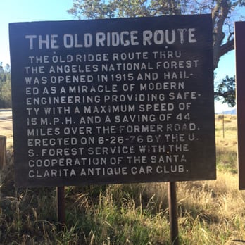
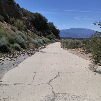
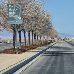
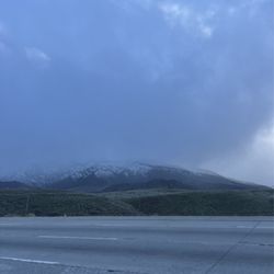
100 years ago, before the 5 fwy, people drove along the Ridge Route to get from LA to Bakersfield. It was was a 44 mile, two-lane, highway. It opened in 1915 and was in use until 1968 after it was replaced by the 5 fwy. Much of the road runs through the Angeles National Forest and passes by many historical landmarks. It's interesting to read about it's history and to view some of the old ruins. One of it's more distinctive sections is Deadman's Curve, located at the base of the grapevine. The Ridge Route is also listed in the National Register of Historic Places. There two access points that allow you to drive along southern sections of the road. From Los Angeles head north on I-5 freeway. Exit at Castaic and take Parker Rd to the Ridge Route. This route only lets you experience a small portion of the road. It was blocked off after storm damage in 2005. I recommend continuing along 5 fwy north and exiting at Hwy 138 heading toward Lancaster. You'll pass a reservoir on the left and you will eventually see a sign for "Old Ridge Route" located on the right. This route provides some nice views of the area and also allows you to see some of the locations of the historic hotels. Sections of the road can be a little rocky since it's no longer maintained. read more


6 years ago

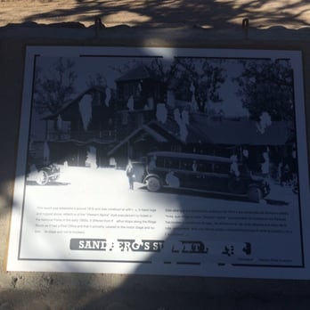
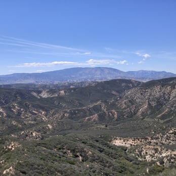
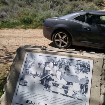
Looking for a local adventure, I stumbled across this one while looking at the back of my Huell Howser roadmap. It said that this road was crafted 100 years ago, as the original road from Los Angeles to Bakersfield. I also discovered online directions to actually find and drive onto the old road. Cool! That sounds like an adventure! So I hopped in the car and drove towards the southern side of the road, up in Castaic. I followed the directions, passed where I went to movie school, and continued along Old Ridge Road. Eventually, I hit a block. Iron poles were formed into an impassable barrier. I even attempted to open it up, but several padlocks further locked the gate. Bummer. It's been fun so far, let's not let a little closed gate stop this trip! I climbed back into the car, and hopped on the 5 freeway. Ironically, the road that would eventually replace the little old road I was actually trying to get onto. I drove north for about thirty minutes to reach the northern end of the old road. I passed an old information marker, which was heavily faded and sun-bleached, but mostly still legible. It spoke of an old hotel that was once here. Grand and majestic a century ago, but reduced to nothing but it's foundation now. I drove on another few beautiful and scenic miles of unmaintained and slowly deteriorating highway, but eventually hit a stretch where fancy Italian racing tires were simply not meant to go. I parked the car, and got out for a stroll. There was another guy there in an SUV, and he said that the old road only went another mile or two before being also blocked by a great iron gate. I thanked him for the information and decided to walk another mile and a half or so before turning back. Again, majestically scenic and beautiful vistas of nature. This bit of the road was also heavily worn, with rocks from the hillsides that had spilled down onto it, creating caltrops that would have certainly damaged Baby's tires. Not too far from where I had parked, I also saw a second information marker in much the same condition as the first. This one spoke of the great climb up and over the mountain that would often stop many of the older cars in their tracks. It's certainly a neat bit of history. A road that's 100 years old is a rarity and a charm to visit. Just to sit and wonder what vehicles have travelled on it's old and worn concrete. History is great to see. There's history all around us if you take a moment to look. I'm certainly glad I did. Thanks Huell for putting it on your map. For More Information: https://www.youtube.com/watch?v=UXtw1bMxMWo For More Information: https://en.wikipedia.org/wiki/Ridge_Route read more



More info about The Old Ridge Route



















The Old Ridge Route - landmarks - Updated July 2026
Best of Lake Hughes
People found The Old Ridge Route by searching for…
Scenic Drive in Lake Hughes, CA
Things to Do in Lake Hughes, CA
Scenic View in Lake Hughes, CA
Public Services & Government in Lake Hughes, CA
Off Road Trails in Lake Hughes, CA
Tourist Attractions in Lake Hughes, CA
Abandoned Buildings in Lake Hughes, CA
Attractions in Lake Hughes, CA
Beautiful Views in Lake Hughes, CA
Post Offices in Lake Hughes, CA
Natural Hot Springs in Lake Hughes, CA
Arts & Entertainment in Lake Hughes, CA
Hiking Trails in Lake Hughes, CA
View Points in Lake Hughes, CA
Sightseeing in Lake Hughes, CA
Trending Searches in Lake Hughes, CA
Browse Articles
Browse Nearby
Browse Brands
Related Searches in Lake Hughes, CA
Beautiful Flower Fields in Lake Hughes, California
Best Fishing Locations and Guides in Lake Hughes, California
Best Lookout Points to Visit in Lake Hughes, California
Best Observation Deck Views in Lake Hughes, California
Best Waterfalls and Swimming Holes in Lake Hughes, California
Book Engaging Historical Tours in Lake Hughes, California
Discover Charming Historic Homes in Lake Hughes, California
Discover Fun Things to Do Alone in Lake Hughes, California
Discover Historic Sites and Places in Lake Hughes, California
Discover Lakes & Ponds to Explore in Lake Hughes, California
Discover Popular Landmarks in Lake Hughes, California
Discover Popular Photo Spots in Lake Hughes, California
Discover Romantic Views in Lake Hughes, California
Discover Stunning Skyline View Spots in Lake Hughes, California
Discover Top Nature Parks to Visit in Lake Hughes, California
Enjoy Hiking Adventures in Lake Hughes, California
Enjoy Scenic Night View Experiences in Lake Hughes, California
Enjoy a Beautiful Waterfall Hike in Lake Hughes, California
Enjoy the Best Night View Spots in Lake Hughes, California
Explore Beautiful Castles and Landmarks in Lake Hughes, California
Explore Beautiful Parks and Green Spaces in Lake Hughes, California
Explore Indoor Public Spaces in Lake Hughes, California
Explore Popular Day Trips From Lake Hughes, California
Explore Popular Scenic Overlook Points in Lake Hughes, California
Explore Popular Scenic Views Near Lake Hughes, California
Explore Popular View Points Around Lake Hughes, California
Explore Scenic Lakes to Visit in Lake Hughes, California
Explore Secret Spots Worth Visiting in Lake Hughes, California
Explore Venues & Event Spaces in Lake Hughes, California
Explore the Best Swimming Holes Around Lake Hughes, California
Find Exciting Tours to Take in Lake Hughes, California
Find Parks and Recreation Activities in Lake Hughes, California
Find the Best Bridge Spots in Lake Hughes, California
Find the Best Playgrounds to Visit in Lake Hughes, California
Get Your City Pass for Attractions in Lake Hughes, California
Hiking Trails With Waterfalls in Lake Hughes, California
Must-See Tourist Attractions Around Lake Hughes, California
Plan a Scenic Drive Route Near Lake Hughes, California
Popular Places to Take Pictures in Lake Hughes, California
Popular Places to Walk Around in Lake Hughes, California
Popular Things to Do in Lake Hughes, California
Popular Things to See in Lake Hughes, California
Stair Climbing Activities and Gyms in Lake Hughes, California
Top Hiking Trails to Explore in Lake Hughes, California
Top Places to Visit in Lake Hughes, California for Sightseeing
Top-Rated Factory Tours to Explore in Lake Hughes, California
Tour Famous Lighthouses Located in Lake Hughes, California
Where to Catch the Best Sunrise View in Lake Hughes, California


