Cancel

    Open app

    Search

    Coal Creek Trail

    5.0 (2 reviews)

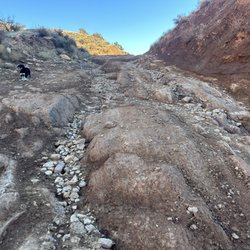
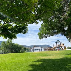
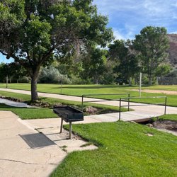
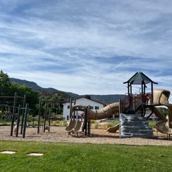
    Coal Creek Trail Photos

    You might also consider

    Recommended Reviews - Coal Creek Trail

    Your trust is our priority, so businesses can't pay to alter or remove their reviews. Learn more about reviews.
    Yelp app icon
    Browse more easily on the app
    Review Feed Illustration
    Photo of Ivory B.
    49
    560
    74132

    3 years ago

    Helpful 8
    Thanks 2
    Love this 8
    Oh no 0

    2 years ago

    Helpful 0
    Thanks 0
    Love this 0
    Oh no 0

    Verify this business for free

    Get access to customer & competitor insights.

    Verify this business

    Kanarra Falls - The river is the trail!!

    Kanarra Falls

    4.8(81 reviews)
    18.8 km

    Kanarra Falls was absolutely worth it. The entire trail was beautiful from start to finish, but…read moreonce you get into the canyons it is seriously mesmerizing. The red rock, the narrow canyon walls, and walking through the water made the whole hike feel so different from anything else we've done. The water was definitely cold, but honestly it felt so refreshing. One of my favorite parts was that it wasn't packed full of people. We went early in the morning, and thanks to the permit system, you're not dealing with huge crowds all over the trail or trying to squeeze past people in the canyon. In my opinion, this is the only way to do a hike like this. Limiting the number of people makes the experience so much more peaceful and lets you actually stop, look around, and enjoy how incredible the canyon is. Such a beautiful hike and definitely one I would recommend. Go early, be prepared to get your feet wet, and take your time because the scenery is amazing.

    Tons of waterfalls + slot canyon hiking through a freezing river = one of the most epic trails I've…read moreever done! It's like a mini version of The Narrows in Zion. The Kanarra Falls trail is quite an adventure - it's a water hike with some dramatic scenery and intense rock scrambling depending on how far in you go. If you only go to the ladder, I'd say it's a moderate trail. But if you go all the way to the last falls, it's more strenuous. I hiked it in late spring and the water was a balmy 38°F! I did some research and planned ahead to wear thick neoprene socks - But even with my thermal socks, the water was so cold my lower legs were numb for about 60-70% of the trail which made this moderate/strenuous hike even more challenging! So I highly recommend the socks if you're hiking outside of the late summer season bc that water is COLD! And you'll be walking in water depths anywhere from your ankles up to your mid-shins for about 75-80% of the trail. Getting to the first large falls by the ladder isn't terribly difficult and you'll still see several smaller falls along the way. The first part is along a well maintained dirt trail with a few small water crossings before you have to get down into the riverbed. So for those wanting to stop at the top of the ladder, it's still a fantastic and much less strenuous hike. But there are about 3-4 gorgeous falls and slot canyons past that leading up to the last falls that I really would've regretted not seeing. The rock scrambling can get quite difficult- especially for a short person (I'm 5'2"). At one point I had to hoist myself up over some very tall boulders using just my arms and had to do a bit of a chimney crawl up another boulder and a narrow slot wall so be prepared and know your abilities bc I struggled to get back down LOL! I used one of my poles for most of the hike bc the riverbed is very rocky and slippery. I also wore an old pair of my fave Salomon waterproof(ish) hiking shoes with really solid tread - definitely helped. I imagine in the hot weather you'd be fine in some sort of water shoe with no socks but not in winter/spring. Reservations for this hike are required year-round as they limit the number permitted daily to preserve the environment here since this is such a popular trail. It was easy to reserve my spot online and I recommend doing it as far in advance as possible bc spots go fast - especially in the summer. There's plenty of paved parking at the trailhead with nice bathrooms. There are also more bathrooms along the trail right before the first water crossing. It's easy to find - google maps takes you right to the parking area. AllTrails says the trail is 3.6 miles with 656 feet elevation gain but I did just over 5 miles total with 1100+ feet elevation gain by going past the ladder at the first falls - totally worth it - Definitely in my top 5 trails of all time!
    Photos
    Kanarra Falls - Got my souvenir - I always get a sticker for my water bottle when I finish a big trail lol!

    Got my souvenir - I always get a sticker for my water bottle when I finish a big trail lol!

    Kanarra Falls - Parking lot at the trailhead

    Parking lot at the trailhead

    Kanarra Falls - Bathrooms on the trail right before the first water crossing - last chance for toilets!

    See all

    Bathrooms on the trail right before the first water crossing - last chance for toilets!

    Red Reef Trail

    Red Reef Trail

    4.9(11 reviews)
    58.8 km

    You can use your national park pass to avoid the fee here. You just have to display it on your…read moredash. Maps took us like 2 miles north, then back track to the tunnel to get in. Not sure if that was the best way or not. The parking lot is not huge, and you can't park in the designated camping area spots. There are plenty of picnic tables, probably more than parking spaces. There are at least 20 tables there. There are a few trails to choose from. Very close the parking and campsites is a short 1/4 hike (or shorter) to the dinosaur prints. There is a hike in the other direction to the mini waterfall and pond. Probably about a mile or a little over a mile (1direction). We also found an old almost petrified bristlecone tree (that was neat). We got lucky with the weather for Dec, it was probably about 60 degrees and very nice. I saw that in the summer it can be over 110 so I am glad that we got the nice weather. The red /orange scenery is spectacular and representative of the area, like it is at zion, bryce, snow canyon, pioneer park, etc. We enjoyed a picnic lunch there, and we had a blue bird, a scrub jay, come join us and beg for food. Check out my photos.

    +++++++++++++++++++++++++++++ DO NOT FOLLOW THE YELP…read moreDIRECTIONAL MAP TO GET HERE! +++++++++++++++++++++++++++++++ To reach the Red Reef trailhead, take Exit 23 off Interstate 15 S and head east on Red Cliffs Campground Road. The trailhead is located at the campground, which is about 5 miles down the paved road. GPS Coordinates: 37.224794, -113.406300 It is $5 to park your car here in the parking lot, follow directions to the trail. It is a beautiful and easy hike - until the very end. it meanders along a path - then at the end you need to climb some pretty big rocks to see the payoff of the beautiful canyon. We loved this hike. (but were thrown off by the Yelp directions that sent us in an alternate direction.

    Photos
    Red Reef Trail
    Red Reef Trail
    Red Reef Trail

    See all

    Canyon Overlook Trail - Rees's Roots - Overlook Trail - Zion National Park Utah

    Canyon Overlook Trail

    4.8(58 reviews)
    52.7 km

    The parking here is literally impossible unless you come early in the day to get to the tiny…read moreparking lot (located on east end of the Zion-Mt. Carmel Tunnel, but you can only turn into it if you're heading east-bound) , or park semi-legally on the shoulder of the road or in one of the scenic pullouts. There's not much room to walk on the shoulder of the road, and I saw whole families walking on the road itself, almost causing cars on the road to run into them. I don't really know of a good solution other than making it a shuttle stop or something. Anyways, if you're lucky to get a spot, the hike is amazing. There's some stairs to begin with, and the trail eventually gets narrow with railings and a boardwalk. As you complete the trail, the whole Zion canyon opens up before your eyes. You can see the expansiveness, and when I visited the sky was a perfect, cloudless blue. It's a short hike (albeit may be steep for some people), and I think the payoff is worth it. On the way back, I got to see several desert bighorn sheep grazing right above the Tunnel. They didn't seem to be bothered by the cars or the people.
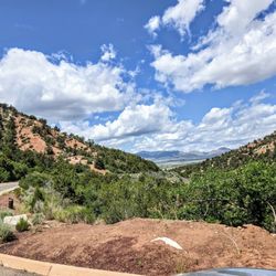
    Really nice views at the top on this short mile long trail but parking is not plentiful. If you're…read morejust looking for views, this is a good option. But if you want more of a hike this may not satisfy that. We went in the afternoon as we were finishing our day and came from the visitor center. We drove up the same road as the shuttle and turned at stop 3. The road leading to the hike had a few pulloffs and lots of nice views. Once you reach the end of the tunnel (they only allow one lane so traffic will periodically stop one way), the trail is right there as you exit the tunnel. There's limited compact car parking on the right and then a small lot a little further on the left (with bathrooms). Cars were also parking by the no parking area signs. The hike itself is short and can get congested. But the views at the end are quite nice. We also heard thunder throughout but didn't get rained on.

    Photos
    Canyon Overlook Trail - 7am 20 minute hike

    7am 20 minute hike

    Canyon Overlook Trail - Rees's Roots - Overlook Trail - Zion National Park Utah

    Rees's Roots - Overlook Trail - Zion National Park Utah

    Canyon Overlook Trail

    See all

    Kolob Canyons - On Taylor Creek Trail

    Kolob Canyons

    4.8(42 reviews)
    28.9 km

    Zion National Park covers nearly 150,000 acres. Most people will go the most popular area in…read moreSpringdale, but there's a separate area known as Kolob Canyons which is located in a different area of the park about an hour's drive away. I spent a leisurely day here, which I thought was enough to enjoy the visitor center, the scenic drive, and hike Timber Creek Overlook as well as Taylor Creek Trail. The visitor center has the NPS ranger desk, a small gift shop with the usual NPS offerings, and information about the rocks. There's also washrooms here and water available. The drive was beautiful with many pull outs to enjoy the view. I drove up to Timber Creek Overlook which is at the end of the drive. It's about a 1.2 mi path, although it was evidentially super muddy in the past with super deep foot prints and people walking everywhere. It was ok. The Taylor Creek Trail was amazing. I've never hiked a trail with as many stream crossings, which made it fun. There's also two homestead cabins on the way, and the trail takes you through a narrow box canyon toward the Double Arch Alcove. The end of the hike was pretty chilly due to the shade and the water present. Brr. I think this is a great counterpart to the more famous area - it's definitely less visited and you get more solitude.
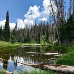
    Kolob Canyons as part of Zion National Park is an underrated gem much less visited than The Narrows…read morein Zion. It's located about an hour north of the main park entrance, off the highway on the way to Cedar City. An admission fee is required to enter this area of the park. We arrived around 8:30am and there were only several cars in front of the visitor center. We checked in with our national park passes and started the 5-mile scenic drive up to the top of the mountain. There's are many pullouts along the road to take pictures and see the beautiful views. A circular parking lot is at the summit with vault restrooms and a nice view of the Kolob Canyons. The secret here is to hike the 0.5 mile trail with the trailhead at the parking lot. The hike has a little elevation, but a 76-year old in our party was able to hike all the way. The views at the end of the trail are phenomenal and worth the trip. We spent a lot of time here taking pictures and soaking up the sights. We could see far into the horizon, past the mountains into Arizona on a clear day. For me, visiting Kolob Canyons was my favorite and most memorable part of my Utah trip. The crowds here are nearly nonexistent, though parking at the top of the mountain can get full. If you're ever in the area, I highly recommend adding Kolob Canyons to your itinerary!

    Photos
    Kolob Canyons - Ashdown Gorge

    Ashdown Gorge

    Kolob Canyons - On Taylor Creek Trail

    On Taylor Creek Trail

    Kolob Canyons - View on Kolob Canyon Rd. in Zion National Park

    See all

    View on Kolob Canyon Rd. in Zion National Park

    Alpine Pond Trail - Love sunsets here so much.

    Alpine Pond Trail

    5.0(2 reviews)
    21.0 km

    It's been a while since we did this trail but it was definitely one of the prettiest and calm hikes…read morewe have ever done. Short but not lacking in views. Easy to find within Cedar Breaks National Monument. The trail is rated easy however for those not used to altitude, it might challenge you just a little bit. You are up at over 10,500 feet. There is also an unguarded edge with a fall of 2,500 feet so steer clear of the edge. The trail weaves through the forrest and there are beautiful wildflowers and abundant wild life. We certainly witnessed and watched a few deer. When you reach the pond, the area surrounding the pond is so pretty and peaceful. I loved hearing the whistling wind as I approached the edge of Cedar Breaks. The views are epic and so much color with orange, pinks, reds, cream across the landscape with lots of striking green trees. This is where all the action developed as The Hurricane Fault is what developed the Grand Staircase. So much to see and take in on this trail so my advice to you is pack a lunch and head out on cruise control. Take a deep breath and just enjoy!

    Adding details about this trail as most folks don't realize it even exists…read more It's one of those places you really shouldn't miss if you're exploring the natural side of Utah. This particular trail is seasonal due to its elevation at about 10,500 ft. Best months to visit are May - Aug as the wildflowers are at their peak. It's so beautiful that it might take your breath away. It's also a shorter trail of about 2.5 miles round trip. To find this trail, you'll need to enter Cedar Breaks National Monument and park in the Chesman Overlook parking lot. Wooden signs will point you in the right direction. The trail is a loop and will provide you with some of the most spectacular views of the orange, red, creamy amphitheater. You get to hike right along the rim of the cliffs! It's breathtaking to say the least. You'll make your way to a meadow passing by all sorts of spectacular trees and wildflowers. Then there's the pond itself, surrounded with more wildflowers. Just WOW moments after more wow moments. Pro tips: Take a picnic and enjoy it by the pond. Stop and smell the wildflowers. Some of them smell like little bits of heaven. Hope you enjoy this place as much as I do. Happy hiking!

    Photos
    Alpine Pond Trail - The pond

    The pond

    Alpine Pond Trail - Mountain Lupine growing wild

    Mountain Lupine growing wild

    Alpine Pond Trail - Wildflowers

    See all

    Wildflowers

    Coal Creek Trail - hiking - Updated September 2026

    Loading...
    Loading...
    Loading...