Cancel

    Open app

    Search

    Cascade Falls

    4.3 (12 reviews)

    Cascade Falls Photos

    You might also consider

    Recommended Reviews - Cascade Falls

    Your trust is our priority, so businesses can't pay to alter or remove their reviews. Learn more about reviews.
    Yelp app icon
    Browse more easily on the app
    Review Feed Illustration

    Reviews With Photos

    Cascade Falls
    Amanda D.

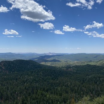
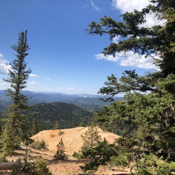
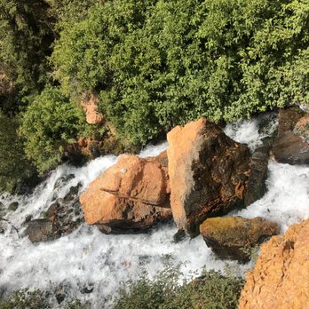
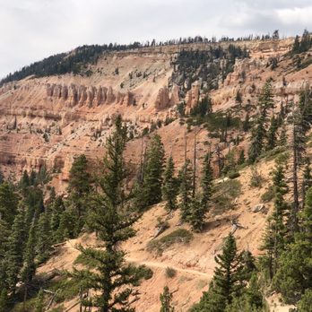
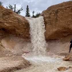
    My four kids and I hiked this trail in about an hour on a Thursday late morning in late May. I am sure it can be done much faster but we don't hike for speed in our family - we like to meander and enjoy the adventure. To put everything in perspective - I am over 40, overweight, and out of shape - but based on reviews I felt fairly sure this hike was achievable. My kids are 16, 14, 13, and 11 and are all of average hiking ability for their ages. Overall - it was a little difficult for me in spots but at no point did I think I wouldn't make it there or back. I just took breaks and took my time. My kids had 0 problems at all. Some were skipping and running on the way back. The views were stunning! The waterfall was gorgeous. The path was shaded in parts and had several very cool places to sit and look (and catch your breath if you need to - ahem, cough, cough). We only saw other groups of people twice and everyone was friendly and moving along. The only thing I would say is that if you take young children, you need to be careful - one side of the trail has a steep drop off for almost the whole hike.

    Gorgeous views
    Emma W.

    Cascade Falls is a really nice hike and is located inside of Dixie National Forrest. You don't have to be an experienced hiker to finish the trail. It's a fairly short trail but the end result is beautiful. Breathtaking vistas along the entire trail. Although the hike is only about a mile long the elevation is nearly 9,000 so it's slightly harder to breath. Be sure to not wear yourself out, and bring lots of water and inhalers if you have asthma. The trail starts in a covered wooded forrest for almost half a mile and proceeds on a rock path. There are stairs and a paved path to continue the trail. It has some spectacular views along the way, and the end result is a beautiful waterfall coming out of a cave aka Cascade Falls. I highly recommend this trail and it only takes about an hour to hike from start to finish.

    See all

    2 months ago

    Helpful 0
    Thanks 0
    Love this 0
    Oh no 0
    Photo of Tina A.
    146
    272
    1556

    3 years ago

    Helpful 5
    Thanks 3
    Love this 7
    Oh no 0

    3 years ago

    Helpful 0
    Thanks 0
    Love this 0
    Oh no 0

    2 years ago

    Helpful 0
    Thanks 0
    Love this 1
    Oh no 0

    3 years ago

    Helpful 0
    Thanks 0
    Love this 0
    Oh no 0
    Photo of Emma W.
    119
    71
    164

    7 years ago

    Helpful 1
    Thanks 0
    Love this 2
    Oh no 0

    6 years ago

    Helpful 0
    Thanks 0
    Love this 0
    Oh no 0
    Photo of Zina C.
    34
    18
    31

    7 years ago

    Helpful 0
    Thanks 0
    Love this 1
    Oh no 0

    13 years ago

    Helpful 8
    Thanks 0
    Love this 4
    Oh no 0
    Photo of Eric P.
    2
    144
    1

    12 years ago

    Helpful 1
    Thanks 0
    Love this 1
    Oh no 0

    8 years ago

    Helpful 0
    Thanks 0
    Love this 1
    Oh no 0

    6 years ago

    Helpful 0
    Thanks 0
    Love this 0
    Oh no 0

    Ask the Community - Cascade Falls

    Review Highlights - Cascade Falls

    Although there was no shade available on that platform, it was enjoyable nonetheless.

    Mentioned in 2 reviews

    Read more highlights

    Verify this business for free

    Get access to customer & competitor insights.

    Verify this business

    Kanarra Falls - The river is the trail!!

    Kanarra Falls

    4.8(80 reviews)
    24.0 mi

    Tons of waterfalls + slot canyon hiking through a freezing river = one of the most epic trails I've…read moreever done! It's like a mini version of The Narrows in Zion. The Kanarra Falls trail is quite an adventure - it's a water hike with some dramatic scenery and intense rock scrambling depending on how far in you go. If you only go to the ladder, I'd say it's a moderate trail. But if you go all the way to the last falls, it's more strenuous. I hiked it in late spring and the water was a balmy 38°F! I did some research and planned ahead to wear thick neoprene socks - But even with my thermal socks, the water was so cold my lower legs were numb for about 60-70% of the trail which made this moderate/strenuous hike even more challenging! So I highly recommend the socks if you're hiking outside of the late summer season bc that water is COLD! And you'll be walking in water depths anywhere from your ankles up to your mid-shins for about 75-80% of the trail. Getting to the first large falls by the ladder isn't terribly difficult and you'll still see several smaller falls along the way. The first part is along a well maintained dirt trail with a few small water crossings before you have to get down into the riverbed. So for those wanting to stop at the top of the ladder, it's still a fantastic and much less strenuous hike. But there are about 3-4 gorgeous falls and slot canyons past that leading up to the last falls that I really would've regretted not seeing. The rock scrambling can get quite difficult- especially for a short person (I'm 5'2"). At one point I had to hoist myself up over some very tall boulders using just my arms and had to do a bit of a chimney crawl up another boulder and a narrow slot wall so be prepared and know your abilities bc I struggled to get back down LOL! I used one of my poles for most of the hike bc the riverbed is very rocky and slippery. I also wore an old pair of my fave Salomon waterproof(ish) hiking shoes with really solid tread - definitely helped. I imagine in the hot weather you'd be fine in some sort of water shoe with no socks but not in winter/spring. Reservations for this hike are required year-round as they limit the number permitted daily to preserve the environment here since this is such a popular trail. It was easy to reserve my spot online and I recommend doing it as far in advance as possible bc spots go fast - especially in the summer. There's plenty of paved parking at the trailhead with nice bathrooms. There are also more bathrooms along the trail right before the first water crossing. It's easy to find - google maps takes you right to the parking area. AllTrails says the trail is 3.6 miles with 656 feet elevation gain but I did just over 5 miles total with 1100+ feet elevation gain by going past the ladder at the first falls - totally worth it - Definitely in my top 5 trails of all time!

    Been living in Kanarraville since 2015 , I'm 65 just did the falls last summer with my sister it…read morewas amazing. I have a daughter in law that goes up all the time. It's Beautiful.

    Photos
    Kanarra Falls - Got my souvenir - I always get a sticker for my water bottle when I finish a big trail lol!

    Got my souvenir - I always get a sticker for my water bottle when I finish a big trail lol!

    Kanarra Falls - Parking lot at the trailhead

    Parking lot at the trailhead

    Kanarra Falls - Bathrooms on the trail right before the first water crossing - last chance for toilets!

    See all

    Bathrooms on the trail right before the first water crossing - last chance for toilets!

    Emerald Pools - 2,000 foot canyon walls of Emerald Pools

    Emerald Pools

    4.2(95 reviews)
    20.1 mi

    There are three Emerald pools at different elevations, and so the best thing about this trail is…read morethat if you're tired after the first pool (the lower pool) you can turn around and feel pretty accomplished. I think a lot of people do this since the lower pool is definitely the busiest. There's also a neat little waterfall cascading into the pool, so my personal opinion is that it's the prettiest pool. The middle pool actually goes up to the sandstone shelf that creates the waterfall to the lower pool. It's pretty neat, although I didn't dare go near the edge as the rocks can be slippery, and I wasn't about to risk anything. The trail here is a little steeper than the trail to the lower pool. The upper pool is at the base of the grotto with sweeping cliffs. It does have some steps and a lot of sand. The sand can sap your energy, and I saw a few people needing to rest and gather their strength. The grotto was a bit flooded when I went, and so you might have to step on some rocks to avoid getting your shoes wet. I saw a bunch of ground squirrels frolicking around here. Overall, gorgeous and unique trail to hike in Zion!

    I visited Emerald Pools at Zion National Park right before the 4th of July, and it was a really…read morenice stop to add to the trip. I only did the easier route to the Lower Emerald Pool, and that was enough for me that day since I did other trails like the Riverside walk. You can get there from the Zion Lodge shuttle stop, which is stop #5, so it's pretty easy to work into your day if you're already taking the shuttle through the park. The trail to the lower pool was scenic without feeling too difficult. You still get those beautiful Zion views along the way, and once you get closer to the pool area, the canyon walls and water make it feel really peaceful. The lower emerald pools is about .6 miles, 1.2 round trip. There are also Middle and Upper Emerald Pools if you want to keep going, but I kept it simple with the lower pool this time. I went right before 4th of July so the park was definitely busy, I'd recommend bringing water, wearing comfortable shoes and giving yourself extra time for the shuttle and crowds. I'm glad I did Emerald Pools. The Lower Pool was a pretty, easy hike and a great option if you want something scenic in Zion without committing to a harder trail.

    Photos
    Emerald Pools - Loving the size of the huge rocks & 2,000 foot canyon we pass by on this hike.

    Loving the size of the huge rocks & 2,000 foot canyon we pass by on this hike.

    Emerald Pools
    Emerald Pools - Emerald Pools hike - start!

    See all

    Emerald Pools hike - start!

    Observation Point

    Observation Point

    4.8(53 reviews)
    18.7 mi

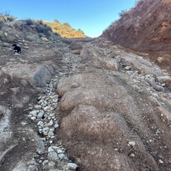
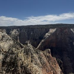
    This is a unique hike to an INCREDIBLE view. I saw online people saying this is the actual best…read moreview in Zion and honestly, it is indeed one of the grandest - even more so than Angel's landing. Of note, the trail changes from roc/dirt to sand and the day I came it was chilly and SO windy, especially by the viewpoint. My allergies were absolutely killing me and I had to put on my sunglasses at the viewpoint because of how much I was tearing up with the wind and sand/dust. Nevertheless though the view was totally clear and absolutely breathtaking! I also loved the little stretch to get to the viewpoint where you can see some vistas in the distance, and feel like your kind of walking through a desert field (that's how I felt anyway). Bear in mind how CRAP the roads are to get to the trailhead (observation point/east Mesa trailhead). I 100% recommend either going in a high clearance vehicle or using the $8 per person Zion ponderosa shuttle because these are some of the worst roads I have ever seen (I took the shuttle). I was driving a rented Nissan Sentra on this trip and I have zero question I would have been sweating bullets or just trapped in a pothole ditch if I had tried to drive the car out. And if it's been raining, the 1-1.5 foot deep potholes become a mud slick - I wouldn't even try coming out at all if that's the case.

    The overlook point fr9m Zion National Park in Utah is a natural marvel…read more From the winding road across the mountains to the tunnel until you reach the summit point for a 1.5-mile hike you'll definitely love the views.

    Photos
    Observation Point
    Observation Point
    Observation Point

    See all

    Willis Creek

    Willis Creek

    4.7(3 reviews)
    35.8 mi

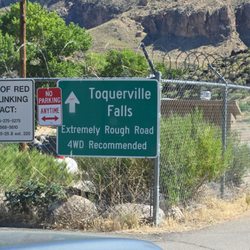
    This review is for the Willis Creek Slot Canyon Trail. I've heard of them but never been to one,…read moreand we decided to stop here on the way home to our rental. To get to the trail head, you have to drive in on an unpaved five or so mile road which is scary at times. Make sure you have clearance for your car like the sign says before coming. Our Toyota 4Runner made it through without any problems. After what seems like an eternity because you can't go fast, we got to the head. There's a sign-in book for names, where you're from, and if you're a day or evening/overnight group. Now off to the Slot Canyon! This trail is marked as easy. It's mostly gravel rocks and little steps. My son the adventurous one wanted and did make his own excursion from what others surely have done before. Since it was late afternoon, we decided on a half hour in and then a turn around. The major slot canyon is pretty close to the start of the trail, and it's rather epic. The rocks are so smooth and it can be peaceful in there. I believe because of the remoteness of the canyon, it never seems to be crowded. I would recommend honking shoes, not sneakers, and appropriate clothing for the sun that will bear down on you. Bring lots of water. Watch out for the horse poop! If we weren't so exhausted after a long day, we probably would have hiked along the trail much longer than a half hour, but we definitely got the flavor we were looking for. Have you ever been to an amusement park like Disney where they create mountains and rocks? I can say I've been to the real deal and it's much better.

    Beautiful and special place. Watch out for horse poop up and down the creek. Hike is short and…read moreeasy. The drive up was sketchy, I wouldn't attempt in a 2 wheel drive. We drove an all wheel drive suv and made it. We loved it.

    Photos
    Willis Creek - Instagram: @telephonesmoothie

    Instagram: @telephonesmoothie

    Willis Creek - A natural hole to stick your arm through.

    A natural hole to stick your arm through.

    Willis Creek - Instagram: @telephonesmoothie

    See all

    Instagram: @telephonesmoothie

    Red Reef Trail

    Red Reef Trail

    4.9(11 reviews)
    40.6 mi

    You can use your national park pass to avoid the fee here. You just have to display it on your…read moredash. Maps took us like 2 miles north, then back track to the tunnel to get in. Not sure if that was the best way or not. The parking lot is not huge, and you can't park in the designated camping area spots. There are plenty of picnic tables, probably more than parking spaces. There are at least 20 tables there. There are a few trails to choose from. Very close the parking and campsites is a short 1/4 hike (or shorter) to the dinosaur prints. There is a hike in the other direction to the mini waterfall and pond. Probably about a mile or a little over a mile (1direction). We also found an old almost petrified bristlecone tree (that was neat). We got lucky with the weather for Dec, it was probably about 60 degrees and very nice. I saw that in the summer it can be over 110 so I am glad that we got the nice weather. The red /orange scenery is spectacular and representative of the area, like it is at zion, bryce, snow canyon, pioneer park, etc. We enjoyed a picnic lunch there, and we had a blue bird, a scrub jay, come join us and beg for food. Check out my photos.

    +++++++++++++++++++++++++++++ DO NOT FOLLOW THE YELP…read moreDIRECTIONAL MAP TO GET HERE! +++++++++++++++++++++++++++++++ To reach the Red Reef trailhead, take Exit 23 off Interstate 15 S and head east on Red Cliffs Campground Road. The trailhead is located at the campground, which is about 5 miles down the paved road. GPS Coordinates: 37.224794, -113.406300 It is $5 to park your car here in the parking lot, follow directions to the trail. It is a beautiful and easy hike - until the very end. it meanders along a path - then at the end you need to climb some pretty big rocks to see the payoff of the beautiful canyon. We loved this hike. (but were thrown off by the Yelp directions that sent us in an alternate direction.

    Photos
    Red Reef Trail
    Red Reef Trail
    Red Reef Trail

    See all

    The Narrows - Sept 2023 -  Squirlo posing for his photo shoot   :D

    The Narrows

    4.9(128 reviews)
    17.0 mi

    You get to The Narrows by taking the shuttle to the Temple of Sinawava, which is shuttle stop #9…read morewhen the shuttle is running, and going on the Riverside Walk which is a nice paved two mile round trip walk alongside the Virgin River. That trail ends at the river where The Narrows begin - aptly named as it's the most narrow part of the gorge. I spent a little bit of time in the river, but nothing serious as I didn't have enough time to dedicate to the trek to Wall Street. It's on my list of things to do for a future trip. You shouldn't enter the The Narrows if there's any rain in the weather forecast or any rain in the surrounding areas. It's too risky to be caught in the canyon with any chance of flash floods. There are port-a-potties and water at the shuttle station. Even though you're hiking in a river, that water should not be consumed as there have been cyanobacteria and their associated toxins found in the Virgin Riven. There is no known recreational water filtration or disinfection method that can reduce the toxins to a safe level for drinking!

    One of the most beautiful outdoor experiences of my life…read more The Narrows combines stunning scenery, lush plant life, wildlife, and just the right amount of adventure. What more could you ask for? We visited on June 22 under nearly perfect conditions. It was hot in Springdale, but the slot canyon stayed cool and comfortable. The water was deep enough in spots to give the youngsters a little trepidation and excitement, but everyone made it through with huge smiles and a sense of accomplishment. The towering canyon walls, flowing river, and ever-changing scenery make this a hike unlike any other. Equal parts beauty and exhilaration. One final note: please don't feed the fat little squirrels. They're already living their best lives and definitely don't need the extra calories.

    Photos
    The Narrows - My poor walking stick at the end of the journey!

    My poor walking stick at the end of the journey!

    The Narrows - Meet Squirlo...the cutest and friendliest animal here. He walks up to you like you're his buddy.  :)

    Meet Squirlo...the cutest and friendliest animal here. He walks up to you like you're his buddy. :)

    The Narrows

    See all

    Mossy Cave Trail

    Mossy Cave Trail

    4.6(38 reviews)
    37.0 mi

    Mossy Cave Trail is outside the fee area for Bryce Canyon Canyon National Park, and I'm not sure if…read morethe rangers check if you've paid. Anyways, I have an annual pass so I didn't worry about it. This is one of the lowest elevation hikes in the park as well as one of the only hikes that begins with a climb and ends with a descent, so if you're not sure about your endurance and want an easy, safe hike where you won't get stuck, this hike is for you! You can see hoodoos, and also Tropic Ditch Falls. It's not a waterfall in the usual sense, as it's a result of a man-made canal that diverted water from East Fork of the Sevier River to Bryce Canyon. I would say that the view was....ok. The trail also leads you to Mossy Cave, which isn't a cave but a sheltered overhang. I was in the season where there wasn't any moss, nor any icicles. It was pretty cold temperature-wise in the grotto. This is a low-effort, low reward type of hike, which is ok. In comparison to the beautiful views that you can get in the scenic drive inside the park, I would say skip this trail if you're short on time and wanting views.

    I was recommended this hike by my Airbnb host. It's rather short, took me about 20 min total…read more Parking is limited but because it's short I got lucky and got a spot from someone leaving. There are a couple NP potties there (no running water). There wasn't much water the day I came, you could see a trickle of the waterfall but it wasn't particularly exciting. Depending on the time of year, that can change. Overall, I wouldn't have spent time doing this hike if I hadn't been passing by it (but I was, on my way to Capitol Reef). But if you are passing, it's a nice walk with a little hill :)

    Photos
    Mossy Cave Trail
    Mossy Cave Trail - There it is!

    There it is!

    Mossy Cave Trail

    See all

    Cascade Falls - hiking - Updated August 2026

    Loading...
    Loading...
    Loading...