Del Dios Highlands County Preserve Photos



You might also consider


More like Del Dios Highlands County Preserve
Recommended Reviews - Del Dios Highlands County Preserve
Start your review...


Reviews With Photos
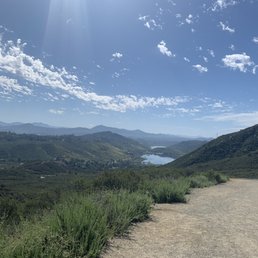

This review is strictly about the steep hill climb. I love it for a quick intense workout. The gates open at 8am which isn't helpful since usually the heat has started around then. If you park across the street just beware that people frequent that lot and break into cars. I would just wait until 8 and leave all valuables at home. The hill is STEEP so unless your pet is used to hikes do not bring them. If you do bring water for both of you. I just go up the hill past the gate to the view of the dam then turn around and run back down. With that don't sprint down. You will probably fall. Its slippery and has loose gravel all over the trail. Anywho if you like hills or just looking for a good workout without the gym this is a great one!


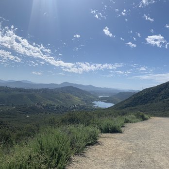
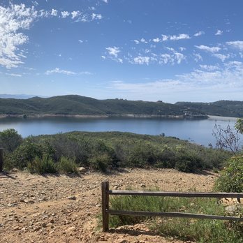
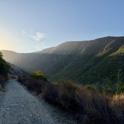
Been here three times and I find this trail challenging but very doable. Like the other reviewers have noted, the trail takes you on an immediate incline from the entrance and gradually becomes steeper as you progress along. The steepest part comes right before the summit and really takes some effort. The views are great when you do get to the top, the view of Del Dios reservoir is spectacular. Coming back down the trail is probably my least favorite part of the hike because the gravel is slippery and the decline is sharp. I recommend crisscrossing the trail to prevent falling. All in all, you'll get a nice workout and great views from this trail.


This is a great workout trail that connects to the Elfin Forrest Preserve. It is super near my parents house and we line to hike, trail run and explore the area. Depending on the clarity of the view, you can see all the major peaks and the Pacific Ocean! The preserve opens each day around 8 am. If you come before it opens, you can park across the highway. Cars go fast though so be safe! The first mile of the main trail is uphill. However, there is another trail you can take from the parking area! This one is more steep. When you get up the first big incline, there are more trails to explore! It's easy to do a couple of miles but you can also just do a quick up and down. This is a dog friendly trail but they need to be on leashes. Please pick up your dogs waste! Enjoy the views, fresh air and exercise!


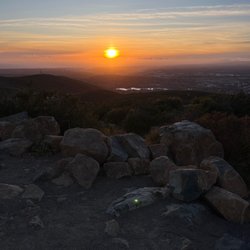
The Del Dios Preserve connects to other preserves and trails so you can make this a short hike or a long trek. This review is primarily on the Del Dios Highland section which is a 3.0 round trip trail from the parking area to the top of the mountain where you can connect to other trails or return. This is not a hike for the faint of heart it is 1.5 miles of up hill battle some areas are very steep, all are on a good wide dirt trail. If you only want a short trip take the trail for about 1/4 mile and then take a left to the end of the point. Great boulders to sit and have a picnic and over looks the lake. If you are more adventurous continue to the top. Thank the eagle scout who put the bench in about 1/2 way. There is no water on the trail so take plenty in the summer this is a very, very hot area with little or no shade. When you get to the top, on a good day you can see the ocean and all the way up to the mountains past L.A. and you can see Lake Hodges to your east. The hike down is exactly that downhill, watch your footing on the steepest slopes as the dg is loose. I would recommend this hike in the early morning, would make a great sunrise or late afternoon, you can get awesome sunsets.


I have a love/hate relationship with these trails! I'm kidding, but some of these hikes kick my rear! Seriously though, this area is gorgeous! There is a trail for everyone and all abilities. The lake views are stunning! It's also a great area to bring your dogs for a hike! Enjoy...but watch out for snakes.


3 years ago
I like the view but the only thing that I didn't know which didn't mention on the reviews is that it's not good for strollers. read more


This is the Del Dios Highlands Trail. This is a 2.6 mile Up and Down hike that ends at the entrance to the Elfin Forest Trail system. This was a bit tougher than I was expecting as this trail goes straight up the side of a small mountain. Not fun on a hot August afternoon. The trail is very gravely, and it's slippery on the way down if you're not wearing the right shoes. Trail is wide with a few viewpoints along the way. Near the end of his trail there is viewpoint #2 with a placard stating "Peaks of Interest" . This stupid sign shows Harmony Grove as a green meadow, but as your look past the placard you see that Harmony Grove has been destroyed and replaced with a mega housing development. They need to update the placard to show homes, not a field and cows... Tip - If you're planning on venturing into the Elfin Forest trails be sure to leave breadcrumbs to lead you back to the Del Dios Highlands trail. It's easy to miss because it's hidden and not marked..Its also not marked on any of the Elfin Forrest maps. - Because of the steep 1.3 mile hike up, I'm not sure this is good for small kids or pets. read more


This review is strictly about the steep hill climb. I love it for a quick intense workout. The gates open at 8am which isn't helpful since usually the heat has started around then. If you park across the street just beware that people frequent that lot and break into cars. I would just wait until 8 and leave all valuables at home. The hill is STEEP so unless your pet is used to hikes do not bring them. If you do bring water for both of you. I just go up the hill past the gate to the view of the dam then turn around and run back down. With that don't sprint down. You will probably fall. Its slippery and has loose gravel all over the trail. Anywho if you like hills or just looking for a good workout without the gym this is a great one! read more



6 years ago
Been here three times and I find this trail challenging but very doable. Like the other reviewers have noted, the trail takes you on an immediate incline from the entrance and gradually becomes steeper as you progress along. The steepest part comes right before the summit and really takes some effort. The views are great when you do get to the top, the view of Del Dios reservoir is spectacular. Coming back down the trail is probably my least favorite part of the hike because the gravel is slippery and the decline is sharp. I recommend crisscrossing the trail to prevent falling. All in all, you'll get a nice workout and great views from this trail. read more


This is a great workout trail that connects to the Elfin Forrest Preserve. It is super near my parents house and we line to hike, trail run and explore the area. Depending on the clarity of the view, you can see all the major peaks and the Pacific Ocean! The preserve opens each day around 8 am. If you come before it opens, you can park across the highway. Cars go fast though so be safe! The first mile of the main trail is uphill. However, there is another trail you can take from the parking area! This one is more steep. When you get up the first big incline, there are more trails to explore! It's easy to do a couple of miles but you can also just do a quick up and down. This is a dog friendly trail but they need to be on leashes. Please pick up your dogs waste! Enjoy the views, fresh air and exercise! read more


16 years ago
The Del Dios Preserve connects to other preserves and trails so you can make this a short hike or a long trek. This review is primarily on the Del Dios Highland section which is a 3.0 round trip trail from the parking area to the top of the mountain where you can connect to other trails or return. This is not a hike for the faint of heart it is 1.5 miles of up hill battle some areas are very steep, all are on a good wide dirt trail. If you only want a short trip take the trail for about 1/4 mile and then take a left to the end of the point. Great boulders to sit and have a picnic and over looks the lake. If you are more adventurous continue to the top. Thank the eagle scout who put the bench in about 1/2 way. There is no water on the trail so take plenty in the summer this is a very, very hot area with little or no shade. When you get to the top, on a good day you can see the ocean and all the way up to the mountains past L.A. and you can see Lake Hodges to your east. The hike down is exactly that downhill, watch your footing on the steepest slopes as the dg is loose. I would recommend this hike in the early morning, would make a great sunrise or late afternoon, you can get awesome sunsets. read more


13 years ago
I have a love/hate relationship with these trails! I'm kidding, but some of these hikes kick my rear! Seriously though, this area is gorgeous! There is a trail for everyone and all abilities. The lake views are stunning! It's also a great area to bring your dogs for a hike! Enjoy...but watch out for snakes. read more


13 years ago

10 years ago
The second half mile may break your heart, but awesome views when you get to the top. Hat, sunblock, and water are required, as there is minimal shade. read more

9 years ago
More info about Del Dios Highlands County Preserve
9860 Del Dios Hwy
Escondido, CA 92025
Directions
Visit Website
http://www.sdparks.org
Hours
Outdoor Amenities
Ask the Community - Del Dios Highlands County Preserve
Review Highlights - Del Dios Highlands County Preserve
You might also consider




















Why does Yelp recommend reviews?

Del Dios Highlands County Preserve - hiking - Updated September 2026
Best of Escondido
People found Del Dios Highlands County Preserve by searching for…
Beautiful Views in Escondido, CA
Hiking Trails in Escondido, CA
Dog Friendly Hiking Trails in Escondido, CA
Running Trails in Escondido, CA
Waterfall Hike in Escondido, CA
Flower Fields in Escondido, CA
Running Tracks Open to the Public in Escondido, CA
Lakes & Ponds in Escondido, CA
Hiking With Kids in Escondido, CA
Parks for Kids in Escondido, CA
Walking Trails in Escondido, CA
Trending Searches in Escondido, CA
Antiques near Del Dios Highlands County Preserve
Apple Orchards near Del Dios Highlands County Preserve
Apple Picking near Del Dios Highlands County Preserve
Barbershop near Del Dios Highlands County Preserve
Bike Shop near Del Dios Highlands County Preserve
Casinos near Del Dios Highlands County Preserve
Cliff Jumping near Del Dios Highlands County Preserve
Consignment Shops near Del Dios Highlands County Preserve
Cruising Spots near Del Dios Highlands County Preserve
Dog Friendly Things To Do near Del Dios Highlands County Preserve
Estheticians near Del Dios Highlands County Preserve
Eyebrow Threading near Del Dios Highlands County Preserve
Eyelash Extensions near Del Dios Highlands County Preserve
Furniture Stores near Del Dios Highlands County Preserve
Hiking near Del Dios Highlands County Preserve
Kids Birthday Party near Del Dios Highlands County Preserve
Makeup Artists near Del Dios Highlands County Preserve
Mattresses near Del Dios Highlands County Preserve
Outdoor Activities near Del Dios Highlands County Preserve
Parks near Del Dios Highlands County Preserve
Picnic Areas near Del Dios Highlands County Preserve
Playgrounds near Del Dios Highlands County Preserve
Public Running Track near Del Dios Highlands County Preserve
Public Shower near Del Dios Highlands County Preserve
Public Tennis Courts near Del Dios Highlands County Preserve
River Swimming near Del Dios Highlands County Preserve
Rock Quarry near Del Dios Highlands County Preserve
Scenic Overlook near Del Dios Highlands County Preserve
Star Gazing near Del Dios Highlands County Preserve
Sunrise View near Del Dios Highlands County Preserve
Teeth Whitening near Del Dios Highlands County Preserve
Volleyball Courts near Del Dios Highlands County Preserve
Browse Nearby
BEST of Escondido, California Coffee near Del Dios Highlands County Preserve
BEST of Escondido, California Restaurants near Del Dios Highlands County Preserve
BEST of Escondido, California Things to Do near Del Dios Highlands County Preserve
BEST of Escondido, California Parks near Del Dios Highlands County Preserve
BEST of Escondido, California Breakfast near Del Dios Highlands County Preserve
BEST of Escondido, California Lakes near Del Dios Highlands County Preserve
BEST of Escondido, California Campgrounds near Del Dios Highlands County Preserve
Browse Brands
Related Searches in Escondido, CA
Affordable Kayak Rental Services in Escondido, California
Best Dog Hiking Trails Around Escondido, California
Best Fishing Locations and Guides in Escondido, California
Best Nature Trails for Hiking in Escondido, California
Best Off Leash Dog Parks in Escondido, California
Best Parks for Parties and Events in Escondido, California
Best Places for Horseback Riding in Escondido, California
Best Sightseeing Experiences Available in Escondido, California
Best Water Parks for Kids in Escondido, California
Check Out Great Playgrounds in Escondido, California
Check Out Off Road Trails in Escondido, California
Discover Baseball Fields Around Escondido, California
Discover Dog Friendly Trails to Explore in Escondido, California
Discover Easy Hiking Trails Near Escondido, California
Discover Fun Toddler Parks in Escondido, California for Your Little One
Discover Kid Friendly Hiking Trails in Escondido, California
Discover Lakes & Ponds to Explore in Escondido, California
Discover Popular Bike Trails in Escondido, California
Discover Soccer Fields in Escondido, California Near You
Discover Top Nature Parks to Visit in Escondido, California
Discover Top State Parks to Visit in Escondido, California
Discover Walking Parks in Escondido, California Near You
Discover a Hiking Trail in Escondido, California
Discover the Best Beaches in Escondido, California
Discover the Best Kids Park Spots in Escondido, California
Discover the Best Night Hike Trails in Escondido, California
Dog-Friendly Hikes With Dogs in Escondido, California
Enjoy Camping Adventures Around Escondido, California
Enjoy Kayaking Adventures in Escondido, California
Enjoy Off Leash Dog Hikes in Escondido, California
Enjoy Scenic Places to Walk in Escondido, California
Enjoy Tent Camping Spots Around Escondido, California
Enjoy a Beautiful Waterfall Hike in Escondido, California
Enjoy the Best Picnic Spots and Ideas in Escondido, California
Enjoy the Best Walking Path in Escondido, California
Enjoy the Best Walking Trails in Escondido, California
Explore Beautiful Parks and Green Spaces in Escondido, California
Explore Easy Hikes Perfect for All in Escondido, California
Explore Free Picnic Areas Around Escondido, California
Explore Fun Activities to Do in Escondido, California
Explore Parks With Pull Up Bars in Escondido, California
Explore Picnic Parks Near Escondido, California
Explore Popular Campgrounds Near Escondido, California
Explore Popular Dog Walking Trails in Escondido, California
Explore Popular Kids Parks Throughout Escondido, California
Explore Popular Picnic Areas Around Escondido, California
Explore Popular RV Parks Around Escondido, California


