Cancel

    Open app

    Search

    Deschutes River State Recreation Area

    3.2 (15 reviews)

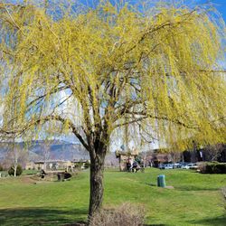
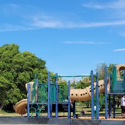
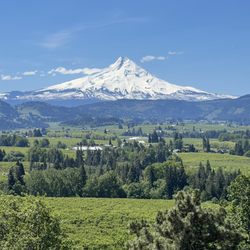
    Deschutes River State Recreation Area Photos

    More like Deschutes River State Recreation Area

    Recommended Reviews - Deschutes River State Recreation Area

    Your trust is our priority, so businesses can't pay to alter or remove their reviews. Learn more about reviews.
    Yelp app icon
    Browse more easily on the app
    Review Feed Illustration

    Reviews With Photos

    River trail
    Robin S.

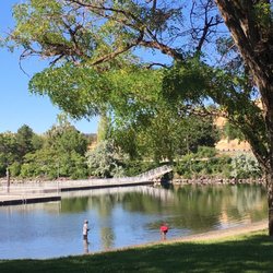
    This is a review for the river trails, not the other fine facilities offered in this park. Awesome trail. We stopped in here on the way to The Dalles because it looked cool on the map. The Deschutes River provides a picturesque backdrop to an amazing riverside trail. Along with the typical river terrain, you'll walk through gorgeous grasslands, boardwalk and even a beach. Add in the imposing and impressive bluffs to the east and across the river and you've got a trail worthy of a national park. We walked a couple of miles or so along the river - always looking out for rattlesnakes - before turning back and then jumping to the upper trail for the remainder of the way back. That trail has a more desert mountain feel to it and the views are even better. Parking is easy, there are restrooms and it's free if all you're doing is a day hike. Highly recommended.

    View from the bike trail that is located directly above the hiking trail!

    See all

    2 years ago

    Helpful 4
    Thanks 1
    Love this 0
    Oh no 0

    6 years ago

    Helpful 1
    Thanks 0
    Love this 0
    Oh no 0

    3 years ago

    Helpful 0
    Thanks 0
    Love this 0
    Oh no 0

    10 years ago

    Helpful 2
    Thanks 0
    Love this 2
    Oh no 0

    4 years ago

    Helpful 0
    Thanks 0
    Love this 0
    Oh no 0
    Photo of Jessica L.
    524
    76
    50

    6 years ago

    Helpful 0
    Thanks 0
    Love this 0
    Oh no 0

    7 years ago

    Helpful 0
    Thanks 0
    Love this 0
    Oh no 0
    Photo of Erin S.
    101
    198
    1650

    10 years ago

    Helpful 6
    Thanks 0
    Love this 5
    Oh no 0
    Photo of Stacey S.
    129
    113
    21

    6 years ago

    Helpful 0
    Thanks 0
    Love this 0
    Oh no 0

    7 years ago

    Helpful 1
    Thanks 0
    Love this 0
    Oh no 0
    Photo of Deb S.
    17
    112
    274

    14 years ago

    Helpful 0
    Thanks 0
    Love this 0
    Oh no 0
    Photo of Colin S.
    120
    29
    10

    10 years ago

    Helpful 1
    Thanks 0
    Love this 1
    Oh no 0

    10 years ago

    Helpful 0
    Thanks 0
    Love this 0
    Oh no 0

    10 years ago

    Helpful 2
    Thanks 0
    Love this 0
    Oh no 0
    Photo of Nancy C.
    31
    51
    32

    11 years ago

    Helpful 2
    Thanks 0
    Love this 1
    Oh no 0

    Ask the Community - Deschutes River State Recreation Area

    Review Highlights - Deschutes River State Recreation Area

    I will mention that the train does go by there, but I didn't think it was very loud at all and didn't seem to go by that often as others have commented on.

    Mentioned in 3 reviews

    Read more highlights

    Verify this business for free

    People searched for Parks 103 times last month within 15 miles of this business.

    Verify this business

    Mosier Creek Falls - Wildflower time

    Mosier Creek Falls

    4.3(8 reviews)
    23.4 mi

    Best time for this hike is end of April and May when the wildflowers are in bloom and cover the…read morehillsides with purple widow's grass, yellow balsam root, blue lupine and lavendar bachelor buttons. It's my favorite time to be in this area! Best place to park is right before the Mosier Creek Bridge as you leave the tiny two block downtown area. As you begin the hike you come to the cemetery of the founding father's of this charming town. Continue for another 10 minutes to the falls and the swimming hole below. The falls are small, not like the 7 popular falls you see along the Old Historic Highway by Multnomah Falls, but still lovely. Continue on and up where views of the Columbia River from this vantage point are breathtaking. The river widens In this area and slight turns as it makes it's way through Mosier and onto Rowena making for a beautiful vista to take in and photo ops. Unlike at Rowena Plateau and Tom McCall Preserve, dogs are allowed on these trails.

    Pretty fun trail with a variety of sites!…read more There's a small parking area right in town just on the other side of the bridge from where the trail begins. You can make a very short hike of it and just go to the falls. Or you can continue on from there and complete the approximately 3 mile out and back with a small loop at the top...I recommend the latter. There's nice signage at the start explaining some trail details. You'll pass by a cool, tiny cemetery and venture on to the falls. Mosier Falls was a bit more substantial than I'd expected, set in a pretty canyon with an overlook for your viewing pleasure. Should you wish to continue on the trail...and you really should...you'll start up the side of the hill on switchbacks and stairs to the top. Tiny flowers popping up were blanketing the entire hillside, and I'm guessing it'll be quite a show in couple of weeks. After zigging and zagging multiple times you'll reach the top and come to an overview with spectacular views of the gorge. There's a bench there should you need a little rest or just wish to sit and take in the view for a bit. From the viewpoint you'll see the dirt trail continue on. It meanders further down to the end of the line...a short loop that offers even more gorge views. The trail is quite narrow and fairly unshaded most of the way and there are regular signs warning hikers of private property lines. We enjoyed it on a Saturday morning, along with quite a few other hikers. It's a decent workout, a pretty waterfall, and some beautiful gorge views...not too shabby!

    Photos
    Mosier Creek Falls
    Mosier Creek Falls
    Mosier Creek Falls - Mosier Creek Falls - Feb 2024

    See all

    Mosier Creek Falls - Feb 2024

    Horsethief Lake State Park - Horsethief Butte - from the top

    Horsethief Lake State Park

    4.4(12 reviews)
    9.5 mi

    With Horsethief Butte as the scenic backdrop, this lake is a relaxing spot for fishing & kayaking…read more Equipped with bathrooms & showers, a popular place for camping & RV sleepovers. Not naturally formed, flooded into existence by the Dalles Dam. Without a natural circulation of water, the summer creates toxic algae harmful to humans and fish. Warning signs are posted. A petroglyph trail is a highlight for all; in depth tour guide available by reservation. Boat launch access to the Columbia River.

    Lovely piece of the Gorge. We've stopped by the lake portion and checked out the Petroglyphs before…read morewhile passing through, as well as briefly jumping onto a trail at the Butte. This weekend we got around to investing more time in the trails of Butte and it was pretty fun. The trails don't allow for a complete loop around the rock, as there's a block for restoration on the east side. But you can wander most of the way around the water side...up and around the rocks is really where's it at though. There are 3 access points to the top from the trails, and the bouldering up is loads of fun. Once atop you can roam all about and enjoy fabulous views from every angle. While the remainder of the trails at Butte are average, we found it pretty entertaining to climb around the rock portion. There's a decent amount of parking...Discover Pass required...as well at a vault toilet at the trailhead.

    Photos
    Horsethief Lake State Park - Horsethief Butte

    Horsethief Butte

    Horsethief Lake State Park
    Horsethief Lake State Park - Beautiful ;)

    See all

    Beautiful ;)

    White River Falls State Park - Old Hydro Building

    White River Falls State Park

    4.5(8 reviews)
    28.7 mi

    Love this State Park!…read more This place is a little gem amongst state parks. It's kind of in the middle of nowhere...wouldn't have come upon it most likely had the hubby not seen note of it on a waterfall blog. First impression, the grounds are pristine. Perfectly manicured grasses scattered with picnic tables. Restrooms...extremely clean. There's a decent amount of parking near the restrooms/upper falls, as well as some right off the highway. A genius idea really, they made a now ghostly, obsolete hydroelectric power plant into a park. You can hear the upper falls as soon as you pull up, running hard and fast right now! You get great views from the overlook at the end of the lot, which is very accessible to most anyone. From there you can take the trail down to peek into the rusty, old ruins of the plant, as well as further down to another smaller, but still impressive falls. Heads up though, the trail down is NOT accessible to everyone. The footing is loose and fairly steep. BUT, if you can at least get down to the overlook above the old building do it...the view of the upper falls from that point is extraordinary. Really a gorgeous falls, much more than I expected. Just a great park, I highly recommend a visit to this one!

    Spectacular falls, gorgeous views, interesting hiking trail to the bottom. Had to climb over logs…read moreand rocks to get to the bowl of the lower falls. Looks like something out of the movies! So amazing and can't believe it took me so long to get here! Fun ruins to explore as well!

    Photos
    White River Falls State Park - Old Hydro Building

    Old Hydro Building

    White River Falls State Park - Old Hydro Building

    Old Hydro Building

    White River Falls State Park - The water is seriously beautiful.

    See all

    The water is seriously beautiful.

    Tamanawas Falls - The river runs along the trail

    Tamanawas Falls

    4.8(38 reviews)
    32.7 mi

    What a beautiful hike! I'd say it's pretty family-friendly overall. There is some uphill hiking and…read moretwo short sections that are a little questionable to get up and over, but we were able to do it with a 9-month-old strapped to one parent, a 3-year-old strapped to the other, a 12-year-old, a 14-year-old, and two grandparents. We loved that most of the trail is shaded by trees, though enough sun still comes through that sunscreen is recommended. Definitely bring water. One of the coolest parts is that you can go up behind the waterfall, but be prepared to climb rocks to get there--it's not an easy walk-up-and-around situation. The hike is about 3.5-3.6 miles. There were a decent number of people there, but it never felt overwhelmingly crowded. Amenities include restrooms, picnic tables, an information kiosk, and dogs are allowed on leash. A $5 day pass, Northwest Forest Pass, or Interagency Pass is required from May 15 to October 1.

    Tamanawas Falls is one of my favorite waterfalls I've seen in Oregon…read more I've hiked it twice now-- once this past summer with my cousin, and more recently, last week. The hike is about three and a half miles round trip, with about 600 feet in elevation gain. Some light scrambling is necessary to get up close to the waterfall. There is a decent sized parking area at the trail head. Parking is $5 or free with a valid recreation pass. The waterfall itself is a hundred foot tall curtain. While it's only about one third the size, the shape reminds me of Vernal Fall in Yosemite. The basalt underneath the waterfall is very pretty and interesting to examine. There were lots of yellow trees (in October) including maple and Tamarack. I've read that you can go behind this waterfall, but I did not, since I'm a chicken, and like to play it safe around water. The hike was a little harder than it sounds, but still definitely doable within a couple of hours. There are a few campgrounds nearby, including Sherwood, Pollalie, and Nottingham.

    Photos
    Tamanawas Falls
    Tamanawas Falls - Tamanawas Falls

    Tamanawas Falls

    Tamanawas Falls

    See all

    Catherine Creek Trail

    Catherine Creek Trail

    4.5(10 reviews)
    22.5 mi

    A simple yet beautiful trail that is fully paved and meanders down towards the river providing…read morevast, expansive views of the magnificent Columbia River. If you visit during wildflower season, it's even more beautiful with colorful wildflowers covering the fields. This trail is one of the few ADA accessible, which I really appreciate. While I do not use a wheelchair, I do have a disability and my legs can not handle the dirt and rock trails that are uneven. So having a paved path means that I can enjoy the gorgeous nature in this area. Wildflower season ranges from end of March to June, but every year is different based on the weather. This year (2022) was a very cold and rainy spring which delayed and prolonged the season. In April the hills were covered in yellow balsomroot and then blue lupine. End of May and heading into June, the next wave of flowers brings shades of blue from the delicate cornflowers with California poppies providing vibrant pops of orange Along the way. It's stunning! Wildflower season is my favorite season! Along the path there are many benches for those wanting to just relax and chill; some in the shade, some in the sun. There are also placards providing info on the area, the wildflowers, and the importance of pollination. The Catherine Creek paved trail is south of the parking area, which is a gravel section along Highway 8. Cross the street, the access is just past the porta potty. If you want the Catherine Creek Arch trail, it is on the same side as the parking, just head up the hill on the dirt trail. It's an easy 1.5 mile paved path that does have some declines and inclines as you make your way down, around, and then back up. If you head clockwise, you can see the creek to your left. If you decide to go off the paved path down to the creek, know there is a lot of poison oak and ticks. I stayed on the path, which is clear and well maintained. Note for wheelchair users - the path is wide and paved, but there are some areas where it slopes down and then makes it way back up. Another great thing about Catherine Creek Trail and Catherine Creek Arch Loop is that parking is free, no day pass required. The parking area is on the smaller side and on weekends, especially during wildflower time, it does get crowded. I went midweek and there was plenty of parking and I only came across two people on the path. Great for people of all ages and skills. For expert hikers, do the Catherine Arch first then finish with Catherine Creek.

    The trailhead was pretty busy Saturday afternoon, but there's a decent amount of parking along Old…read moreHwy 8 at the head. There are trails on both sides of the Hwy...according to the trail map only two above 8 and one below within Catherine Creek, but another trail leads towards Coyote Wall. We only took one uphill loop this day. The trails are quite narrow and the footing mostly uneven and rocky. The views are stunning throughout, and the flowers are emerging. As the trails wind mostly through the open ridge there is almost no shade...sunblock sunblock! It's an enjoyable spot for a hike for sure, although for me not quite AS pretty as the nearby Labyrinth Trail. We will definitely return to complete the other trails...good times.

    Photos
    Catherine Creek Trail - Such an interesting and beautiful landscape, no matter the season.

    Such an interesting and beautiful landscape, no matter the season.

    Catherine Creek Trail
    Catherine Creek Trail

    See all

    Deschutes River State Recreation Area - parks - Updated June 2026

    Loading...
    Loading...
    Loading...