Cancel

    Open app

    Search

    Dinosaur Ridge Photos
    You might also consider

    Recommended Reviews - Dinosaur Ridge

    Your trust is our priority, so businesses can't pay to alter or remove their reviews. Learn more about reviews.
    Yelp app icon
    Browse more easily on the app
    Review Feed Illustration
    Photo of Chris L.
    3357
    1438
    7335

    7 years ago

    Helpful 60
    Thanks 1
    Love this 49
    Oh no 0

    You might also consider

    Verify this business for free

    People searched for Landmarks & Historical Buildings 565 times last month within 5 miles of this business.

    Verify this business

    Lake Chabot Regional Park

    Lake Chabot Regional Park

    4.5
    (644 reviews)
    5.3 km

    A great place for the entire family. A beautiful park where you don't have to drive for hours to…read morevisit. On the weekends, parking is $5. Best to get there early because parking fills up quick. I was there for a BBQ on July 25th, at 10 a.m., and I was able to make parking in the overflow. There's parking on the outside street, but that fills up quick, as well. Anyway, inside the park, there's a long trail that goes all the way around the lake. There's boat rental, either kayak, paddle boat, you can rent a tour boat. I think you can bring your own boat, but it's best to call and make sure. There's BBQ and picnic benches. Volleyball court. A lot of green grass to sit, play sports. There's only one restroom near the boating area, and a few small restrooms if you trek around the lake. There are plenty of hiking trails. There's camping as well. An outdoor Cafe next to the boats. No swimming or wading. You can fish, but I wouldn't eat what you catch. There's warning signs about the water.

    So this reservoir was built in 1874 but closed to public, then opened for recreational use in the…read more60s. So the trails around the lake have matured really well. Like most parts of the paved trails are very well shaded from trees that have grown over those years. My dog and I walk for around an hour to hour and a half, so we usually pick west or east from the parking lot and return the same way. I think we've only explored like half of the lake so far. I've seen wild turkeys, deers, rabbits, and ducks around. And if you are wearing overear headphones, you get the natures remix with all the birds and insects chirping.

    Photos
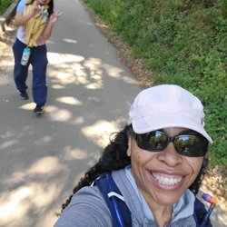
    A family that hike together, stay healthy together
    A family that hike together, stay healthy together
    6/1/23
    6/1/23
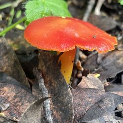
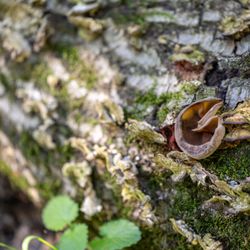
    Mushrooms in the winter

    See all

    Mushrooms in the winter
    Cull Canyon Regional Recreation Area

    Cull Canyon Regional Recreation Area

    4.0
    (144 reviews)
    6.1 km

    WEEKDAY VISIT REVIEW OF LAGOON…read more HIGHLIGHTS *Free parking *Low entrance fee *Plenty picnic areas with picnic tables *Plenty change rooms *Very clean public spaces *Attentive lifeguards *Free life jackets to borrow ENTRANCE FEES Under 1 free 1-15 $2 15-65 $3 Senior $2 Cash and card accepted You get a wristband once paid. Ten feet deep swimming area requires a test. You need to be able to swim 20 yards. Shallow area fenced off from deep waters. This lagoon water is cold but not super cold. Fun family day place, especially for toddlers, preschoolers and young children.
    It's one of those hidden gems. A perfect place to spend…read morehalf a day in open water with kids. Not too far for tri valley resident. There is plenty of areas to lay your mats or raise tents. Shallow waters for little ones. They do provide vests onsite but must be limited. The floaties and tubes are allowed only in certain areas. There are always lifeguards on duty. Limited parking And reservation is per day per person. $6 per person. They close it once they are full. Place is open 11-6. We reached around 11:30 and it was almost full. There are changing rooms, shower and restrooms for both men and women. Life guard was on duty and at one point they did ask everyone to come out. They also have a diving deck which is 11 feet deep. There are picnic areas too. People were having picnic, celebrating birthdays and grilling. Perfect for a hot tri valley afternoon. No food onsite so carry everything. There is 5 min walk from parking lot so you need to drag your beach stuff. Recommend to get one of those beach carts. Only drawback the beach/ sandy part is limited and it was mostly occupied and sand is coarse.

    Photos
    6/2025
    6/2025
    Cull Canyon Regional Recreation Area
    First aid section and life jackets

    See all

    First aid section and life jackets
    Hayward Japanese Gardens - Hayward Area Rec. & Park District

    Hayward Japanese Gardens - Hayward Area Rec. & Park District

    4.5
    (399 reviews)
    9.0 km

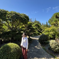
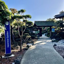
    Five stars because it costs no yen…read more As far as Japanese gardens go, this one is my least favorite because it is rectangular, with a visible metal fence perimeter, with ugly trash and graffiti visible from across the creek and no opportunities to feed the koi fish. Three things, though, that make it special is that they have memorial plaques, stray cats, and blowtorched wood for an aged and weather-resistant finish. From 1913-1962, the site was a practice site for farming and raising livestock for Hayward Union High. It became a garden by the late 1970s, and when dedicated in 1980, focusing on botany (with plants donated by local Japanese-American nurseries) rather than religion. Every first Saturday at 1pm there's a free lecture/tour. It's not especially beautiful or big (3.5 acres) or exciting (the few people I saw there were on their phones), but it's a peaceful, clean area. I think informational displays could help people enjoy it more. Or phone chargers. Information like, many of the wooden connections (including the main entry gate) have notches instead of notches to fit together like puzzle pieces. This more authentic approach prevents rust. Or, the garden uses the Shakkei technique: when you can stand at the highest point, the surrounding trees are meant to look like distant mountains, with specific plants blended with the Japanese maples and native Oaks to make the garden feel ten timers larger than its actual 3.5 acres. Or, the hand-selected granite boulders from the Sierra Nevadas are buried one-third into the ground so it looks like they are growing, which is why I don't manicure myself often. .

    Review #1000 Me and…read moremy daughter came here on Father's Day for the first time, as this place has been on my list for a while!! Talk about peaceful!! This place is very serene, with all the walkways, gazebos, the pond full of large koi fish and ducks, and benches to sit down and relax. It's so quiet here, even with other people around, this place just makes people talk with a very low volume. It's free to enter, and very small, and it's tucked away in Hayward, very close to Castro Valley!! Parking is free also, and they keep this place super clean. A very relaxing way to spend a Sunday afternoon, it's almost like a semi retreat coming here!! This is a super chill place for real!!!

    Photos
    12/2024
    12/2024
    Koi fish pond
    Koi fish pond
    Baby pine cones

    See all

    Baby pine cones
    Sequoians Clothes Free Club

    Sequoians Clothes Free Club

    4.7
    (29 reviews)
    3.5 km

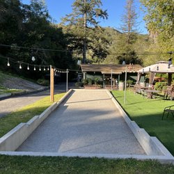
    Sequoians is an inclusive body-positive space for all ages, genders, and body types (including…read morepost-surgery or modified bodies)! It's an overall pretty chill space with a clubhouse, bocce ball, hiking, and pool/hot tub. It's member-only, and the community is tight-knit and welcoming. We have been members for the last year, and my girls (9,7,5) love going. They are treated with incredible love and respect by all the members and there are currently several families with kids, ranging from 5-14 years old. Yes, it's naked. Yes, you will see naked people. Yes, you will be naked! Kids under 18 do not have to be naked if they don't want to, but adults are expected to be clothes-free most of the time. Let me tell you why Sequoians is walking the walk on inclusivity, and why it isn't creepy. 1) Creepiness is gross and bad for all ages; sexualizing kids is wrong, full stop. 2) Creepiness is bad for business! Getting accused of improper activities is bad for business! Sequoians, and nudists in general, have a vested interest in keeping their spaces safe for everyone. 3) Inclusivity is more fun! More people can be included and feel safe, and that feels good. Therefore: Sequoians makes a big deal of vetting potential members, and everyone is educated about body positivity and etiquette. You see consent engagements in real life, in terms of playing with the kids, hanging out in shared spaces, keeping spaces clean, and working together for the benefit of everyone. Everytime we do out there, my kids say "ohhhhh we love it here!" and I do too. If you are interested in learning more, please read the website. And come visit!

    Great judgement free spot!…read more Every member I have met has been friendly, helpful and welcoming. The location is somewhat remote - and no cell service is a bonus. I really enjoy being in nature and hearing nothing but birds and wildlife. That said, it is a bit busier on the weekends, but not rowdy. Wonderful place to remove clothing and be in nature. If you're interested in gawking at naked members of the opposite sex, save your time and go to a strip club.

    Photos
    Enthusiast, chef, community member
    Enthusiast, chef, community member
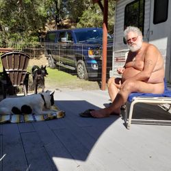
    Relaxing with my pups at The Sequoians Clothes Free Club.
    Relaxing with my pups at The Sequoians Clothes Free Club.
    Beautiful private trails to enjoy nature naturally.

    See all

    Beautiful private trails to enjoy nature naturally.
    Bass Cove Trail

    Bass Cove Trail

    5.0
    (3 reviews)
    5.2 km

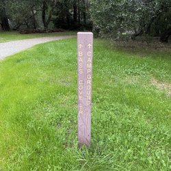
    A great trail on the west side of Lake Chabot!!!…read more I'm lucky I live a quick drive away from here. This is one of my go to trails when I want to get a quick mid week hike in and I don't have a lot of time. I access this trail through Chabot Park, this trail is to the left. It's all dirt, small rolling hills until you get to the camp grounds. This trail doesn't always run right next to Lake Chabot, lots of curving in and out from the lake and back with small inclines and declines along the way. This trail is mostly used by walkers and bike riders, and it's a good way to just get away from it all, at least for a little while, or as long as you feel like it!!

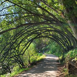
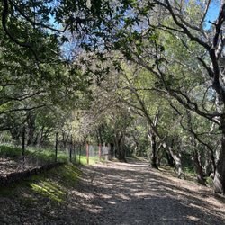
    MY PHOTOGRAPHS. (1) View to the south, of a deep canyon. At the top of my photo, you can see the…read moreBay-O-Vista neighborhood in San Leandro. (2) Later on, you pass a little peninsula of land, where people sometimes go fishing. Here and there by the water's edge there are thick patches of tall reeds. (3) Further along on Bass Cove Trail, there is a transition in the trail, where long branches from thousands of trees cover the entire trail, like a tunnel. (4) Gulch that is covered with arching trees, where the tree are covered with bright green moss. (5) Further along on Bass Cove Trail, you will encounter a second trail sign at a fork in the trail. The sign indicates the direction to Bass Cove, and the direction of Goldenrod Trail. I am posing in this photo. (6) Close up photo of one of the thousands of trees covered with bright green moss. (7) View of a beautiful little bay, located at the western edge of Lake Chabot. As you can see from this photograph, Bass Cove Trail is now about 200 feet above the Lake Chabot. (8) Photograph of several ducks. The ducks are swimming at the northern-most part of Bass Cove. BASS COVE TRAIL. The most direct access to Bass Cove Trail is by starting at the parking lot at the end of Estudillo Ave. The initial part of the hike is uphill and, once beyond the dam, it remains mostly level, where you are taking a clockwise route around Lake Chabot. Early in your hike, you will encounter a chain linked fence at the right side of the trail. Just beyond this fence is a very steep hill (almost a cliff) where a canyon resides at the bottom of the cliff. The view of the trees growing near the bottom of this canyon is beautiful. Dramatic photographs can be taken from the top of the very steep hill. Further along Bass Cove Trail, hikers will encounter a beach that has thick clusters of reeds. On occasion, one or two fishermen practice their fishing hobby near these reeds. A tiny restroom is at the edge of Bass Cove Trail, next to this beach. DISTINCTIVE STYLE OF BASS COVE TRAIL. From the beach with reeds, all the way to the northern-most area of Bass Cove, the trail consists of about 20 loops that loop inland and away from the lake, and about 20 loops that loop towards the lake. The trail loops inland where there is a gulch (the gulch is like a notch in the mountain, and the trail takes you through this notch). The trail loops towards the lake, wherever a narrow hill extends from the mountain to the west. This extending hill is sort of like an arm reaching out from the mountain to the west (here, the trail allows you to skirt this arm, and to walk around the extending arm). When hiking northwards, the gulches to your left provide opportunities for taking photographs of moss-covered trees and bushy clusters of ferns. To the right side of the trail, which is filled with gnarly-looking trees, some of them covered with electric-green moss. Because the brightly-lit waters of Lake Chabot are in back of the gnarly trees, the outlines of the gnarly trees are easier to see. DUCKS. My 300 millimeter telephoto lens enabled me to take several photographs of the ducks that make their home at the northern-most area of Bass Cove. This northern-most area had another cluster of reeds. Once at this northern-most area, hikers have the choice of continuing their clockwise hike around Lake Chabot, or continuing in the northwards direction on a straight trail (not a loop trail) that follows along Grass Valley Creek. HUMOR WHILE HIKING. Near the end of my return hike, I noticed two women walking uphill towards me, and one of them was wearing a long coat with an unusual color. I paused in my walk and said, "Can you tell me the color of your coat? I know that it is not pink or scarlet." Then, the woman with the brightly colored coat answered, "It is fuchsia ! ! !" Within a blink of an eye, I replied, "Oh, I was so CONFUCHED ! ! !" The two ladies responded with a cascade of merry laughs. Then, I continued my walk, and I was glad that their response had made my day.

    Photos
    Bass Cove Trail
    Bass Cove Trail
    Bass Cove Trail

    See all

    East Bay Regional Park District

    East Bay Regional Park District

    4.7
    (595 reviews)
    7.3 km

    I went hiking at the Reinhardt Regional Redwood Park for the first time and loved it!…read more Plenty of street parking at the Redwood Bowl lot and we had no issues with vehicle break ins, luckily, although there were a few warning signs up to remind you to put your valuables away. There are bathrooms by the Redwood Bowl but we couldn't find any helpful maps so just used our phones to navigate. The trail we ended up taking was around 4 miles and took 2 hours. Most of it was shaded and among redwood trees so I really enjoyed that this could work as an afternoon hike. It's a moderate difficulty level with some steep areas. There's also a popular picnic area with grills and an archery range. You could even walk to the nearby swimming pool or visit the Chabot. We only did one half of the hiking loop so will be back to check out the other side.

    Peak My Interest…read more ***PLEASE NOTE THIS IS THE YELP PAGE FOR REINHARDT REDWOODS REGIONAL PARK*** I was attempting to change the name to the proper moniker that included "Reinhardt," but Yelp mods, being the highly regarded sort, somehow decided in their infinite wisdom that they should change it to "East Bay Regional Park District"?! What the what?? 0_o So, that's on me, kids. My bad. Onto the review... A giant ±1,833-acre redwood forest nestled in the Oakland Hills, this park was a former logging site back in the 1800s. Fortunately, there has been a nice resurgence of redwoods to replace those that were cut down. It ain't old-growth, but we'll take what we can these days. The Good: * Free at certain times of year and at certain entrances (more below) * Mountain biking on certain trails (check map and trail signage) * Horseback riding on certain trails (check map and trail signage) * Camping available (check website for info and reservations) * Reservable and non-reservable picnic tables (check map & website) * Restrooms available in parking lots, as well as at some campsites * Nearly forty miles of trails with something for everyone * If you're looking for a moderate ±4.5-mile loop, go to the Skyline entrance and take the Serpentine Prairie Trail to Dunn Trail to Golden Spike Trail, then back to Dunn Trail The Meh: * $5/vehicle entrance fee on weekends and major holidays between April and October, only at the Redwood Gate entrance * Most of the trails are pretty decent, but some are in rough shape due to water damage The Ugly: * One of the few parks I've seen with "off-leash" sections for dogs--which is fine, except you know there's a good majority of dog owners who think they can control their dogs but really can't. We saw a panicked guy chasing his dog down a trail at one point, and who knows when--if ever--he caught up to it. ¯_(ツ)_/¯ Conclusion: Great park with tons of trails and lots to see and do.

    Photos
    Reinhardt Redwood Regional Preserve
    Reinhardt Redwood Regional Preserve
    Reinhardt Redwood Regional Park
    Reinhardt Redwood Regional Park
    Reinhardt Redwood Regional Preserve

    See all

    Reinhardt Redwood Regional Preserve

    Dinosaur Ridge - landmarks - Updated August 2026

    Loading...
    Loading...
    Loading...