San Lorenzo Trail Photos


You might also consider


More like San Lorenzo Trail
Recommended Reviews - San Lorenzo Trail
Start your review...


Reviews With Photos


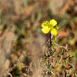
Stumbled upon this place by accident. Once you begin to walk the trail, you'll notice a lot of small beautiful things, like pretty flowers, butterflies, etc. The serenity is amazing. Everyone walking the trail is so friendly. I love the fact that it's very quiet. It's nice that it's a very long trail.. We'll definitely be returning.


I absolutely love coming to this beautiful oasis. We have been coming for a couple of years and returned this week to be close to the water. It was just what we needed after a long day of too much screen time for both us and our kids.


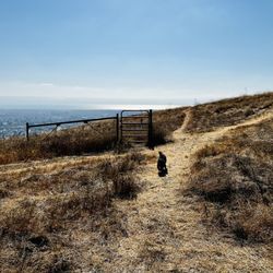
Hidden gem! If you go left you go to the Hayward Shoreline but it's a rugged trail for bikers. If you go to the right, it's about 3 miles to the Marina. Such a great view and nice smooth path for kids biking.


Nice trail for some fresh air and nice scenery! Make sure you bring a light jacket if you go in the afternoon/early evening.


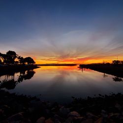
This trail is lovely and peaceful. Even in the high 90's today, with the breeze it was tolerable. Other people encountered on the trail were normal and friendly, but it wasn't overcrowded. The sunset was gorgeous. It's a good place to take some pictures. This was just what I needed today.


2 months ago

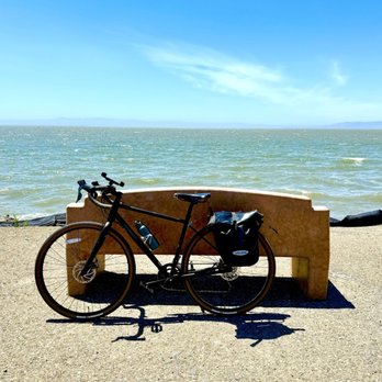
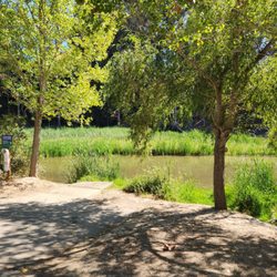
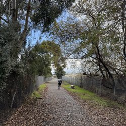
A Hidden Waterfront Gem for Biking, running and Walking If you are looking for a flat, peaceful, and incredibly scenic escape in the East Bay, this section of the trail where San Lorenzo Creek meets the bay is a must-visit. The trail setup is great because it caters to everyone. There is a beautifully paved main road perfect for walking, running, and easy cycling, but if you like a little more texture, there are wide gravel off-paths that are incredibly fun to ride on. It's a heavily trafficked spot for locals who come out to get their daily steps in or catch a sunset. They have also placed dedicated benches at perfect intervals along the path so you can sit down, take a break, and just soak in the unobstructed shoreline views of the San Francisco Bay. What makes this trail extra special is that you are riding right through a massive, protected nature preserve (the Oro Loma Marsh). The wetland is teeming with wildlife--if you look out into the pickleweed and mudflats, you'll see tons of unique shorebirds, egrets, and ducks. It's amazing to think this peaceful sanctuary used to be an industrial commercial salt flat decades ago before being restored back to nature. Tip for visitors: The trail is completely open and exposed to the elements. There's no shade out here, which means when that bay breeze kicks up, it feels absolutely amazing and refreshing on a hot summer day. But if you come later in the afternoon, definitely bring a light jacket as it can get quite windy. The Stretch: This section acts as a perfect bridge connecting San Leandro to Hayward. Heading north to the San Leandro Marina is about 2.25 miles of smooth pavement, while heading south into the Hayward Shoreline is another 2.25 miles of rugged gravel. You can easily do a flat, 4.5-mile round-trip or push it all the way to a 10-mile ride! Very relaxing, clean, and highly recommended! Cheers! read more


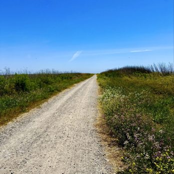

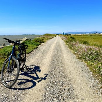

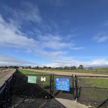
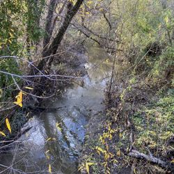
Cut and pasted from the internet: "Enjoy this 6.6-mile out-and-back trail near San Lorenzo, California. Generally considered an easy route, it takes an average of 1h 56min to complete." Quality/Quantity - Easy, but muddy trails due to the recent rain and storms. Cold and windy; well not for me as my daughter and I power walked. Explored and discovered the dog park, near the back of the golf course. See pictures. Mostly walkers here, a few bikers and only one IDIOT cyclist that lost control and almost hit me... Atmosphere - See above. Dog friendly, they have a good size dog park. A few benches along the way. A trash can; maybe there were more, but I did not notice. NO restrooms, until you get back to Marina Park. Service - Self service. Price - Free. Owner Comment - Cut and pasted from the internet: "San Lorenzo Creek is one of western Alameda County's primary waterways. In 2005, the District undertook protective measures to stabilize creek banks and retaining walls along a stretch of the creek between Foothill Boulevard and Sixth Street, Hayward.In 2008, a coalition of agencies--including the city of Hayward, the Hayward Area Recreation and Park District, the National Park Service, the Alameda County Resource Conservation District, and the District--worked together to restore the creekside trail along San Lorenzo Creek and beautify the area near City Center." read more




3 months ago

Stumbled upon this place by accident. Once you begin to walk the trail, you'll notice a lot of small beautiful things, like pretty flowers, butterflies, etc. The serenity is amazing. Everyone walking the trail is so friendly. I love the fact that it's very quiet. It's nice that it's a very long trail.. We'll definitely be returning. read more


6 years ago
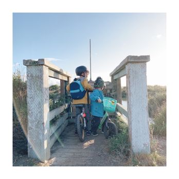
I absolutely love coming to this beautiful oasis. We have been coming for a couple of years and returned this week to be close to the water. It was just what we needed after a long day of too much screen time for both us and our kids. read more




6 years ago

5 years ago

8 years ago
Nice trail for some fresh air and nice scenery! Make sure you bring a light jacket if you go in the afternoon/early evening. read more


9 years ago
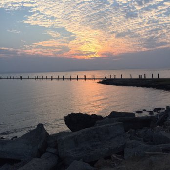
This trail is lovely and peaceful. Even in the high 90's today, with the breeze it was tolerable. Other people encountered on the trail were normal and friendly, but it wasn't overcrowded. The sunset was gorgeous. It's a good place to take some pictures. This was just what I needed today. read more






10 years ago
Good place to walk dog(s). Next today with lovely views on clear day. Tide was in today but, still a good day for excerise. read more


14 years ago

13 years ago
More info about San Lorenzo Trail
2539 Grant Ave
San Lorenzo, CA 94580
Directions
Hours
Outdoor Amenities
Ask the Community - San Lorenzo Trail
Review Highlights - San Lorenzo Trail
You might also consider































Why does Yelp recommend reviews?


San Lorenzo Trail - hiking - Updated August 2026
Best of San Lorenzo
People found San Lorenzo Trail by searching for…
Things to Do in San Lorenzo, CA
Hiking Trails in San Lorenzo, CA
Beautiful Views in San Lorenzo, CA
Walking Trails in San Lorenzo, CA
Places to Take Pictures in San Lorenzo, CA
Sunset View in San Lorenzo, CA
Dog Friendly Hiking Trails in San Lorenzo, CA
Watch Sunset in San Lorenzo, CA
Secret Spots in San Lorenzo, CA
Parks for Kids in San Lorenzo, CA
Swimming Lakes in San Lorenzo, CA
Hiking With Kids in San Lorenzo, CA
Off Leash Dog Hiking Trails in San Lorenzo, CA
Trending Searches in San Lorenzo, CA
Antiques near San Lorenzo Trail
Barbershop For Men near San Lorenzo Trail
Cliff Jumping near San Lorenzo Trail
Cruising Spots near San Lorenzo Trail
Dog Friendly Things To Do near San Lorenzo Trail
Eyebrow Threading near San Lorenzo Trail
Kids Haircut near San Lorenzo Trail
Meteor Shower near San Lorenzo Trail
Mini Golf near San Lorenzo Trail
Movie Theatre near San Lorenzo Trail
Pedicure near San Lorenzo Trail
Permanent Makeup near San Lorenzo Trail
Picnic Areas near San Lorenzo Trail
Places To Take Pictures near San Lorenzo Trail
Preschools near San Lorenzo Trail
Public Golf Courses near San Lorenzo Trail
Public Pools near San Lorenzo Trail
Rock Quarry near San Lorenzo Trail
Scenic Night View near San Lorenzo Trail
Scenic Overlook near San Lorenzo Trail
Shopping Malls near San Lorenzo Trail
Souvenir Shops near San Lorenzo Trail
Star Gazing near San Lorenzo Trail
Sunrise View near San Lorenzo Trail
Swimming Holes near San Lorenzo Trail
Trading Card Shops near San Lorenzo Trail
Used Furniture Stores near San Lorenzo Trail
Browse Articles
Browse Nearby
BEST of San Lorenzo, California Coffee near San Lorenzo Trail
BEST of San Lorenzo, California Things to Do near San Lorenzo Trail
BEST of San Lorenzo, California Restaurants near San Lorenzo Trail
BEST of San Lorenzo, California Walking Trails near San Lorenzo Trail
BEST of San Lorenzo, California Parks near San Lorenzo Trail
BEST of San Lorenzo, California Breakfast near San Lorenzo Trail
BEST of San Lorenzo, California Campgrounds near San Lorenzo Trail
BEST of San Lorenzo, California Sightseeing near San Lorenzo Trail
BEST of San Lorenzo, California Day Trips near San Lorenzo Trail
Browse Brands
Related Searches in San Lorenzo, CA
Best Dog Hiking Trails Around San Lorenzo, California
Best Fishing Locations and Guides in San Lorenzo, California
Best Nature Trails for Hiking in San Lorenzo, California
Best Places for Horseback Riding in San Lorenzo, California
Best Sightseeing Experiences Available in San Lorenzo, California
Check Out Off Road Trails in San Lorenzo, California
Discover Dog Friendly Trails to Explore in San Lorenzo, California
Discover Easy Hiking Trails Near San Lorenzo, California
Discover Kid Friendly Hiking Trails in San Lorenzo, California
Discover Popular Bike Trails in San Lorenzo, California
Discover Walking Parks in San Lorenzo, California Near You
Discover a Hiking Trail in San Lorenzo, California
Discover the Best Night Hike Trails in San Lorenzo, California
Dog-Friendly Hikes With Dogs in San Lorenzo, California
Enjoy Camping Adventures Around San Lorenzo, California
Enjoy Kayaking Adventures in San Lorenzo, California
Enjoy Off Leash Dog Hikes in San Lorenzo, California
Enjoy Scenic Places to Walk in San Lorenzo, California
Enjoy a Beautiful Waterfall Hike in San Lorenzo, California
Enjoy the Best Walking Path in San Lorenzo, California
Enjoy the Best Walking Trails in San Lorenzo, California
Explore Beautiful Parks and Green Spaces in San Lorenzo, California
Explore Easy Hikes Perfect for All in San Lorenzo, California
Explore Fun Activities to Do in San Lorenzo, California
Explore Popular Campgrounds Near San Lorenzo, California
Explore Popular Dog Walking Trails in San Lorenzo, California
Explore Top Dog Parks in San Lorenzo, California Near You
Explore the Best Beach Spots in San Lorenzo, California
Family Friendly Hiking With Kids in San Lorenzo, California
Find Beautiful Views in San Lorenzo, California
Find Cozy Camping Cabins in San Lorenzo, California
Find Top Dog Friendly Parks to Visit in San Lorenzo, California
Find Top-Rated Waterfalls in San Lorenzo, California Now
Find the Best Parks for Picnics in San Lorenzo, California
Hiking Trails With Waterfalls in San Lorenzo, California
Off Leash Dog Hiking Trails in San Lorenzo, California
Popular Outdoor Activities to Try in San Lorenzo, California
Popular Picnic Spots to Visit in San Lorenzo, California
Popular Waterfall Hiking Trails in San Lorenzo, California
Safe River Swimming Areas in San Lorenzo, California
Safe and Fun Parks for Kids in San Lorenzo, California
Top Hiking Trails to Explore in San Lorenzo, California
Top Playgrounds for Kids to Enjoy in San Lorenzo, California
Top Running Trails to Explore in San Lorenzo, California
Top Swimming Lakes to Enjoy in San Lorenzo, California
Top Swimming Spots and Pools in San Lorenzo, California
Top-Rated Camping Sites in San Lorenzo, California
Walk Dog Friendly Hiking Trails in San Lorenzo, California
Walk the Best Paved Walking Trails in San Lorenzo, California


