Dishman Hills Natural Area Photos


More like Dishman Hills Natural Area
Recommended Reviews - Dishman Hills Natural Area
Start your review...


Reviews With Photos


The two pros of this area is free parking and it's location in Spokane Valley. Here are the cons... -The trails are not labeled and there are tons of random paths. -During our two hour hike we ran into three homeless camps which was terrifying! -Someone also broke a bunch of ceramic plates so there are shards of glass up there, thankfully we spotted it before our dog headed that day. -Not everyone keeps their dog on a leash - Its extremely rocky at points and since it was raining this can be very dangerous for people with balance issues ie small children or the elderly

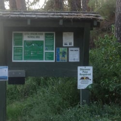
A nice little get away within the city to explore nature. I stopped here for a little walk after having breakfast nearby. There are trails that are marked and a sign at the beginning pointing out the routes you can take. I only explored for a mile or so, but it was a perfect little get away. I came across many families that were coming to a small playground area for their toddlers or families that were hiking the overall easy pathways with their children. A pretty, perfect little escape for a quick, overall easy hike. I'd recommend! read more


1 year ago

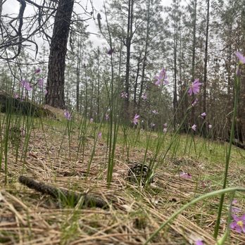
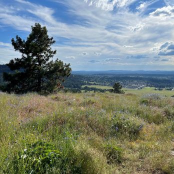
The Dishman Hills conservation area is a collection of connecting trails, grouped around a trailhead but all contain at least one trail connecting them to the rest. I spent the majority of my time at the Glenrose Trailhead, mainly because it was the closest trailhead to my house but also because there was a wide variety of hiking terrain in the first couple miles of trail. There were sporadic pines, prairie bluffs with views of the entire Spokane Valley, and dense forest. The trail was designed for elevation gain and drop all along the trail. This was vastly different from many other mountain trails that are straight up until you reach the top or until you quit. During my first time hiking the trail, I must've been there during peak flower season because the flowers were bright blue and purple on all the prairie bluffs overlooking the city. It brought a lot of color to the mainly brown and green landscape. On a hike a few weeks later, the flowers showed striking signs of decay. The blue and purple were still there but I had to focus to find them. On one weekday evening, I hit the same trail with my mountain bike. I figured that I would be able to more easily conquer the miles if I was on a bike. The ascents were manageable but steep, making for a great workout but I can't say that I made it any farther than I did when I was on foot. The descent were easy but I knew that the return trip would be even harder. The Dishman Hills are the best collection of trails that I've found in the Spokane area and I only hiked and biked on a small portion of them while I was in the area. read more


8 years ago
The two pros of this area is free parking and it's location in Spokane Valley. Here are the cons... -The trails are not labeled and there are tons of random paths. -During our two hour hike we ran into three homeless camps which was terrifying! -Someone also broke a bunch of ceramic plates so there are shards of glass up there, thankfully we spotted it before our dog headed that day. -Not everyone keeps their dog on a leash - Its extremely rocky at points and since it was raining this can be very dangerous for people with balance issues ie small children or the elderly read more


One of the smaller trails, a little bit more than 4 miles, Dishman Hills Natural Area trail is the best way to get out of the hibernation that the winter sets in .. at least for me .. It was still chilly but the sun had been shining for a few days straight, knew that the snow would have melted .. time to start the season :) .. and a lot of other people thought the same :) .. People coming with families and children and children coming in with dads moms .. oh good day it was. Gives you good views of the Spokane Valley from one of those points .. may be a deer or two if you are lucky .. The hidden ponds .. frozen at this time of the year :) .. People might feel that the trails are not marked well but then "gps maps" if there is some real challenge or you would always find people hiking, jogging and all. So, that is easy. All in all, never would have thought a trail could be right in the city. Don't miss it :) read more


8 years ago

7 years ago

8 years ago


More info about Dishman Hills Natural Area
625 S Sargent Rd
Spokane Valley, WA 99212
Directions
(509) 998-8807
Call Now
Hours
Outdoor Amenities
Ask the Community - Dishman Hills Natural Area

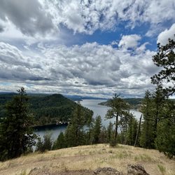


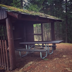

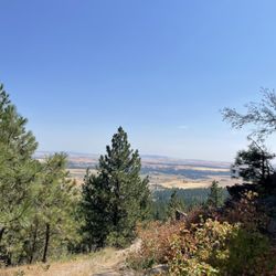
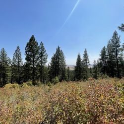










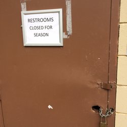


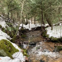


Dishman Hills Natural Area - hiking - Updated September 2026
Best of Spokane Valley
People found Dishman Hills Natural Area by searching for…
Campgrounds in Spokane Valley, WA
Playgrounds in Spokane Valley, WA
Swimming Lakes in Spokane Valley, WA
Picnic Areas in Spokane Valley, WA
Beautiful Views in Spokane Valley, WA
Parks for Kids in Spokane Valley, WA
Scenic View in Spokane Valley, WA
Walking Trails in Spokane Valley, WA
Hiking Trails in Spokane Valley, WA
Secret Spots in Spokane Valley, WA
Dog Swimming in Spokane Valley, WA
Waterfall in Spokane Valley, WA
Free Parking in Spokane Valley, WA
Off Leash Dog Hiking Trails in Spokane Valley, WA
Camping Sites in Spokane Valley, WA
Tent Camping in Spokane Valley, WA
View Points in Spokane Valley, WA
Natural Hot Springs in Spokane Valley, WA
Camping Cabins in Spokane Valley, WA
Running Trails in Spokane Valley, WA
Trending Searches in Spokane Valley, WA
Apple Orchards near Dishman Hills Natural Area
Apple Picking near Dishman Hills Natural Area
Archery near Dishman Hills Natural Area
Barbershop near Dishman Hills Natural Area
Bird Sanctuary near Dishman Hills Natural Area
Blow Dry Bar near Dishman Hills Natural Area
Caves near Dishman Hills Natural Area
Cliff Jumping near Dishman Hills Natural Area
Consignment Shops near Dishman Hills Natural Area
Corn Maze near Dishman Hills Natural Area
Dog Friendly Things To Do near Dishman Hills Natural Area
Dog Swimming near Dishman Hills Natural Area
Eyebrow Threading near Dishman Hills Natural Area
Eyelash Extensions near Dishman Hills Natural Area
Hiking near Dishman Hills Natural Area
Kids Birthday Party near Dishman Hills Natural Area
Makeup Artists near Dishman Hills Natural Area
Mens Suits near Dishman Hills Natural Area
Off Road Trails near Dishman Hills Natural Area
Parks near Dishman Hills Natural Area
Photo Spots near Dishman Hills Natural Area
Picnic Areas near Dishman Hills Natural Area
Places To Take Pictures near Dishman Hills Natural Area
Private Schools near Dishman Hills Natural Area
Public Shower near Dishman Hills Natural Area
Rock Quarry near Dishman Hills Natural Area
Scenic Overlook near Dishman Hills Natural Area
Browse Articles
Browse Nearby
BEST of Spokane Valley, Washington Coffee near Dishman Hills Natural Area
BEST of Spokane Valley, Washington Restaurants near Dishman Hills Natural Area
BEST of Spokane Valley, Washington Things to Do near Dishman Hills Natural Area
BEST of Spokane Valley, Washington Breakfast near Dishman Hills Natural Area
BEST of Spokane Valley, Washington Walking Trails near Dishman Hills Natural Area
BEST of Spokane Valley, Washington Parks near Dishman Hills Natural Area
BEST of Spokane Valley, Washington Campgrounds near Dishman Hills Natural Area
BEST of Spokane Valley, Washington Sledding near Dishman Hills Natural Area
BEST of Spokane Valley, Washington Ski Resorts near Dishman Hills Natural Area
Browse Brands
Related Searches in Spokane Valley, WA
Affordable Kayak Rental Services in Spokane Valley, Washington
Best Dog Hiking Trails Around Spokane Valley, Washington
Best Fishing Locations and Guides in Spokane Valley, Washington
Best Places for Horseback Riding in Spokane Valley, Washington
Best Sightseeing Experiences Available in Spokane Valley, Washington
Discover Dog Friendly Trails to Explore in Spokane Valley, Washington
Discover Easy Hiking Trails Near Spokane Valley, Washington
Discover Fun Toddler Parks in Spokane Valley, Washington for Your Little One
Discover Kid Friendly Hiking Trails in Spokane Valley, Washington
Discover Popular Bike Trails in Spokane Valley, Washington
Discover a Hiking Trail in Spokane Valley, Washington
Discover the Best Night Hike Trails in Spokane Valley, Washington
Dog-Friendly Hikes With Dogs in Spokane Valley, Washington
Enjoy Camping Adventures Around Spokane Valley, Washington
Enjoy Kayaking Adventures in Spokane Valley, Washington
Enjoy Off Leash Dog Hikes in Spokane Valley, Washington
Enjoy River Tubing Adventures in Spokane Valley, Washington
Enjoy Tent Camping Spots Around Spokane Valley, Washington
Enjoy a Beautiful Waterfall Hike in Spokane Valley, Washington
Enjoy the Best Walking Trails in Spokane Valley, Washington
Explore Beautiful Parks and Green Spaces in Spokane Valley, Washington
Explore Easy Hikes Perfect for All in Spokane Valley, Washington
Explore Fun Activities to Do in Spokane Valley, Washington
Explore Popular Campgrounds Near Spokane Valley, Washington
Explore Popular State Park Destinations in Spokane Valley, Washington
Explore Top Dog Parks in Spokane Valley, Washington Near You
Explore the Best Beach Spots in Spokane Valley, Washington
Family Friendly Hiking With Kids in Spokane Valley, Washington
Find Cozy Camping Cabins in Spokane Valley, Washington
Find Parks and Recreation Activities in Spokane Valley, Washington
Find Popular Ziplining Spots Around Spokane Valley, Washington
Find Top-Rated Waterfalls in Spokane Valley, Washington Now
Find the Best Parks for Picnics in Spokane Valley, Washington
Find the Best Playgrounds to Visit in Spokane Valley, Washington
Hiking Trails With Waterfalls in Spokane Valley, Washington
Off Leash Dog Hiking Trails in Spokane Valley, Washington
Popular Outdoor Activities to Try in Spokane Valley, Washington
Popular Picnic Spots to Visit in Spokane Valley, Washington
Safe River Swimming Areas in Spokane Valley, Washington
Safe and Fun Parks for Kids in Spokane Valley, Washington
Top Dog Friendly Things to Do in Spokane Valley, Washington
Top Hiking Trails to Explore in Spokane Valley, Washington
Top Playgrounds for Kids to Enjoy in Spokane Valley, Washington
Top Running Trails to Explore in Spokane Valley, Washington
Top Swimming Lakes to Enjoy in Spokane Valley, Washington
Top Swimming Spots and Pools in Spokane Valley, Washington
Top-Rated Camping Sites in Spokane Valley, Washington
Walk Dog Friendly Hiking Trails in Spokane Valley, Washington


