Eagle Rock Canyon Trail Photos


You might also consider


More like Eagle Rock Canyon Trail
Recommended Reviews - Eagle Rock Canyon Trail
Start your review...


Reviews With Photos


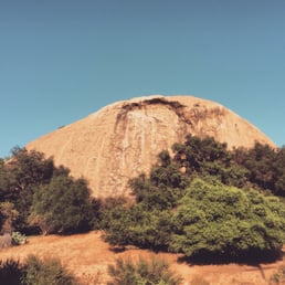
Not sure if the picture I took is the actual Eagle Rock but I did not go on the trail or hike it. Just wanted to see "the rock" as it's part of the local Route 66 historic Road.


Short & fun .8 mile loop trail. Review is for eagle rock canyon trail (at fig & 134), not the eagle rock trail in topanga- which can be confusing if looking at pictures on other reviews here... Once you park on eagle rock view dr (dead end) or on Figueroa (turns into scholl canyon), just north of the 134, there is a little entrance, which I missed walking by the first time. Once inside the entrance at the break in the wooden fence, you hit a fork on trail. This is the loop point. Either route will take you back to this point. We could not get on top of the "eagle rock historic landmark" because a neighbor there told me the land owner had fenced it off. Super easy hike if you are looking for something quick.


This hike is easy and we'll marked for those who are afraid to hike alone, or are unexperienced. Although this hike is short, don't underestimate the inclines it has. It gave me a sweat! By the end of it, you get an amazing view. Props to whoever left a notebook up at the rock. There's a notebook (there's been a record of 3 already) that all hikers sign while they're up there. You can read lines of poetry, letters, and dates in the notebook. It's hidden under and in the Eagle rock. Keep an eye out for it!


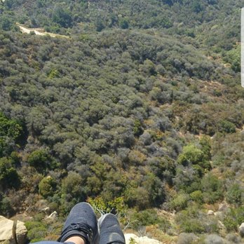
Had to check this out, this trail is really short! Although it gets really steep so if you haven't hiked in a while this can make you sweat a little lol. Went there around 9-ish in the morning, I think the view of the city would be much nicer during Sunset. We did not see the chairs so not sure if we were able to reached the top but when we get to the "top" me and my friend were like, "oh is this it?" The top I am referring to is the part where it seemed like you can't go any further because it was already fenced, anyway, I hope these pictures will help to give you an idea how this looks like! PS. I also took a screenshot of the direction how to get here :)


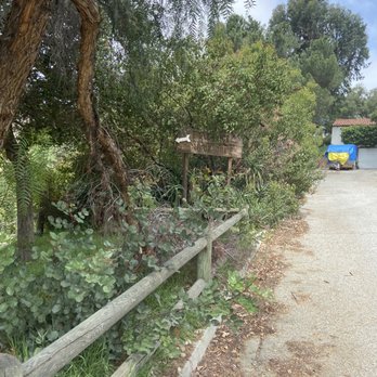
Ok, so, I don't know about this trail. I parked at the bottom of eagle rock view drive. It is a dead end street. The trail starts at that end. I did not know this because the sign was blocked by the large tree. I eventually saw the sign and entered the trail. I walked a whole 5 steps until I saw a tent and thought, "hmm...people camp here? that's weird, but okay..." then I saw a whole row of tents and then decided not to trespass on people's homes and went back to my car. I was confused...and I didn't know if the other yelp reviewers entered elsewhere. But that was my experience!


Trippet Ranch is located at 20825 Entrada Road, Topanga CA 90290. (Where Eagle Rock Canyon should begin) Eagle Rock in Topanga State Park is a popular destination for hikers, trail runners and mountain bikers. This hike is approximately 2.2 miles (one way) to get to the very top of the rock. In fact, there are two fault lines running through the park: the Topanga and the Santa Ynez faults. Start early so you could avoid paying parking fee and a lot of people on the trail. Be careful on the trails.. There is mountain bikes that come down the trail really fast. Brings water there isn't any water stations or restroom. On a clear day you may see the ocean view and the west side of the San Fernando valley. Great trail for beginners!!


Think of this as a steep stroll. This loop is only about a mile in length, but a great hike for little kids. At the top you get to sit on a bench, eat the snacks you brought with you and enjoy the sunset. Exposed for 3/4 of the route, it's not too long to over heat but I'd still recommend sunblock esp in the summer. For all you movie buffs out there. On the way down you'll see the Eagle Rock substation that was used for Erewhon Prison in the movie Face/Off. Parking: you can park on Figueroa, but I prefer to park at the bottom of Eagle Rock View drive and walk down.


This is a nice, easy to moderate level hike that's less than a mile. The trail can be narrow at times, so be careful. All the flora is wonderful and you do get some nice views of the city, but not from the top of the rock itself, unfortunately. This link gives step-by-step instructions on how to get there: http://eaglerock.patch.com/groups/peter-chois-blog/p/bp--patch-blog-how-to-hike-up-the-eagle-rock-canyon-trail Glad we hiked this trail and look forward to the next time!


I started this hike from the top of Reseda up to the Hub then to Eagle Rock Trail. It is under 3.5 mile fairly easy hike up the fire road to get here. It's a loop so once you get to the bottom, you can make a quick left to get back to the Hub down to the parking lot. If you still have the energy to hike more, you can go straight to Trippet Ranch trail, all the way to Parker Mesa. Why 4 stars? it's because it's my favorite route to mountain bike on my way to Parker Mesa. The hike will give you a glimpse of the ocean, mountain ranges and rock formations. This trail is where i broke my knee and busted my chin (requiring 7 stitches) from a bad mtb fall on my way to Parker Mesa so it's a bit of an unforgetable trail for me...

Short but sweet. As others have said, it's only about 1 mile round trip but it is pretty steep and when you get to the top you get a nice view of the city and it's a perfect for sunsets as the peak faces west. There's even community chairs up there and a hobo-ish couch waiting for you. The first time I went there I couldn't find the the trail. If you're on the dead-end road next to the big Eagle Rock look for a small sign under a tree at the end of the road.


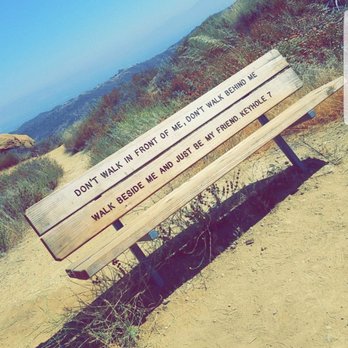
I had hiked Eagle Rock Canyon by myself around the end of May of 2018. The trail looked as if it wasn't maintained and narrow, only could fit one person walking at a time. There were plants sticking out on the majority of the trail, along with lots of bees. When I had reached the top of the mountain, after the plastic chairs, there was a fenced gated with a no trespassing sign. I wasn't able to find the wooden bench in the yelp pictures. The trial loops back down if you keep continuing on the trial. If anyone can help me find how to get to the top of the hill/ mountain, that would be great!

Tough little hike 4 miles round trip going is all uphill no breaks on that. The trail does not have any shade so make sure you're well cover unless u don't mind that extra burn. Can't get lost follow the driving directions on this site which takes you directly to the parking lot where u pay $10, make sure to take exact change or you can pay with a credit/debit card. Signs to little Rock are everywhere so all you have to do is follow them and you will get there. Enjoy!


The trail head is located at the foot of Eagle Rock. Exit Figueroa Avenue from the 134 and you're there. The trail is a respectable loop of about a mile. There's a pretty good elevation gain and great views of Los Angeles and the islands.


2 years ago

5 years ago
When coming here make sure you do research prior and find the actual location. Where ever the direction took me, was not accurate. Saw this sign so thought it was correct. I walked down to the dead end found a very skinny narrow trail. Thinking this was it I started walking however after 20 min of seeing different paths all leading to different "No trespassing" signs I started getting over it. I didn't see one single person here and Again the trail was so narrow at one point it felt like it was falling apart beneath me. I even got lost at one point. I definitely didn't go the correct way. Someone before Mentioned this yelp page was a mess and I one hundred percent agree. I read several Yelps trying to see any information on if I was in the right spot or not and I knew I wasn't but I couldn't find where the right place was. Do your research first people. Clearly I went to the wrong place. read more



Short & fun .8 mile loop trail. Review is for eagle rock canyon trail (at fig & 134), not the eagle rock trail in topanga- which can be confusing if looking at pictures on other reviews here... Once you park on eagle rock view dr (dead end) or on Figueroa (turns into scholl canyon), just north of the 134, there is a little entrance, which I missed walking by the first time. Once inside the entrance at the break in the wooden fence, you hit a fork on trail. This is the loop point. Either route will take you back to this point. We could not get on top of the "eagle rock historic landmark" because a neighbor there told me the land owner had fenced it off. Super easy hike if you are looking for something quick. read more


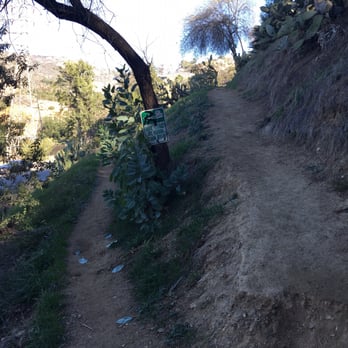
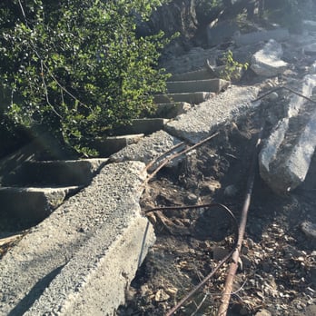


This hike is easy and we'll marked for those who are afraid to hike alone, or are unexperienced. Although this hike is short, don't underestimate the inclines it has. It gave me a sweat! By the end of it, you get an amazing view. Props to whoever left a notebook up at the rock. There's a notebook (there's been a record of 3 already) that all hikers sign while they're up there. You can read lines of poetry, letters, and dates in the notebook. It's hidden under and in the Eagle rock. Keep an eye out for it! read more


5 years ago
Had to check this out, this trail is really short! Although it gets really steep so if you haven't hiked in a while this can make you sweat a little lol. Went there around 9-ish in the morning, I think the view of the city would be much nicer during Sunset. We did not see the chairs so not sure if we were able to reached the top but when we get to the "top" me and my friend were like, "oh is this it?" The top I am referring to is the part where it seemed like you can't go any further because it was already fenced, anyway, I hope these pictures will help to give you an idea how this looks like! PS. I also took a screenshot of the direction how to get here :) read more


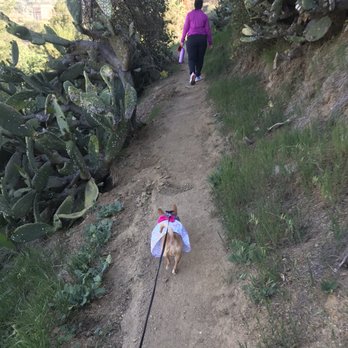


9 years ago
Ok, so, I don't know about this trail. I parked at the bottom of eagle rock view drive. It is a dead end street. The trail starts at that end. I did not know this because the sign was blocked by the large tree. I eventually saw the sign and entered the trail. I walked a whole 5 steps until I saw a tent and thought, "hmm...people camp here? that's weird, but okay..." then I saw a whole row of tents and then decided not to trespass on people's homes and went back to my car. I was confused...and I didn't know if the other yelp reviewers entered elsewhere. But that was my experience! read more


Trippet Ranch is located at 20825 Entrada Road, Topanga CA 90290. (Where Eagle Rock Canyon should begin) Eagle Rock in Topanga State Park is a popular destination for hikers, trail runners and mountain bikers. This hike is approximately 2.2 miles (one way) to get to the very top of the rock. In fact, there are two fault lines running through the park: the Topanga and the Santa Ynez faults. Start early so you could avoid paying parking fee and a lot of people on the trail. Be careful on the trails.. There is mountain bikes that come down the trail really fast. Brings water there isn't any water stations or restroom. On a clear day you may see the ocean view and the west side of the San Fernando valley. Great trail for beginners!! read more


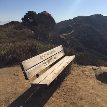

Think of this as a steep stroll. This loop is only about a mile in length, but a great hike for little kids. At the top you get to sit on a bench, eat the snacks you brought with you and enjoy the sunset. Exposed for 3/4 of the route, it's not too long to over heat but I'd still recommend sunblock esp in the summer. For all you movie buffs out there. On the way down you'll see the Eagle Rock substation that was used for Erewhon Prison in the movie Face/Off. Parking: you can park on Figueroa, but I prefer to park at the bottom of Eagle Rock View drive and walk down. read more


12 years ago
This is a nice, easy to moderate level hike that's less than a mile. The trail can be narrow at times, so be careful. All the flora is wonderful and you do get some nice views of the city, but not from the top of the rock itself, unfortunately. This link gives step-by-step instructions on how to get there: http://eaglerock.patch.com/groups/peter-chois-blog/p/bp--patch-blog-how-to-hike-up-the-eagle-rock-canyon-trail Glad we hiked this trail and look forward to the next time! read more


8 years ago
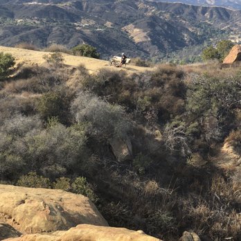
I started this hike from the top of Reseda up to the Hub then to Eagle Rock Trail. It is under 3.5 mile fairly easy hike up the fire road to get here. It's a loop so once you get to the bottom, you can make a quick left to get back to the Hub down to the parking lot. If you still have the energy to hike more, you can go straight to Trippet Ranch trail, all the way to Parker Mesa. Why 4 stars? it's because it's my favorite route to mountain bike on my way to Parker Mesa. The hike will give you a glimpse of the ocean, mountain ranges and rock formations. This trail is where i broke my knee and busted my chin (requiring 7 stitches) from a bad mtb fall on my way to Parker Mesa so it's a bit of an unforgetable trail for me... read more




11 years ago
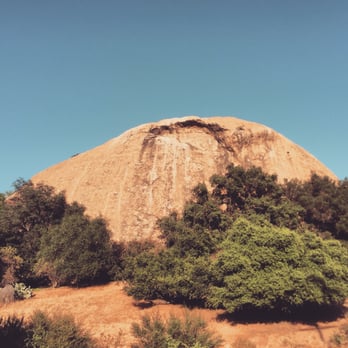
Short but sweet. As others have said, it's only about 1 mile round trip but it is pretty steep and when you get to the top you get a nice view of the city and it's a perfect for sunsets as the peak faces west. There's even community chairs up there and a hobo-ish couch waiting for you. The first time I went there I couldn't find the the trail. If you're on the dead-end road next to the big Eagle Rock look for a small sign under a tree at the end of the road. read more


8 years ago
I had hiked Eagle Rock Canyon by myself around the end of May of 2018. The trail looked as if it wasn't maintained and narrow, only could fit one person walking at a time. There were plants sticking out on the majority of the trail, along with lots of bees. When I had reached the top of the mountain, after the plastic chairs, there was a fenced gated with a no trespassing sign. I wasn't able to find the wooden bench in the yelp pictures. The trial loops back down if you keep continuing on the trial. If anyone can help me find how to get to the top of the hill/ mountain, that would be great! read more


9 years ago
Tough little hike 4 miles round trip going is all uphill no breaks on that. The trail does not have any shade so make sure you're well cover unless u don't mind that extra burn. Can't get lost follow the driving directions on this site which takes you directly to the parking lot where u pay $10, make sure to take exact change or you can pay with a credit/debit card. Signs to little Rock are everywhere so all you have to do is follow them and you will get there. Enjoy! read more


9 years ago

15 years ago
The trail head is located at the foot of Eagle Rock. Exit Figueroa Avenue from the 134 and you're there. The trail is a respectable loop of about a mile. There's a pretty good elevation gain and great views of Los Angeles and the islands. read more


7 years ago

10 years ago
This is a long and tiring hike for non_experienced hikers. However, the views from the top of eagle Rock are beautiful. Tips: bring plenty of water and lose clothing. read more


7 years ago

11 years ago
This trail is quite short, it's a mile loop. The trail is dry and lacks visually interesting features. Its only redeeming quality is its proximity and access to the eagle rock monument. read more


9 years ago

9 years ago
12 years ago

10 years ago
10 years ago
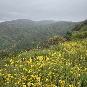
Short but nice hike. When you get to eagle rock the view is amazing! This hike was during spring so the mountains were so green and you can see the ocean in the distance. I recommend climbing around eagle rock and looking for hidden caves because everyone who gets there just sits at the top and there's less people in the caves. It's very fun but be very careful because the rocks are really rough and you are on the edge of the mountain. read more


10 years ago
12 years ago

11 years ago
More info about Eagle Rock Canyon Trail
20829 Entrada Rd
Los Angeles, CA 90290
Pacific Palisades
Directions
(323) 452-3720
Call Now
Hours
Outdoor Amenities
Ask the Community - Eagle Rock Canyon Trail
Review Highlights - Eagle Rock Canyon Trail
You might also consider

















Why does Yelp recommend reviews?
1 review that is not currently recommended
The reviews below are not factored into the business's overall star rating.

13 years ago
Eagle Rock Canyon Trail - hiking - Updated September 2026
Best of Los Angeles
People found Eagle Rock Canyon Trail by searching for…
Hiking Trails in Los Angeles, CA
Campgrounds in Los Angeles, CA
Beautiful Views in Los Angeles, CA
Running Trails in Los Angeles, CA
Waterfall Hike in Los Angeles, CA
Stair Climbing in Los Angeles, CA
Full Moon Hike in Los Angeles, CA
Scenic View in Los Angeles, CA
Secret Spots in Los Angeles, CA
Things to Do in Los Angeles, CA
Off Road Trails in Los Angeles, CA
Scenic Overlook in Los Angeles, CA
Walking Trails in Los Angeles, CA
Lookout Point in Los Angeles, CA
Dog Friendly Hiking Trails in Los Angeles, CA
Playgrounds in Los Angeles, CA
Hiking Groups in Los Angeles, CA
Night Hiking in Los Angeles, CA
Sunset View in Los Angeles, CA
Trending Searches in Los Angeles, CA
Apple Orchards near Eagle Rock Canyon Trail
Apple Picking near Eagle Rock Canyon Trail
Archery near Eagle Rock Canyon Trail
Bike Shop near Eagle Rock Canyon Trail
Blow Dry Bar near Eagle Rock Canyon Trail
Casinos near Eagle Rock Canyon Trail
Cliff Jumping near Eagle Rock Canyon Trail
Consignment Shops near Eagle Rock Canyon Trail
Cruising Spots near Eagle Rock Canyon Trail
Dog Friendly Things To Do near Eagle Rock Canyon Trail
Eyebrow Threading near Eagle Rock Canyon Trail
Eyelash Extensions near Eagle Rock Canyon Trail
Hiking Trails With Waterfalls near Eagle Rock Canyon Trail
Kids Birthday Party near Eagle Rock Canyon Trail
Lakes & Ponds near Eagle Rock Canyon Trail
Makeup Artists near Eagle Rock Canyon Trail
Nail Technicians near Eagle Rock Canyon Trail
Off Road Trails near Eagle Rock Canyon Trail
Parks near Eagle Rock Canyon Trail
Picnic Areas near Eagle Rock Canyon Trail
Places To Take Pictures near Eagle Rock Canyon Trail
Private Schools near Eagle Rock Canyon Trail
Public Shower near Eagle Rock Canyon Trail
Rock Quarry near Eagle Rock Canyon Trail
Scenic Night View near Eagle Rock Canyon Trail
Scenic Overlook near Eagle Rock Canyon Trail
Sunrise View near Eagle Rock Canyon Trail
Swimming Holes near Eagle Rock Canyon Trail
Browse Articles
Browse Nearby
BEST of Los Angeles, California Coffee near Eagle Rock Canyon Trail
BEST of Los Angeles, California Things to Do near Eagle Rock Canyon Trail
BEST of Los Angeles, California Restaurants near Eagle Rock Canyon Trail
BEST of Los Angeles, California Breakfast near Eagle Rock Canyon Trail
BEST of Los Angeles, California Walking Trails near Eagle Rock Canyon Trail
BEST of Los Angeles, California Parks near Eagle Rock Canyon Trail
BEST of Los Angeles, California Taxis near Eagle Rock Canyon Trail
BEST of Los Angeles, California Campgrounds near Eagle Rock Canyon Trail
BEST of Los Angeles, California Motel near Eagle Rock Canyon Trail
Browse Brands
Related Searches in Los Angeles, CA
Best Dog Hiking Trails Around Los Angeles, California
Best Fishing Locations and Guides in Los Angeles, California
Best Nature Trails for Hiking in Los Angeles, California
Best Places for Horseback Riding in Los Angeles, California
Check Out Off Road Trails in Los Angeles, California
Discover Dog Friendly Trails to Explore in Los Angeles, California
Discover Easy Hiking Trails Near Los Angeles, California
Discover Kid Friendly Hiking Trails in Los Angeles, California
Discover Popular Bike Trails in Los Angeles, California
Discover Scenic Mountain Bike Trails Near Los Angeles, California
Discover Walking Parks in Los Angeles, California Near You
Discover a Hiking Trail in Los Angeles, California
Discover the Best Night Hike Trails in Los Angeles, California
Dog-Friendly Hikes With Dogs in Los Angeles, California
Enjoy Camping Adventures Around Los Angeles, California
Enjoy Kayaking Adventures in Los Angeles, California
Enjoy Off Leash Dog Hikes in Los Angeles, California
Enjoy Scenic Places to Walk in Los Angeles, California
Enjoy Tent Camping Spots Around Los Angeles, California
Enjoy a Beautiful Waterfall Hike in Los Angeles, California
Enjoy the Best Walking Path in Los Angeles, California
Enjoy the Best Walking Trails in Los Angeles, California
Explore Beautiful Parks and Green Spaces in Los Angeles, California
Explore Easy Hikes Perfect for All in Los Angeles, California
Explore Fun Activities to Do in Los Angeles, California
Explore Popular Campgrounds Near Los Angeles, California
Explore Popular Dog Walking Trails in Los Angeles, California
Explore Top Dog Parks in Los Angeles, California Near You
Explore the Best Beach Spots in Los Angeles, California
Family Friendly Hiking With Kids in Los Angeles, California
Find Parks and Recreation Activities in Los Angeles, California
Find Top Dog Friendly Parks to Visit in Los Angeles, California
Find Top-Rated Waterfalls in Los Angeles, California Now
Find the Best Parks for Picnics in Los Angeles, California
Hiking Trails With Waterfalls in Los Angeles, California
Off Leash Dog Hiking Trails in Los Angeles, California
Popular Outdoor Activities to Try in Los Angeles, California
Popular Picnic Spots to Visit in Los Angeles, California
Popular Waterfall Hiking Trails in Los Angeles, California
Safe River Swimming Areas in Los Angeles, California
Safe and Fun Parks for Kids in Los Angeles, California
Top Hiking Trails to Explore in Los Angeles, California
Top Playgrounds for Kids to Enjoy in Los Angeles, California
Top Running Trails to Explore in Los Angeles, California
Top Swimming Lakes to Enjoy in Los Angeles, California
Top Swimming Spots and Pools in Los Angeles, California
Top-Rated Camping Sites in Los Angeles, California
Walk Dog Friendly Hiking Trails in Los Angeles, California
Walk the Best Paved Walking Trails in Los Angeles, California


