Switzer Falls - USDA Forest Service Photos


You might also consider


More like Switzer Falls - USDA Forest Service
Recommended Reviews - Switzer Falls - USDA Forest Service
Start your review...


Reviews With Photos


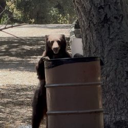
Switzer falls is truly a fabulous little hike that is is approximately two miles each way. This hike starts at the bridge over the river, and will take you pass mini water falls (when water exist), creeks, gorge and even historic ruins. You'll even go by some old trail camps, with remains of old wood burning stoves. As you proceed with your hike you'll see upper falls, just pass the fence, and shortly after you can see ruins of an old chapel on top of a hill. Soon you will hit the lower Switzer Falls During this hike, there are some easy water crossing during the summer time, but with a good rainfall these crossings can be challenging. The hiking difficulty is easy to moderate due to some climbing. The hike is mostly without shade so plan for days that are hot and sunny- on warm sunny days, best to start super early and wear a good hat. Be careful during summertime, as there is poison oak-- if you see three leaves, leave it be, especially if they are red. Also watch out for bears- they enjoy the garbage cans and berries. WE SAW A BEAR AT THE START! Best to do this hike on weekdays as on the weekend, this hikes get busy which means you will not get to enjoy the beauty of the waterfall. Also the parking lot will fill up on weekends= so if coming on the weekend, trying to get to the hike by 6am. Don't forget to post your parking pass. There are primitive bathrooms onsite.


Still, one of my favorite hikes. There's two options to go, upper or lower part of the waterfall. Whichever you chose, you'll have to do some river crossing. A hiking stick will help u because it can be challenging to balance at some crossings. Ask hikers where to walk if you're new here. Mostly shaded until you walk up and out of the trees, than you'll be looking for shade on a hot day. Bring water and snacks so you can take your sweet time. Moderate hike. Great for picnics at the entrance (parking lot area) if you're not here to hike. Never had a bad hiking experience. If you come on a day when the water levels are higher than you're comfortable with (rare) then you can turn back and try another day. Keep in mind, you will likely soak your shoes at some crossings. Just look out for rocks or areas that have algae on it. It's slimy and slippery so watch your step. Ive seen too many kids and hikers underestimate how fast water is or slippery the rocks can be and end up falling in the water. Happened twice today. Other than that, a very dog and people friendly hike. Enjoy!
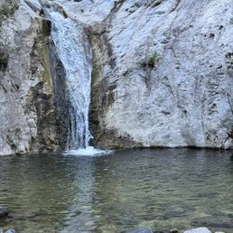

This is a fun, great, rewarding hike. Multiple stream crossings and a moderate uphill trek makes it all worth it once you get to the falls. You have to get here early to avoid the crowds. Well worth it once you're at the falls.

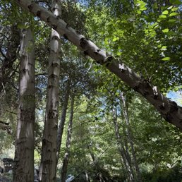

This is the one of the most beautiful hiking trails in Los Angeles. Peaceful and relaxing places surrounded by mountains. Entry level for hiking, definitely want to go there again!

The Switzer Falls Hike is 3.7 miles with 692 ft of elevation gain. This hike's difficulty is moderate and will take 2 hours from start to finish depending on your pace. Looks on the pictures and videos. An Adventure Pass is required to park at this location. Enjoy the trails and please leave no trace.


A very enjoyable and pretty easy hike in between easy and moderate difficulty. I would say it's very similar to the Trail Canyon Falls hike although easier. We spent a total of two hours on the hike and went to the Lower and Upper Falls. To get to the Upper Falls take the trail to the right of the Lower Falls. It looks harder than it is from the ground. It would be possible for anyone who does not have mobility issues. I would not suggest it for dogs or small children however. Trekking poles will really help with the inclines and river crossings but are not needed. We crossed the river about 8 times but our feet did not get wet at all. The gate to the bottom picnic area was open today and they were not checking for parking passes. If you have to park just off the highway in the upper parking lot that will add a steep, all downhill extra mile (and then uphill on the way out) segment onto the hike you already have planned. I would suggest parking in the lower lot as close to the trail head as possible. Bathrooms are available in the parking lot and also a few hundred feet into the trail. This area can get very busy so I would suggest going during the early morning or weekdays. I would highly recommend to people of all ages and fitness levels. Don't be afraid to climb up to the Upper Falls you got this!
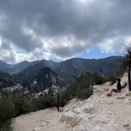

Great hike. You will need the adventure park pass to park here or else rangers will ticket you. Parking is located off the road, some lots, and more if you drive down towards the hike. Pros + not too long of a hike, I used Alltrails app. It shows 3.6 miles + it's relatively easy and beautiful! + dogs are allowed on the trail as long as their leash but I saw a lot of people without Cons - it can get pretty cold, check the weather before you go - some of area is pretty narrow which requires you or the party to stop to let others pass. - the path in some areas are rocky - lots of people are typically loitering by the waterfall, so hard to get a good photograph


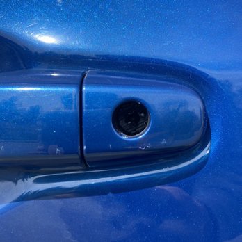
BE WARNED - everyone else's comments about their cars being broken into are true. Luckily my aunt's car was intact, but her car was scratched and key cyclinder (the key hole on the driver's side of older cars) was damaged/removed. It'll cost her $500 for replacement parts and labor. We parked off a lookout point on the 2, so there aren't any watchful eyes out there. The hike itself was fine except I slipped and fell on my hip from a slippery wet rock at the first stream crossing. Just heed everyone else's warning that your car might get damaged even if you remove your valuables ahead of time.


Wonderful experience, especially because my car was NOT broken into! I was nervous after reading all the reviews, so I took extra precautions: got there early to park at the trail head lot, cleaned out EVERYTHING from inside the car, left the glovebox open and rear seats down, and turned my alarm on. Didn't see any suspicious activity while I was there, so it felt safer than I expected. As for parking, I arrived at 8:25am on a Saturday and both lots were full. Since I didn't want to park at the top on route 2, I waited at the bottom lot until a car left at 8:50am. Well worth it for peace of mind and easy access to the trail. Was grateful not to hike up to the top at the end! Trail was pretty chill until about 10:30am when it got busier. It started to get hot after that time too. Arriving early has many benefits! Other tips: wear a hat, waterproof hiking shoes, bug spray, comfortable clothes, sunscreen, bring an extra pair of socks and lots of water, and use trekking poles. This made the hike pleasant because my feet didn't get wet, the bugs stayed away from me, and I could handle the hot sun. Brought my bathing suit but the water was too cold to swim in.


One of my favorite spots to hike to! It's around 4.5 miles round trip, but the hike from the upper lot to the lower lot and back is the hardest part. I always enjoy this particular hike, especially when it has rained that way there's a small creek! Most of the creek crossings are doable, as long as you wait a little after it rains. The waterfall isn't too bad as well. The route can get a little confusing for first timers, when the trail first splits between up or straight, take the trail up! The straight trail will bring you a small upper pool of water, which is actually the top of the waterfall or at least close to it. When you reach a second fork of up or down, go down to reach the waterfall!


Beautiful waterfall! Came here with my dog and partner, it's as lovely as it looks in the photos! 10/10 recommend. You can also camp and have little picnics :)


Definitely recommend, dog friendly easy hike, water level was low but we absolutely enjoyed it!.


1 month ago
This was my first real hike, and it was great! It was a bit confusing to get there but there were plenty of people around to help out. The water is ice cold and you need water shoes to comfortably walk around in the water. Be careful not to slip on the algae covered rocks! Still wonderful read more


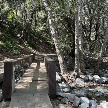
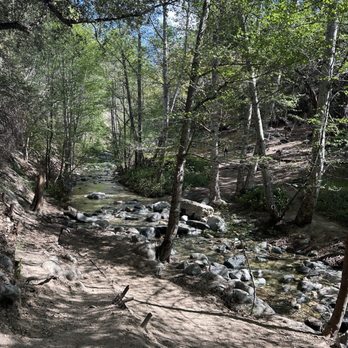
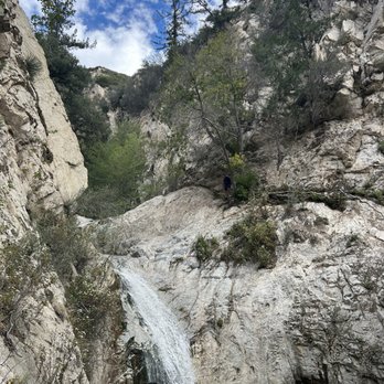
Perfect hike for a hot day. I love waterfall hikes and listening to the sound of calm, running water. The added challenge on these hikes is the multiple stream crossings. I brought some hiking poles which helped with balance and probing for loose rocks and logs. If you want to get parking in the lower lot, it's best to come before 8AM. We found parking in the second lot. An Adventure Pass or Day Pass is required. Parking is enforced. A car received a ticket for being in a No Parking zone. The start of the trail is nicely shaded. The second half is a hilly, narrow, sun exposed path which routes back into the canyon toward the Lower Switzer Falls. I'm glad they had fencing on some narrow and steep parts of the trail. We encountered an active rattlesnake which headed down the mountain, so be on the lookout. Overall, the hike takes about 3 hours for 5.5 miles. The additional hike back up to the parking lot was about 1/4 of a mile. Note: if you need to use the restroom, it's best to bring your own toilet paper and to go before you start your hike. It was kind of smelly, but if you gotta go... you gotta go. read more


11 months ago
This place is great for fully appreciating nature! The trail is around 5-5.5 miles round trip, depending on where you park. What impressed me most about this trail is that it's almost fully covered by shade. We went in the late afternoon, and I'd say probably 80-85% of it is covered. Very impressive! Here are some useful tips: 1. There are three parking lots: two are next to the highway, and one is near the hiking entrance. I'd recommend getting a parking pass if possible. 2. There are only three restrooms at the beginning of the trail, so use them when you see them. 3. If you're aiming to go to the waterfall, make sure to look for the signs. Some signs aren't very clear, so we had to stop and ask other hikers frequently. Luckily, people there are super friendly and happy to help. Just pay attention to your surroundings. 4. The trail is dog-friendly, but dogs must be on a leash. 5. Waterproof hiking boots are recommended. All in all, it's a fun trail. It's a great place for a picnic and camping, and it's very close to the stream. Great for kids, families, and pets! read more


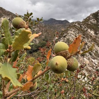
Switzer falls is truly a fabulous little hike that is is approximately two miles each way. This hike starts at the bridge over the river, and will take you pass mini water falls (when water exist), creeks, gorge and even historic ruins. You'll even go by some old trail camps, with remains of old wood burning stoves. As you proceed with your hike you'll see upper falls, just pass the fence, and shortly after you can see ruins of an old chapel on top of a hill. Soon you will hit the lower Switzer Falls During this hike, there are some easy water crossing during the summer time, but with a good rainfall these crossings can be challenging. The hiking difficulty is easy to moderate due to some climbing. The hike is mostly without shade so plan for days that are hot and sunny- on warm sunny days, best to start super early and wear a good hat. Be careful during summertime, as there is poison oak-- if you see three leaves, leave it be, especially if they are red. Also watch out for bears- they enjoy the garbage cans and berries. WE SAW A BEAR AT THE START! Best to do this hike on weekdays as on the weekend, this hikes get busy which means you will not get to enjoy the beauty of the waterfall. Also the parking lot will fill up on weekends= so if coming on the weekend, trying to get to the hike by 6am. Don't forget to post your parking pass. There are primitive bathrooms onsite. read more







1 year ago

Still, one of my favorite hikes. There's two options to go, upper or lower part of the waterfall. Whichever you chose, you'll have to do some river crossing. A hiking stick will help u because it can be challenging to balance at some crossings. Ask hikers where to walk if you're new here. Mostly shaded until you walk up and out of the trees, than you'll be looking for shade on a hot day. Bring water and snacks so you can take your sweet time. Moderate hike. Great for picnics at the entrance (parking lot area) if you're not here to hike. Never had a bad hiking experience. If you come on a day when the water levels are higher than you're comfortable with (rare) then you can turn back and try another day. Keep in mind, you will likely soak your shoes at some crossings. Just look out for rocks or areas that have algae on it. It's slimy and slippery so watch your step. Ive seen too many kids and hikers underestimate how fast water is or slippery the rocks can be and end up falling in the water. Happened twice today. Other than that, a very dog and people friendly hike. Enjoy! read more




This is a fun, great, rewarding hike. Multiple stream crossings and a moderate uphill trek makes it all worth it once you get to the falls. You have to get here early to avoid the crowds. Well worth it once you're at the falls. read more

1 year ago

8 months ago
Gorgeous 3:45 minute hike to the falls and back. Bring water and snacks. You will get wet crossing many streams. There are some areas where you will be hiking on a narrow cliffside with a straight drop down so be cautious. And btw, if anyone tells you "you're almost there", you're not, lol! read more


1 year ago
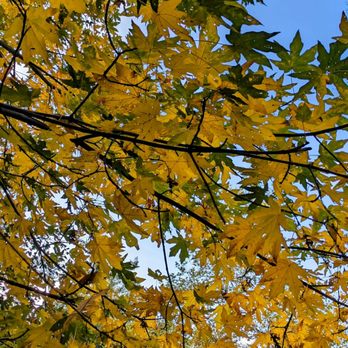
This is the one of the most beautiful hiking trails in Los Angeles. Peaceful and relaxing places surrounded by mountains. Entry level for hiking, definitely want to go there again! read more


The Switzer Falls Hike is 3.7 miles with 692 ft of elevation gain. This hike's difficulty is moderate and will take 2 hours from start to finish depending on your pace. Looks on the pictures and videos. An Adventure Pass is required to park at this location. Enjoy the trails and please leave no trace. read more


11 months ago

1 year ago

A very enjoyable and pretty easy hike in between easy and moderate difficulty. I would say it's very similar to the Trail Canyon Falls hike although easier. We spent a total of two hours on the hike and went to the Lower and Upper Falls. To get to the Upper Falls take the trail to the right of the Lower Falls. It looks harder than it is from the ground. It would be possible for anyone who does not have mobility issues. I would not suggest it for dogs or small children however. Trekking poles will really help with the inclines and river crossings but are not needed. We crossed the river about 8 times but our feet did not get wet at all. The gate to the bottom picnic area was open today and they were not checking for parking passes. If you have to park just off the highway in the upper parking lot that will add a steep, all downhill extra mile (and then uphill on the way out) segment onto the hike you already have planned. I would suggest parking in the lower lot as close to the trail head as possible. Bathrooms are available in the parking lot and also a few hundred feet into the trail. This area can get very busy so I would suggest going during the early morning or weekdays. I would highly recommend to people of all ages and fitness levels. Don't be afraid to climb up to the Upper Falls you got this! read more


Great hike. You will need the adventure park pass to park here or else rangers will ticket you. Parking is located off the road, some lots, and more if you drive down towards the hike. Pros + not too long of a hike, I used Alltrails app. It shows 3.6 miles + it's relatively easy and beautiful! + dogs are allowed on the trail as long as their leash but I saw a lot of people without Cons - it can get pretty cold, check the weather before you go - some of area is pretty narrow which requires you or the party to stop to let others pass. - the path in some areas are rocky - lots of people are typically loitering by the waterfall, so hard to get a good photograph read more


5 years ago
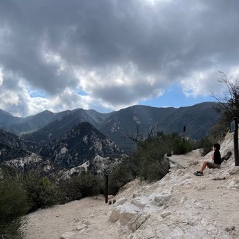
BE WARNED - everyone else's comments about their cars being broken into are true. Luckily my aunt's car was intact, but her car was scratched and key cyclinder (the key hole on the driver's side of older cars) was damaged/removed. It'll cost her $500 for replacement parts and labor. We parked off a lookout point on the 2, so there aren't any watchful eyes out there. The hike itself was fine except I slipped and fell on my hip from a slippery wet rock at the first stream crossing. Just heed everyone else's warning that your car might get damaged even if you remove your valuables ahead of time. read more


1 year ago

3 years ago
Wonderful experience, especially because my car was NOT broken into! I was nervous after reading all the reviews, so I took extra precautions: got there early to park at the trail head lot, cleaned out EVERYTHING from inside the car, left the glovebox open and rear seats down, and turned my alarm on. Didn't see any suspicious activity while I was there, so it felt safer than I expected. As for parking, I arrived at 8:25am on a Saturday and both lots were full. Since I didn't want to park at the top on route 2, I waited at the bottom lot until a car left at 8:50am. Well worth it for peace of mind and easy access to the trail. Was grateful not to hike up to the top at the end! Trail was pretty chill until about 10:30am when it got busier. It started to get hot after that time too. Arriving early has many benefits! Other tips: wear a hat, waterproof hiking shoes, bug spray, comfortable clothes, sunscreen, bring an extra pair of socks and lots of water, and use trekking poles. This made the hike pleasant because my feet didn't get wet, the bugs stayed away from me, and I could handle the hot sun. Brought my bathing suit but the water was too cold to swim in. read more


One of my favorite spots to hike to! It's around 4.5 miles round trip, but the hike from the upper lot to the lower lot and back is the hardest part. I always enjoy this particular hike, especially when it has rained that way there's a small creek! Most of the creek crossings are doable, as long as you wait a little after it rains. The waterfall isn't too bad as well. The route can get a little confusing for first timers, when the trail first splits between up or straight, take the trail up! The straight trail will bring you a small upper pool of water, which is actually the top of the waterfall or at least close to it. When you reach a second fork of up or down, go down to reach the waterfall! read more


2 years ago
Beautiful waterfall! Came here with my dog and partner, it's as lovely as it looks in the photos! 10/10 recommend. You can also camp and have little picnics :) read more


2 years ago
Definitely recommend, dog friendly easy hike, water level was low but we absolutely enjoyed it!. read more


I went in thinking this would be an easy hike but boy, was I in for a surprise. I came with a friend on a Saturday around 9am. There weren't too many parking spots but people were seen parking on the street or just squeezing their cars into whatever spaces fit (guilty). The hike is said to be 3.6 miles roundtrip but felt much longer. You walk downhill to a picnic area where the trail starts and experience two different terrains on your way to the falls. A good part of the hike consisted of trying to maintain our footing as we crossed rocky streams. The second part of the way there was on an unshaded dirt path that wrapped around the mountains; not sure if the hike is entirely child friendly since this section was pretty narrow, especially for two way traffic. The waterfall wasn't the most impressive but did provide a good view for a "yay we made it" break. The way back was a lot quicker but exhausting since it's mostly uphill. The hike took us about 4 hours and is perfect for those looking for a great leg workout. I was left feeling sore for days! read more


2 years ago
Always an amazing time! Went many miles in this time plus the hill. Lots of activity and loved the swing close to water fall. read more

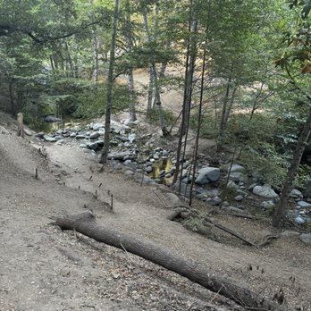
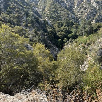


This place was beautiful. It's a fun place to be active work your friends & family. I went with my family & friends (4 adults & 3 kids ages 5,6,7 yrs old). When you step into to forest it feels like a dream. Everything is so green. My only concern is hiking to the furthest waterfalls, which is about a 4+mile hike, with kids. We were not aware of how steep & how narrow some areas along the trail was. It was slightly scary hiking up the mountain where you can easily slip & fall a hundred feet with little kids. There were families with little kids doing well. But if this is your first or second time hiking dont go on the trail along the mountain. Stay at.the bottom where the river is. You should be ok. Also they do have picnic tables in the front. There are bathrooms too. But when I went they were closed due to Covid-19. So plan ahead. There ate way too many people walking by to find a place and tinkle if your a Lady. Bring at least 40+oz of water per adult if hiking the 4+miles trail. Also bring snacks h maybe a sandwich because you'll burn many calories. The hike taken us 5 hours start to finish. Remember we were with little kidd & we hung out at the waterfall for a little bit. read more



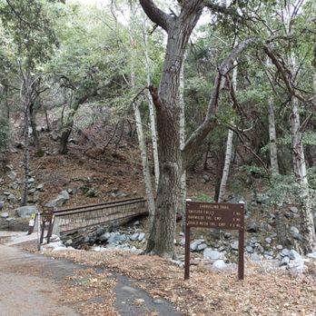
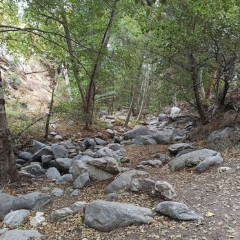
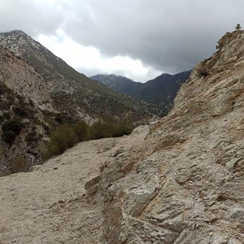
This was my second time coming here. First time was over 7 years ago! I only had a vague memory of the hike and it helped me navigate all the way to the waterfall. Make sure you have proper footwear and clothing! It was 37°F this morning! Holy crap, it was cold. Arrived at 8:45am and the parking lot at the top was full so I had to park on the side of the street across the parking lot. The gate at the top is locked so you're not able to drive down and park at the bottom where the trail begins. After you reached the bottom, the trail starts when you see a bridge. For the most part, you start off on flat ground next to a stream. Followed by an uphill climb to the top of the mountain. Once you reach the top, take the left trail that will take you down the mountain. Then more flat ground until you reach the waterfall. You will cross the stream about 10 times each way. Your shoes won't get wet if you step on the correct rocks and hop over to the other side. I would still recommend a hiking shoes because there are some rocky areas. Overall, this was a fun hike and my foot took a beating! read more






2 years ago
Absolutely amazing. As someone who doesn't hike a ton but is reasonably in shape, I'd rate this as a high-moderate if not slightly difficult. We spent just over 3 hours on the hike, including sitting at the falls for about 30 minutes. The long uphill section on the way back can be a little strenuous. Bring ample water and a snack. Just get your feet wet and you'll avoid slippery rocks at the multiple little water crossings and actually be able to enjoy it all. Very clean/almost no trash (I carried out a soda cup someone left, was all I saw) let's keep it that way. read more


Really nice 5 mile (roundtrip) hike with a rewarding cascading waterfall at the end. Make sure to arrive EARLY, hikers start trickling in at about 6am,parking can get tricky and waterfall area becomes jam packed. It is quite tricky to find though without the full parking lot and other cars around you since there are quite a few trails in the area. Its a long winding downhill paved route (that used to be for cars with more parking down but is temp closed) until you reach the picnic area. From there its a pretty easy straight hike with minimal elevation. read more


A great hike with incredible views of the mountains and a very cute waterfall at the end. All the recent rain had made this a beautiful weekend hike. Currently, the lower parking lot is closed, so you have to park on the highway level, which involves hiking down (and then back up) a steep hill to get to the entrance of the trail. There are a lot of creek crossings, so hiking boots would be helpful, to avoid getting your feet soaked, but sneakers are not completely impractical. I also thought it would be hot after all the hiking, but because a large majority of the hike was shaded, it was pretty cool temperature wise. There are restrooms at the beginning of the trail, as well as a few picnic tables. At the beginning of my hike, I saw two crews of Montrose Search and Rescue helping people who had gotten injured along the trail. Very reassuring to witness! There were a lot of people on the trail - couples, families, and even dogs. It was a great workout to start the new year! read more
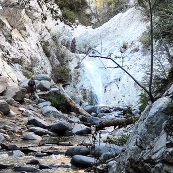


3 years ago
A beautiful hike, but a high break in area especially if you park at the very top behind the gate. A Volkswagen bug's window had been smashed when I finished my hike. Cops can't do anything about it. read more


5 years ago
Lower parking lots are closed, so you park right on the main road and hike .75 miles to the start of the trail. It's a pretty steep incline, a paved road that you'll have to walk back up once the hike is over. Restrooms at the main road are closed, but there are vault toilets available in the lower lots near the trailhead. So, we showed up around 10am on a Thursday because we had heard great things about this trail. However, we had a super creepy incident happen almost immediately after starting the main trail. We saw a man dressed up as a Sasquatch on the other side of the creek. We were laughing thinking he was maybe making a You Tube video with friends. When he heard us, he came running across the creek and right up to us, where he stood about a foot from us for what seemed like forever. He growled a couple times and ran away down the trail. Probably one of the strangest things I've ever experienced. My kids were terrified! We spent the next mile processing what happened and then finally made it to the falls which seemed like it took forever. There were only a couple other people on the trail. Overall, it's a great trail. Just wish we hadn't seen some creepy dude trying to freak us all out. On the way back we saw a rattlesnake. Definitely would go back. read more


4 years ago

5 years ago
I like the drive going to this trail. It's a long and winding road along the Angeles Crest Highway. The trail starts from the top of the road and it goes down to the forest with a beautiful stream. It has a lot of picnic tables where you can bring food and hang out before the trek. The trail could be a little tricky when you go up the mountain but the view is majestic. If you're afraid of heights, then this trail is not for you. You have to walk on the side of the mountain, single track where there is a deep drop so make sure you wear a proper gear. Wear a hiking shoes that has a good traction. What I like about this trail is because it has a lot of shade. The stream from the waterfalls is so relaxing and therapeutic. Use a hiking stick if you can. read more


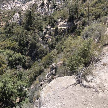


3 years ago

6 years ago
COVID REVIEW! Just hiked the Switzer Falls trail yesterday. As of right now, some of the parking lots in the area are not open so you don't need to buy an Adventure Pass if you're just parking on the side of the road nearby, which is what I did! However, if you want an Adventure Pass for $5, you can grab one from the Shell station just off the 2 freeway. (About 15 min from the actual trail). I went with a friend on a Saturday at around 1PM. Thought it'd be crazy busy, but it wasn't. Parking was relatively easy, but I know that other reviews have stated that it gets crazy packed early in the morning - so just be cautious and know that it could end up being super busy / hard to find parking. As soon as we got here, we noticed that people mostly were not wearing masks. Because it's outside, it doesn't feel as worrisome in the pandemic so long as we all stay a safe distance (which can be hard when the trails are narrow further into the hike). I did mask up most of the time unless it felt like there were zero people around in certain areas. After parking, you'll see the Picnic Area sign and a gate that keeps cars from driving in further (there's a small lot as well, but it was full.) We walked around the gate and then downhill. This is where the trail begins. We continued walking downhill for a while until you get to a bridge. Once you cross the bridge, you should see signs indicating different trails. The Switzer Falls trail is where we went, and it was still a while to get there from this point. There's a ton of shade at this point, and lots of little areas with water. Super beautiful and relaxing. Once you've hiked to actual trail, it starts to get a little confusing if you've never been here before. The shade disappears and you start to go uphill, which can be strenuous so know that this is not a super easy hike if you're trying to see falls. There's three different water falls. You might need to ask someone on the trail who has been here, to know where to go next. Once we got to a small waterfall, there were people swimming and just sitting near the water. But everyone was a safe distance away from each other, and it wasn't too packed when we went. Again, I'm sure it gets crazy at peak times. We dipped our feet and enjoyed the moment for a little while before making the trek back. This is where it gets tough. The hike back is incredibly tiring if you don't hike often. The final stretch is all uphill. I had seen reviews about this before coming here, but I didn't realize exactly how exhausting it would be. Bring plenty of water especially if you're going in the summer. I brought a big hydro flask and had plenty of ice water the whole time. By the time we were done, it was 5PM. Overall, it took us 4 hours to and from the falls. As we were leaving, we saw many people coming in to hike to the falls - it wasn't as hot anymore so many people do start later in the day. I'd advise that you just need to be cautious of when it gets dark. We also did see little snakes in the water by the waterfall, and also a rattle snake at one point on the trail. Be super cautious of your surroundings. The gnats were super annoying on the way back, as well. Bring first aid if you can, I did lose my footing at one point and slid down - pretty badly scraping my knee. My review probably sounds overly safe, but.. better safe than sorry! Nature is beautiful but unforgiving. Good luck to everyone hiking! It's a wonderful place to visit and unplug. read more


2 years ago
There's pros and cons to this like the pros is that there's beautiful views and a beautiful waterfall. The cons is a thought that this was a beginner friendly hike. When I went the first time that I went I took the wrong trail. It was me and my friend and we walked for about two months before we walked back because we didn't see anybody on that trail so we went back and found the trail but is definitely not beginner friendly a lot of times that I was scared and wanted to turn back so bad but I went through with it. It's more so harder going up than it is coming down, you literally have to climb up a little rock to get there had anxiety going up but if you're someone that loves hikes, then this is for you definitely don't go here if you're looking for beginner friendly read more


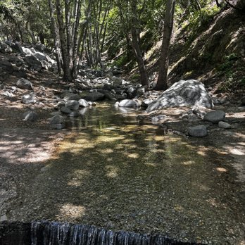
3 years ago
WARNING !! BEWARE!!! TONS OF THEFT!!! My vehicle got broken into this morning, they stole MY JBL $300 speaker, some $200 cash, penny board, lV cross bag, and my credit cards!!! Even if you don't have anything showing in your car they will break in just to look for stuff ! F these mfks low lives someone needs to put them in their place ! Never going back !! Do not leave you car on the hill in the top!!! Ps the hike is amazing now that it rained !!! read more

Page 1 of 8
More info about Switzer Falls - USDA Forest Service
34-14 Angeles Crest Hwy
La Canada Flintridge, CA 91011
Directions
Hours
Indoor Amenities
Outdoor Amenities
Switzer Falls - USDA Forest Service Reviews in Other Languages
Ask the Community - Switzer Falls - USDA Forest Service
Has anyone been there recently? Are the parking lots still closed?
Yes, parking lots are still closed @ the bottom.
Anyone know if it's open now? Says closed on google...
The gate is closed. So you can't park inside, but you can park elsewhere and walk in.
Is it open still or is it close due to COVID 19?
Yes the trail is open the parking lots are closed.
Anyone know if trail is open (bear activity)?
Not sure about Bear activities I've never encountered one ever. The trails are usually open year around
Review Highlights - Switzer Falls - USDA Forest Service
You might also consider












Why does Yelp recommend reviews?
17 reviews that are not currently recommended
The reviews below are not factored into the business's overall star rating.

2 years ago

14 years ago
4 years ago

9 years ago

2 years ago

2 years ago

4 years ago

9 years ago

5 years ago

3 years ago
3 years ago

2 years ago

14 years ago
10 years ago
2 years ago

3 years ago

15 years ago


