Cancel

    Open app

    Search

    East Branch Trail

    4.0 (2 reviews)

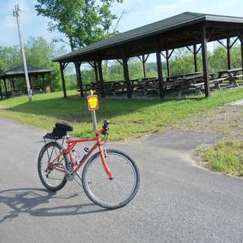
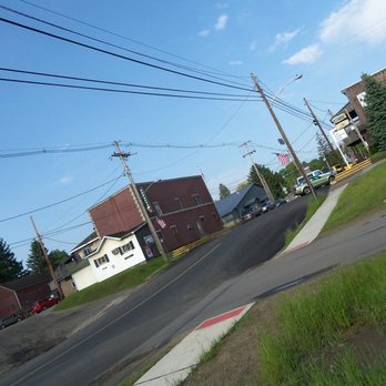
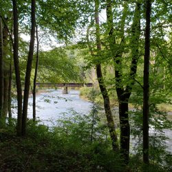
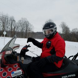
    East Branch Trail Photos

    Recommended Reviews - East Branch Trail

    Your trust is our priority, so businesses can't pay to alter or remove their reviews. Learn more about reviews.
    Yelp app icon
    Browse more easily on the app
    Review Feed Illustration
    Photo of Troy B.
    417
    856
    39715

    9 years ago

    Helpful 2
    Thanks 0
    Love this 1
    Oh no 0
    Photo of Sara L.
    49
    85
    17

    6 years ago

    Helpful 0
    Thanks 0
    Love this 0
    Oh no 0

    Verify this business for free

    Get access to customer & competitor insights.

    Verify this business

    Sandy Creek Trail - Gorgeous rails to trails paved bike route. 24 mile round trip through some amazing scenery!!

    Sandy Creek Trail

    5.0(4 reviews)
    30.4 mi

    One of the prettiest bike rides I've ever taken! This amazing rails to trail fully paved bike path…read moreis 24 miles round trip through some truly spectacular scenery and woodlands. The largest of 7 wooden bridges along the path spans the Allegheny River and the smaller ones cross several creeks. What you don't see are any roads along this gorgeous wilderness path. There is a slight upward grade during much of the 12 miles from Fishermans Cove to the end of the line - the good news is it's nearly imperceptible until you turn around and head back. You feel like you're flying on your return trip which is really fun! This area is the definition of remote so go prepared with food, water & flat tire supplies. There's decent cell service, so bring your phone. There is also a fairly long tunnel mid-trail with reflectors down the center. A light would likely make you feel a tad more comfortable on a cloudy day. The reflectors work decently to direct you on a sunny day. This bike trail is located slightly over an hour north of Cranberry Township. Google map Seneca Hills Bible Camp which is where you turn off Old Route 8 off I-80. At the T heading to the Bible Camp you head right to Fisherman's Cove to the trailhead. If you're interested in more information and specific directions, here is a link: www.avta-trails.org ' sandy-creek-trail

    Wow. This is a spectacular trail!! Such a pleasant ride through the woods crossing the river and…read morecreek multiple times on a paved surface. I don't even know how they managed to get blacktop back into some of these remote areas but they did!! It's mostly shaded as well so even on hot days this would be a great choice when you just want to ride! We started at the western end of the trail called Fisherman's cove. A little tricky to find and accessible by a gravel road about 3 miles off old route 8. Parking here is limited and is roadside so I can imagine it getting pretty crowded on weekends. But it is so worth it. The eastern end is 12 miles out at Van. The ride back seemed a lot quicker since there appears to be a minor downhill heading back although it is an easy ride in both directions. The fact that it's quite remote means there are no road crossings so you can just ride completely carefree!! If you feel up to it you can extend the ride by joining up with other rails to trails and make a long day out of it!! We absolutely loved it and will no doubt be heading back there this fall to enjoy the ride and the scenery! Highly recommended!!

    Photos
    Sandy Creek Trail - The turn around point where the paved trail ends - or you could start here

    See all

    The turn around point where the paved trail ends - or you could start here

    Clarion Highlands Trail

    Clarion Highlands Trail

    5.0(1 review)
    39.0 mi

    Please note that the address shown isn't either end of the trail, nor is it the trailheads. It's…read morebased on the Trail Link maps of where the parking is at the east end. And it's not even close to where my husband Rick and I began our ride on the trail. Anyway, the Clarion Highlands Trail is part of a network of bike trails centered around the Oil City/Franklin/Emlonton/Polk, PA areas. The cluster of trails includes the Sandy Creek Trail, the Allegheny River Trail, the Samuel Justus Trail, as well as this one. You can ride them in any and all combinations for a truly fascinating ride. I should let you know that the Clarion Highlands Tail is the roughest of them all. The trail is not only the highest in Pennsylvania, it's also in many places a dirt trail with only ruts to bike through. And it's not always well marked. A good map or your GPS will help while cycling. And a mountain bike is an absolute must--no other bike can traverse this trail in places. Finally, the trail is isolated and only experienced cyclists, or newbies with a guide, should attempt it. But if you are an experienced cyclist, the trail is a very rewarding ride. My husband Rick and I combined it with a trip on the Sandy Creek Trail. We began our ride on the Sandy Creek Trail and headed east out of the junction with the Samuel Justus Trail and the Allegheny River Trail. We saw some restrooms at the junction. If you're beginning your trip on the Sandy Creek Trail like we were, better stop here. These are the only restrooms on the trip. The segment on the Sandy Creek Trail was easily the easiest on the trip. The trail is paved all the way and it's the most scenic. About 2/3rds the way between the trail junctions and Cranberry Rockland Road, we passed through a couple of tunnels. But so much for the Sandy Creek Trail--this review is after all about the Clarion Highlands Trail. We reached the trail at Lake to the Seas Highway/28th Division Highway. As I mentioned before, here the trail turns more difficult. While this is a rails-to-trails conversion, I've been unable to determine the history of the route. You should also be aware that a lot of the bridges that used to carry the rail tracks across the local roads have been removed. There are some very steep downgrades at these crossings. Just after picking up from the Sabdy Creek Trail, the Clarion Highlands Trail passes south of State Gamelands #45. It heads along in an ESE direction, passing a golf course before coming up to one of the trailheads. At Ashland, PA it passes Phipps Cemetery, near Elmo, PA. This is the highest point on the trail, some 1,472 feet above sea level. From there it curves into a NE direction before turning east. A couple miles east is the aforementioned parking lot, but Rick and I toughed it out another mile or so to the end. Oh and the trail ends in the middle of nowhere at a side road. So after a rest stop here, we headed back and while I enjoyed the ruggedness of the trail, I was sure glad to get back to some pavement on the Sandy Creek Trail. Anyway, this is a very rewarding ride but again, it isn't for the faint of heart. If you do decide to take it, please take the necessary preparations. 1) As usual, make sure you and your bike are in tip-top condition. 2) Make sure you either bring a good map or a GPS. The trail is poorly marked. It's path isn't always obvious. 3) Make sure you bring plenty of water and snacks (especially if you're a diabetic like I am). There are no places anywhere along the trail to obtain them. Dried fruits, nuts, apples, Cliff Bars, raisins, and peanut butter sandwiches travel well. 4) Make sure you have a tire repair kit, mini pump, and a chain tool. 5) A mountain bike is a necessity. 6) It's a fun trail. Have fun.

    Loud Performance - The shop is filling up here with the talk of snow in the forcast

    Loud Performance

    5.0(4 reviews)
    29.5 mi
    $$$

    It is so cool to see a bike shop like this thriving in the area. When I lived here, this didn't…read moreexist. These guys are doing big things for the local mtb community. There are now groomed trails that can be ridden year-round! How freaking cool is that! The first think you may notice when driving by is the green wood-paneled Cadillac limo. This rad thing is their shop van! These guys load up and hit up bike parks in this thing. This is by far the coolest shop van I've ever seen. The guys at the shop are the nicest humans you'll find. They are all so good at what they do, and won't make you feel like an idiot when you come in. I had the pleasure of camping here for a women's weekend event, and the guys at the shop made sure we had what we needed and let us have our fun. Shop dog Willow is the cutest! If you stop by, make sure you get a sticker of sweet Willow. I'm almost bummed that I don't live here anymore, but now I have an excuse to come visit! I will be back, and I would recommend this shop without hesitation!

    While in New York for snowy weekend we decided to rent snowmobiles. The people that we stay with…read morenormally rent from this place. I first have to explain the building. It is my dream man cave with rough-hewn lumber for siding on the inside and smells of 2-cycle engines and gasoline. Complete with the friendliest people you could ever meet. Snowmobile people generally stick together and it seems like everyone in this crew including all of the customers came in and out of this place during the day seem know each other and were really friendly. Now going into this place I want to let you know that renting snowmobiles is not a cheap way to spend your morning. The snowmobiles they have are not 12 year old pieces of junk most of them are current model year and have very few miles on them. The particular sled I was on retails for about $16,000 and I paid around $230 to rent for 4 hours. Not a bad deal if you're only going to snowmobile once or twice a year. This dealership was located in a town of Ellery and the way the trail system works here is that these snowmobile clubs are all volunteer and they maintain the trails which go through private properties. So they have to respect the property owners so the trails are maintained. We had an incident with one of the snowmobiles where we ended up flipping it into a very small body of water. It was completely unintentional however fellow on a snowmobile have to be driving by and knew where we rented the sled from call the owner, helped us get this let out of the water unfortunately the engine was hydrolocked. This stranger than helped us towed the sled a few miles up to the street where the owner, Bryce, met us with the trailer and he wasn't even mad. We helped him load the sled in the trailer and got it back to the shop or he even encouraged us to grab another sled and go out and finish up a rental. But to be honest we're pretty much done at that point. Fortunately the damage was minimal and the shop did not charge us for the damage. These are Stand Up Guys working very hard in a small company and I would encourage you 110% to give them a try.

    Photos
    Loud Performance - The sled that was flipped.

    The sled that was flipped.

    Loud Performance
    Loud Performance

    See all

    Mahoning Shadow Trail

    Mahoning Shadow Trail

    4.0(1 review)
    69.7 mi

    4.5 stars. The…read moreMahoning Sghadow Trail is a 15 mile rails-to-trails conversion that connects Valier, PA with the tiny hamlet of Winslow via the famous Punxsutawney, PA. It follows the right-of-way of the Pennsylvania and Northwestern Railroad Line, which served the coal industry in southern Jefferson County. The tracks west of Punxsutawney served the Eureka mines of the Berwind-White Coal Company. Along the way the hiker or cyclist will find a lot of hidden remains of the once flourishing coal and coke industries in the area, including several remnants of coke furnaces. A few of them have been restored with signs saying how and when they were used. My husband Rick and I did a full 30 mile round trip on the trail. We began our ride at the western trailhead in Valier, PA. The trailhead is located on County Road 3015, Fordham Road, about 3/10s of a mile in from County Road 3013. Most on line maps will recognize the address I gave you above. Google Maps is best because it shows bike trails. It's best to start at this end of the trail because there is ample parking available. This section of trail follows the beautiful Mahoning Creek. After following the creek for a little bit, we encountered a second trailhead with limited parking along County Highway 3008. We headed NNE then turned south, passing Saints Peter and Paul Cemetery. We curved away from the creek for a bit, going through a wooded area intermixed with some small fields and homes before re-joining it at Gresock Road. Coming in to Punxsutawney, we passed the Punxsutawney Water Treatment Plant and while that might not have been the historical or scenic highpoint, the remnants of 50 beehive coke ovens are located just west of here. We then crossed the creek on an old railroad bridge that has been re-decked for cyclists. Punxsutawney is the only major town on the trail, and as there are no restrooms or even water pumps or fountains along the way, it's an appropriate rest stop. There is a bit of a detour on city streets, however it's well marked. Leaving Punxsutawney we went through some beautiful woodlands along the creek. The eastern section runs along the tranquil Mahoning to the village of Cloe and from there strays from the waterway a bit. We noticed that the trail is interrupted in Cloe for about 1/4 mile or so. We had to use PA 236 tp pick up the trail again, however we noticed it is well marked. And while we thought the western half of the trail is pretty scenic, we really liked the eastern half. This half of the trail has some steep grades, especially for a former railway line. We climbed through the scenic highlands until we reached the small village of Hudson. There are some deep hemlock forests in through here too. We rode all the way to the eastern trailhead which is at County Raod 2001. The trail pretty much ends here with no parking available. Although it appears to cross the highway, it's a private driveway on the other side. So we did a good 30 mile round trip and although the Mahoning Shadow Trail isn't the longest of our rails-to-trails, it's very scenic and it makes for a good morning's or afternoon's cycling. In addition to my usual bike trips, just remember there are no facilities along the trail except in Punxsutawney.

    David S Ammerman Trail

    David S Ammerman Trail

    4.0(1 review)
    85.4 mi

    The David S. Ammerman Trail, formerly known as the Clearfield and Grampian Trail, is another one of…read morePennsylvania's rails-to-trails conversions. It connects Clearfield with Grampian, PA via the roadbed of the Pennsylvania Railroad. The Pennsylvania Railroad's sucsessor, Conrail Railroad, operated the last trains over this route in 1988. In 1992 Clearfield County Rails to Trails obtained ownership, but it would be several years until the trail was completed. In 2011, the name was changed to the David S. Ammerman Trail in memory of the man who championed turning the abandoned rail corridor into a recreational trail. The Ammerman is one of the few rails-to-trails in western PA that my husband Rick and I hadn't yet tried. So with a rare day off together, we decided to trek all the way to Clearfield County to do our first ride of the season. We began our ride in Clearfield at the trailhead, right off of Chester Street, next to the site of an old hardware store. I'm basing the address of the trailhead on Google Maps. Anyway, like www.traillink.com says, there's ample parking here if your'e going to do a ride. The trail surface is all crushed limestone, so a trail, hybrid, or mountain bike is recommended. The ride out of Clearfield is an easy one and you can take it at a leisurely pace. You'll go past some backyards and businesses. Once out of Clearfield, it's a pleasant ride on down to Curwensville . A number of antique stores are along the way. Curwensville is midway between Clearfield and Grampian and the old railroad right-of-way is interrupted in town. The trail makes an odd crossing at Bloomington Avnue and State Street, but it's well marked so you shouldn't get lost. Back on the trail, we made our way west, reaching our endpoint at Grampian, so named by Scottish settlers after the Grampian Mountains of Scotland. The Ammerman isn't the most spectacular rails-to-trails, but it features a few short former railroad bridges, views of forests and farmlands, and it crosses Kratzer Run, Anderson Creek and the Susquehanna River. Although we traveled nearly 200 miles roundtrip in order to enjoy a 20 mile bike ride, we made a whole day of it.

    East Branch Trail - hiking - Updated August 2026

    Loading...
    Loading...
    Loading...