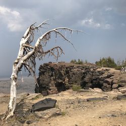
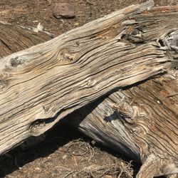
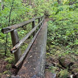
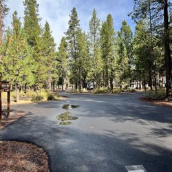
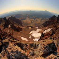
Cancel

    Open app

    Search

    Elk Lake

    4.0 (3 reviews)

    Elk Lake Photos

    You might also consider

    Recommended Reviews - Elk Lake

    Your trust is our priority, so businesses can't pay to alter or remove their reviews. Learn more about reviews.
    Yelp app icon
    Browse more easily on the app
    Review Feed Illustration

    6 years ago

    Helpful 0
    Thanks 0
    Love this 0
    Oh no 0

    3 years ago

    Helpful 0
    Thanks 0
    Love this 0
    Oh no 0

    4 years ago

    Helpful 0
    Thanks 0
    Love this 0
    Oh no 0

    Verify this business for free

    Get access to customer & competitor insights.

    Verify this business

    Tam McArthur Rim Trail

    Tam McArthur Rim Trail

    5.0(2 reviews)
    12.4 mi

    Tam McArthur Rim appears on many 'must do' lists for Central Oregon hiking trails. Rightfully so…read more It's spectacular and accessible. Clocking in at about 6 miles round trip from the trailhead to the rim overlook, the trail gains some 1300 feet in elevation, so it's not easy. More like moderate. The trail can be negotiated with pretty much any athletic shoes. There is a steep section near the beginning and also somewhat near the end. Although it's fairly well marked and apparent, the trail does split in two during the second half and it's not apparent which path is the 'officail' one. It doesn't matter we took the rim-side path going up and the other one coming down. I suspect one may be designated the horse trail (a horse trail joins TMR along the way). From the rim you'll get great views of the Three Lakes area below as well as the Cascade Range volcanoes. When we hiked, the fires in the region caused limited visibility but Broken Top and the Three Sisters were nicely in view, as well as Bachelor looking the other way. Being super popular, I expected a lot of traffic on the trail even on a weekday. Not so much. we saw maybe six other groups/singles and had the overlook to ourselves for a good half hour. The trail continues on to Broken Top but even if you're not doing that, do hike a bit further along the rim (a few hundred yards) - there's a loop that comes back around to the trail to Three Lakes. This is a lightly shaded trail. You'll be among the trees for a good bit but more often you'll be exposed to full sun. As always with area hikes, check out Chris C's review too.

    This is a must go trails if you are looking for a view of the mountains without actually climbing…read moreany of the actual mountains. Things to note, depending on the time of year you go, the parking may be snowed in, there might be a lot of mosquitoes, and you may get fairly sunburned if you do not wear sunscreen. This trail starts out of three creeks lake parking lot. It is a pretty steep incline to start out as you approach the actual rim. Once you reach the rim you can start to ge t a good view of the lakes in the area to the east. Then the trails gets fairly flat and you start to follow a cliff that has a massively steep drop off so be careful. As you walk along this cliff you are treated to one of the most breathtaking views of the three sisters mountains in central Oregon. Depending on the time of year you are hiking you will encounter many snowfields that are quite a sit themselves. If you are a photographer looking for shots, be sure to wake up and leave early as the sun approaches this area fairly quick. This is one of my favorite hikes in central Oregon and I'm always back for more! Here is a link to the land management agency that monitors this area https://www.fs.usda.gov/recarea/deschutes/recarea/?recid=71841 Here is a good website with navigation and distance for the hike http://www.alltrails.com/trail/us/oregon/tam-mcarthur-rim-trail

    Photos
    Tam McArthur Rim Trail
    Tam McArthur Rim Trail
    Tam McArthur Rim Trail

    See all

    Tamolitch Blue Pools - You've passed the blue pools if you see this bridge!

    Tamolitch Blue Pools

    4.7(13 reviews)
    20.9 mi

    This is my second time completing this trail. It is very popular so make sure to get here early if…read moreyou don't want to park far from the trailhead. There are dig out restrooms available at the trailhead as well as a trash bin. The trail is easy though there are some boulders you need to scramble over in the lava fields. You will walk along a beautiful river and cross a couple foot bridges and streams along the way. Once at the blue pool you will truly see that the photos you've seen online are not edited! The water is unbelievable. You can walk down to the water but it is not recommended to jump in unless you are experienced. The water is 30 degrees year around and several injuries have occurred here- so be wise and have fun.

    It rained the whole drive over it seemed! But the trees kept the hike dry. Free parking and porta…read morepotties at the front entrance. The trail is a fairly easy one but you have to watch where you step. The first .75 miles was quite flat but the next .75 miles was fairly rocky. My husband and I both rolled our ankles at different points. Once you get to the actual spot to see the blue pools, there is one sign that says no biking. At that point, veer off towards the water area to see the pool! We missed it and were in the zone of walking and we ended up going too far! Don't go to the bridge that only has one side to hold on to. That means you've gone too far

    Photos
    Tamolitch Blue Pools
    Tamolitch Blue Pools - Standing at a ledge overlooking the Blue Pool.

    Standing at a ledge overlooking the Blue Pool.

    Tamolitch Blue Pools - Mossy rocks

    See all

    Mossy rocks

    LaPine State Park - La Pine State Park - campground

    LaPine State Park

    4.8(39 reviews)
    19.2 mi

    August 26-29, 2025 - La Pine, OR…read more We've stayed at La Pine Campground a few times over the years, and each visit reminds us why we keep coming back. The campground is divided into three loops, each with its own character. The North Loop offers water and electric hookups, with sites that are more widely spaced than the others--something I really appreciate. That extra room makes it feel quieter and more private, and it's probably where we'll book our next stay. The Middle Loop has full hookups, while the South Loop is the busiest, featuring full hookups as well as some cabins. . There are many hiking/cycling trails (dog-friendly), and the Deschutes River runs through the campground. There is a short hike to a waterfall, and a large dog park. Unfortunately, we were a bit restricted in our outdoor activities because of the smoke from the two fires in the area. There was actually ash falling on one of the days. Also, there had been several sightings of a mountain lion in the area, so that added a bit of caution to our activities. Nevertheless, we will definitely come back.

    We just stayed one night, right before the campgrounds closed for the year. The grounds were nicely…read moremaintained, and we enjoyed a very peaceful and quiet stay. Some sites are fairly tight, while others had some nice room. The trails here were very enjoyable. Serene surroundings around the river and through the trees. We saw lots of deer, birds, and other critters scrambling about. I'm sure it would've had a slightly different feel during peak season, but we very much enjoyed our night and day of off season.

    Photos
    LaPine State Park - Kitchen for 3 days

    Kitchen for 3 days

    LaPine State Park - August 27, 2025 - Large fenced pet area.

    August 27, 2025 - Large fenced pet area.

    LaPine State Park - South space 25

    See all

    South space 25

    Salt Creek Falls - Two waterfalls for the price of one admission...both Salt Creek Falls and Diamond Creek Falls are fantastic.

    Salt Creek Falls

    4.7(12 reviews)
    21.4 mi

    Salt Creek Falls is Oregon's 2nd tallest waterfall, a 286 foot plunge from top to bottom. Visiting…read morehere is easy. It's located right off Highway 58 and 65 miles southeast of Eugene, OR. It's a $5 day use fee. I visited on Labor Day Monday and it wasn't so busy. Once you park, Salt Creek Falls is off to the right hand side but...Diamond Creek Falls (another very worthwhile waterfall to visit) is located towards the left hand side. So...I'd suggest visiting both. You get rewarded with 2 waterfalls for the price of 1 admission. The pathway to Salt Creek Falls Viewpoint is half a mile at most, but along the way there'll be a quick preview of the falls beside the staircase leading towards the trailhead. You can't miss it and you'll hear the falls loudly crashing down below. The hike to the viewing deck is casual. You walk through the forest. It's pretty quiet. Once you arrive at the lookout viewpoint, Salt Creek Falls is impressive. You get undisturbed looks at the waterfall. If your curiosity interests you, you can walk around past the platform for closer glances. I did venture out a little just to avoid the guardrail being in my pictures. But I would say...it's a very steep decline and footing wasn't so secure. Be cautious with your steps. You'll understand this while there. Btw...there were no signs indicating you couldn't venture past the viewing deck. It's up to you to decide how much further you'd like to explore. I noticed some people joined me on the cliffside, while others stayed on the viewing deck. In all, it doesn't take long to see Salt Creek Falls. It's definitely a refreshing breathe of air to be at another marvelous Oregon waterfall, and that's where making the next part of your visit better when you return back to the parking lot and continue onto the 3 mile roundtrip trail to Diamond Creek Falls. I won't say too much about Diamond Creek Falls. I can save it for another review, but I will say it's a complete 180 degree different type of waterfall and setting. You get more into the heart of nature. And you can stand at the base of Diamond Creek Falls looking right up at it cascading in front of your eyes in comparison to witnessing Salt Creek Falls from a vista point platform. They're both unique natural wonders in their own ways. If you're in the central part of Oregon, I'd make plans to come to Salt Creek Falls. I think you'll be pleasantly surprised by two magical looking waterfalls that barely get recognition. I didn't know they existed prior to 2024, and I thought I had been to them all, lol. Goes to show...there always more to see, always more to discover. Getting out among the great outdoors is a beautiful thing.

    Great waterfall viewing here. It's not too far from the parking lot down to the viewing areas…read more There are different viewing areas to go to and get different vantage points. What I liked about this is that they do have accessible viewing areas. Definitely worth going to and having a picnic, hike or both.

    Photos
    Salt Creek Falls
    Salt Creek Falls - If you venture past the Salt Creek Falls observation deck, it'll offer better views for capturing that magical moment.

    If you venture past the Salt Creek Falls observation deck, it'll offer better views for capturing that magical moment.

    Salt Creek Falls - Half mile path through the forest heading to Salt Creek Falls overlook.

    See all

    Half mile path through the forest heading to Salt Creek Falls overlook.

    Broken Top Mountain

    Broken Top Mountain

    4.5(2 reviews)
    9.0 mi

    Depending on your experience level and head-space, this is either an extremely heady "hike" or an…read moreeasy climb. This is 99% a hike, but once you near the summit, you will definitely have to do some rock climbing moves. They are easy moves, easier than anything you'd find in a rock gym, but the rock is a little loose. This is the Oregon Cascades after all, where the mountains feel like they are made out of epoxy and kitty litter! The summit views are tremendous though. Almost all the Oregon Cascades are visible (from N-to-S): Hood, Jefferson, The Three Sisters (this is an excellent place to photograph South Sister), Bachelor, etc. The best views though, are peering right down into the massive summit crater of Broken Top. Bring a wide-angle lens! Expect this to take a full day. I recommend starting EARLY. (before sunrise)

    This is one of my favorite mountains to climb, but also one of the more dangerous hikes I have been…read moreon. This mountain looks as if it has blown its top, but according to a couple of geology classes I have taken, the cone at the top has been eroded by glaciers. Which is almost as cool. Another noticeable feature to this mountain is its location compared to the other mountains in the Cascade Range in this area. The Three Sisters, Mount Bachelor, Mount Jefferson, and Mount Thielson are all in the same linear path. But Broken Top is west of this path. What is important about that is that when you get to the top of Broken Top you are actually given a different perspective of the other mountains. You are looking at the Cascade Moutain Range as if you are flying above them. Now if you combine this with the fact that you can drive pretty close to the base of this mountain. You have a pretty awesome combination. There are a couple ridges that you can take to get to the top of Broken Top. I have only been on the southern ridges. From what I am told, this is not the safest path to take. I don't recommend it unless you are an experienced climber. My friends and I took this path because it is the shortest. The downside is that it is fairly steep and does not lead you to officially summit the top. We both had some close calls on this ridge. The terrain is so steep that once you misstep and start sliding you have a really hard time stopping. I had started to slide on this ridge a couple of times and was very lucky to have caught my arm on some rocks before sliding off of a cliff. Next time we will be sure to take the ridge to the north. From what I am told, it is longer but much safer and takes you to the official summit. The hike itself is very beautiful. You start above the treeline somewhat and follow the trailhead. You will find an old canal and some melting glaciers in the summertime. Once you enter the valley you will see that you are inside the bowl of Broken Top. Everyone I have talked to seems to all agree that this reminds you of the video game Halo. As the bowl looks like the giant halo around the planet that you see. From here you will want to pick the ridge you plan on climbing up. I recommend passing on the south ridge and walk around to the north ridge. This trail is located in the three sisters wilderness and it important to remember that help is not close. So you will want to be extra careful. As you may not even have cell coverage. The terrain and the ecology around here are fragile, so you will want to be respectful and travel along durable paths and not leave any trash on the ground. Obey the rules and make safe decisions and you will have a five-star experience. Here is a link to the land management agency that manages this land https://www.fs.usda.gov/recarea/deschutes/recarea/?recid=38808 Here is a lin to a map and elevation gain and loss to the different routes https://www.alltrails.com/trail/us/oregon/broken-top-trail Here are some more summit tips on this mountain http://www.summitpost.org/broken-top/150574

    Photos
    Broken Top Mountain
    Broken Top Mountain
    Broken Top Mountain

    See all

    Tumalo Falls - Tumalo Creek

    Tumalo Falls

    4.6(52 reviews)
    12.4 mi

    We were excited to complete the Cascade Lakes Scenic Byway and visiting Tumalo Falls was our first…read morestop. We visited in late September and the temperature was pretty perfect. Be sure to arrive early to grab a good parking spot. The lot is small and fills up very quickly. Once parked, we walked up to the viewing area and took in these gorgeous falls. They are located within the Deschutes National Forest and the falls head over a cliff face of 97 feet. Tumalo Creek continues down the mountain. We followed the trail up further and discovered more waterfalls which I believe are called Middle Tumalo Falls. I believe we hiked a total of 4 miles and we really enjoyed hanging out here. I love and seek water hikes of all types and this one just kept providing us a good time. It was a great way to start our day and prepared us for a whole day of experiencing the beauty of Central Oregon. Always remember when visiting these natural areas to pack in/pack out and LEAVE NO TRACE.

    Beautiful Falls. We went to Tumalo Falls and Deschutes National Forest with our family (locals) and…read moreloved it. We started our hike at the trailhead just steps from the parking lot. The path is well-maintained and leads directly Tumalo Falls. It is incredible and cascades from a height of 89 feet. So impressive. The sound and power of the Falls is such an outstanding sight. It took us 2 1/2 hours-but it was worth every view. See you next year!

    Photos
    Tumalo Falls - Waterfall

    Waterfall

    Tumalo Falls - Looking over the top all the way down - 97 feet

    Looking over the top all the way down - 97 feet

    Tumalo Falls - Parking lot

    See all

    Parking lot

    Elk Lake - lakes - Updated June 2026

    Loading...
    Loading...
    Loading...