Father Crowley Vista Point Photos


You might also consider

More like Father Crowley Vista Point
Recommended Reviews - Father Crowley Vista Point
Start your review...


Reviews With Photos


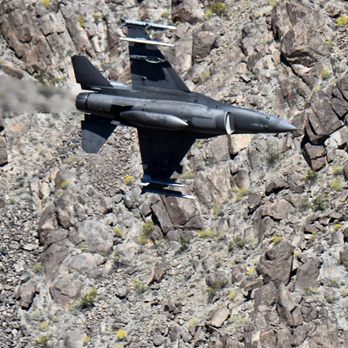
Its not always fun and games and there is as always an element that something can go wrong. Yesterday something did. (I was not spotting there yesterday) A F-18E Super Hornet from the VFA-151 'Vigilantes' squadron based out of Lemoore Naval Air-station impacted the side of the canyon. Seven spectators were hurt (thankfully minor injuries) but no ejection was observed and the pilot is presumed dead. In looking at the impact site he/she may have come in too high and/or too fast and was unable to make the turn. The impact spot is right where most of us perch to take pictures and that's where most fo the injuries occurred. As of now there is a NOTAM that effectively closes parts of the R-2508 complex including sidewinder and Jedi while recovery efforts continue. To the pilot of SWITCH11, your family, and members of VFA-15, thank you as always for your service and sacrifice. You will be in our thoughts and prayers and you have my families eternal gratitude. M0557/19 NOTAMN Q) ZLA/QFAXX/IV/NBO/A/000/999/3454N11753W005 A) KEDW B) 1908011924 C) 1908080001 E) SIDEWINDER POINT A TO POINT C CLOSED. JEDI TRANSITION (C-J) CLOSED. USE CAUTION, HELO OPERATIONS IVO POINT J.


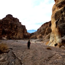
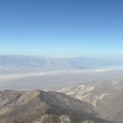
We have explored Death Valley National Park a few times but have never been to this part of the park. Named after a catholic priest, this Vista point is a beautiful spot to see the view of Rainbow Canyon. You could simply walk out of your car and look down at the Rainbow Canyon but we recommend that you take a stroll down a gravel road and see the view of Panamint Valley. We walked a total of 1.39 miles. Most walked down to the valley while a few cars drove down it. There are bathrooms here as well.


Located about 10 minutes away from Panamint Springs Resort is Father Crowley Vista Point. It's a fully paved parking lot with restrooms and a decent viewpoint overlooking part of Death Valley. Up until late 2019, there were jet fighters that flew through the "Jedi Transition" canyon as part of their training. Since a tragic accident of an F/A18 fighter pilot that crashed into the canyon wall in July 2019, all flights through the canyon have ceased for now. The viewpoint is a nice stopping point to stretch a bit. I took a motorcycle trip out there last weekend and stopped by the viewpoint for a bit. Spring is a great time to visit before the triple digit temps kick in during summertime in Death Valley.

I have geeked out on youtube videos for the past couple of years about a place called Rainbow Canyon...also known as "Star Wars" Canyon...and in another world..."The Jedi Transition." GOOGLE IT! Those videos captured many a different aircraft roaring into and out of the canyon. So close that you could see the pilots expertly navigating the airspace from inside their respective cockpits. The intoxicating roar of their engines bouncing off the canyon walls and slamming into your ear drums. It's a sound that creates goosebumps. I would eventually commit to a weekday (Tuesday, Wednesday, Thursday, I have heard are your best chances...I chose the Humpday (both times) ) and made the journey out from Las Vegas. So far the average if you live in the NW side of town is about 2 hours and 45 minutes. On 02/06/19, my copilot and I made the journey and stopped at a turn about on the 190 and hiked to an area at the end of the canyon. We dropped packs a little after 1300 hours, and were treated to passes by F-18's, F-35's and a single Fouga CM.170 Magister (looks like a T-33 Shooting Star). There were multiple plane spotters, some of the professional caliber, spread through out the canyon. We were no threat to them with our iPhones, but the phones did get some good video. On 02/27/19, after jones'n for a return to this amazing area...I made the trip north, this time solo. I made a quick stop in Beatty, NV and then headed west. I stopped in Stovepipe Wells for some sundries and headed over the range into Panamint Valley. After yet...another stop, I made my way up five or so miles to where I parked in a turn out. I threw on my pack and bounced up some hills and perched on the rim of the canyon. About 45 minutes later, an F-15 came roaring through the canyon. Shortly after a member (F-16) of the Thunderbirds ripped through with smoke on. After seeing an F-35, I decided to head up to the "Point" proper to enhance my awareness of the area. Father Crowley Vista Point is a bit more modern than the cliffs of the canyon. There is a parking lot and a restroom. It was hear that I engaged in fellowship with other spotters. The view from here gives you something else entirely. I was told that some fighter pilots key in on crowd and give them a show. Be it overhead passes or just ripping through the valley, you're in for a show regardless! This section of the 190 is magical and now haunts me everyday. I can't wait to plan my next trip!


Nice views into Rainbow Canyon: Death Valley National Park Not many people know this spot to be part of the Death Valley National Park... at least I didn't at first but this was my second visit here for the beautiful scenic features. It is located near the western park boundary. When we drive to Las Vegas we stop here to stretch our legs, use the restroom and enjoy the beautiful landscape. Perhaps this lookout is more well known for its use as a military flight training site at Rainbow Canyon. Remember in the original "Star Wars" movie the way the fictional X-Wing starfighters flew through deep corridors of the enemy Death Star?... Air Force and Navy military pilots are known to dangerously but skillfully maneuver their jets (F/A-18E Super Hornets) through the high-walled cliffs that way too and that's why the vicinity has been nicknamed "Star Wars Canyon." It would be so cool to catch this one day as it is never a guarantee which days training flights will take place. We saw a few people there with camera tripods. Rainbow Canyon is below Father Crowley Lookout. There is a plaque on a stone monument at the parking area in memory of Father Crowley. He was known as The Desert Padre. He would often stop here and admire the views when he visited his parishioners to/from Death Valley and his home in Lone Pine. He hit a steer on one of his trips. Review #2123 read more


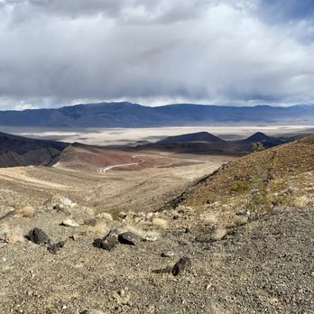


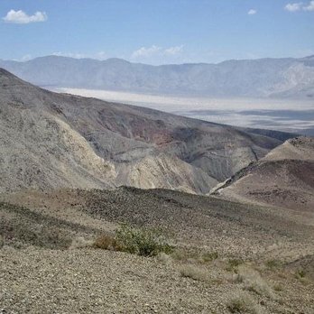


Father Crowley Vista Point was one of our first stops after entering Death Valley National Park. It's right off 190, easy to spot and stop at. They have a big parking lot, signs, restrooms, vista points. If you'll exit Death Valley in other areas, make an effort and stop here. This is the "Star Wars Canyon", near Panamint Valley. The vistas are breathtaking and it's a good introduction to Death Valley. Military jets used to train here and unfortunately some crashed. The canyon is steep and not that wide. There was one more person when we stopped by, so it was great during Covid. Quiet, a tad windy, picturesque, huge, beautiful landscape spreading in front. Great vistas, nice place to stop if you enter from Olancha. read more


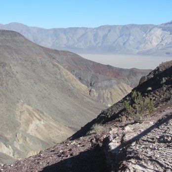
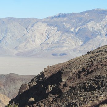

Its not always fun and games and there is as always an element that something can go wrong. Yesterday something did. (I was not spotting there yesterday) A F-18E Super Hornet from the VFA-151 'Vigilantes' squadron based out of Lemoore Naval Air-station impacted the side of the canyon. Seven spectators were hurt (thankfully minor injuries) but no ejection was observed and the pilot is presumed dead. In looking at the impact site he/she may have come in too high and/or too fast and was unable to make the turn. The impact spot is right where most of us perch to take pictures and that's where most fo the injuries occurred. As of now there is a NOTAM that effectively closes parts of the R-2508 complex including sidewinder and Jedi while recovery efforts continue. To the pilot of SWITCH11, your family, and members of VFA-15, thank you as always for your service and sacrifice. You will be in our thoughts and prayers and you have my families eternal gratitude. M0557/19 NOTAMN Q) ZLA/QFAXX/IV/NBO/A/000/999/3454N11753W005 A) KEDW B) 1908011924 C) 1908080001 E) SIDEWINDER POINT A TO POINT C CLOSED. JEDI TRANSITION (C-J) CLOSED. USE CAUTION, HELO OPERATIONS IVO POINT J. read more




6 years ago
We have explored Death Valley National Park a few times but have never been to this part of the park. Named after a catholic priest, this Vista point is a beautiful spot to see the view of Rainbow Canyon. You could simply walk out of your car and look down at the Rainbow Canyon but we recommend that you take a stroll down a gravel road and see the view of Panamint Valley. We walked a total of 1.39 miles. Most walked down to the valley while a few cars drove down it. There are bathrooms here as well. read more

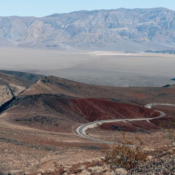
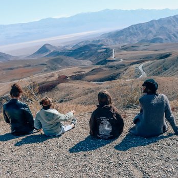


Located about 10 minutes away from Panamint Springs Resort is Father Crowley Vista Point. It's a fully paved parking lot with restrooms and a decent viewpoint overlooking part of Death Valley. Up until late 2019, there were jet fighters that flew through the "Jedi Transition" canyon as part of their training. Since a tragic accident of an F/A18 fighter pilot that crashed into the canyon wall in July 2019, all flights through the canyon have ceased for now. The viewpoint is a nice stopping point to stretch a bit. I took a motorcycle trip out there last weekend and stopped by the viewpoint for a bit. Spring is a great time to visit before the triple digit temps kick in during summertime in Death Valley. read more


I have geeked out on youtube videos for the past couple of years about a place called Rainbow Canyon...also known as "Star Wars" Canyon...and in another world..."The Jedi Transition." GOOGLE IT! Those videos captured many a different aircraft roaring into and out of the canyon. So close that you could see the pilots expertly navigating the airspace from inside their respective cockpits. The intoxicating roar of their engines bouncing off the canyon walls and slamming into your ear drums. It's a sound that creates goosebumps. I would eventually commit to a weekday (Tuesday, Wednesday, Thursday, I have heard are your best chances...I chose the Humpday (both times) ) and made the journey out from Las Vegas. So far the average if you live in the NW side of town is about 2 hours and 45 minutes. On 02/06/19, my copilot and I made the journey and stopped at a turn about on the 190 and hiked to an area at the end of the canyon. We dropped packs a little after 1300 hours, and were treated to passes by F-18's, F-35's and a single Fouga CM.170 Magister (looks like a T-33 Shooting Star). There were multiple plane spotters, some of the professional caliber, spread through out the canyon. We were no threat to them with our iPhones, but the phones did get some good video. On 02/27/19, after jones'n for a return to this amazing area...I made the trip north, this time solo. I made a quick stop in Beatty, NV and then headed west. I stopped in Stovepipe Wells for some sundries and headed over the range into Panamint Valley. After yet...another stop, I made my way up five or so miles to where I parked in a turn out. I threw on my pack and bounced up some hills and perched on the rim of the canyon. About 45 minutes later, an F-15 came roaring through the canyon. Shortly after a member (F-16) of the Thunderbirds ripped through with smoke on. After seeing an F-35, I decided to head up to the "Point" proper to enhance my awareness of the area. Father Crowley Vista Point is a bit more modern than the cliffs of the canyon. There is a parking lot and a restroom. It was hear that I engaged in fellowship with other spotters. The view from here gives you something else entirely. I was told that some fighter pilots key in on crowd and give them a show. Be it overhead passes or just ripping through the valley, you're in for a show regardless! This section of the 190 is magical and now haunts me everyday. I can't wait to plan my next trip! read more


13 years ago
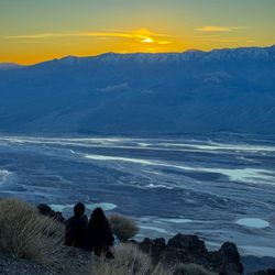
Father Crowley Vista is alongside Highway 190, 7 miles from Panamint Springs, California. The sight is an amazing look over the Panamint Mountains, down into Rainbow Canyon created by lava flow. The sight is pretty amazing, and gives a great panorama view of the Western edge of Death Valley. After this view, Highway 190 takes a dip down the bottom of the valley. If you are traveling down 190, this is a must stop since the parking area is right off of the highway and absolutely no trailing or hiking is needed to see this view. read more


5 years ago

8 years ago
More info about Father Crowley Vista Point
Hwy 190
Death Valley, CA 92328
Directions
Hours
Outdoor Amenities
Father Crowley Vista Point Reviews in Other Languages
Ask the Community - Father Crowley Vista Point
Review Highlights - Father Crowley Vista Point














Father Crowley Vista Point - hiking - Updated September 2026
Best of Death Valley
People found Father Crowley Vista Point by searching for…
Things to Do With Kids in Death Valley, CA
Scenic View in Death Valley, CA
Off Road Trails in Death Valley, CA
Scenic Overlook in Death Valley, CA
Sunset View in Death Valley, CA
Running Trails in Death Valley, CA
National Parks in Death Valley, CA
State Parks in Death Valley, CA
Hiking Trails in Death Valley, CA
Hiking With Kids in Death Valley, CA
Walking Trails in Death Valley, CA
Easy Hikes in Death Valley, CA
Meteor Shower in Death Valley, CA
Night Hike in Death Valley, CA
What to Do in Death Valley, CA
Parks for Kids in Death Valley, CA
Places to Take Pictures in Death Valley, CA
Beautiful Views in Death Valley, CA
Playgrounds in Death Valley, CA
Browse Nearby
BEST of Death Valley, California Restaurants near Father Crowley Vista Point
BEST of Death Valley, California Coffee near Father Crowley Vista Point
BEST of Death Valley, California Breakfast near Father Crowley Vista Point
BEST of Death Valley, California Campgrounds near Father Crowley Vista Point
BEST of Death Valley, California Shopping near Father Crowley Vista Point


