1. Harmony Borax Works Interpretive Trail

1. Harmony Borax Works Interpretive Trail

0

Death Valley, CA

Cancel

Open app

Search

Harmony Borax Works Interpretive Trail

4.3 (10 reviews)

Harmony Borax Works Interpretive Trail Photos

You might also consider

More like Harmony Borax Works Interpretive Trail

Recommended Reviews - Harmony Borax Works Interpretive Trail

Your trust is our priority, so businesses can't pay to alter or remove their reviews. Learn more about reviews.
Yelp app icon
Browse more easily on the app
Review Feed Illustration

Reviews With Photos

Jo S.

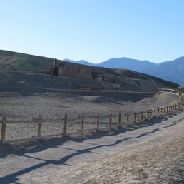
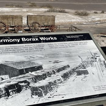
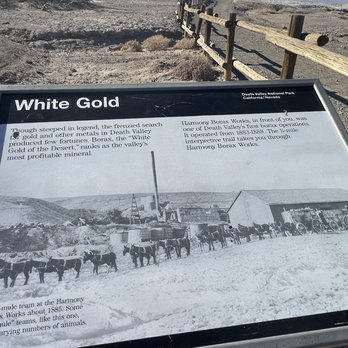
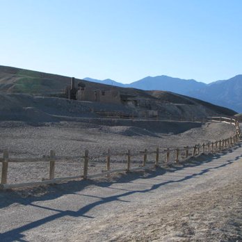
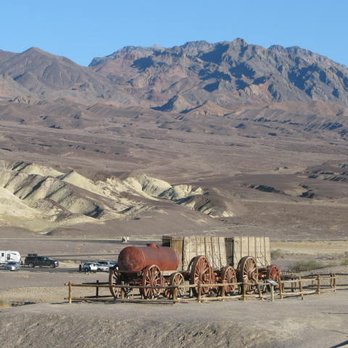
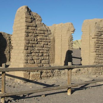
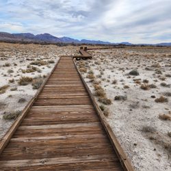
Harmony Borax Works should be on your Must See Places within Death Valley National Park. It's so accessible, very close to Furnace Creek Visitor Center, off 190, there are signs for it and a road that takes you there. The road is paved and you can spot the place from the road. There's parking right there. Anyone can come here, even if you just want to get out of the car shortly or stay longer, walk the trail, take photos and spend at least half an hour and take the information and the views in. This is more a historic visit, that explains the start of Death Valley, due to borax mining. Some remains are here, you'll also get to see where the 20 Mule Team comes from. These are the remains of a mile, it's a self guided tour, not too many people around when we went. So on the way to or back from Furnace Creek, make a stop here. It's educational, a nice break from hiking and hunting for harder to find places, historic and full of great information. And some photos ops that you can take advantage of!

See all

4 months ago

Helpful 1
Thanks 0
Love this 1
Oh no 0
Photo of Ivory B.
49
559
73641

1 year ago

Helpful 6
Thanks 2
Love this 8
Oh no 0

4 years ago

Helpful 6
Thanks 0
Love this 3
Oh no 0

5 years ago

Helpful 13
Thanks 1
Love this 13
Oh no 0
Photo of Ben A.
4995
1742
5077

7 years ago

Helpful 9
Thanks 1
Love this 10
Oh no 0
Photo of Mikey D.
89
42
11

4 years ago

Helpful 1
Thanks 0
Love this 0
Oh no 0

12 years ago

Helpful 2
Thanks 0
Love this 0
Oh no 0

13 years ago

Helpful 1
Thanks 1
Love this 0
Oh no 0

9 years ago

Helpful 0
Thanks 1
Love this 0
Oh no 0

Harmony Borax Works Interpretive Trail Reviews in Other Languages

Ask the Community - Harmony Borax Works Interpretive Trail

Verify this business for free

Get access to customer & competitor insights.

Verify this business

Darwin Falls - Darwin Falls

Darwin Falls

4.4(12 reviews)
37.8 mi

This is one of the best hikes in Death Valley. So amazing to see a waterfall in this dry and…read morepatched desert. There are 2 parking lots, one close to the road and one at the trailhead. You will need a high suspension vehicle to make it to the trailhead parking lot, which I highly recommend, as the hike from the road is quite long. There isn't a set trail to the waterfall, you'll have to make your way there going through water, bushes and scrambling over rocks. But it is a fun hike and you can see the effects of water as the area grows in vegetation the closer you get. Even saw some butterflies, which isn't something I associate with deserts. The waterfall is such a delight to see. It is cool water, and a welcome rest place before heading back. We visited mid- February, the trees had leaf buds. A few more weeks and everything would be very green.

It's gone. Sadly last year's floods and continual flooding since has destroyed the road leading to…read morethe trail. What used to be a 2 mile out and back trail to the falls is now 6 miles thru a recently washed out area. The falls are still amazing but without the road, I'm not sure it's worth it when considering the time. It was a long, loose footing, sandy hike. Plus it started raining so there's that. Disappointed this time but it's still amazing to see when you think about where you are.

Photos
Darwin Falls - Riparian area approaching the falls

Riparian area approaching the falls

Darwin Falls
Darwin Falls - Hillside surrounding the canyon

See all

Hillside surrounding the canyon

Fall Canyon - Big moth caterpillars eating frantically before the summer sun wipes out the tender green plants.

Fall Canyon

5.0(3 reviews)
4.9 mi

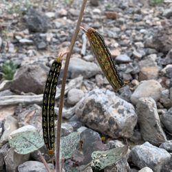
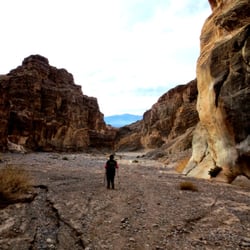
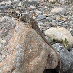
Of all the places we visited as a family for Spring Break in Death Valley, Fall Canyon was my…read morefavorite. Situated in the northern half of the park, Fall Canyon is accessed via a 3 mile road off the main highway, consisting of dirt, sand, gravel, and rocks up to about the size of a cantaloupe-- not impossible to pass in your 1994 Ford Festiva, but I wouldn't recommend it. The park map suggests a "high-clearance vehicle," which means the few extra inches under a Jeep, a truck, or an SUV could mean the difference between making it to the gravel-covered parking lot, or blowing out your exhaust system on the rocks... the latter could prove to be life-threatening in the heat of the desert. That said, before setting out on any hike in DV, be sure to prepare: even traveling with my 4x4 truck, we carried two gallons of water per person in the truck, with Camelbacks that stored 3 liters of water each during our hikes, plenty of shelf-stable snacks like dried fruit, nuts, and trail mix, sunscreen, a couple of lighters, a good knife, light clothing, hats, a first aid kit... I know, rather Boy Scout of us, but you don't take chances when you're traveling on the periphery of civilization with young kids. Phones generally don't work here. Now that all the worry stuff is out of the way... Fall Canyon is desolate and beautiful. Unlike any canyon in my local San Gabriel mountains, Fall Canyon's stark rock walls, carved by aeons of occasional swift moving flash flood waters, rise in stark contrast from the flat canyon bottom of gravel and rocks. This place is a rockhound's dream: if you know where to look, a geology enthusiast can find pre-Cambrian igneous rock (that's nearly 1.7 billion years old, Mildred), limestone, sandstone, breccia, conglomerate, mudstone, quartz, quartzite, gypsum, and maybe even a few other surprises, brought here from far away by fast moving waters. During our trip in April, the area was flecked with colorful wildflowers, growing in earnest against the deadly heat just a few weeks away, and providing food for voracious hornworm caterpillars, eating as fast as they could. A beautiful collared lizard crossed our path, and we had a brief photo-shoot with it before releasing it unharmed. As the sun went down, lots of bats emerged from the caves in the canyon walls, feasting early evening insects. With young kids, we only journeyed about a mile and a half into the canyon. In some places, the slot canyon narrows, while in other areas, it is wide; in most cases, the steep walls on either side keep you directly on the path. I can't wait to return to this area either sans offspring or when they are a little older and can carry their own water, to further explore the deeper parts of this beautiful area.

NO FALLING, JUST A LITTLE SLIPPING!!!!…read more BACKGROUND: Fall Canyon is one of many colorful ravines in the hills surrounding Death Valley in California; shaped by occasional flash floods that flow from the higher mountains beyond, the canyon is remote and little-visited; deep and moderately narrow for many miles, with occasional shaded, cave-like passageways of great beauty. Some of these narrow, twisting sections are enclosed by smooth granitic walls with an unusual bluish tint. As with most other Southwest canyons, the rocks are layered, but quite differently to the orderly slot canyons of Utah - here the strata are multi-colored, buckled, twisted and eroded, the result of ancient geological forces. Fall Canyon is easily reached and offers a perfect wilderness experience, though it should be avoided during the summer months when the weather becomes too extreme. STATS: Distance: 9 miles Elevation Gain: Approx. 2,200ft. or roughly 400-500ft./mile ESSENTIALS: At least 2 liters of water Know your limits Comfy hiking shoes with good lugs Layered Clothing High protein food/snacks Electrolytes Camera Hat (optional) Sunscreen Trek poles (optional) High profile vehicle (strongly recommended) OUR ROUTE: Before heading home from a magically majestic weekend in Death Valley, me and The Crew headed here to Titus-Fall Canyon for a quick in-&-out. The drive from the paved road to the trail head was more than a little dirty and dusty, it was quite bumpy, thank goodness for high profile vehicles. Low profile cars would probably bottom out and leave a trail of car parts on the road. From the trailhead we headed up a soft sandy wash for about three miles, similar to the one at Furnace Creek. There is very little elevation gain, so it's completely doable for beginner hikers. It's the sandy wash provides a quad workout. The canyon closes in a smidge and provides some shade and the shadows created by the slightly limited shinning sun creates some breathtaking sites and colors of the slot canyon. The slots in this canyon don't get so narrow that packs have to be removed, and there's no need to spoon to the left or spoon to the right to get through. There are offshoot slots throughout this wash, which are worth taking a gander, especially if you are not wanting do all nine miles of this hike. Although there are no signs leading you to the end of the trail, the mouth of a 30ft. waterfall will be your sign that the end is here. DISCLAIMER: Hiking is not something that can be taken lightly. It can be life-threatening as you see and hear on the news, people die or get lost all time. Please, if you are going to hike, never go alone and prepare for the worst, hope for the best. Remember when going for a hike, no matter how short you think it may be, always be prepared. Carry at least two liters of water for every five miles (more if the weather is warm), protein bar, nuts, and electrolytes. Wear sturdy lug sole shoes and protective clothing. Some areas the weather can change quicker than a fireman can put on his gear. It is also very important, always always always let a family member or friend know where you are going and when you expect to be back. Lastly, have fun when you hike it up. Review 86 Yelp 100+ Challenge 2015 #deathvalley #hikingdeathvalley #hiking #belowsealevel

Photos
Fall Canyon - Titus-Fall Canyons slots are WIDE

Titus-Fall Canyons slots are WIDE

Fall Canyon - Beautiful contours of Titus-Fall brought to you by wind and flash flooding

Beautiful contours of Titus-Fall brought to you by wind and flash flooding

Fall Canyon - Collared lizard in situ

See all

Collared lizard in situ

Death Valley National Park - This plant looked like it was giving me the finger LOL!! (Ubehebe Crater)

Death Valley National Park

4.7(398 reviews)
4.9 mi

As part of our quest to visit all 63 U.S. national parks, we set off on a six week road trip. I…read morehave a personal rule: I only count a national park as "visited" if I actually spend time there, hike or walk through it, and truly experience it. On this trip, we visited 14 national parks, and Death Valley National Park was one of the biggest surprises of the entire journey. Before visiting, I honestly expected Death Valley to be mostly a vast, empty desert. Instead, we discovered a place that was incredibly diverse, dramatic, and surprisingly beautiful. We stayed at The Oasis at Death Valley, which was a wonderful retreat after long days exploring the park. The funny thing about Death Valley is that when you first drive in, the landscape can seem almost endless and barren. You wonder what you are going to find in such a harsh environment. Then, as you turn toward the different areas of the park, the scenery completely changes. The desert opens up into mountains, colorful hills, salt formations, canyons, and landscapes that look almost unreal. One of the highlights was visiting places like Artist's Palette, where the hills are painted with incredible shades of gold, pink, green, and purple created by different minerals in the earth. It truly feels like nature took a paintbrush and created its own masterpiece. We also enjoyed driving the historic Twenty Mule Team Canyon, named after the famous Borax mining operations that helped put Death Valley on the map. In the late 1800s, teams of 20 mules pulled enormous wagons loaded with borax across the desert because there were no practical roads or railways. Learning about those incredible journeys added a whole different dimension to the landscape. It made us imagine the determination and hardship of the people who lived and worked in this extreme environment more than a century ago. We also visited areas where scenes from the Star Wars movies were filmed, which added a fun element to the experience. It was easy to understand why filmmakers chose Death Valley. The landscape looks like another planet. What surprised me the most was discovering that even in one of the hottest and driest places on Earth, there is life. We were amazed to see fish surviving in the waters of Death Valley, a reminder that nature finds a way even in the most extreme environments. Our visit also came with a little adventure of its own. We experienced a powerful dust storm that knocked out electricity for several hours. It was impressive to witness the force of nature, but thankfully we were safe and comfortable. And we were very lucky with the temperatures. When we arrived, it was around 110 degrees, but the following days cooled down to about 97 degrees. We took advantage of the cooler mornings, waking up early to hike and explore before the midday heat arrived. By late morning or noon, we would return to our peaceful retreat and enjoy the comfort of being out of the desert sun. Death Valley is a place of extremes: extreme temperatures, extreme landscapes, and extreme beauty. It is not just a desert. It is a place full of surprises, colors, history, and incredible scenery. I left with a completely different appreciation for this park and would highly recommend it to anyone willing to experience one of America's most unique landscapes. Death Valley truly earned its place as one of the unforgettable stops on our journey.

STEPH JUDGEMENT: A truly amazing place, period…read more You might think the whole place is just sand dunes, but you'd be wrong. There are fantastic sand dunes, yes, and Mesquite sand dunes is a great place for some free form fun (like sand sledding and boarding, and you can just roll down some dunes like my hubby), but there's so much more! Some more highlights: - Ubehebe Crater: mind-boggling crater with a fun hiking trail around its rim. You can hike down to the bottom too, but you gotta come back out, and we opted to just stay at the top. That rim trail was plenty long for us. - Badwater Basin: We decided to walk out about a mile into it, and as the crowds faded away the vast white expanse made it feel like we were in the Arctic--magical. - Zabrieski Point: Took in breathtaking views and sunset. Also did some hiking around the Badlands nearby, which was really cool. - Death Valley Inn: treated ourselves to some great cocktails at their swanky bar after a grueling hike. The bartender didn't bat an eye when we arrived all dusty and gross. I did clean up a bit in the bathroom, but there's only so much you can do. - Artists Palette: Did the drive-thru road and got out along the way for short explorations into its canyons. We were there in late March/early April and lucked out with relatively cool overcast weather. It was also very windy. The last time I was at Death Valley was in the spring of 2009, and it was also very windy, making my decision to tent camp a miserable experience. This time the hubby and I decided to stay at a hotel in Pahrump, NV, about an hour away. Yes, we had to drive into the park every day, but it was totally worth it. We loved our time here and are looking forward to our next visit, hopefully before another 15 years pass!

Photos
Death Valley National Park - I slayed a dragon lol!! (Part of a Cotton Top Cactus in one of the slot canyons)

I slayed a dragon lol!! (Part of a Cotton Top Cactus in one of the slot canyons)

Death Valley National Park - I made it

I made it

Death Valley National Park - Leftover spring blooms backlit in the sunset at one of the mountain vistas (taken with a macro lens - Dec 2024)

See all

Leftover spring blooms backlit in the sunset at one of the mountain vistas (taken with a macro lens - Dec 2024)

Telescope Peak

Telescope Peak

5.0(2 reviews)
14.9 mi

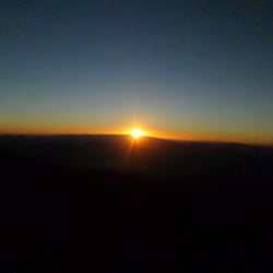
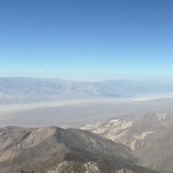
Ok here is my first review of Telescope Peak, it might be a long one…read more Telescope Peak is located in the Death Valley National Park. It is a strenous but totally beautiful hike to the summit. The access to the trail is rather difficult depending on road conditions you might have to take a long detour if you travel from the Southwest. In my case the access to the trail from Trona was closed due to last years road damage so I had to drive through Panamint Valley to access the Western entrance of Death Valley and Emigrant Canyon road that leads further to the remote camp locations. Check the Morning Report on the park´s website for current conditions. Here is my trip report of September 2014: Arrived at Mahogany Flat campground about 5pm. The road to the campground is in very bad shape, they recommend a high clearance 4x4 vehicle but my regular Dodge Charger made it as well, you just have to drive slowly and carefully. Camped overnight at Mahogany Flat. At night it became obvious why it is called Telescope Peak. The sky was clear and no other sources of light polluted the sky so with the naked eye you could spot billions of stars and many comets/shooting stars. Got up early the next morning to catch the sunrise from about half a mile up the trail to Telescope Peak. An amazing show of mother nature as Death Valley and the Bad Water Basin slowly got drenched in sunlight. Return to camp for a good breakfast and the start of the hike to the Telescope Peak about an hour later. To me the hike was quite challenging, the round trip took about 8.5 hours with an elevation gain of almost 3000ft. Especially the last 2 miles of the hike were demanding but with frequent stops and lots of drinking and snacking I reached the peak. The vistas from top of Telescope Peak are very spectacular. The entire Death Valley to the East including Badwater Basin and the Panamint Valley on your West. The Mojave Desert to your SW and the Sierras to the NW....Spectacular There is a log to sign at the peak. After about 40 minutes of relaxing, eating and taking in these stunning views it was time to return to camp. Here are my recommendations for this spectacular hike. Drive carefully on the road to Mahogany Flat. It is not as steep as one might think but the road is in very bad condition. Camp out a night at Mahogany Flat. Several camp sites available on first-come first-served basis. Might be more frequented on week end. Campground has pit toilets but there is NO WATER available so make sure to bring plenty with you. Camp fires are ok in the fire rings/pits on each site. Enjoy the clear sky at night, watch the stars and enjoy the silence out there, soul stimulating.... It does get cold at night because of the elevation at 8800ft so pack in some extra warmth for your stay. Do not miss the sunrise over Death Valley, it is fantastic, force yourself to get up. I even set up my alarm clock. For the hike pack in plenty of water I had about 1.5 gallons. A warm layer for windy situations and of course snacks, trail mix, jerky, sandwich, fruit, whatever you wanna eat and do not mind carrying in your backpack. Put on a hat, dont forget sunglasses and a camera and put on sunscreen. On the peak there is no shade and the sun will beat down on you. Enjoy yourself and the nature

Great 15 mile (round trip) hike with a spectacular views in all directions.read more

Photos
Telescope Peak
Telescope Peak - Sunrise from .5 miles of Telescope Peak trail

Sunrise from .5 miles of Telescope Peak trail

Telescope Peak - Panoramic view of Panamint Valley to the West

See all

Panoramic view of Panamint Valley to the West

Harmony Borax Works Interpretive Trail - hiking - Updated July 2026

Loading...
Loading...
Loading...