1. Fern Spring

    1. Fern Spring

    0

    Yosemite Valley, CA

    Fern Spring

    5.0 (2 reviews)
    Open 6:00 am - 10:00 pm

    Fern Spring Photos

    Recommended Reviews - Fern Spring

    Your trust is our priority, so businesses can't pay to alter or remove their reviews. Learn more about reviews.
    Yelp app icon
    Browse more easily on the app
    Review Feed Illustration

    2 years ago

    Helpful 9
    Thanks 1
    Love this 12
    Oh no 0

    9 months ago

    Helpful 0
    Thanks 0
    Love this 0
    Oh no 0

    Verify this business for free

    People searched for Parks 137 times last month within 15 miles of this business.

    Verify this business

    Yosemite National Park - A fiery red Checkerspot butterfly (I think it's a Variable Checkerspot) along the Swinging Bridge Trail!

    Yosemite National Park

    4.6(1.4k reviews)
    4.9 mi

    My husband, my son, and I spent four unforgettable days hiking in Yosemite National Park. We…read moreabsolutely love hiking, and being surrounded by nature always brings out the best in us. Day 1: We hiked 7.2 miles exploring several smaller trails. We also took the train ride for about an hour, which was so relaxing. The highlight of the day was seeing a black bear. Day 2: We hiked Half Dome all the way to the cables a total of 17 miles. It was by far the hardest hike we've ever done, but every step was worth it. Along the way we passed Vernal Fall and Nevada Fall, both absolutely breathtaking. The hike back was tough on our knees, but we kept a positive attitude and finished strong. Day 3: We hiked Tuolumne Grove Trail and then Glacier Point to Union Point. The round trip was 8 miles, with plenty of uphill climbing on the way back. That night we stayed to watch the shooting stars around 10 p.m., and it was magical. We also saw an adorable baby bear cub. Day 4: We hiked Mariposa Grove Trail to Wawona Point, completing 8 miles. Walking among the giant sequoia trees was an incredible experience that I highly recommend. The trail is moderate and absolutely beautiful. We also spotted a deer. By the end of our trip, we had hiked 40.2 miles in four days. Our legs were exhausted, but our hearts were full. Every mile, every view, and every wildlife encounter made this adventure unforgettable. Yosemite reminded us why we love hiking nature has a way of bringing out the best in us.

    Haven't visited in late spring or early summer in years, and it was absolutely breathtaking. The…read moremeadows were lush and green, the waterfalls were flowing, and the weather was perfect. Yosemite never gets old. It was such a nice change after visiting the park in the winter for the past several years. Already can't wait to be back again soon! We visited Father's Day weekend and got into the park around 6:30 AM. We parked near Yosemite Falls Lodge, and there was plenty of parking at that time. It didn't start filling up until after 8:00 AM, so getting there early was definitely worth it. We pretty much had Lower Yosemite Falls to ourselves while we ate breakfast. We took the shuttle to Mist Trails and ended up doing the hike up to the top of Nevada Falls.

    Photos
    Yosemite National Park - ***AMAZING PLACE***

    ***AMAZING PLACE***

    Yosemite National Park - Sweat lodge

    Sweat lodge

    Yosemite National Park - Glacier Point

    See all

    Glacier Point

    Yosemite Falls - Mar 8, 2026

    Yosemite Falls

    4.7(192 reviews)
    4.7 mi

    Upper Yosemite Falls trail was definitely the hardest hike I've done. It was about 7.2 miles…read moreroundtrip, took exactly 7 hours starting at 10:40am and finally making it down at 5:40pm (5 hours going up, 2 going down), and was 2,700 ft of elevation gain. The terrain is mostly rocks and goes up most of the way, so it's an insane leg workout that left me sore for a couple days after. Going up was exhausting, but there's plenty of spots to sit down and take breaks. About halfway through, we stopped and ate snacks. Going down felt more difficult on my knees, but it was a lot faster. It also started to rain so we had to be careful about slipping. The views were absolutely beautiful and worth it every step of the way. I constantly stopped and took photos and admired it all. Once you get up to the top, you can get really close to upper yosemite falls on a narrow path along some rocks. If you're afraid of heights, you might be a bit scared. It was super chilly when we got up there. Almost everyone we encountered on the trail was super friendly, and it was fun to see familiar faces when we got up to the top and overhear people exclaiming how proud they are of themselves. Going in May when the weather was still cold (about 40° when we were here) was definitely helpful. I don't know if I would have been able to do it if it were hot outside. I get lightheaded pretty easily and there were times I felt like I was going to pass out, but I did it!! Definitely take breaks, don't rush yourself, drink plenty of water, and bring snacks. Make sure you have hiking boots!!! If I didn't have hiking boots I probably wouldn't have been able to do it.

    Went mid-March valley floor hardly any traffic early 8 am. Got busy after 10am. Rode bikes Yosemite…read morevalley loop El Capitan, Half Dome, Horsetail, Bridal veil, and Vernal falls. Tried singletrack that paralleled then the crowds at Yosemite village slowed our pace to a crawl. A family of four walking side by side blocking the path completely. Even oncoming hikers gave them dirty looks. Selfish people have zero consideration or self awareness. If you go biking, go early to avoid crowds.

    Photos
    Yosemite Falls - The view from the top Yosemite Falls YNP June 2023

    The view from the top Yosemite Falls YNP June 2023

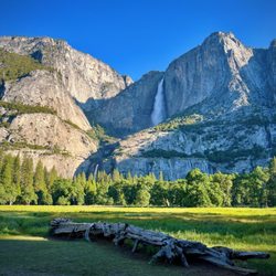
    Yosemite Falls - Phenomenal view of Yosemite Falls from Cook's Meadow below! Early June 2025

    Phenomenal view of Yosemite Falls from Cook's Meadow below! Early June 2025

    Yosemite Falls - Trail Information

    See all

    Trail Information

    Glacier Point Road

    Glacier Point Road

    4.3(3 reviews)
    5.0 mi

    i hiked from badger pass ski area to glacier point on 3/28 and posted a vlog on yoütübe including…read moretips and info so you can be prepared! search "Nikko Gandia Travels." wilderness permit issued at badger pass ranger station (200 ft. to the right of main ski lodge) or a-frame. self registration on porch when open. make sure to keep up with the road closure/construction updates! fresh powder so the snowshoes were needed. camped near ostrander rocks.

    This is the road to some of the most popular attractions in Yosemite Park, but only open half the…read moreyear, closed in the winter due to snow. We were driving from the Bay Area to Yosemite, 4 hours including a potty break in Mariposa, to Yosemite Valley, and then another hour going by dried up Bridalveil falls, and then the tunnel view, to Glacier Point. Glacier Point Road is some 22 miles long, and intersects Highway 41 between Yosemite Valley and Wawona, on the way to Fresno. It's not only a winding mountain road, but takes you from the 4500 foot elevation of the Yosemite Valley, to 7700 foot Glacier Point. As we go up the road, we pass a sign saying 'road closed 7pm', on Sunday November 1, 2015. No overnight parking allowed after October 15. The first part of the road is relatively straight roadway with 35 mph speed limits, through dense forests on both sides of the road, going up the mountain. Last April when the road opened, we saw a heavy duty construction grader, with chains on all four giant tires, each taller than a man, towing snow removal equipment. Badger Pass skiing resort is here, and once the road is covered with snow, cross country skiers will be able to ski on the road. There are very short turn outs on the sides of the road, for pulling over for faster cars to pass. Inevitably if I drive at the 35 mph speed limit, some guy in a hurry comes on my tail. This time its somebody in a pickup, probably local, as he is the only occupant. I speed up to 50 mph, but he clings right up to me, even when I slow down for a car in front of me. Long distances of solid double lines -no passing. The recently paved smooth asphalt road going uphill reaches a peak, and degrades into cracked surface with potholes and jagged edges. At the 16 mile mark, I pull over to the small parking lot at Sentinel Dome, the tallest location on the road, where we do both the Sentinel Dome and Taft Point hikes in 3 hours. At 4:30 pm we drive down the remaining 6 miles to Glacier Point, to enjoy the sunset. Speed limit drops to 15mph as we go down through some hairpin loops in a darkened forest, when all of a sudden, Half Dome rises on the horizon, prior to Glacier Point. We leave at 5:15 for the 1 hour trip back to Yosemite Valley. This part of the Glacier Point road has a 15mph speed limit, with hairpin 180 degree turns, and steep cross traverse roadways in a deep forest. One guy going way too fast approaches us, going way over the center line on the hairpin turn. We were going real slow, and just missed a head on collision. The road becomes dark, and there is nothing like driving on a dark winding mountain road. Amazingly enough cars are still driving up the road to Glacier Point in the darkness! Full moon at Glacier Point? I'm going the speed limit, when some joker comes up right behind me, lights in my rear view mirror, saying go faster. I'm not about to go 50 mph in a 35 mph zone in the dark. Last April I saw a coyote on the road, and the last thing I want to do is hit a bear or deer at dusk, and damage my car. I pull over at the Sentinel dome parking lot, to let the speedster past. Inevitably another car comes onto my tail, and actually passes me on the road in one of the few straight aways, only to pull over at the next turn out to enjoy the setting sun on the horizon, emitting a purple glow. About half way down the road, another car comes onto my tail,.I find a turnout, and let him pass, and then comes a whole series of cars, all going 10-15 mph over the 35 mph speed limit, like it is the Indianapolis 500! Dusk becomes complete darkness. Fortunately the road has a newly painted center line, and two bike lane solid white lines on the edges of the road. Another car comes onto my tail. but this time, I can't utilize the turn outs, as it is too dark, and I have no way to estimate the length of the turnouts. And there are snow poles on the side of the road, to delineate the roadway when covered with snow. The guy follows me at the speed limit for what seems like half an hour, down to the end of Glacier point road, past the tunnel view, onto the Valley loop, where the road becomes two lanes in one direction. At least he never blew his horn. It's 6:15 pm, on this first day of standard time, and is completely dark, when we arrive at Yosemite Lodge at the Falls, after the hour drive from Glacier Point. The following day, it rains hard the entire day. Glacier Point is closed with snow and ice, at least temporarily, and perhaps for the season, until next April, or June if El Nino materializes.

    Photos
    Glacier Point Road
    Glacier Point Road
    Glacier Point Road

    See all

    OARS California Rafting

    OARS California Rafting

    4.9(69 reviews)
    52.3 mi

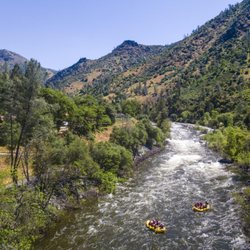
    The trip lead, Dana, was super well-organized and knowledgeable, regularly checking in on how…read moreeveryone was doing - a great natural leader. Our guide, Kylen (?) was a MASTER oarsman (best I've ever seen...), giving us clear instructions when we came upon some unusually challenging rapids. In some sticky situations that other boats got into, he was right ON IT to help them without hesitation, often seeing a problem before anyone else had. I felt completely safe in his care. He also "read the group" really well, connecting easily with everyone. Despite his amazing professional skill and emotional intelligence, he was very low-key and humble... to me, that's a sign of a lifelong learner. This was our 4th trip with OARS. There's so much care into the preparation, the selection and training of the guides and the well-oiled execution on these trips. We're already planning our next!

    I've done a couple trips with OARS now: two on the South Fork of the American River and a 2 day…read moretrip on the Tuolumne. OARS does not disappoint! From incredibly attentive and knowledgeable guides to luxurious camping accommodations, they take care of you. All you have to do is show up and paddle. Maybe you don't even have to paddle if you're sitting in the gear boat. The American River trips are an easy day trip from Sacramento or the Bay Area. If you're looking for a little more adventure, a multi-day guided whitewater trip is so fun, with lots of downtime to swim, look at the stars, play games, and eat yummy food. There's no freeze dried camp meals here. Everything is boated in and prepped on the beach for you. So good. All around, so good.

    Photos
    OARS California Rafting
    OARS California Rafting
    OARS California Rafting

    See all

    Columbia Rock - National Register of Historic Places

    Columbia Rock

    5.0(2 reviews)
    4.1 mi

    Awesome trail! It was one hell of a hike going up and zig zagging but the views are absolutely…read morebreathtaking views! Worth every step! If you keep going you will head towards Upper Yosemite Falls. I believe that is what we were told. Which we will be doing next month lol fun times! You cannot beat the views on this trail. The views are spectacular--everything Yosemite is about. You shouldn't be too afraid of heights either. We made it in time to experience the Firefall phenomenon! EPIC!

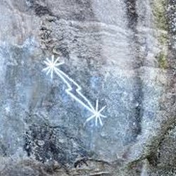
    We were looking for a short, moderately strenuous, and view rewarding hike…read more Found at this Columbia Rock viewpoint via Upper Yosemite Falls trail. Distance is about 2 miles round trip, all switchbacks, and about 1,000 ft elevation. Our entire hike took about 2 hours, including a long break at the famous viewpoint,180 degrees views of Yosemite Valley with Half Dome. 32 oz water required for Winter and Spring, 64 oz wafer required for Summer and Fall. We started the trail from Camp 4, bathrooms avail there. Saw lots of climbers practicing their sport. I also saw a plaque listing Camp 4 as a National Register of Historic Places for the growth and development of rock climbing. Later, I read that Camp 4 is one of 3 most famous climbing base camps on earth, along with Everest Basecamp, and Chamonix by Mont Blanc. Look for Midnight Lightning, a chalk lightning bolt drawn on a super difficult concave shaped boulder.

    Photos
    Columbia Rock
    Columbia Rock - Midnight Lightning

    Midnight Lightning

    Columbia Rock - Switchback trail

    See all

    Switchback trail

    Fern Spring - parks - Updated July 2026

    Loading...
    Loading...
    Loading...