Cancel

    Open app

    Search

    Fort Simcoe Historical State Park

    5.0 (2 reviews)

    Fort Simcoe Historical State Park Photos

    More like Fort Simcoe Historical State Park
    Recommended Reviews - Fort Simcoe Historical State Park
    Your trust is our priority, so businesses can't pay to alter or remove their reviews. Learn more about reviews.
    Yelp app icon
    Browse more easily on the app
    Review Feed Illustration
    Photo of Gia C.
    37
    119
    38

    7 years ago

    Helpful 1
    Thanks 0
    Love this 1
    Oh no 0
    Photo of Gary W.
    25
    16
    10

    4 years ago

    Helpful 0
    Thanks 0
    Love this 0
    Oh no 0

    Verify this business for free

    Get access to customer & competitor insights.

    Verify this business

    Shoe Lake Hike Via Pacific Crest Trail - Old Snowy

    Shoe Lake Hike Via Pacific Crest Trail

    5.0(1 review)
    33.1 mi

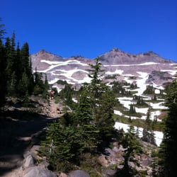
    Had been stalking the White Pass/Shoe Lake area for windows of good weather the last month or two…read more(every weekend, it would conveniently be rainy/snowy up there!). Recently I saw the forecast open up for some sunny conditions---during the work week. I decided to make the trip---isn't that what vacation days are for?? I drove up to White Pass, from the east side, with clear blue skies the entire way. I parked on the highway (across from the Kracker Barrel at the base of the White Pass slopes). I slapped on my 35lb pack, grabbed my dogs, and we scrambled up the slopes. I like going this route (vs. starting at the Trailhead) because there are nice views and it cuts down on distance. It's a bear of a workout though! Once on the PCT, it's a nice, fairly flat, and scenic hike---y'know, the usual. Near the new ski run up on top, I heard/saw workers cutting/burning trees to clear way for the ski run (sometimes I wish I could make them turn the ski lift ON, so I could be taken all the way up to the Miriam Lake Basin....but what fun would that be?? I had seen evidence of recent snow every here and there (1-4" patches of snow). Once at the Miriam Lake Basin/Hogback Ridge, I made my way to Shoe Lake. There's one stretch of this big open piece of trail where there was quite a bit of hard icy snow. Camped above the beautiful Shoe Lake. I heard an elk bugling at around 7pm---it must have been south down the hill. Such a cool sound to hear! But it was also scary, because within seconds I also heard something very big plodding around nearby--definitely an elk. It was so close I could hear it breathing. A wee bit scary! (and cool) Oh, I did spy some huckleberries along the way, amazingly enough---but they weren't as good as the ones I picked 3weeks ago. Such a late season! The night yielded beautiful views of the Milky Way, constellations, Jupiter, satellites, and the like. The hike back was nice for most of the way. I saw a herd of mountain goats in the Miriam Lake Basin. The snow/ice mentioned earlier was pretty scary in the morning. The first clouds of the trip rolled in around 1pm...but I was pretty much done. While unloading at my car, an employee from the Kracker Barrel rode his bike to me. He was wondering where I was and if I was ok. Apparently, I forgot to roll my driver's side window up---so it was open for 24hrs!! Everything was fine, but I sure felt dumb. Anyway, probably my last backpacking trip of 2011. A great way to end the season!

    Photos
    Shoe Lake Hike Via Pacific Crest Trail - Reflection

    Reflection

    Shoe Lake Hike Via Pacific Crest Trail - From Nearby Peak

    From Nearby Peak

    Shoe Lake Hike Via Pacific Crest Trail - At Dusk

    See all

    At Dusk

    Snowgrass Flat Trail

    Snowgrass Flat Trail

    5.0(2 reviews)
    33.6 mi

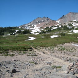
    CGI can't create THIS. Poets are inspired by THIS…read more Painter's canvases are made for THIS. Singers muse about THIS. My legs gravitate to THIS. THIS.....is Snowgrass Flat in the Goat Rocks Wilderness. When it comes to hiking the Cascades, sadly, I'm a creature of habit. I have favorite hikes which I rinse and repeat annually. This is a bad thing when you have miles and miles of lands full of the most beautiful color, scenery, experiences to be had. Snowgrass Flat is now added to my repetoire of go-to places for Cascadian hikes. With a trailhead located south of Packwood, one must venture for about 45min along a dusty gravel road (it's about a 15-17mile trek; while in your car, you will feel like a sock in a washing machine due to the washboarded road). And I'm not kidding about the dust, it's a dustgasm. But it's all worth it. The trailhead was fairly filled with many a hiker's vehicle (but on the trail, we didn't see too many). The trail starts with a quickstep along the side of a pine-filled mountain---every once in a while you'll be afforded views of Mt. Adams to your right. There is water on this trail, and you may cover a bog or two, streams, and at mile 1-2 a torrent which is handled by a nicely-built bridge. Due to the water, there are some boggy-ness, and with this there can be some mosquitoes, but we didn't come across much on our way up (perhaps the bug spray helped...or maybe I just wasn't tasty enough). If you want a workout, you will have one. It doesn't slap you upside the head, but it's a nice, slow, long burn---so it's nice. After about 2-3hrs (around Mile 5-6 for us), the horizon starts to open up and you feel like you are reaching the top. This is the Flat That Is Snowgrass. You are in meadows galore. For some reason the sky is bluer, the waters are clearer, the craggy snow-covered peaks are breath-takers....it's everything a hike should be. There are many options for camping. Here you can see St. Helens in hazy distance, and Mt. Adams is there to taunt. Other sights are Goat Lake to the north---it's captured in what appears to be an eternal winter. The biggest feature would have to be Old Snowy and his mountain homies. If you have the time, my friends told me that Goat Lake and Old Snowy are excellent additional trips one can take from Snowgrass Flat. **mental note made** I can't wait to come here again. This is why I love Washington state. This is why I hike. THIS is brought to you by the YELP-1200.

    Amazing backpacking weekend here. Lots of campsites, but the wildflowers were outstanding as…read morewell!! Gorgeous place and the weather was just perfect! Goat Lake was amazing to get to as well. This place has amazing views too. The mosquitos were definitely around, but manageable. Bring bug wipes though!! Highly recommend this place!

    Photos
    Snowgrass Flat Trail - Stream In Snowgrass

    Stream In Snowgrass

    Snowgrass Flat Trail
    Snowgrass Flat Trail - Looking Toward Old Snowy

    See all

    Looking Toward Old Snowy

    Mosier Creek Falls - Wildflower time

    Mosier Creek Falls

    4.3(8 reviews)
    52.8 mi

    Best time for this hike is end of April and May when the wildflowers are in bloom and cover the…read morehillsides with purple widow's grass, yellow balsam root, blue lupine and lavendar bachelor buttons. It's my favorite time to be in this area! Best place to park is right before the Mosier Creek Bridge as you leave the tiny two block downtown area. As you begin the hike you come to the cemetery of the founding father's of this charming town. Continue for another 10 minutes to the falls and the swimming hole below. The falls are small, not like the 7 popular falls you see along the Old Historic Highway by Multnomah Falls, but still lovely. Continue on and up where views of the Columbia River from this vantage point are breathtaking. The river widens In this area and slight turns as it makes it's way through Mosier and onto Rowena making for a beautiful vista to take in and photo ops. Unlike at Rowena Plateau and Tom McCall Preserve, dogs are allowed on these trails.

    Pretty fun trail with a variety of sites!…read more There's a small parking area right in town just on the other side of the bridge from where the trail begins. You can make a very short hike of it and just go to the falls. Or you can continue on from there and complete the approximately 3 mile out and back with a small loop at the top...I recommend the latter. There's nice signage at the start explaining some trail details. You'll pass by a cool, tiny cemetery and venture on to the falls. Mosier Falls was a bit more substantial than I'd expected, set in a pretty canyon with an overlook for your viewing pleasure. Should you wish to continue on the trail...and you really should...you'll start up the side of the hill on switchbacks and stairs to the top. Tiny flowers popping up were blanketing the entire hillside, and I'm guessing it'll be quite a show in couple of weeks. After zigging and zagging multiple times you'll reach the top and come to an overview with spectacular views of the gorge. There's a bench there should you need a little rest or just wish to sit and take in the view for a bit. From the viewpoint you'll see the dirt trail continue on. It meanders further down to the end of the line...a short loop that offers even more gorge views. The trail is quite narrow and fairly unshaded most of the way and there are regular signs warning hikers of private property lines. We enjoyed it on a Saturday morning, along with quite a few other hikers. It's a decent workout, a pretty waterfall, and some beautiful gorge views...not too shabby!

    Photos
    Mosier Creek Falls
    Mosier Creek Falls
    Mosier Creek Falls - Mosier Creek Falls - Feb 2024

    See all

    Mosier Creek Falls - Feb 2024

    Horse Heaven Hills Trails

    Horse Heaven Hills Trails

    4.7(3 reviews)
    65.3 mi

    Gave this trail another try & thought it was worthy of an update. Instead of driving to the top of…read moreHorse Heaven, I parked at the "official trailhead" at the base of the "hill". Wanted to ride the trail here, but within tens of feet, I was sadly turned away....by gravity. Yeah, I had to get off and walk. I then made it to a point and saw where the trail ultimately went. Ummm...scary. The only way I could make it to the top was if there was a "mountain bike escalator"--until that happens, this trail is strictly for the big-quaded hikers! PLAN B I took the gravel road (for autos) to the top of Horse Heaven (and to the trailhead I parked at last time). It's a nice steady 2-mile climb. My legs were feeling it, and I was liking it. To your left are the beautiful Horse Heaven Hills and the sky; to your right, the towns of Kiona, Prosser, and wineries---all from a stellar birdseye viewpoint. I heard a gunshot at one point. This caused me to stop and scan the farms below, but I couldn't see anything. I continued up at a cautious cadence. I made it to the top trailhead, and continued along the ridge trail (the one I tried last year--see my original Yelp). A personal note---this time I didn't have to walk up the hill. I made it all the way up via pedal power (stopped once, cuz of a balance issue, but got back in the saddle and finished off the hill---rocks, burly wind, and all). The descent was definitely sexy. There's nothing like barreling down a hill like a mad demon. At only a 20min drive away, this is a decent option for getting a quick leg workout. UPGRADE TO 3.5 stars (rounding UP).

    Walk, drive, ride. It's you rchoice. Do you remember that…read moresong which includes," kiss the sky"? here is your chance. It's a vast open sky and view of lots of sand.

    Photos
    Horse Heaven Hills Trails
    Horse Heaven Hills Trails - Moonrise

    Moonrise

    Horse Heaven Hills Trails - View from the top of mcbee hill

    See all

    View from the top of mcbee hill

    Ancient Lakes

    Ancient Lakes

    4.0(5 reviews)
    71.4 mi

    It's not the landscape, the wildlife, the trails or the views. It's the people. Most are…read moreperfectly fine and are out there to camp, hike, and fish for the sake of the activities. However, there is a percentage that is there because it's free and remote while still being accessible to a town where they can get their drug of choice. You'll recognize them by the ancient, filthy, motorhomes. My son was hiking with his girlfriend when they were approached by one of these "campers" who asked if they had any fentanyl to sell! Wow! Is there no where to escape this scrounge? Anywhere?

    Mileage: estimated about 10 miles total (2 miles to where we set up our tents, then we hiked a loop…read moreof about 6 miles, then 2 miles back to the car the next day) Backpacked: April 16-17, 2016 This past weekend a group of us did an overnight backpack trek to Ancient Lakes. 3 first timers backpacking and it turned out to be an awesome trip! We had some problems trying to find directions out to the place, so here's directions from my personal experience. Directions: we stayed in Quincy the night before, so we took the 28 to Whitetail Road. Made a left on Whitetail from the 28, then a right on road 9 NW. follow road 9 NW and it turns into Ancient Lakes Rd NW. At the end of the road, you'll find the west parking lot. I am not sure how to get to the east parking lot. There's a lot of parking here, when we got there by 11 am, it was really crowded but we still found a spot. (When you are on Whitetail Rd, it might look like you are just driving through farms, but buried in there, there's Ancient Lakes!) There is a port-o-potty at the trail head on the west side. Trail head: is well marked, we hiked in about 2 miles and got to the lakes and the rolling grass area where you can set up tent where ever. There are some man made fire rings scattered through out the area. Hiking: After we picked a spot and set up camp, we hiked a loop around the lakes. We started towards the waterfall. It was a scramble up the side of the waterfall, like a class 4 rock scramble lol. Loose rocks, loose footing. From there, we went pass that waterfall and onto the backside where the east parking lot is. Which there's another waterfall there, and there's also camp spots there too. We looped around, it wasn't too hard. We estimated this part of the hike to be around 6 miles round trip back to our tents. Lots of people camping, we counted about 50 tents, then you estimate about 2/per tent, so like 100 people were out here! But you still are able to find solitude. We came across 3 snakes, an owl, and a marmot. Easy trek, not very hilly at all. Good for first time backpackers. The area can be explored in a day. I found this site useful: https://www.theoutbound.com/washington/backpacking/ancient-lakes-day-hike-or-backpack

    Photos
    Ancient Lakes - Lovely weeds

    Lovely weeds

    Ancient Lakes - More lovely weeds

    More lovely weeds

    Ancient Lakes - Dusty Lake trailhead

    See all

    Dusty Lake trailhead

    Badger Mountain Trails - Multiple trails on Badger Mountain

    Badger Mountain Trails

    4.5(20 reviews)
    73.4 mi

    Badger Mountain has the best trails in the tri-cities area, with multiple trails around Badger…read moreMountain for beautiful views of eastern Washington. Anyone who likes hiking would be a fool to not hike around Badger Mountain while in the area. We had an awesome time here! My partner and I visited Badger Mountain for some hiking and and followed Google Maps to the trailhead that took us through an affluent part of the neighborhood of Richland that's high up in the mountains. Unlike in the Seattle area of popular trails, there was parking to be found during a Sunday afternoon in the lot. At the lot, there was a map of various trails, dog poop bags and off to the side was a small playground area with bathrooms and a water fountain. My partner and I hiked the Canyon Trail with our dog, which gets you to the top of Badger Mountain. Friends of Badger Mountain, which maintains the trails did a fantastic job with creating trails and there are even stairs in the beginning part of the hike to climb. The hike was easy for those who are used to hiking, but provides a good workout as it's not a stroll in the park. At the top of Badger Mountain is a bench and you can see beautiful views of the city and eastern and central Washington. And since there are multiple trails that connect to one another, I recommend taking one trail up and the descending on another trail for more views. Just remember that there is no shade coverage here, so be prepared. Great hike!

    The playground area is a perfect age entire while the littles wait for others to hike the mountain!…read more It is clean and green!

    Photos
    Badger Mountain Trails
    Badger Mountain Trails
    Badger Mountain Trails

    See all

    Fort Simcoe Historical State Park - parks - Updated September 2026

    Loading...
    Loading...
    Loading...