Cancel

    Open app

    Search

    friendship park

    4.0 (2 reviews)

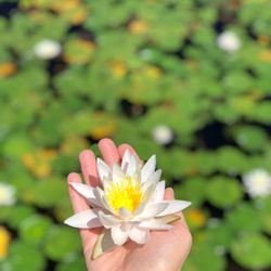
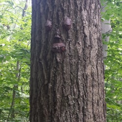
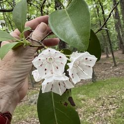
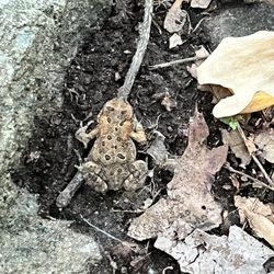
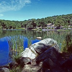
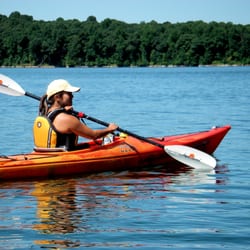
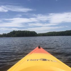
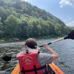
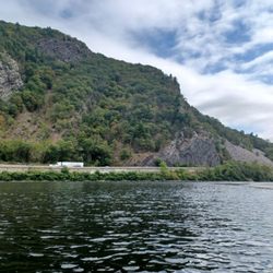
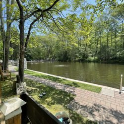
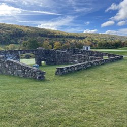
    friendship park Photos

    Recommended Reviews - friendship park

    Your trust is our priority, so businesses can't pay to alter or remove their reviews. Learn more about reviews.
    Yelp app icon
    Browse more easily on the app
    Review Feed Illustration

    3 years ago

    Helpful 0
    Thanks 0
    Love this 0
    Oh no 1
    Photo of Mark N.
    453
    1612
    6187

    8 years ago

    Helpful 6
    Thanks 0
    Love this 0
    Oh no 0

    Verify this business for free

    People searched for Hiking 2,982 times last month within 15 miles of this business.

    Verify this business

    Norvin Green State Forest

    Norvin Green State Forest

    4.4
    (29 reviews)
    4.0 mi

    I love the outdoors , but this hike was not my favorite :( it has an absurd amount of insects…read moreand YES I know it's a forest , but it not even well kept when it comes to markers on the trees for hikers . You can easily get lost because there's barely any markers or directions . The view from the summit is ok but even that doesn't have a sign either . They have bathroom signs to bathrooms that don't exist . Parking to a lot that says private lot .. nature is beautiful . But I wouldn't recommend this place , the pictures posted here are the ONLY thing to see . DO NOT RECOMMEND !!! There are other beautiful hiking places ..

    Norvin Green is one of my absolute favorite places in NJ to hike. It has a tremendous variety of…read moretrails with different terrain, difficulty level and unique environments; if the mood strikes you, it's possible to hike up and down a few mountains with gorgeous 360-degree views, or something much easier that involves exploring some of the mines on the eastern side of the forest, closer to the reservoir. There's something for virtually any type of hiker, and because so much of the area is rugged, you're not likely to find too many ignorant young hiking pups wandering aimlessly without water or a map. I usually get out here at least a few times every year, and most recently stopped by with one of my chums two Saturdays ago for an 8.1-mile hike. If you're approaching Norvin Green from 287, I would strongly recommend stopping by the Quick Chek on 511 - the bathroom options are pretty much non-existent in the forest (apart from strategically placed foliage), the employees there are always very pleasant and you have a lot of hiking snack options if you haven't had time to preplan that aspect of the adventure. We did a circuitous route beginning at the Weis parking lot up the green trail, past the natural pool to the kiosk, then up blue to Wyanokie High Point, back down and continuing on the blue trail to Carris Hill, then taking the yellow trail from there down into the wetlands, turning west onto the blue trail, past Chik Falls and over to Otter Hole. At that point, you can either take the green Otter Hole trail back to the kiosk (I think that's about 6 miles), or turn west again in .2 miles onto yellow and up Buck Mountain, meandering along the ridge until you hit the woods road (subjective term) and can follow it back to the green trail/kiosk. Deciding to incorporate Buck Mountain adds about two miles to the trip, so if your haunches aren't up to it, just keep going north on green. You'll still get a workout in, regardless. The climb up to Wyanokie is fairly strenuous. I'm in very good hiking shape and can do it without any breaks if needed, but you're definitely earning the views once you ascend past the main tree line. The view on top has to be one of the top two or three in the state; on a clear day, you can see the NYC skyline (that's true as well for the top of Buck Mountain and several points along the yellow trail before it descends), as well as the mountainous regions to the north and west. It's gorgeous, and the only damper on this particular day was the obvious effects of the seasonal drought - tons of brown foliage and several of the water features were dried up or close to it. Especially down in the wetlands, you're usually hopping over a small stream or two. Not on this day, and Chik Falls was a barely discernable trickle. The Buck Mountain climb is one of the toughest in the area - if you can do it without taking a breather, god bless. It's something like an 800-foot ascent in .1 miles; it doesn't require actual rock scrambling or climbing, but it's probably in the tier right below that. But as with Wyanokie, you're getting amazing views for the sweat expended on the incline, and because it's a nastier section of the forest, there isn't nearly as much foot traffic. It's not unusual to get some solid wildlife sightings up on the ridge. This particular hike certainly had its share of wildlife. We saw either a garter or ribbon snake with Pittsburgh Steelers coloring, a skink, AKA the corgi of lizards, oodles of small frogs (presumably panicking over the lack of water), and met two canine chums, Nala and Argo. A very solid crop, and not out of the ordinary for this area. I couldn't recommend this place more highly. Nearby Wanaque doesn't have a lot of great eating options, so given that you've more than earned your calories from tromping around in the woods, I'd venture a little further south to sup on scrumptiousness.

    Photos
    Norvin Green State Forest
    Norvin Green State Forest
    Norvin Green State Forest

    See all

    Apshawa Preserve

    Apshawa Preserve

    3.6
    (7 reviews)
    2.3 mi

    This is one of my favorite local hikes. Its not too far of a drive if you are coming from Bergen…read moreCounty like myself. Upon arrival there is a pretty decent size lot with a good amount of parking. I have never had an issue finding a spot. The hikes are pretty calm with nothing being too strenuous. But you can still get a good hike in. There is a huge lake, a waterfall, some old foundations, a few old tanks, and a dam. So there is a lot to see here. There is even one point where you can see what appears to be an old jeep off one of the trails. This is a good hike if you want to get a good walk in without it being to tough. There is also plenty to see throughout the hikes.

    This is our first hike that we took in NJ and although we did not see any bears (thankfully!!) - my…read morehusband did pull out a huge dog tick which was making its way into my skin!! This was absolutely my nightmare come true and I am partially to blame for because I did not spray an insect repellant. I also did not wear clothing that covered my stomach (it was hot!). Anyways, apart from that little scare, it was a beautiful hike. There are a few different trails (based on difficulty) which are detailed on a billboard at the entrance. There are a ton of squirrels and chipmunks running around...like A TON! So don't get scared and think it's a bear. The Butler Reservoir is a beautiful scenery and you can take some awesome pictures! Also, the trail itself is pretty rocky. TIPS: *Wear good hiking shoes, there are some steep/slippery areas and it's rocky most of the way. *Spray insect repellant, inspect your exposed skin for ticks AND take a shower right after you get home. Remove the tick very slowly to prevent the head from breaking off. *If you see a bear - DO NOT RUN! Scream and make yourself appear bigger/more scary by waving hands. *Take a lot of beautiful pictures! *Plan and follow the trail. The trail is available on google maps if you ever get lost and there are color coded markings on the trees throughout the hike. And most importantly - HAVE FUN!

    Photos
    Apshawa Preserve
    Thinking about my next adventure LOL
    Thinking about my next adventure LOL
    Apshawa Preserve

    See all

    Lake Hopatcong Adventure

    Lake Hopatcong Adventure

    4.5
    (6 reviews)
    16.0 mi

    Did you know that Lake Hopatcong is NJ's largest freshwater lake?…read more And did you also know that there's a great little place on the lake that lets you rent all sorts of strange inventions like a 'pedalboard' and a 'hydrobike' (along with the classics like kayaks and paddleboards) - so you can cruise along the lake, get a bit of exercise, fill those lungs with fresh air and more importantly... work up an appetite (so you can hit The Windlass right after)? I tell you it's true. All true. There were six of us (celebrating a birthday) - 5 on hydrobikes, 1 on a pedalboard. The lake is drop dead gorgeous and we went when it was still early and a bit overcast so it wasn't too crowded with boats and jet-skis and the like. (Waves/wakes from other boats can really dampen your own fun... so that stuff matters a bit.) But I gotta be honest: it was a lot of work. Unlike a kayak where you might get a nice 'bite' with your oar and can coast a bit... the bike is akin to being pneumatic (you stop pedaling and you almost immediately come to a halt as well). And those seats? They are not comfortable at all. Sore dupas all around (the following day as well, actually). But we all had a great time. The crew (Patty and Joe, I believe) were really cool, total professionals, and we always felt like we were safe as well having a great time exploring some of the lake and adjoining islands and whatnot. (We would definitely return in the future but would lean towards a kayak and not do the bikes again.) Wear sunblock, bring water, not sure if it was just me but my right foot was pretty soaked by the end whereas my left was dry (so you'd be better off wearing an old ratty pair of sneakers, regardless). Post-pedal was The Windlass (excellent) as well as some mini-golf (also excellent). Lots to do in this lovely part of Jersey. (But it'll cost ya!)

    A cousin of mine tried the hydrobikes and lived it, so I thought I would give it a try. I asked a…read morefriend to come with me and he said it looked like a pain in the ass. I made a reservation online. Patty was so friendly and made it a great time! She let me use some sun block and fill up my reusable cup at their water fountain. She told me that I would probably like the standup paddle board better because it had better maneuverability. I took her advice. It was a lot of excise and fun as we rode around and she told me about the history and pointed out different areas around the lake. We even picked up some trash from inside the lake and it made me happy to know that there are good people out there who are also passionate about the environment. It was hot and I "accidentally" fell in and got to enjoy the water a little bit. Patty also gave me restaurant and hiking recommendations around the area and even took a picture of me. You may be able to call and make a same day appointment, but online will only allow the following day. I don't think it's with bringing or risking losing your camera or phone out on the lake, there isn't anything really photo worthy.

    Photos
    Lake Hopatcong Adventure
    Lake Hopatcong Adventure
    Lake Hopatcong Adventure

    See all

    Edge of the Woods Outfitters

    Edge of the Woods Outfitters

    4.7
    (118 reviews)
    42.3 mi
    $$

    Fun time kayaking on the Delaware River with a group of 13! The serenity of the river and nature…read morewas incredible. The water is warm even though it was only 70 ish degreees.

    (This was a few months ago so the details could be a bit iffy.)…read more This was a very impromptu trip and everything at Edge of the Woods makes doing that easy. Head to the website, book the date & time you want and you're done. www.watergapadventure.com/river-trips A few things worth noting: They offer multiple trip lengths. The standard 4-, 6- and 10-mile trip (Smithfield to Portland) are all booked generically and then when you get there you tell them what you want to do. All pricing is the same which believe me compared to others companies, that's very different - in a good way. They do offer two other longer trips but those require calls to the main office I assume to assess river conditions; your own competency and shuttle availability. The main office in Delaware Water Gap is very easy to find and there was plenty of parking on a quiet post-Labor Day Monday. You check in, you're handed a laminated map, life jacket and given a brief route explanation and then you're off in the van. One problem arose and it was kind of a PIA but it was worked around. Most companies have different types/sizes/models of kayaks and quite often, will ask you what you prefer. Not here. When we left the office, the guy driving didn't say a word to me until we get to Smithfield Beach to unload. He had a few kayaks pre-loaded in the carrier but definitely did not look at them before we left. One of them had a broken foot pedal that he said couldn't be used, another was very much designed for a smaller individual (i.e. if you're taller and/or taller & larger it ain't happening safely) which only left two tandem models. Using a tandem as a single individual is not the end of the world but especially when the seats are still left in the two person configuration (i.e. one front and one back versus the rear one being placed more towards the middle), it's a PIA to maneuver the craft and you are paddling harder to get the job done compared to a single. The scenery along the route was decent. You could see a bit of the Shawnee Resort and Golf Course, an old stone bridge abutment in the middle of the river, under and along 80 and then when you get into the Water Gap itself with the high cliff sides. Very picturesque. Once you go under the old train viaduct in Portland, you give the office a call for the shuttle to meet you at the out point which is at the Portland Pedestrian Bridge. The whole experience was about four hours door to door to cover the ten miles on the water plus the shuttle to & from the pick up and drop off points. Lots of nice scenery, due to the low water level there wasn't much in the way of current except for the area around viaduqt in Portland and even that wasn't bad. I'm not a big fan of the equipment here but I wouldn't let that deter me from coming back in the future for one of their northern longer trips.

    Photos
    Two person kayak fun.
    Two person kayak fun.
    Edge of the Woods Outfitters
    Edge of the Woods Outfitters

    See all

    friendship park - hiking - Updated July 2026

    Loading...
    Loading...
    Loading...